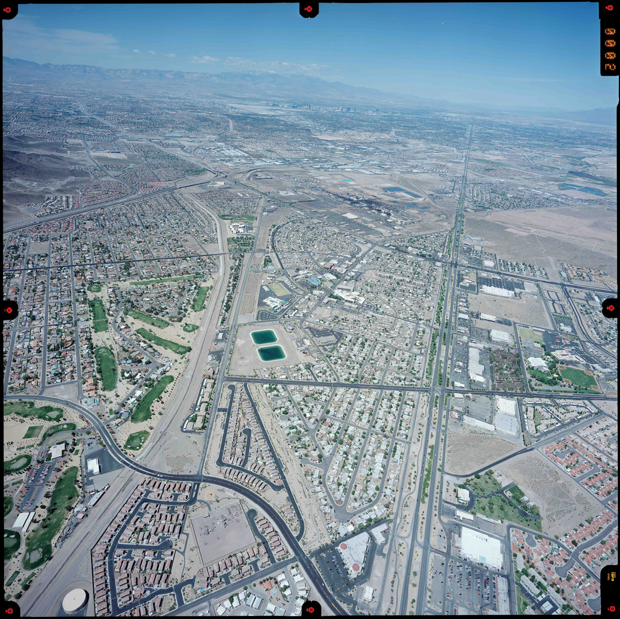
The Townsite and BMI Plant area, middle to center-top of photo. 2011 photo courtesy of AeroTech Mapping.
The genesis for the retracement survey for the Henderson Townsite was a previous project in the area of the 1931 Plat of Sierra Vista City. This subdivision is about two miles northwest of the Henderson Townsite. If there were any remaining original monuments from the 1931 plat, this would help resolve a roughly five-foot discrepancy in the area of the center quarter of Section 1. The search recovered 4 original monuments from the 1931 plat.
In the past, some surveyors working in Section 1 resorted to defining a center quarter corner for the east half of the section, and a different center quarter for the west half of the section. The recovery of four monuments from the original plat helped to resolve where and how the center-section error was created. The original search methods utilized in the initial project were not practical on a larger scale because of the destruction to the pavement.
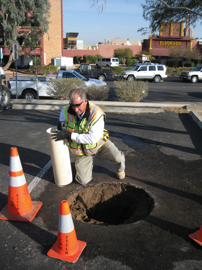
City of Henderson survey crew party chief, Brian Witzel. He is setting a monument well extension tube at the deepest found monument, 3 feet below the asphalt.
This small success, along with the 2011 article in Point of Beginning “What Lies Beneath” by Joseph D. Fenicle, PS and also the 2012 article in The American Surveyor “A Reckless Path of Destruction” by Michael J. Pallamary, PS both get credit for intensifying the City of Henderson’s efforts to search for any remaining original Townsite survey monuments prior to roadway pavement maintenance projects.
As part of any survey retracement, it helps to know physically what was set for monumentation, what depth the monuments were typically set and if the monument gives a reading with a metal detector. The monuments set with this plat were 6” diameter, 12” long concrete cylinders with a small brass tag stamped RE 428. Unfortunately, these monuments did not provide any signal with a magnetic locator. The depth of the monuments recovered with this retracement were typically 1 foot below the asphalt. The shallowest was recovered in a residential back yard with only 0.2’ of cover and was in near perfect condition. The deepest monument recovered was 3 feet below the asphalt in the Convention Center parking lot.
The first successful recovery of one of the 1931 Sierra Vista City Plat monuments, about 1.8 feet below asphalt. This was somewhat typical for the 1930s, a 6” x 12” concrete cylinder. There was no visible brass tag or copper wire in the center. However, a magnet would stick to the center of the monument. It did not take long to figure out the dig bar makes a much different sound when contacting a concrete cylinder. The survey crews doing the search work learned to really enjoy the sound of success.
One interesting side benefit of this effort was the evolution of the search procedures for the original monuments below the existing roadways within the Townsite area. The first-generation search method was to open a 12-inch square hole in the asphalt and dig with a standard shovel. This worked initially because the search was conducted a few weeks before a complete remove and replace roadway project started. However, this level of destruction is usually not an option for most search locations.
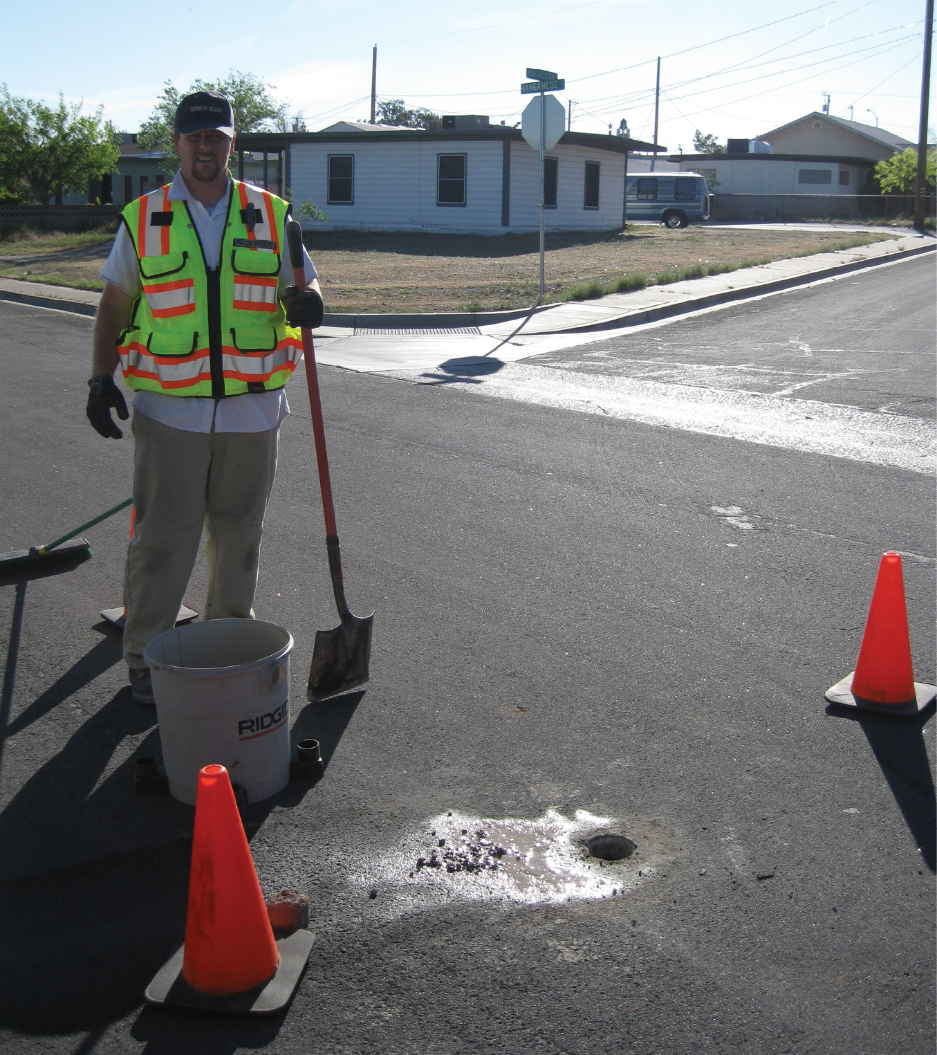
City of Henderson survey crew member, Nathan Wardle. He is getting ready for a survey shot on a found original monument. Note the core hole has been expanded to the right. At times, this was required to center the rod over the found monument.
With a few of the original Townsite monuments found, the search coordinates could be calculated much more accurately. By scaling down the process of utilizing a Vactor truck to pothole and locate utilities, the City’s survey crews evolved to coring a 4-inch to 6-inch hole in the asphalt and then using a dig bar and shop vac to hand-dig the search hole. This combination of hand digging and use of a shop vac to remove the material, provided a more precise and efficient way to excavate and evaluate findings.
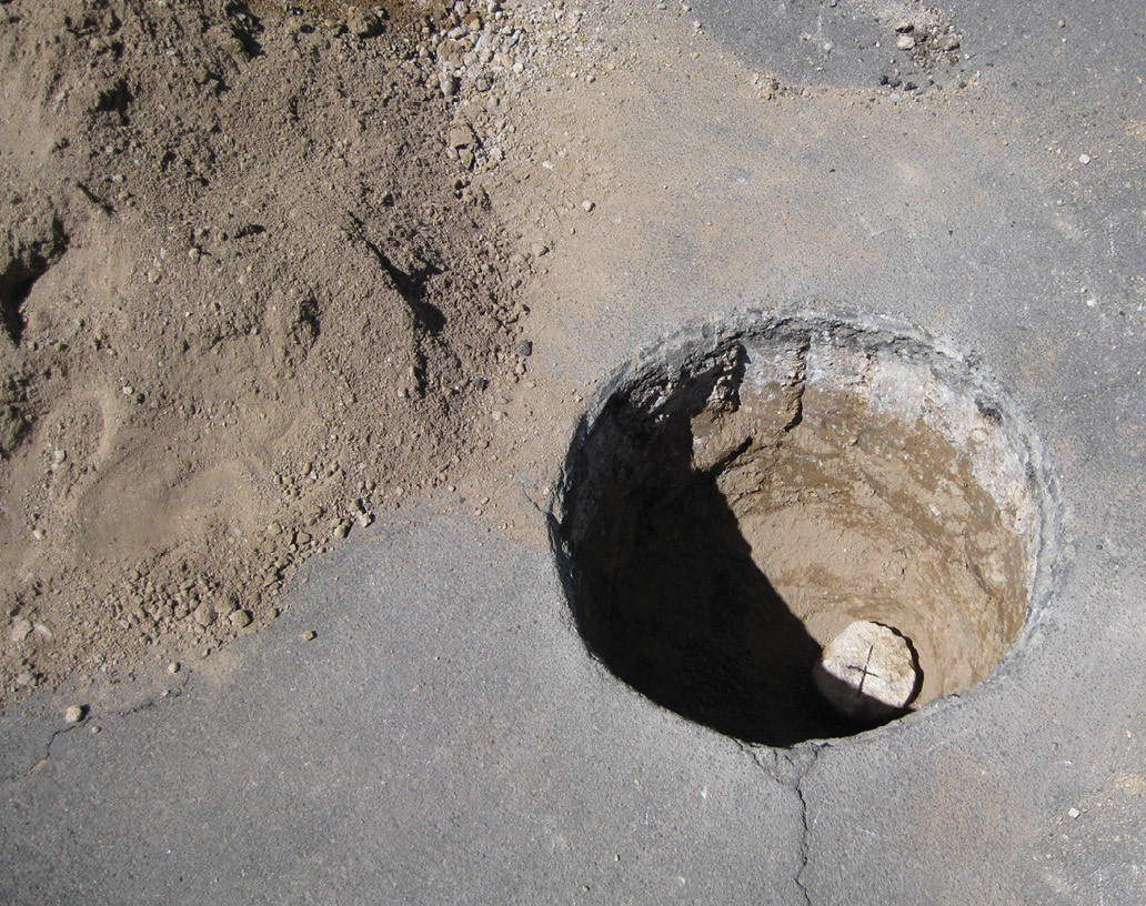
A core bit with a diameter large enough to accommodate a hand is used to penetrate the asphalt. A dig bar and shop vac can then be used to quickly remove material up to a depth of three feet and, by angling the dig bar, the search hole below the asphalt can easily grow to twelve inches wide. A flat-topped dig bar or a shovel handle can then be used to replace and compact the material previously removed. Finally, the asphalt disc can be removed from the core bit and put back in place. From an asphalt esthetic perspective, it will typically be difficult to notice anything was done at the search location.

City of Henderson survey crew party chief, Brian Witzel. The first unsuccessful search hole is in the foreground of this photo. The 2nd search hole, closest to the truck, was the first successful recovery of one of the 1931 Sierra Vista City Plat monuments. What is not seen in the photo, is the look on the survey crews face when asked to dig the 2nd search hole. Until this point, there were no successful finds.
This procedure has been used over the last decade and the City’s survey crews have been able to recover 70 of the 132 monuments set with the Townsite Plat. In addition, approximately two dozen other monuments were found that had been destroyed or hit by a blade, laying sideways under the asphalt.
When comparing the overall cost of a roadway maintenance paving project, whether it is a mill and overlay or a complete remove and replace, the cost of the land surveying effort to properly perpetuate historic survey monumentation is pennies on the dollar. A small amount of attention to detail while compiling the scope of services for the design contract and the plans and specifications executed for construction, will go a long way to preserving all property definition associated with historic survey monuments. The different professional land surveying organizations in your states may not realize the power they have, as these organizations are the perfect tool to ensure the municipalities are taking proper precautions with respect to survey monument preservation. If you are fortunate enough to have a Statute, Code or Ordinance to support this monument preservation, even better. Nevada has the benefit of NRS 625.550, shown below.
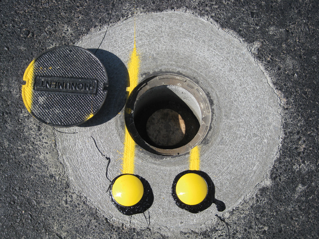
Pavement & monument preservation success.
NRS 625.550 Intentional removal or defacement of monument unlawful; exception; penalty.
- Except as otherwise provided in subsection 2, a person who intentionally removes, changes or defaces any monument that has been properly established and marked by a professional land surveyor as required by this chapter, is guilty of a public offense, as prescribed in NRS 193.155, proportionate to the value of the loss resulting therefrom, but in no event less than a misdemeanor.
- This section does not apply to a professional land surveyor who acts in accordance with NRS 625.380.
- As used in this section, the “value of the loss resulting therefrom” means the cost of restoring or replacing the monuments which have been removed, changed or defaced. [Part 13:198:1919; added 1947, 797; A 1949, 639; 1955, 391] — (NRS A 1967, 639; 1989, 789; 1999, 964) ◾
Author’s note: I would like to extend a thank you to the Von Tobel family and the Special Collections Library at the University of Nevada Las Vegas. All comments, feedback and other opinions are welcome. michael.kidd@cityofhenderson.com.
Michael Kidd is currently the City Surveyor for the City of Henderson, Nevada. Michael’s entry into the land surveying profession began with the U. S. Air Force in 1985. He is currently the Vice Chair on the Nevada Board of Engineers and Land Surveyors, he also served as a member of the NCEES Professional Surveyor Exam Committee.
Sidebar:
The History of Henderson

The Townsite and BMI Plant, 7 months after groundbreaking.
The City of Henderson is currently Nevada’s second largest city with a population slightly over 300,000 and the Townsite is the core of the City’s downtown area which is currently experiencing a good amount of growth and redevelopment. The city was incorporated in 1953; however, the spark for what was to become the City of Henderson was created two decades before with the discovery of the world’s largest magnesium-rich ore deposit on the west slope of the Paradise range in northwestern Nye County, near Gabbs, Nevada.
Prior to the beginning of World War II, Congress was having discussions about strategic materials and magnesium quickly became an important topic. The stories of German and Japanese aircraft performance in combat, gave way to fears that the United States was lagging in warfighting capabilities. These fears were confirmed with the inspection of slightly damaged enemy aircraft that were shot down and the discovery of weight-saving magnesium alloys. This accelerated America’s need for greatly increased magnesium production. In the 1930s, Germany, Japan and Russia kept their magnesium production a military secret. Therefore, it became clear the United States would need to greatly increase their production of magnesium and magnesium alloys used for lighter aircraft parts and more volatile munitions.

George Von Tobel—sometime in the 1950s.
The thirst for magnesium, combined with the magnesium-rich ore in Nevada and the following four factors were key to the Basic Magnesium Incorporated (BMI) Plant site selection in the area below Black Mountain: The availability of power from Hoover Dam completed less than a decade before, ample water from Lake Mead, desirable public lands and the United States Army order that the plant must be located at least 250 miles inland from the coast.
To give some perspective on the monumental effort involved with the construction of the BMI Plant, Henderson Townsite and all associated infrastructure, the following timeline and accomplishments are amazing:
- September 15, 1941—Ground-breaking
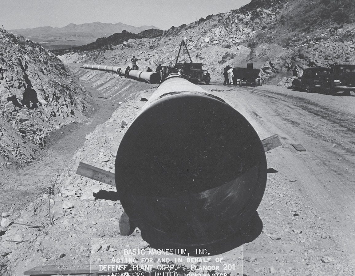
- March 30, 1942—Water flowed into the Townsite reservoirs supplied by 15 miles of new 40” water main
- August 31, 1942—Power switched on, supplied from the newly constructed 35 miles of 230 KV power transmission lines, and the first magnesium ingots were produced
- Also completed in support of the BMI plat operations were 18 miles of permanent railroad track and 27 miles of roadway, of which 13 miles were paved
40” water main installation, March 1942.
The trucking operation to support hauling material from Gabbs, Nevada to the BMI plant was just another of the huge undertakings. At the peak of magnesium production, there was a truck delivering material to the plant every 74 minutes, with a round trip distance of 668 miles. As reported in the BMI newspaper, The Basic Bombardier “It’s the biggest trucking operation of its kind in the United States—longest haul ever undertaken on a continuous basis, largest equipment, heaviest payload, widest variation in temperature—and a pioneering venture into an entirely new field”.
The peak daily work force during the construction of Hoover Dam was a little over 5,000 workers. By the end of 1943, BMI had a workforce of 13,000 workers. During peak construction, there were 90 surveyors working on the project and throughout the project, on average, there were 10 survey crews supporting construction activities. The plant closed on November 15, 1944 after 166,322,685 pounds of magnesium and magnesium alloyed material were produced.
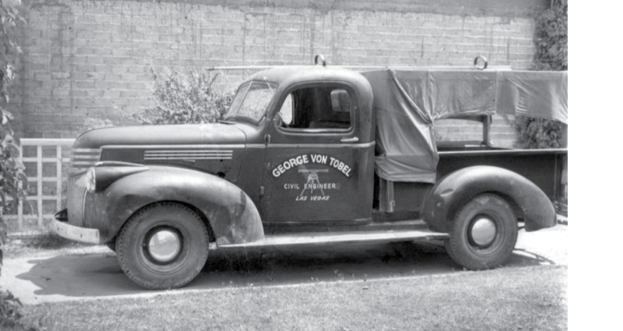
RE 428 George Von Tobel’s survey rig.
Construction of the Townsite began in February 1942 in order to provide housing for some of the BMI workers. The total Townsite area is about 400 acres and the original plat included 1,016 residential lots, a school site and a commercial area. Although the Townsite was constructed in the early 1940s, the plat was not completed and didn’t record until 1952 due to the war asset disposition process. During this interim period, families continued to live in the Townsite homes.
The surveyor that surveyed and completed the plat for the Henderson Townsite was George Von Tobel, Nevada Registered Engineer No. 428. George was born and raised in Las Vegas and left temporarily to earn his degree in Civil Engineering from the University of Santa Clara in California. The five land surveying classes he completed as part of his degree, in addition to his experience in the Army during World War II, building airfields in the south pacific, all contributed to a solid base of knowledge in land surveying.