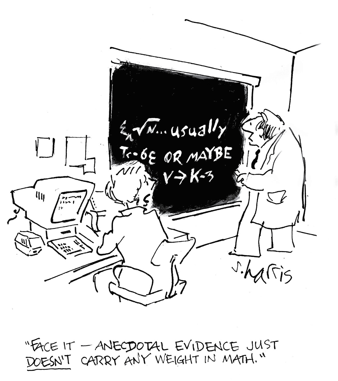
Image and permission by ScienceCartoonsPlus.com.
A PDF of this article as it appeared in the magazine is available by clicking HERE
In answering these questions, we first dispense with the subject of the proper subdivision method of a Township, a task essentially completed in the Lower 48 States by the 1940s (page 12 of Surveying our Public Lands, a BLM 1980 publication). Equally, the first staking of a platted subdivision lacks ambiguity and controversy and can be dismissed from this discussion for this reason. Yet, in the view of the public, in the eyes of the court, and especially within our profession, the “Proper Function of the Land Boundary Surveyor” remains a great controversy. Just where does a missing property corner of record belong?
The land survey profession is not in control of itself
Much of the controversy is because the Land Boundary Survey profession is not in control of itself. On the National and State level, nearly without exception, we are controlled by engineers and quasi-engineers who head our societies, administrative boards, and schools of surveying. Engineers are men and women who live in a world of mathematical exactitudes, where every problem within their realm is expected to have a sole and accurate solution. Such an attitude is not compatible with retracement surveys.
Lost for 60 years. Misplaced 20 feet by math. Linda, “Maybe its over here.”
 Engineers live in a world of exactitudes… an attitude incompatible with retracement surveys
Next, we should exclude from this discussion those in the Public Land Survey States who claim that they are now surveying in a virgin section, one that was never surveyed before, and foolishly tell their clients such. Federal Lands were supposed to be surveyed before segregation into private ownership. Thus, in the realm of private land in the PLS states, there is no justification in presuming that a section is unsurveyed. Nearly the same can be said of the subdivision of sections. Just as the GLO performed a million± miles of section line surveys, local surveyors, often in the form of Land Locators, performed the same number of miles in subdividing those sections into 160 acre aliquot parts.
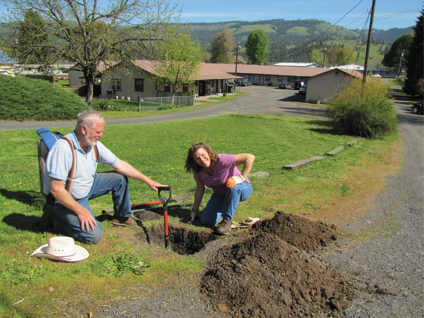
Linda, “Here’s Another One.”
 The GLO and BLM Township survey design was simple but exact, was surveyed by sworn officers and nitpicked by the review sections. Thus in prairie conditions, we should be able to view waves of perfect one mile squares perspecting into the distance, like the Google pro image to the right.
However, on closer examination, GLO and BLM surveys actually look like an extract from page 12 of the 1914 treatise by Robert Harvey, titled: Circular of Instructions to the County Surveyors of Nebraska (https://sso.nebraska.gov/pdf/harvey1914.pdf). Such Shortcut Methods as seen on the next page were sanctioned on page 33, Article X, Sec. 8 of the 1881 GLO Manual of Surveying, and such deviations were not to be noted in the Field Notes. This is also found in the Manuals of 1890, 1894 and 1902.
Page 14 of Circular of Instructions to the County Surveyors of Nebraska. The shortcuts here represent a savings per township of 35 miles, or 35%. There were few if any check-ins and thus little quality control.
Shortcuts sans Field Notes Were Sanctioned in GLO Manuals
Or, in the words of Abraham Lincoln: “Nearly, perhaps quite, all the original surveys are to some extent erroneous, and in some of the sections, quite so. (…The) error is infinitely various”. (From page 6 of The Early Surveyors and Surveying in Illinois by Z.A. Enos, 1891.) Added to the weakness of such organic error is the general lack of permanent markers, so much so that Land Locators and homesteaders often could not find the corners a mere few years after they were set. Such markers were often wooden stakes which the prairie cowboy later used to heat his coffee. Pages 34-37 of the 1894 GLO manual permits the marks required on stone monuments to be placed, instead of on the stone, on a wooden stake in the southeast pit, with no mention of such a swap was to be made in the notes. Even when the marks were on the section corner stones, such marks can be indistinguishable from marks made by cultivator discs.
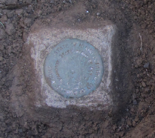
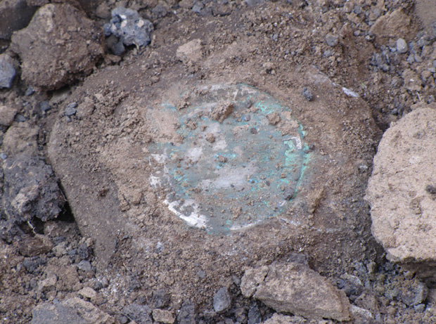
This stone was the central issue in Erickson v. Idaho Board of Licensure.
The photo to the right, showing markings on a stone is the first photo of the stone that was the central issue in the recent Idaho Supreme Court Case of Erickson v. Idaho Board of Licensure (https://law.justia.com/cases/idaho/ supreme-court-civil/2019/45205.html). This stone was presented by another surveyor to be the original SW corner of the subject Section 24, even though a 1915 deed shows it to be 272 feet out of position. Notice the faint lead-in and following marks on the lower notch, as though they were made by a cultivator disc, and this stone was found in an area with 90 years of cultivation history.
Such weaknesses in the GLO’s design for its monuments are a continuing bane in the United States. In contrast, 27 years earlier than in the U.S., in 1883 Canada required its sectional surveys to be monumented with iron posts. The short-sightedness and misfeasance of the GLO/BLM survey sections are still negatively affecting private ownership rights, especially when combined with undue adherence to what were intentionally farcical Field Notes.
Some would suppose that platted subdivisions are more reliable. Not so, neither in freedom from errors nor permanency of marks. In the MODERN subdivisions of Arizona and Idaho, only 20% of the property corner monuments are visible. The old plats predating the recordation laws are even more horrendous on these points. One old subdivision plat in Clearwater County, Idaho, only shows eight monuments on the plat and half the bearings and distances were never given!
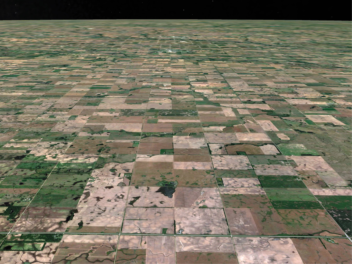
Google Earth Pro, 6-27-2019, Ten Miles west of Hutchinson, Kansas
It is common, common we say, for surveyors to replace “missing” monuments where the record math would place them, rather than analyzing the record and digging for evidence. Which isn’t surprising since our colleagues are taught in class and manuals, to be good little mathematicians. However, that is not the precedence of the courts.
Even BLM’s 2009 Survey Manual, that is reputed to give more weight to evidence, is actually more dismissive of evidence in many instances. In their rush to be the nation’s Cadastre, §5.5 of the 2009 BLM Manual sets forth that all private surveys are purported surveys. In Case No. 2008-271 the IBLA ruled that purported surveys are not evidence. This dismissal of good evidence can be further seen at the BLM 2009 Survey Manual §3.137; 3.217; 5.36; 5.49; 5.50-75 & 6.69-77; 5.77; 6.5; 6.11; 6.13(3); 6:16-20; 36, 41-46; 49, 53, 54; 10.23 & 7.3.
The BLM Cadastral Survey Section, in dismissing evidence, is in serious error, as are any private surveyors who follow BLM’s lead. This is shown in the number of court cases BLM is losing. This is the most important lesson of Dykes v. Arnold: “follow the BLM Manual in dismissing evidence and you will lose in court”.

by Jan Pietruszka / PIXTA
Follow the BLM Manual and You Will Lose in Court
To follow the bearings and distances of the Field Notes or plats, in disregard to available evidence of the original location, can bring into legal dispute every property line in the involved sections or subdivisions. The courts frown on such behavior. However, it is much, much cheaper to proportion than it is to dig for evidence; so, proportioning is the preferred route of many surveyors. When proportioning is inappropriately used someone loses and someone gains. And some clients will seek out the surveyor whose methods give them the most advantage. Indeed, some surveyors will do what the client tells them to do. Where does professionalism end and larceny begin? And is the moldable surveyor an accessory to this larceny?
To recap, it is the duty of a bona fide Land Boundary Surveyor to:
- Research and search for the original monuments and accessories.
- When the monuments are not discernible, to research, survey and look (dig) for evidence.
- Where possible, respect use lines.
- Keep in mind that though he is a quasi-officer of the court, all parties are free to challenge a surveyor’s decisions in court.
Much has been written on this subject by surveyors who are more capable than we, but it is hoped that other surveyors, who would make a buck by expeditiously ignoring evidence, would learn from this missive. But, until they get gut-hooked in court, it is not likely.
In case you haven’t noticed by now, this article is a rewrite, or paraphrase, of Justice Cooley’s 1876 essay, “The Judicial Functions of Surveyors”, including the phrase “it is not likely”. https://onlinelibrary.wiley.com/doi/pdf/10.1002/ 9780470950050.app3
Note from the authors: The American Surveyor articles we have written were often critical of the BLM, NSPS, NCEES and State Boards. In apparent response, in 2014 a national cabal conspired to silence us via administrative board discipline actions. On October 28, 2019 the Idaho Supreme Court, in Erickson v. Idaho Board of Licensure ruled that the Board’s actions were illegal. Yet, an NSPS speaker is now announcing that “…in the Gem State, another surveyor successfully escaped the consequences of some highly problematic survey decisions…because (the Board) had neglected to take action against him with sufficient promptness”. The speaker is ill-informed on the nature of Court civil rulings. We appealed to the Supreme Court on 36 points yet, in a normal action, the court ruled on only one point. It is juvenile on the speaker’s part to believe that the court would have ruled favorably on a vague timeliness statute if there was not merit to most, if not all, of the other 35 points. However, the Supreme Court didn’t just acquit, they unanimously found in our favor at both the original and substituted opinion. In fact, at the top of page 9 of its Substituted Opinion, the Court slammed the Board for its frivolous petition for a re-hearing. There is nothing quite like being shot at and seeing the gun blow up in the shooter’s face, twice.
Chad Erickson has been licensed as a PLS in multiple states since 1985 and he and his wife Linda have been published in The American Surveyor 17 times.
Unless noted otherwise, all images are by the authors.
Sidebar:
♫There was a crooked surveyor,
and he had a crooked smile,
He set a crooked township,
with a hundred crooked miles.
He worked for a Surveyor General,
Who wore a crooked hat
Wrote crooked field notes,
With a crooked little plat.♫