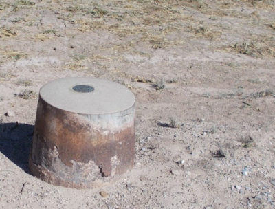
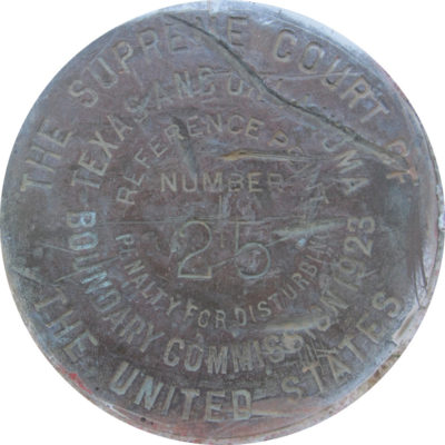
 It is part of a Surveyor’s field work to locate government monuments. An infrequently found monument is stamped “U. S. Supreme Court”. These rare marks are set along state lines at the direction of the Supreme Court after settling interstate boundary disputes.
When one looks through U. S. Supreme Court cases over two centuries there are many interstate disputes. The Constitution directs the Supreme Court to original jurisdiction resolving interstate disputes. Such disputes can cover many topics and the locations of boundary lines between the states being frequent.
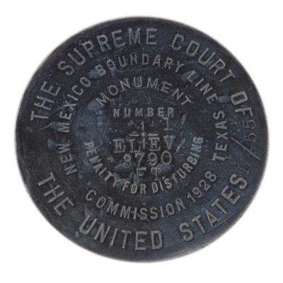 As soon as New Mexico became a state it sued Texas1 over the location of its southern and eastern boundary lines. A United States Supreme Court (USSC) Boundary Commission was tasked to mark the Court determined New Mexico/Texas boundary line in accordance with the Court determination. Another USSC Boundary Commission was assigned to mark part of the line between Oklahoma and Texas2 as discussed last year in American Surveyor magazine article by Nedra Foster, ‘The Red River Flows On’. Vermont and New Hampshire3 after almost two hundred years of simmering dispute ended up at the Supreme Court in the early 1930’s. In these cases, after the Court reached its decision it appointed a Special Master to oversee the setting of boundary line monuments along boundary lines adjudged to be correct. Caps stamped “U. S. Supreme Court” or two state boundary commission are the result of this process.
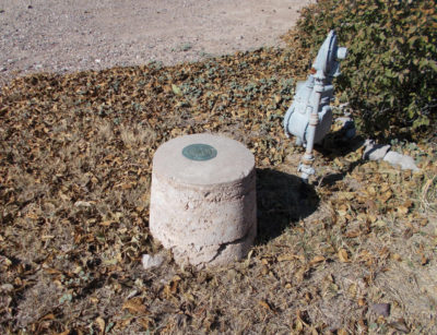 Over the years some of these caps have become part of the National Geodetic Survey (NGS) database as stations. Recently, assisted by Scott Lokken, Mid-Atlantic Regional Geodetic Advisor, a database search for monuments stamped USSC was conducted for the states mentioned above. His searches disclosed 47 PIDs. Then photos for these PIDs (NGS Permanent Identifiers) were downloaded from DSWorld.com application. There probably are many more USSC monuments to be identified but the search method is restricted to individual states. Because the Court sometimes would direct a joint state Boundary Commission to participate in overseeing the setting of directed monuments, the monuments are recorded as such as the “New Mexico/Texas Boundary Commission” even though they were set at the direction of the Supreme Court. Not all USSC monuments have been recorded as PIDs. However, where there is one along a state boundary there probably are more.
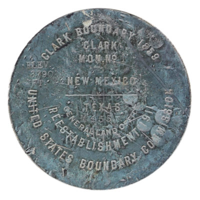 It is sobering to encounter a USSC cap in the field do to its rarity and significance. Your help is requested to identify more. Tell us cap locations. Photographs formatted to NGS standards would also help; the face close-up, the mark from eye-level, then a photo at a distance with a heading in the photo name.
A University Librarian in Pennsylvania has agreed to update and maintain a master list of USSC monuments in the format of the NGS datasheet database. Because the majority will be PIDs it will be in that format. Photographs will be uploaded to DSWorld if PIDs or stored in a separate PICTURES database.
1 New Mexico v. Texas, 276 U.S. 558 (1928)
2 Oklahoma v. Texas, 260 U.S. 606 (1923) and ‘The Red River Flows On’ by Nedra Foster, American Surveyor magazine, May 25, 2019.
3 Vermont v. New Hampshire, 289 U.S. 593 (1933)
Special thanks to New Mexico Civil Engineer/Land Surveyor, Ira L. Harding, whose discussions and article in Rhonda L. Rushing’s 2006 book “Lasting Impressions” page 79 guided me to the USSC topic.
 Sidebar:
Have you ever come across a USSC cap?
Please report any USSC monuments you have found to USSC.caps@gmail.com. Also upload your JPG photos to DSWorld.com for permanent storage. It is intended to share the list developed in a later issue of this magazine along with the photos of these unusual boundary line monuments found around the United States.