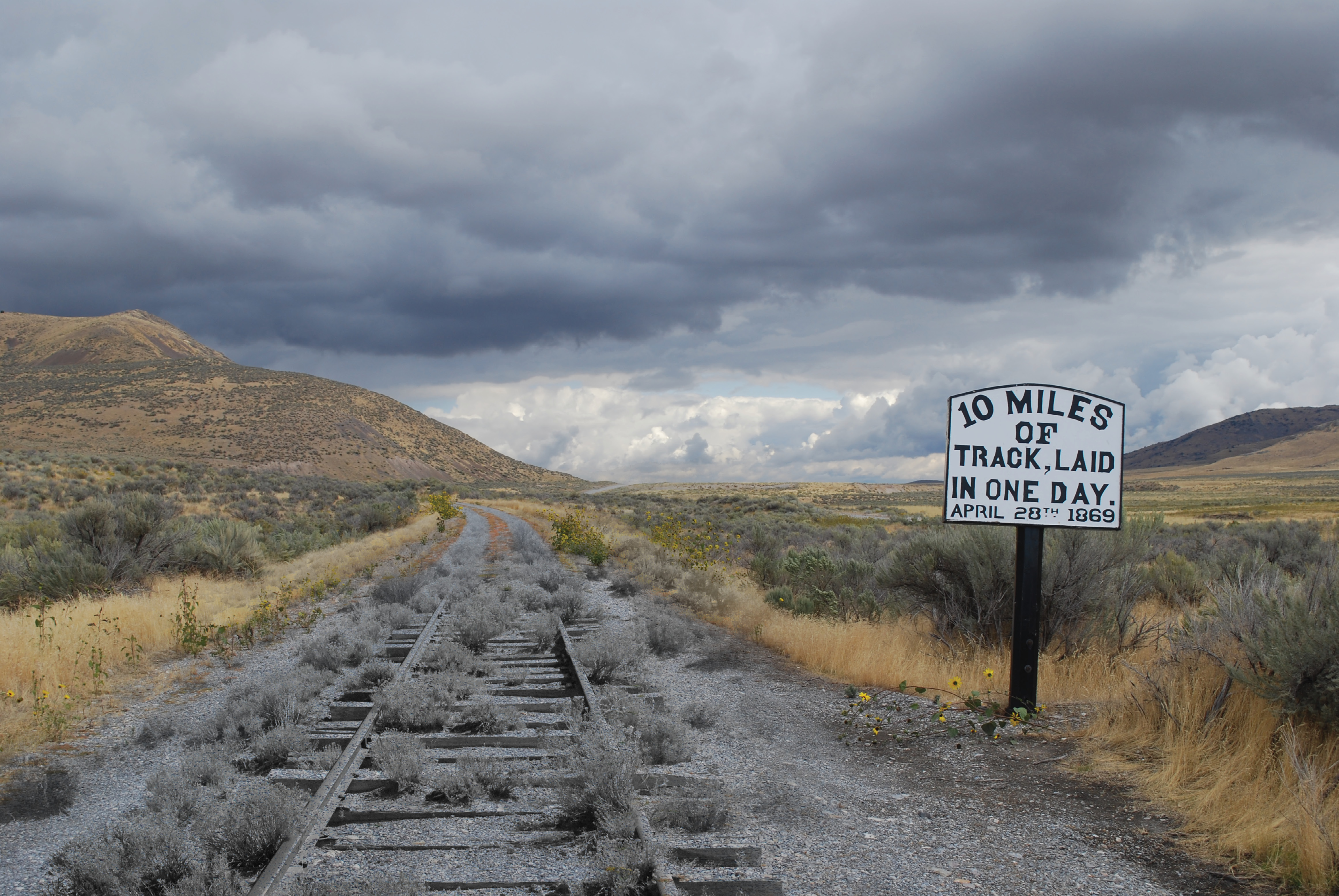
The phantom of a road, once there, follows the lines laid by the surveyors. So close to Promontory, Crocker and Strobridge (CPRR) made the 10 mile bet, knowing that Durant and Casement (UPRR) had “not enough room . . . for them to outdo me.”
The Survey—it was a charmed life for the time
Anna Ferona Pierce Judah penned these words in a recollection of her husband, Theodore Dehone Judah, some 26 years after his death. Because of his surveys through the Sierra Nevada mountains in the late 1850’s and his untiring efforts in Washington, DC, our country was joined from the Atlantic to the Pacific by two thin ribbons of parallel steel. (See American Surveyor; Vol. 9, No. 5; 2012; Pacific Railroad Crazy). “Of the many competing ideas for the Transcontinental Railroad, a clear path was created in the early 1860’s through the vision and advocacy of two prominent figures: Theodore Judah and Abraham Lincoln” (display in the Utah state Capital building June, 2019, celebrating the 150th anniversary of the golden spike). Don’t forget Ted Judah and Abe Lincoln were both surveyors.
The story begins with the author on the campus of the University of California—Berkeley seeking information on the Judah’s. On the uphill walk to the Bancroft Library (September 11, 2019), a group of students was encountered. One, a young lady, was wearing a U.S. Army t-shirt. All carried small American flags that were being placed in the ground in a geometric pattern. Wow! At U.C. Berkeley? One cannot do a Judah pilgrimage without a visit to Berkeley and the Bancroft.
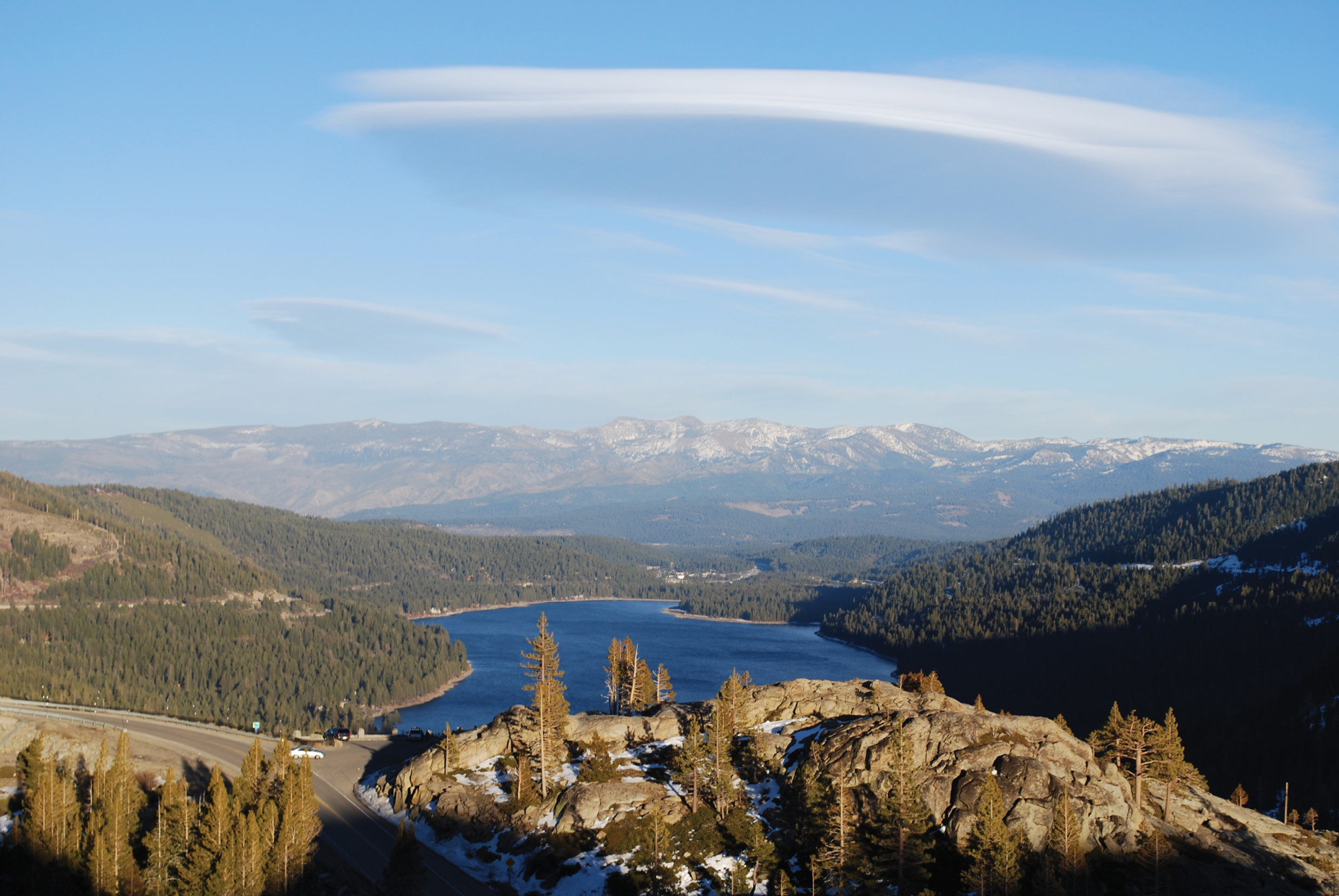
The Summit of the Sierra. “Our line is carried down along the side hill of the spur . . . immediately above the lake with a grade of 105 feet per mile.” T.D. Judah. Judah’s grade is at picture right. I-80 is to the left.
The actual Beginning Point of the Central Pacific Railroad (CPRR), though, was on the levee at Front Street in Sacramento, California (January, 1863). Sacramento is also the Capital of the state and the venue of the California State Library. More research.
From Sacramento, the road (and me) effortlessly headed eastward, following the line surveyed by T.D. Judah. The line then hit the mountains. The genius of Judah was mastering the grade of the road. At the time, 100-110 feet per mile was accepted as a maximum grade. Judah’s challenge was to route a road, climbing 7000 feet with the distance from base to summit being 81 miles. Judah’s grade never exceeded 105 feet to the mile. This was accomplished by some remarkable engineering feats for the time.
Leaving Sacramento, on Interstate Highway 80, I made the trip to Auburn, California and an interesting feature within a seemingly normal suburban neighborhood. Here, once hailed as the eighth “Wonder of the World,” is the Bloomer Cut. By today’s standards, at 68 feet deep and 800 feet in length, it is not so impressive. However, it was this location that the CPRR realizes and appreciates the importance of the contributions of the Chinese workers on the road. The cut remains virtually unchanged and is in use daily by the railroad 154 years following completion.
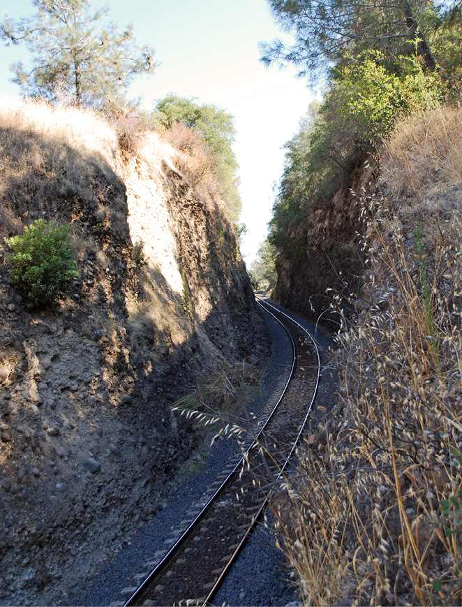
Drilled and blasted February, 1864 to May, 1865, the Bloomer Cut, a major construction feat for the time, is still used today, nearly identical to its original appearance.
Next stop, the Red Frog Lounge in Colfax (formerly Illinoistown), where I enjoyed a cold one on an expansive deck gazing at Cape Horn. Cape Horn is an amazing instance of railroad surveying and engineering. Take a bunch of ice cream cones and turn them upside down. Now, build a railroad through them. Cape Horn is a road having a curve with a delta angle of nearly 180 degrees, winding around a cut bluff 1200 feet above the American River. A second line was tunneled and the road widened over the years. Other than that, very few changes have been made from Judah’s original survey.
It is at the summit of the Sierras, above Donner Lake (yes, those hungry Donners), that Judah’s choice of line proved practicable. A pharmacist and part time surveyor, Doc Daniel Strong, presented this route to Judah. After their initial survey, Judah and Strong realized they had finally found a route that would bind New York and San Francisco as close neighbors. A route over the Sierras was now, indeed, practicable.
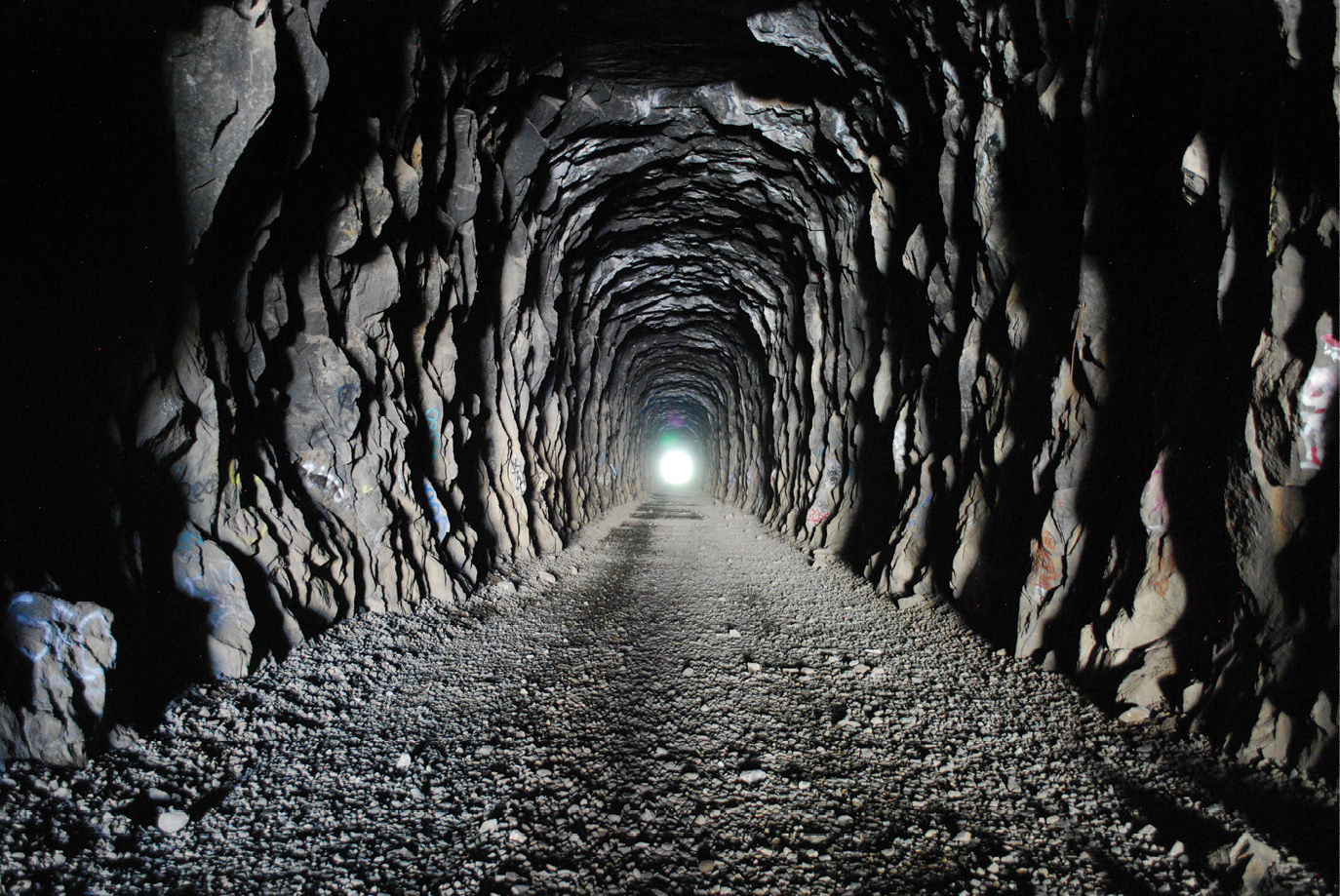
Off I-80, take the Soda Springs exit. Pull into the Donner Summit Resort parking lot on the left. Walk across the highway and enter into the splendor of the Chinese laborers’ efforts in 19th century tunneling. CPRR tunnels 6, 7 and 8 (numbered from the west) are open to the public. Tunnel 6 is the “Summit Tunnel”, 1659 feet long, the longest on the line. It was bored and blasted through solid granite. The “Associates” in Sacramento were unhappy with the lack of progress. A shaft was dug from above and excavation began in four directions. A locomotive named the “Sacramento” was disassembled and hauled to the summit to remove the tailings from the center tunneling efforts. The “Sacramento” was renamed the “Black Plucked Goose.” Bolts used to secure the engine are still in place and the shaft is now covered with a steel plate.
It is truly a joyous experience to walk the summit overwhelmed with the view of Donner Lake one thousand feet below and then gazing into Nevada to the east, the second summit of the Sierra and the Truckee.
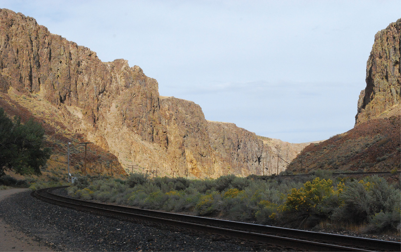
Excavated by nature, the Palisades served as a natural cut for the Pacific Railroad survey location parties. Here the Humboldt River has carved a natural route through some major Nevada mountains near Elko.
Judah writes (1861) “Our line is carried down along the side-hill of the spur or ravine immediately above the lake . . . with a grade of 105 feet per mile (Montague reduced this to 88 feet on the final road) from the summit. The Truckee (River) thus reached, all further difficulty of location ceases . . . with a uniform decline, not exceeding 40 feet per mile.” Judah died from malaria (it’s a long story) in 1863 at the age of 37. Samuel S. Montague, Judah’s assistant, became the Chief Engineer of the CPRR. Judah never witnessed rails on the summit or racing along in the high desert of Nevada.
Right around 50 miles east of the summit, into Nevada, is the spot every man and woman rejoiced and celebrated following their dreams west in the mid-19th century. Truckee Meadows equaled succor, sustenance and salvation, clean water, good pasture. The horrible desert was now behind. Time to replenish and fatten up the livestock. The Meadows are now called Reno. There, I met up with Ray and Mary Root, two exceptionally fine Virginia surveyors. Ray is a former Vice-President of the Surveyors Historical Society (SHS) and Mary is the editor and soul behind “Backsights”, the venerable journal of SHS. There, they joined me, following the Truckee and the Humboldt on our way to Utah and the Golden Spike.
Most probably the greatest surveying achievement for the CPRR crews, The Summit Tunnel. Surveyors, using equipment of the time set line and grade from each end and then sank a central vertical shaft to begin lines in both directions toward each end, at grade.
With the summit conquered, surveying became much less difficult, no more mountains to cut, fill, trestle or tunnel. Surveying got easy, but not the same for railroading. For 500 desert miles, look around. A locomotive must be fed. It consumes wood or coal. A steam locomotive perspired thousands of gallons of water in a hundred miles. A cross-tie is made of wood. For 500 miles of desert, none of these materials are available. The CPRR had mastered the Sierras and were constructing a road on relatively flat terrain but water, rails, cross-ties, fuel and food for the workers had to be carried over the summit into the desert. Water alone could be a nightmare for a dispatcher. Cars with horizontal cylindrical tanks (like an aspirin) were constructed. Car after car full of cord wood climbed the Sierras, feeding the iron beasts on their eastward route.
Leaving Reno, the Truckee River heads north to Pyramid Lake. Between there and Humboldt Sink, there is no water, only alkaline. The Humboldt River had water that would foul a boiler and kill the livestock if they could even consume it. The eastern traveler in the mid 19th century crossed (endured) what was known as the 40 mile desert, usually traveling at night and resting during the daylight hours. An 1850 survey made on this 40 mile stretch noted 1061 dead mules, almost 5000 dead horses, 3750 cattle and 953 graves. A railroad would alleviate these tragedies. On open ground, a well supplied surveying crew could cover some ground though.
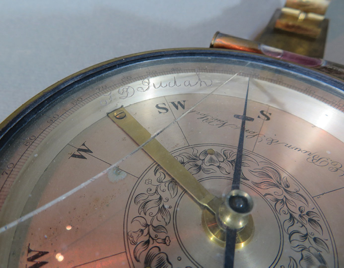
T.D. Judah’s compass displayed in Sacramento, the California hometown of Ted and Anna. Courtesy of the California State Railroad Museum.
Leaving Reno, our first memorable stop was Wadsworth. Here on the original grade of the road is a beautiful through-truss (1907) bridge, no longer in use but usable. In places, the original grade is obvious (cuts and fills) and in others, even a practiced eye can miss it. I-80 through Nevada, seen on a modern day map, resembles a sin curve. The highway generally follows the route of the CPRR chosen by Montague, ambling north and south, avoiding the many mountain ranges dotting that state. In good company with fellow surveyors, we spent two days on the 410 miles across Nevada.
Off I-80, to the south, take the first left past the school. Beowawe, Nevada, a few run-down buildings and a major railroad crossing. In about 40 miles of driving, a number of times we appreciated my choice of a four wheel drive rental Jeep. This road was not on a map or on the GPS receiver. Twice, we annoyed a cowboy, driving a small herd of cattle down the mountain, I guess to winter pasturage. Once, we had to open a gate to go down into a valley to cross another through-truss bridge decked with fairly rotten 2 x 12’s, crossing the Humboldt and paralleling another steel bridge carrying the tracks of the road. It was a ride never to be forgotten, especially in the end. The Palisades. What an amazing geologic feature. Sheer bluffs rising above the winding Humboldt River and the now two sets of rails of the Pacific Railroad. With reluctance, we left the Palisades and headed to Elko.

One of the many remaining wooden culverts from the original road. Nick Montoya and Maybe Baby make the same traverse over the same trestle that many a CPRR train made prior to the Second World War and the Lucin Cutoff over Salt Lake.
Elko is home to Great Basin College. Great Basin has probably the largest enrollment in a Surveying and Geomatics program than any other University in the country. At last count, I was told they had 140 surveying students, mostly on line. Here, we met up with surveying student Nick Montoya and his wife, Emily. We had a hearty family style dinner at a Basque restaurant, named The Star. Leaving the restaurant, Emily pointed out, just down the road and over on the next block, two legal bordellos. This ain’t Georgia.
Very early next morning, Nick and his pooch “Maybe Girl” followed us eastward into Utah. At Oasis, we left I-80. Nick brought his drone, a DJI Mavic Pro, and man, did we get some great pictures of a wye that was not discernable from our ground level vantage point. A drawback on this route was that about 90% of it was in military restricted airspace. No pics there.
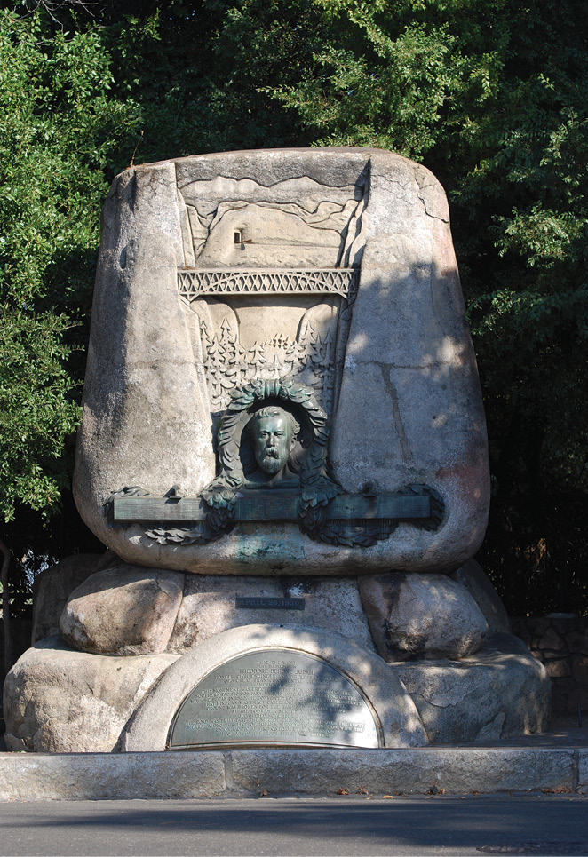
The massive memorial to Judah is found in the old town of Sacramento. It was near this location that Judah introduced the plan for a cross country railroad to Stanford, Huntington, Hopkins and Crocker, later, the “Associates”.
Once again, at Montello, we were on gravel headed for Lucin, Utah. Lucin is where the railroad split in 1904 and headed southeast to cross the Salt Lake. The original route, our route, winds north of the Lake. During the Second World War, the rails were pulled. Our road is now the “Central Pacific Railroad Trail Scenic Backway”. For ninety miles, we rode the grade and for a full ninety miles there was nothing to see but desert and sky. I think it was the first 17 miles that was a tangent. Not much of a challenge for a surveyor.
On the “Backway” one travels on the grade of Montague’s original road and is detoured from the wooden culverts that still stand at creek crossings. Mind you, this is a desert but there are a number of these wooden culverts, most in pretty good shape. At one time, there were at least 23 thriving towns between Lucin and Promontory. Now, there’s nothing. Each place there was a siding or wye, a town grew. Now, there are only foundations, trash or dump sites and grave yards. One forgotten town, Watercress, had a pond with cattails. The water actually was flowing from a pipe routed from the mountains far off to the north. What an amazing 19th century site in this desert.

Following the footsteps of the CPRR surveyors. A trek from Sacramento to Salt Lake City, joined here and there by great friends. (L to R) Mary and Ray Root, both LS’s, both from Virginia; Bart Crattie, LS, Georgia and Nick Montoya, working on that LS, Elko, Nevada. Oh yeah, Maybe Baby too.
Ever eastward, we passed the old town sites, catching glimpses of the Great Salt Lake to the south. Flat deserts and all tangents, Monument Rock is a must. From Lucin to Promontory, there is only one major cut. We drove the ten mile grade that Strobridge’s crew laid the rails upon in one day, winning a bet that was never paid. Here, the remaining culverts are stone. Also here, are the notorious parallel grades the Union and Central Pacific railroads built, taking the taxpayers’ dollars, both being paid by the mile of grade constructed, not rails laid. Suddenly, we found ourselves at Promontory. T.D. Judah wasn’t there for the driving of the golden spike (1869), having died six years earlier. His name was never even mentioned during the ceremony. The spike was driven on May 10, Anna and Ted’s wedding anniversary. We drove through Promontory, on to Salt Lake City.
There, the Surveyors Historical Society were holding the 21’st annual Rendezvous. My duty was to present a paper. The subject? Nobody other than Theodore Dehone Judah, the raison d’être behind this fantastic journey of beauty, fellowship and surveying history.
Sidebar:
From T.D. Judah’s Practical Plan
(January, 1857) (edited)
“The engineer in charge of the survey goes over the country upon which it is proposed to construct a line, and carefully examines the ground with reference to the proposed location. He notes its character, water-courses, ravines, undulations of the ground, crossing points for rivers and decides the general course of the line. This done, he organizes a party, composed of what is usually termed a transit and leveling party.
The business of the transit party is to run a line over the route indicated, measuring distances with a chain, and taking courses or direction of the line by compass or goneometer (a transit with two telescopes mounted above one and the other on the same axis to enable measuring the angle twice for a check), leaving stakes every one hundred feet . . . as guides for the leveling party. The results are put on paper and gives . . .a correct representation of the line, showing curves, tangents, the crossing of roads, rivers, farms, townships, names of land owners and all points of interest along the line.
The leveling party follows the transit party, and runs, with the utmost accuracy, a line of levels, touching upon each stake, taking observations of the undulation of the ground. . . This plotted gives what is called a profile . . .
A topographer is also furnished, whose business will be to sketch topography, taking notes of every feature presenting itself.
Another leveling party is provided for the purpose of running a test level. The consequences of an error . . . on so long a line of surveys would be so annoying . . .
. . . the Engineer . . .knows that . . . this will be over level, open country, offering no obstacles, and that an ordinary party, on preliminary surveys, will make three miles per day without difficulty . . .
Sidebar:
From Cab to Caboose
(January, 1857) (edited)
A full size surveying party in open country ordinarily consisted of from thirteen to sixteen men. Their function was to produce a map and profile of the line, together with topographic information. We lived in tents. I never knew a cook who didn’t sleep in the cook tent. Maybe it was warmer . . . or possibly he had lost confidence in humanity. The cooks on these parties were generally pretty good and the food was plentiful. Most of the camp cooks could turn out good meals, but it was exceptional to find one who didn’t have an irascible disposition. Whatever caused it, they were, as a class, hard to get along with. One morning during the cold winter . . . one of the chainmen burst into my tent and demanded, “Say Noble, can we get along without a cook?” I stopped lacing my boots. “I guess I didn’t understand you. What did you say?” He repeated the question. I said, “Of course not. What brought this up?”. “Well,” he said, “my feet were pretty cold when I got up so I went to the cookstove, and was warming my feet and lacing my boots when Franklin began cursing me and yelling for me to get out of his kitchen. What he said to me I won’t take from anybody and if it will not inconvenience you, I’ll just kill the bastard.” He was dead serious, so I said, “It would inconvenience me considerably. We are fifty miles from a town or railroad, in the middle of a blizzard, and have fifteen men to feed. Let’s go talk to Franklin.”
—Joseph A. Noble; “From Cab to Caboose”; University of Oklahoma Press; 1964