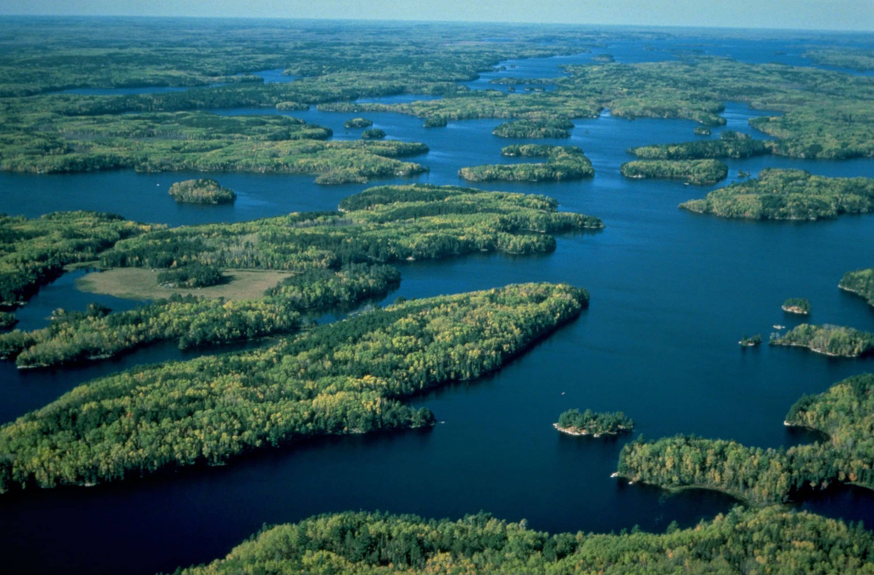
 Voyageurs National Park is located on the international border with Canada, in northern Minnesota approximately 35 miles east of International Falls. About forty percent of the park is water, making it popular for boating, canoeing, and camping lakeside. Fortunate visitors can witness the aurora borealis dancing across the night sky over the park.
 The park is named to commemorate the voyageurs—French-Canadian fur traders who enjoyed the ease of travel along the navigable rivers and lakes and were the first European settlers traveling the area. The fur trade was unregulated until France created a system of limited licenses for fur traders known as “congés.” Voyageurs (French for “travelers”) were licensed traders and represented a trading company, traveling to collect pelts from trappers and transport them back to trading posts.
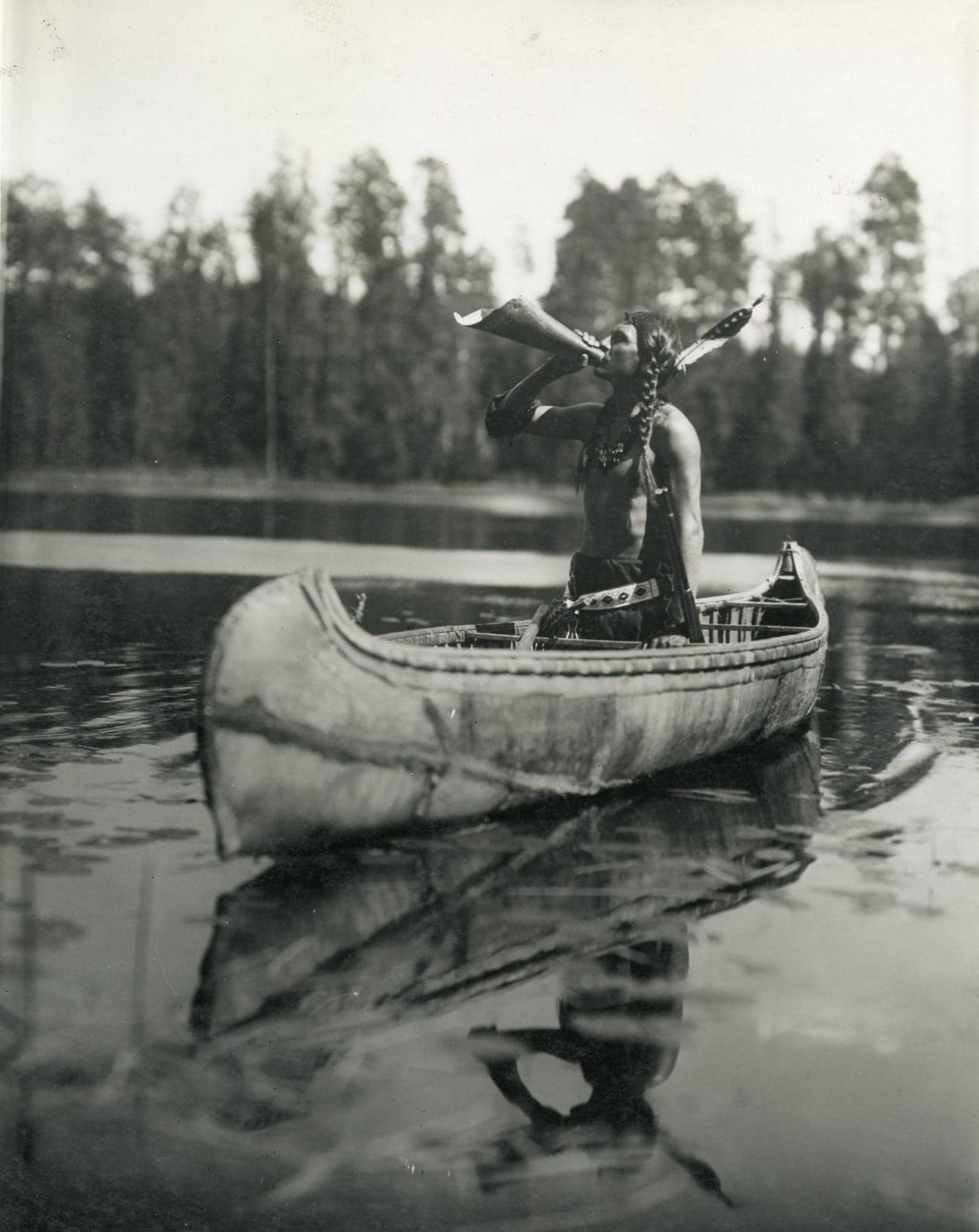
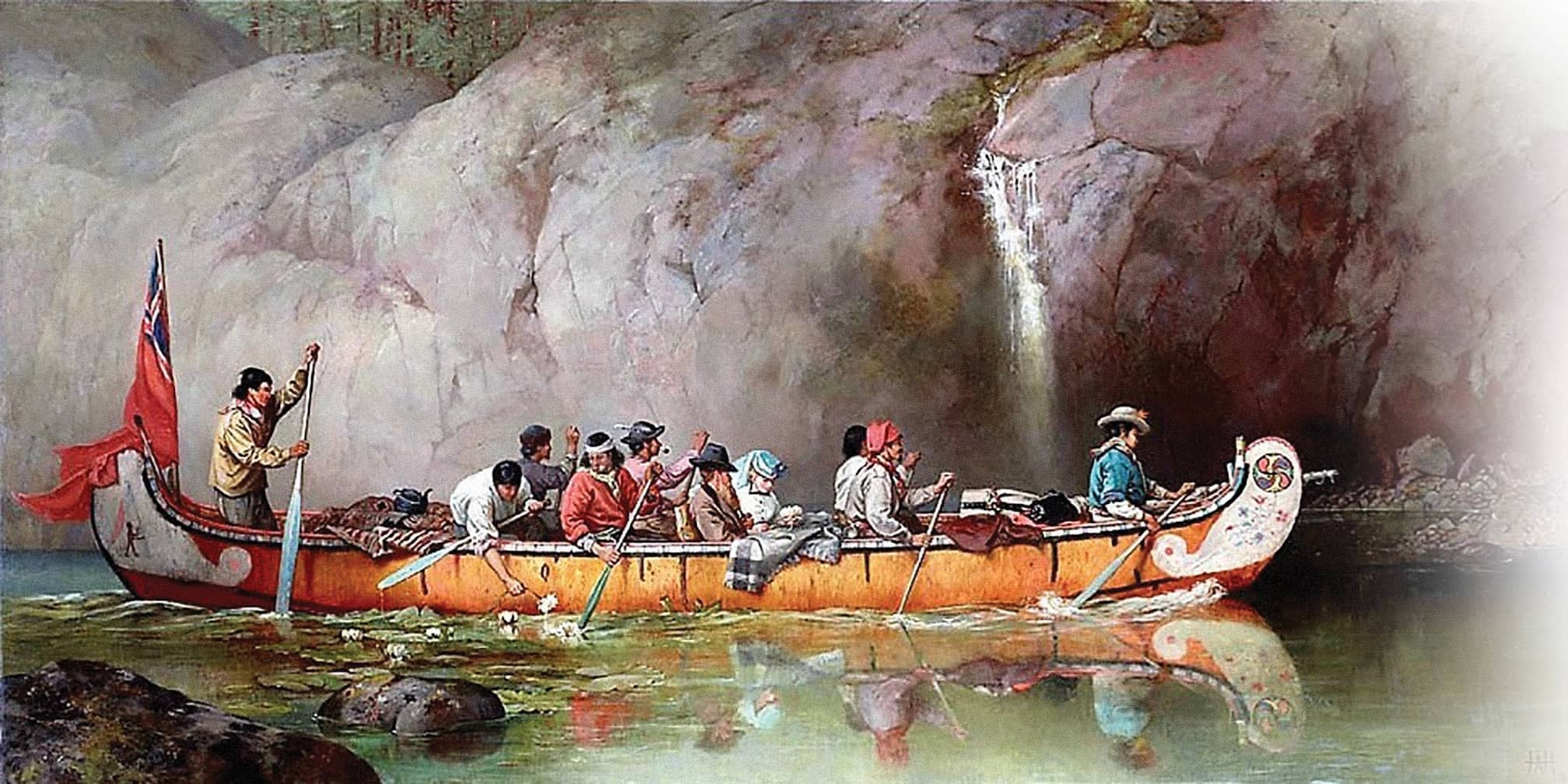 Ojibwe people lived in this area for hundreds of years, navigating the rivers and lakes in their birch canoes. The Ojibwe, also known as the Chippewa, lived in Canada and the United States in the Great Lakes region. An Algonquian speaking group of bands, the Ojibwe became organized as a tribe in the 17th century. As independent bands of migratory fishermen and hunters, the Ojibwe were ideally suited to trade with the Voyageurs. The park has also been home to the Cree, Monsoni, and Assiniboine tribes.
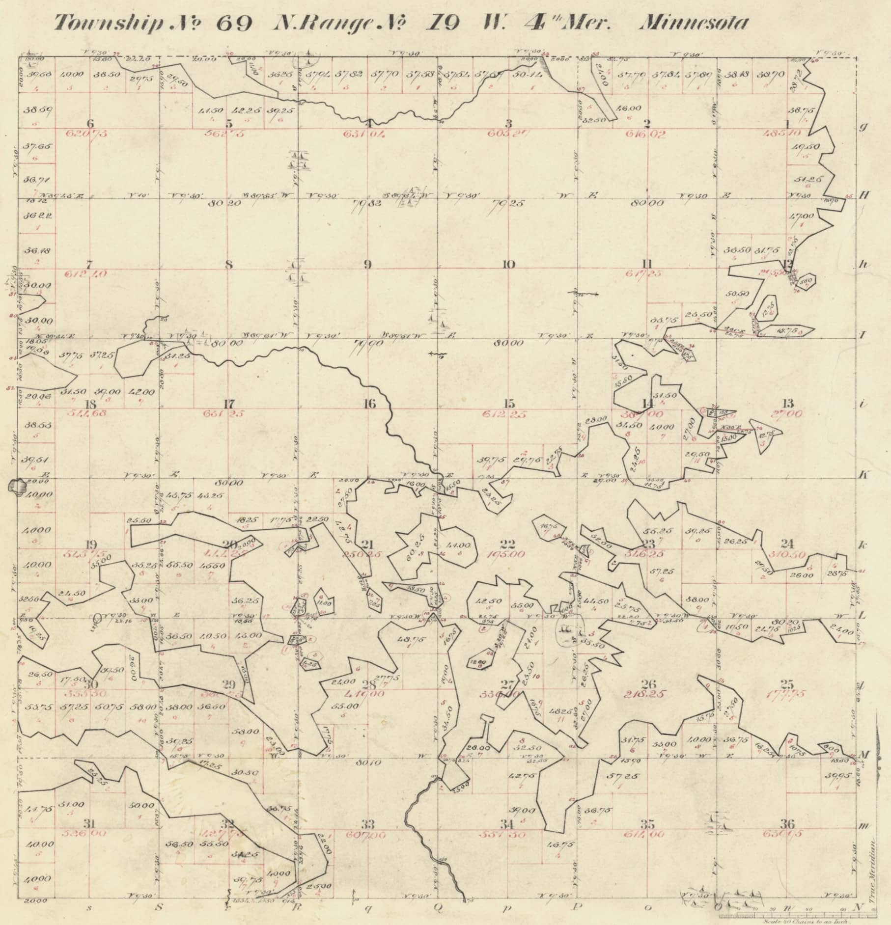
 The original survey of this Township was conducted by deputy surveyor George F. Hamilton. In his field notes, Hamilton begins his introduction with, “Survey commenced with a Burt’s improved solar compass adjusted to the true meridian.”
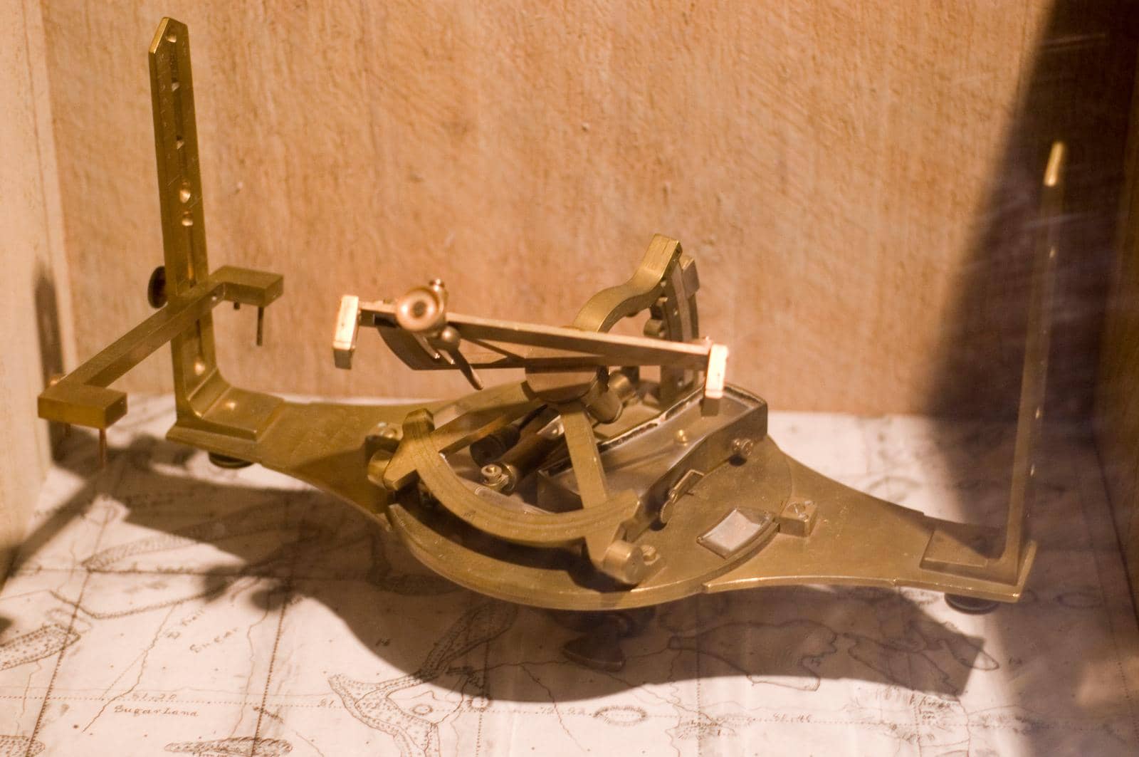
The solar compass was invented by Deputy Surveyor William Austin Burt. Burt patented the solar compass on February 25, 1836, with the United States Patent Office.
 The solar compass truly revolutionized surveying and significantly improved the quality of surveys conducted in the public domain. Burt, while surveying in Michigan, had observed the needle on his magnetic compass spinning “unusually violently” while performing his work in Marquette County, Michigan, due to the magnetic influence of the Marquette Iron Range.
The solar compass allowed surveyors to determine true north from an observation of the sun without the need of a magnetic needle. Adjustments for latitude, declination of the sun, and hour of the day are set to allow the sun to pass through a lens to point north.
The survey plat of Township 69 North, Range 19 West, of the Fourth Principal Meridian in Minnesota was approved on October 29, 1883.
Pursuant to the John D. Dingell, Jr. Conservation, Management, and Recreation Act of 2019, lands managed by the Bureau of Land Management within the boundaries of the park were transferred to the National Park Service.