 Yorkshire, UK, Nov 5, 2019 – Verified photomontage is an important planning tool to envision how proposed surrounding development plans would affect UNESCO World heritage sites. Verified photomontage demands the best accuracy for the best visualization to determine what a development may look like to a person standing at the photographic viewpoint. For MS Environmental (MSE), selected to provide verified photomontage for multiple UNESCO World Heritage sites, including in the UK Royal Botanical Gardens at Kew and the City of Bath, the Spectra Geospatial SP80 GNSS receiver has emerged as the receiver of choice to achieve the highest quality visualization.
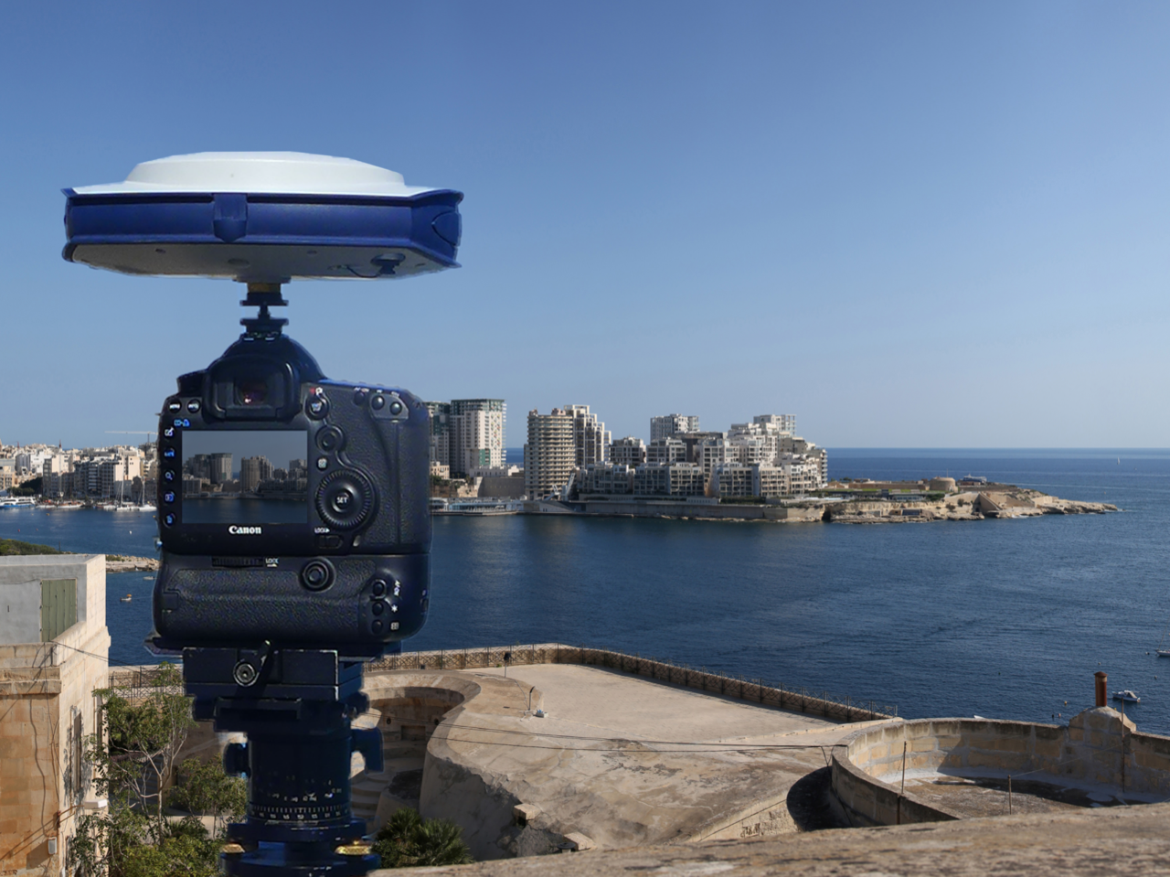
“The one-centimeter accuracy delivered by the SP80 is essential,” says Mike Spence, a Verified Photomontage Specialist and Founder of MSE. “The highest level of accuracy in the relationship between the actual camera location and the 3D model camera gives confidence in the visualization. In addition, The SP80 offers both simplicity and a robust design though it’s taken a few knocks over the years, it gives us the confidence we can use the equipment anywhere in the world and get the best results,” he added.
At Kew Gardens, MSE was commissioned to produce accurate visualizations of views from within the UNESCO World Heritage Site. There was concern about development proposals for tall tower blocks in west London and how these might affect historic views from Kew Gardens. The work culminated in a Public Inquiry where evidence was presented which showed how views would change as a result of the proposed development. “Without the level of accuracy provided by the SP80 together with a transparent technical methodology it would have been unclear precisely how these historic views would change,” Mike Spence noted.
At the UNESCO World Heritage City of Bath, the Bath and North East Somerset Council commissioned MSE to produce technical photography from strategic views around the World Heritage City to show how development proposals would affect strategic views across the city.
About the Spectra Geospatial SP80
The SP80 tracks and process all available GNSS signals, to provide the most reliable measurements and the highest possible accuracies in challenging environments. It also offers the best communications and connectivity capabilities available today including SMS and email alerts and anti-theft protection. The ergonomic design and unlimited operating time make the SP80 an extremely versatile and complete solution.
About MS Environmental
Headquartered in Yorkshire, MS Environmental specializes in technical photography, 3D modeling, visualizations, verified photomontages to aid architects, planners and professionals working in environmental impact assessment and development planning and consultation.
About Spectra Geospatial
Spectra Geospatial is an established brand known for delivering quality products to the survey, GIS and construction markets. Focusing on the specific needs of the conventional surveying market, the Spectra Geospatial brand offers a complete product portfolio including Global Navigation Satellite Systems (GNSS), optical total stations, data collection hardware, field and office software, as well as a wide range of construction tools. Spectra Geospatial surveying equipment is an economical choice that utilizes technologies for optimal efficiency. With convenience and reliability as the foundation of the Spectra Geospatial brand, it is an ideal choice for value. The Spectra Geospatial brand is backed with the strong technical support that users have come to expect from a quality name in surveying and construction.
