 The General Land Office is pleased to bring you the original survey plat for T1N R14W of the San Bernardino Meridian which is where the Hollywood sign is located. This plat was approved August 14th, 1876. The land where the sign is located was deemed unsurveyable by the original surveyors.
Before the glitz and glamour of Hollywood, southern California was comprised of farms, bandits, and undeveloped land. However, due to it’s mild, warm, and consistent weather, the real estate market began to explode in the late 1800s. Soon after in the early 1900s, the area also became the ideal destination for early film studios that had previously struggled with filming in more variable climates.
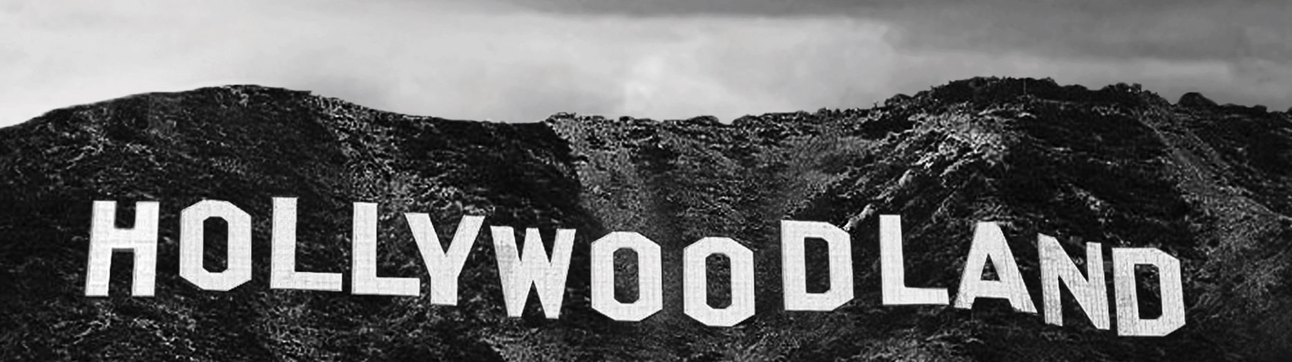 The Hollywood sign was first erected in 1923, 47 years after the land was surveyed. The sign is located on Mt. Lee, just north of Griffith Park, and initially said “Hollywoodland.” Complete with 4,000 lights, the sign would blink at night, flashing the words “Holly,” “wood,” and “land” consecutively. The “land” would eventually be removed in the 1940’s.
In the next 50 years, after world wars and the urban exodus to the San Fernando Valley, crime rose and the Hollywood sign began to decay. The top of the “D,” along with the third “O,” fell off the sign and an arsonist set fire to an “L.”
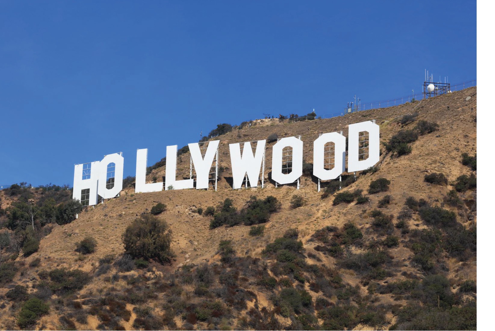 It wasn’t until the late 1970s when the sign would be fully repaired. Fleetwood Mac, Alice Cooper, Gene Autry, and other famous celebrities either hosted or attended charity events to help raise funds to repair the letters. In August of 1978, the original letters were taken down and replaced three months later by the current sign that can be seen today.
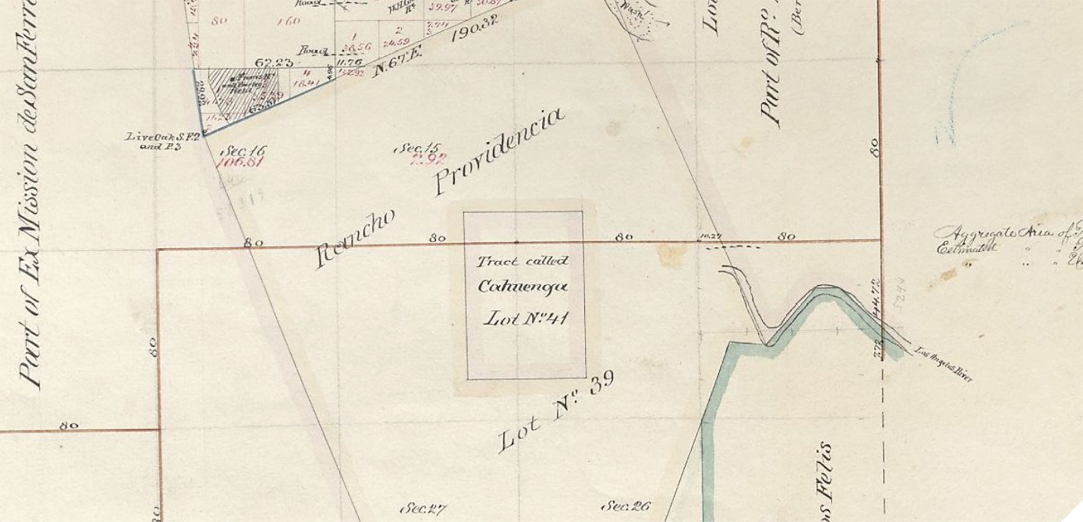
If you zoomed out on the plat, you may have seen an unsurveyed area that was called “Rancho Providencia.” Ranchos were first granted to Spanish missions as a “use” permit, where Spain owned the land but the mission was allowed to use it for mission purposes. After Mexico’s independence, Mexico passed laws to grant title to the recipient. Rancho Providencia, the rancho depicted on the GLO survey plat here was granted to Vincente de la Osa in 1843 during Mexican rule.
A few years later Mexico ceded control of California, Nevada, and parts of Wyoming, Colorado, New Mexico and Arizona to the United States. This ended the rancho period, putting the remaining lands not already granted as ranchos into the public domain. The Land Act of 1851 allowed for owners of ranchos to file a claim with the Public Land Commission who could recognize title granted from a prior sovereign and eventually recommend that a patent be issued to the owner(s).
Note: An 8.2Mb MrSID file of the complete plat of the original survey of Township 1 North, Range 14 West can be found at http://bit.ly/35k7qoO