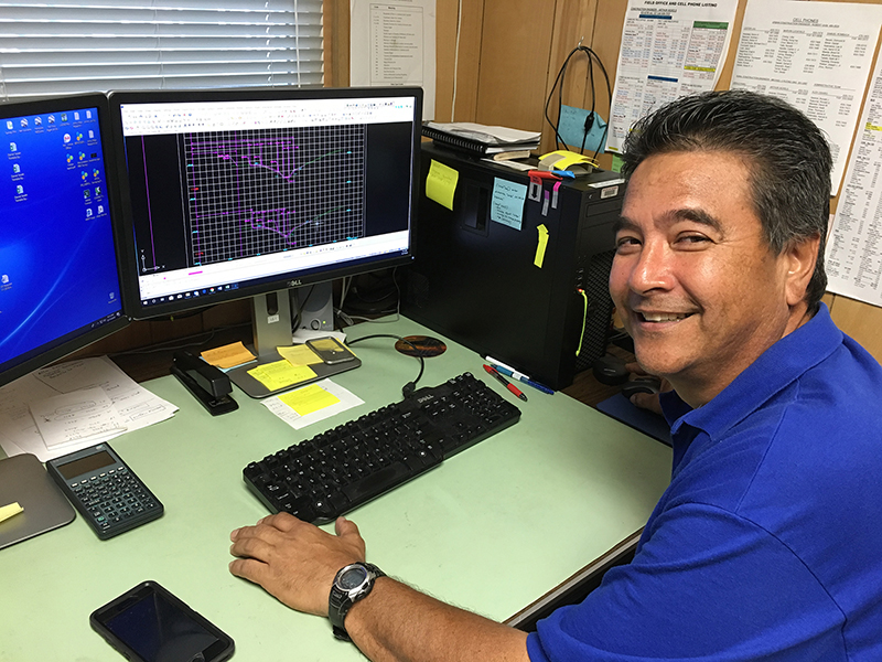
Daniel Sasaki of Hawaii DOT
One aspect of Carlson Civil that Daniel Sasaki, Land Surveyor III of the Hawaii DOT, happened upon and decided he really liked was the drive-through option.
“You choose a car and you can have it ‘drive’ over your profile so it shows you if there’s a hump or bump in the road,” he said. “It’s pretty neat.”
But that’s not all that Sasaki and his team, Justin Ching, Carlos Hipolito, and three other survey crews on Oahu like about Carlson. They have been using Carlson Survey and Carlson Civil since 2015, when they moved over from Eagle Point. “I hung onto Eagle Point until my warranty expired and it was time to move on to another program,” Sasaki explained, noting that they demoed other software but went with Carlson because it fit their needs and their budget. “We wanted to go with a CAD program and Carlson is a very good program for the price,” he added.
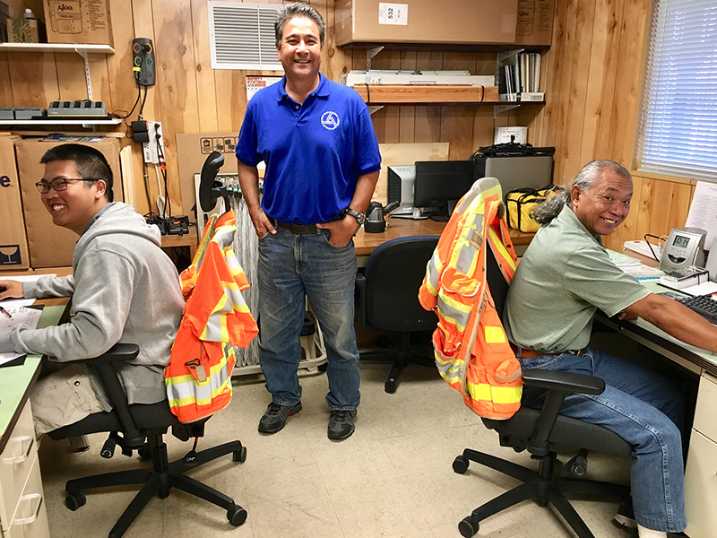
Honolulu office Hawaii DOT team (l. to r.) Justin Ching, Daniel Sasaki, and Carlos Hipolito.
While the general image of Hawaii might be of glorious weather, endless beaches, and palm trees, Sasaki has to deal with the reality of the weather – “lots of wind, rain, hurricanes” – and that fact that Oahu has way more traffic, even a 12-lane highway, due to a much higher population than the other islands that make up the state. Both take a toll on the roads on the island.
Projects he’s responsible for include widening and resurfacing existing roads, fixing washouts and bumps in the road, and building new roads. While his office is not doing the design, they use Carlson day-to-day to check and review the designs they receive.
“We have to make sure that what we’re getting is correct,” he said. “We redraw the plans in Carlson using the construction plan data just to make sure that what they send me in the plan will work at the site.”
In addition to the drive-through option, Sasaki and his team extensively use field-to-finish, profiles, TOPO, cross sections, cut and fill, and centerlines. “The Profile program really helped me out a lot,” Sasaki explained. “If there’s a bump in the road, I do my TOPO and my surface, which means I can plot out the cut and fill for whatever station I need to and then I can create a map and give it to the contractor and tell them this is the area to cut or fill to smooth the road.”
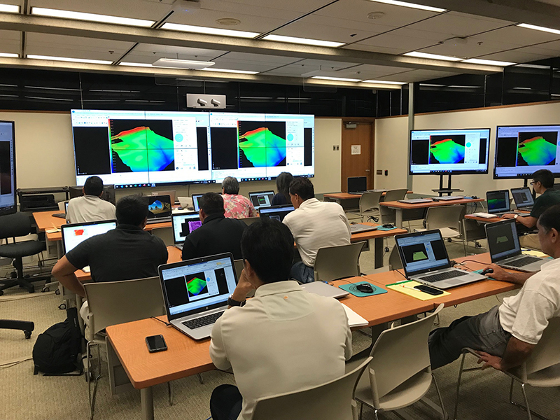
Civil Suite training for City & Council of Honolulu
Carlson fits their needs
Unlike the rest of the U.S., Hawaii is standardized using South Azimuth, not North Azimuth. Sasaki notes that configuring Carlson to use South Azimuth was a breeze and very helpful to them. He also likes the ability to set his codes up the way he wants them. “I like to have my codes certain ways,” Sasaki said. “The software allows me the flexibility to do it how I want to. That flexibility is a big plus.”
Besides getting his varied work needs handled by the everyday use of Carlson Survey and Civil, there is Carlson’s tech support that Sasaki especially praises.
“It wasn’t that bad to switch over to Carlson from Eagle Point,” says Sasaki, “but I call Carlson’s tech support once in a while and they are very helpful. In fact, one of the reasons we went with Carlson was because of their tech support.”
Sasaki also likes that Carlson is open to suggestions to improve their programs. “You leave a message asking for them to improve something and right away Carlson takes the suggestions and works on the improvement,” he adds.
Would he go with Carlson again? “Yes,” he says, “I would definitely buy Carlson again. It fits our needs and I keep finding ways to improve and create short cuts.”
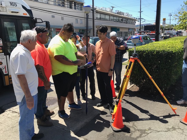
Training on Oahu
More Carlson Aloha
Recently the City & County of Honolulu acquired several Carlson Civil Suites to outfit their Land Survey Department and have begun the transition. “I was out in Honolulu a few weeks ago training their staff of 15,” said Luis Rojas, Carlson Regional Sales Director for Hawaii. “The staff has been pleasantly surprised with the capacity of Carlson software, intuitive interface, and ease of use for what they do.”
This adds to a growing number of government, public, and private companies that are users of Carlson Software in the Aloha State, which include well-known companies such as Hawaiian
Dredging, Kiewitt Pacific, amongst many others. But it isn’t just the software that’s receiving the Aloha. Recently, companies like Engineers Surveyors Hawaii Inc. and Dennis Hirota have acquired Carlson BRx6+ GNSS receivers and Carlson’s controllers to enhance their field work.
“Lastly,” adds Rojas, “we’ve strengthened our relationship with Surveyors Supply Company Inc., Carlson’s reseller in the islands. Dave Wilmarth and his team are ready to showcase Carlson’s BRx6+ GNSS, controllers. field and office software to any customers in the islands.”
