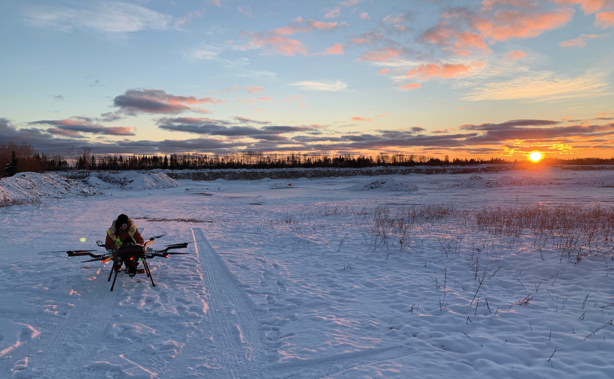
Field preparations and pre-flight in the Upper Peninsula.
During a frigid late-November trip to Michigan’s Upper Peninsula,the Skytec team needed UAS and lidar equipment to perform well in harsh weather. The equipment delivered, warming the hearts of our clients and our freezing flight crew.
When Skytec1 packed up its equipment in Chattanooga, Tennessee to travel roughly 1000 miles to a job site in Michigan’s Upper Peninsula, the weather couldn’t have been more different than what it would eventually endure. November in Tennessee is a mild month, barely hinting at winter to come. In the Upper Peninsula, however, winter was already fully entrenched. This acquisition mission would push the upper thresholds of lidar collection capabilities from an unmanned system in cold, snowy conditions.
Skytec knew this would be challenging, but the team was confident that the equipment and expertise it would be bringing to the site would be more than enough to complete the mission without incident. It turned out that they were right, though the bone-chilling temperatures did result in frozen fingers, toes and noses.
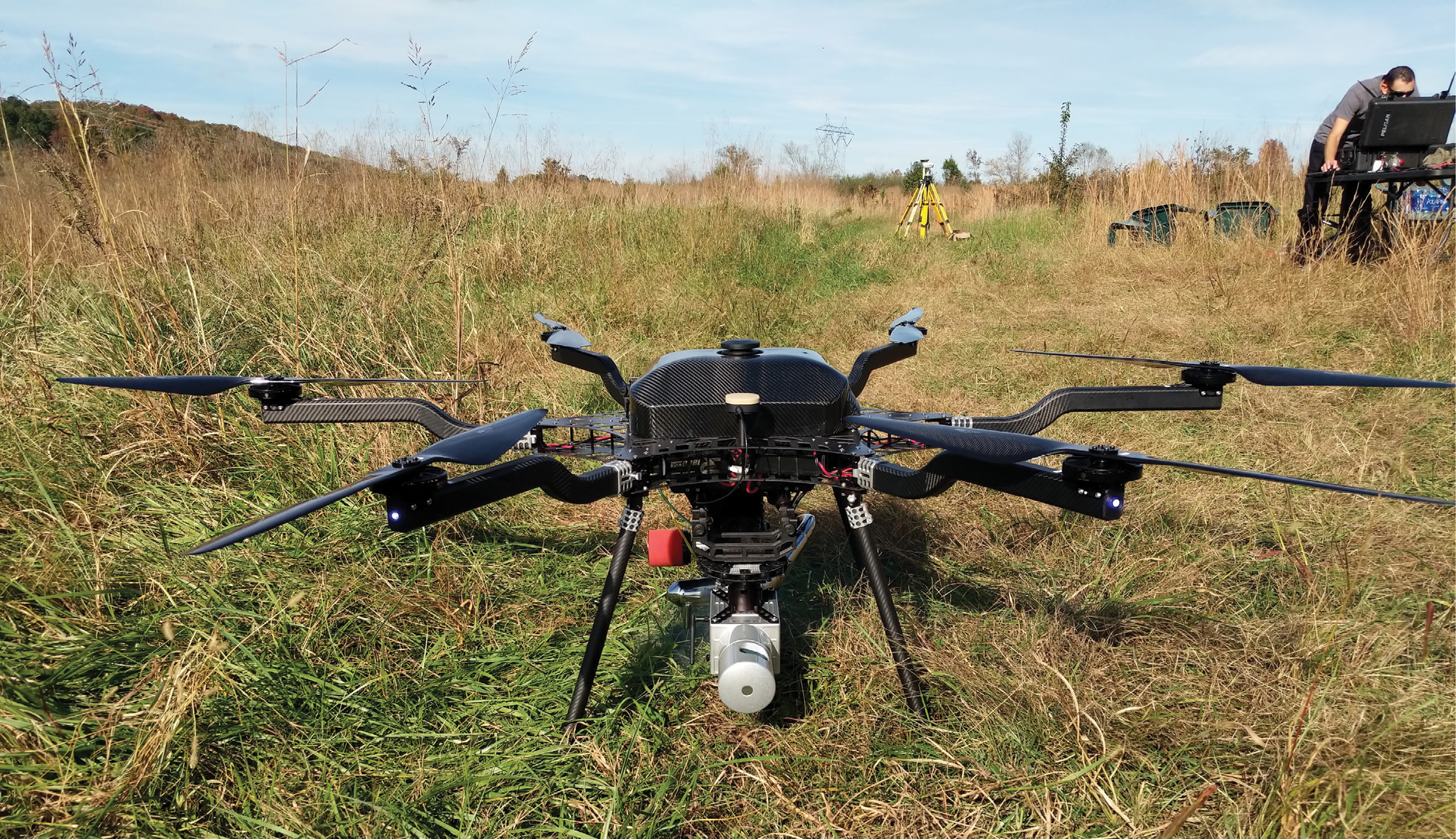
Harris H6 hybrid UAS equipped with LiDAR USA Snoopy A-Series HD sensor.
A two-party Tennessee excursion
Skytec’s venture to the Upper Peninsula arose from a combination of interesting relationships and circumstances.
Skytec was co-founded by Andy Carroll and Bill Rogers, who serve as Chief Technology Officer and Chief Executive Officer respectively. The company is a leader in unmanned aerial systems, remote sensing, and GIS technologies. Its tagline, “Acquire, Analyze, Inform”, points toward its service model. it uses its UAS fleet and imaging tools to acquire site information, analyze that data using in-house GIS and remote sensing expertise, and creates the opportunity to help inform consequential decisions made by its clients.
Skytec has teamed with a myriad of partners from across the country on projects ranging the full spectrum of complexity. One of those partners has been Wingfield Scale & Measure2, also based in Chattanooga, which specializes in industrial weighing and measuring solutions.
Wingfield, a third-generation family business, maintains a robust collection of terrestrial lidar systems and expertise. But for a particular client, who needed a two large mining sites assessed in the Upper Peninsula, an aerial lidar option made the most sense. The client needed to measure the volumes of overburden materials that would be cleared from its sites as well as the remaining surface materials. This job would require aerial lidar due to the vast areas to be captured, over 2400 acres, and densely forested conditions on site.
The Wingfield team, therefore, reached out to Skytec.
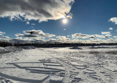
Harris H6 and lidar payload in flight on a frigid day.
Tough terrain and harsh weather—a good UAS fit
The weather awaiting Skytec in the Upper Peninsula was in stark contrast to what the team had been enjoying in Tennessee. Whereas Tennessee’s November temperatures often creep into the mid-60s, snow was already blanketing the ground at the Michigan job site with cloud-filled skies and windy conditions.
Historically, the kind of job for which the team was preparing would require extensive groundwork by field crews or the acquisition of lower-resolution data from manned aircraft. With the frigid weather conditions, snow, and low cloud ceilings, however, manned aircraft would have had a very difficult time collecting the required data.
Skytec’s lidar and UAS tools
To meet the client’s needs head-on, Skytec decided to use its brand new Harris H6 hybrid system.
The H6 is a heavy-lift gas/electric hybrid-powered UAS, capable of flight times surpassing 1.5 hours in fair conditions while equipped with lidar payloads.
The lidar selection was Skytec’s LiDAR USA Snoopy A-Series HD system. This Velodyne HDL-32E-based system maintained a low to moderate weight of 2.51 kg and high-density scanning capability of greater than 200 pulses per square meter at an elevation of 60 meters above ground level. Coupled with the hybrid-powered system, this enabled the flight team to plan for flight times greater than one hour, leaving adequate fuel reserves for unexpected conditions.
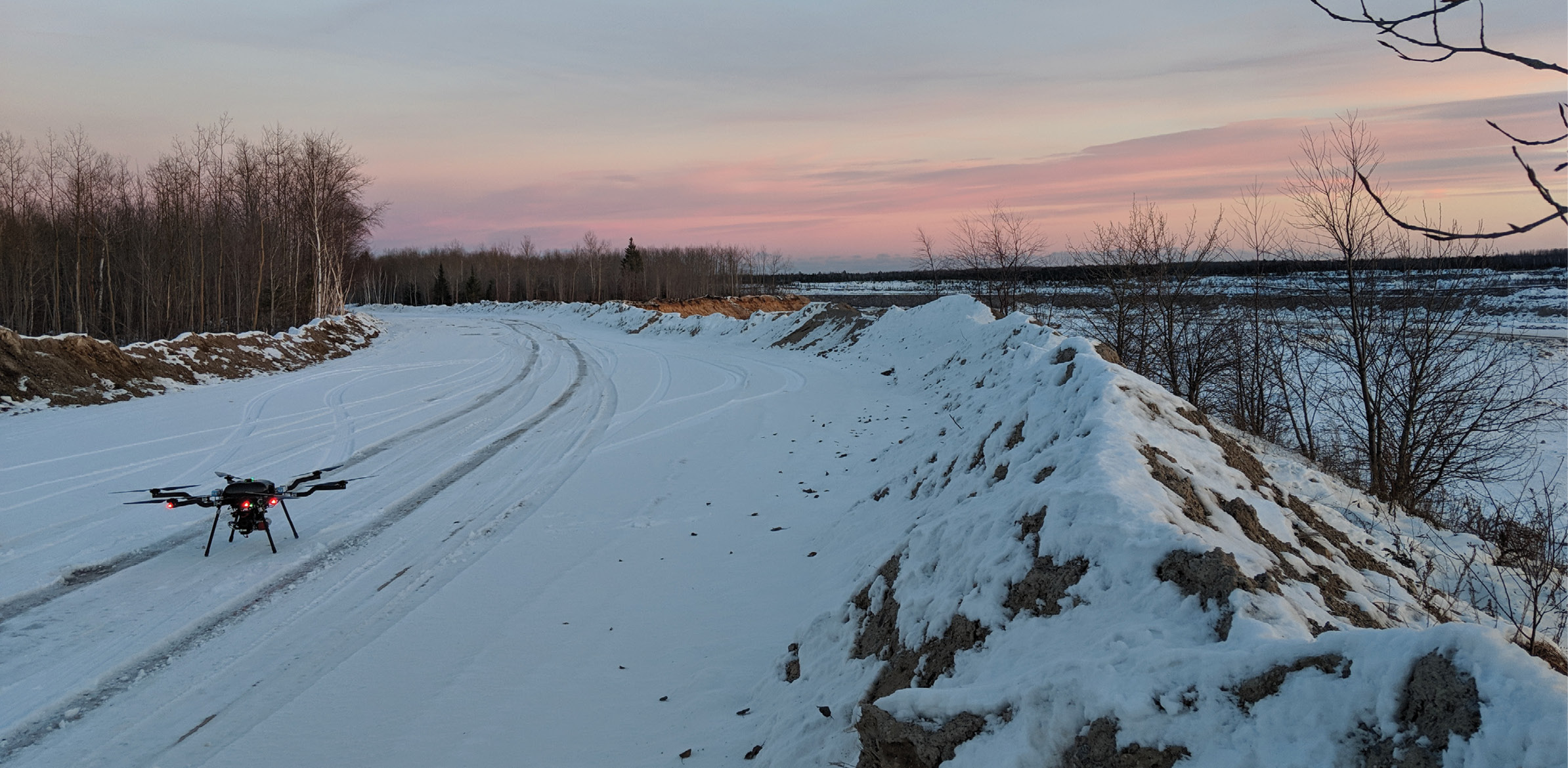
Harris H6 and lidar payload ready for take-off.
Tough weather, no problem
Given the testy weather Skytec knew it would encounter, the team assumed that the maximum performance of the equipment would be tough to achieve. Yet even in those harsh, sub-freezing temperatures, the hybrid UAS performed quite well. Thanks to the high-quality system, Skytec enjoyed three great benefits:
- Extended flight times: The system was able to achieve more than 76 minutes of flight time on a single mapping grid with the UAS. On that grid, the flight covered an area of 700 acres with a dense point cloud through snow, wind and forest canopy. If Skytec had used an all-electric system with lithium batteries only, the team would have been significantly limited due to weather conditions, expecting to see flight times of only 10-15 minutes, at best, in the daily high temperatures of 15°F.
- Enhanced Line of Sight Range: With a 2.3 meter arm-to-arm diameter and 2-stroke engine, the H6 remained easily visible and audible from distances up to 1900 meters away. The system was easily tracked and located on the horizon during mapping grids over the mining site. Skytec’s Desert Rotor ground control station, operating at 900 MHz with a dual-antennae system, maintained relative connectivity at 97% signal strength or greater. This ability to fully control and track the H6 at great distances instilled a high level of confidence with the flight team in the field.
- Consistent data acquisition: Because the hybrid UAS could fly for much longer durations, Skytec was able to collect high-accuracy data much more consistently. Before Skytec added the hybrid system to its fleet, the lidar field data collection process was, literally, “stop-and-go”. A typical grid flight would consist of starting the system, beginning a grid flight line, collecting data, landing to change batteries, launching again, collecting more data, etc. — over and over. The constant change in heading and elevation, sensor restarts, and fluctuating power supplies places additional computational requirements for positioning and sensor inertial measurement units. That increased work typically introduces errors and lowers the overall consistency of the data. With the hybrid, Skytec was able to significantly reduce the introduction of these sources of error.
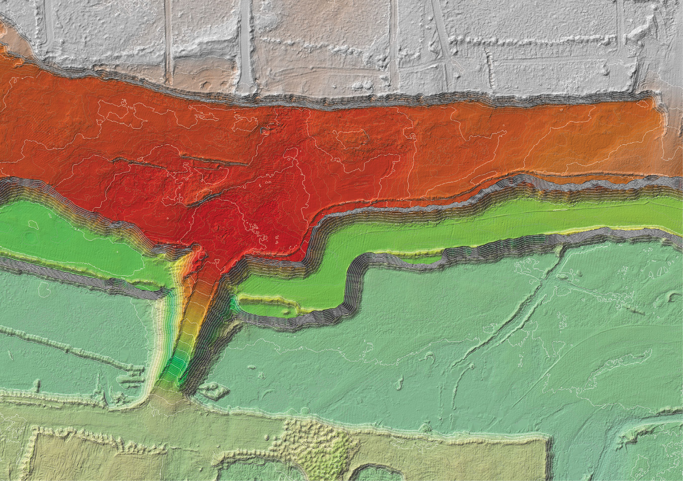
Lidar-derived deliverable for Skytec/Wingfield shared client.
Great data acquisition equals quality mapping results
Thanks to the exceptional performance of the UAS, Skytec was able to acquire reliable data in a comparatively short time. The next step was to parse that information into a comprehensible, actionable format for the client shared with Wingfield.
Raw lidar data and control points collected by post-processed GNSS base observations were fused with telemetry records in Novatel’s Inertial Explorer and LiDAR USA’s Scanlook software. LAS files were ground-classified using automatic and manual classification techniques. GeoCue’s LP360 and Esri’s ArcGIS Pro were used to perform final tiling and accuracy reports. The client received classified LAS v1.2 files and digital terrain model products at USGS QL0 standards.
Elevation surfaces were derived from the digital terrain models and used in CAD software to quantify anticipated volumes of overburden materials and volumetric changes for stockpiles. This provided the client with a greatly increased level of accuracy for volume estimates. These estimates were used for budgeting and progress tracking throughout the year. Overall, the client was provided with a higher accuracy dataset, in a shorter amount of time, representing excellent value in terms of product and price.
Heading home
In all, the combined Skytec/Wingfield team spent roughly a week on the Upper Peninsula site. In retrospect, in addition to a renewed appreciation for Tennessee Novembers, the team learned a great deal about how some of the newest technologies in the UAS and lidar industries function in harsh circumstances.
The team was delighted with how the hybrid performed and yielded downstream results in terms of data acquisition and analysis for the shared client. Without quality unmanned technology, it would have been difficult to obtain the kind of reliable information the client needed about its mining sites.
Skytec fashions itself as a UAS/lidar early adopter. The experience in Michigan was heartening in that it demonstrated a remarkable advance in the technology space in which the company operates. Skytec, therefore, is hopeful further innovations are available to it soon, enabling it to address new client challenges.
After 15 years in the higher education space leading the ga Interdisciplinary Geospatial Technology Lab at the University of Tennessee at Chattanooga, Andy Carroll3 co-founded Skytec, LLC in 2015 with Bill Rogers. Andy serves as Chief Technology Officer.
1 skytecllc.com
2 https://www.wingfieldscale.com/
3 linkedin.com/in/andrewcarroll67