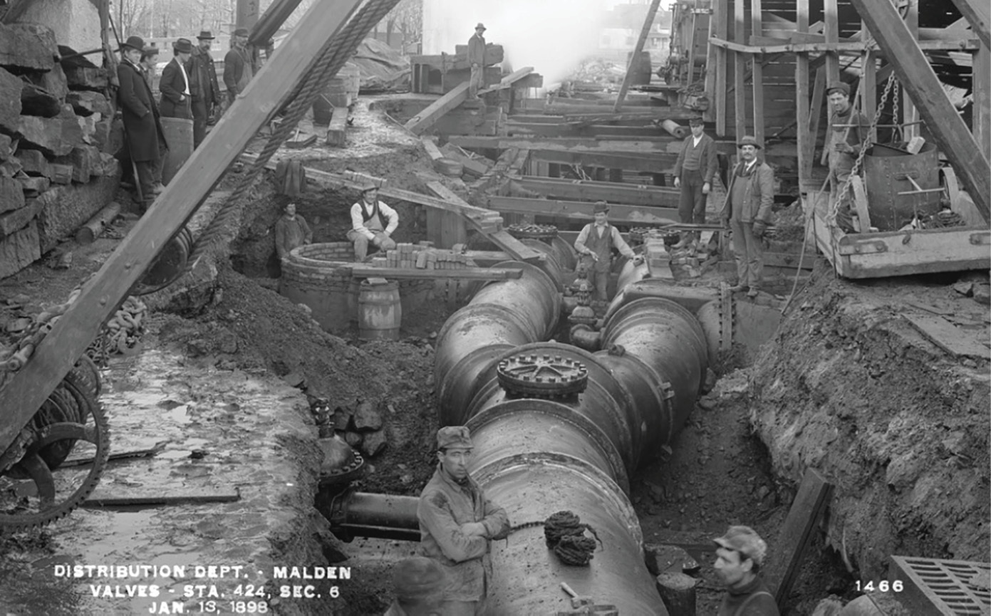
A public utility crew at work on subsurface utilities in Malden, Mass., in 1898.
For the last few decades, Subsurface Utility Engineering (SUE) has elevated the architecture, engineering, and construction (AEC) industries in accuracy and quality by promoting greater knowledge and care of underground assets. In fact, a Penn State University study revealed that every dollar spent investing in the SUE process brings a return of $22.21.
While SUE as a discipline has propelled the industry forward, the terminology—subsurface utility “engineering”—has caused confusion and division among engineers, surveyors, geophysicists, designers, and owners involved in the planning phases of development projects.
When it comes to the underground environment, engineering refers most accurately to the design, relocation, and handling of underground utilities. Those practices are only one part of the equation, however, and using “engineering” as a generalized term diminishes the importance of the first step in any successful project: mapping the above- and below-ground environment.
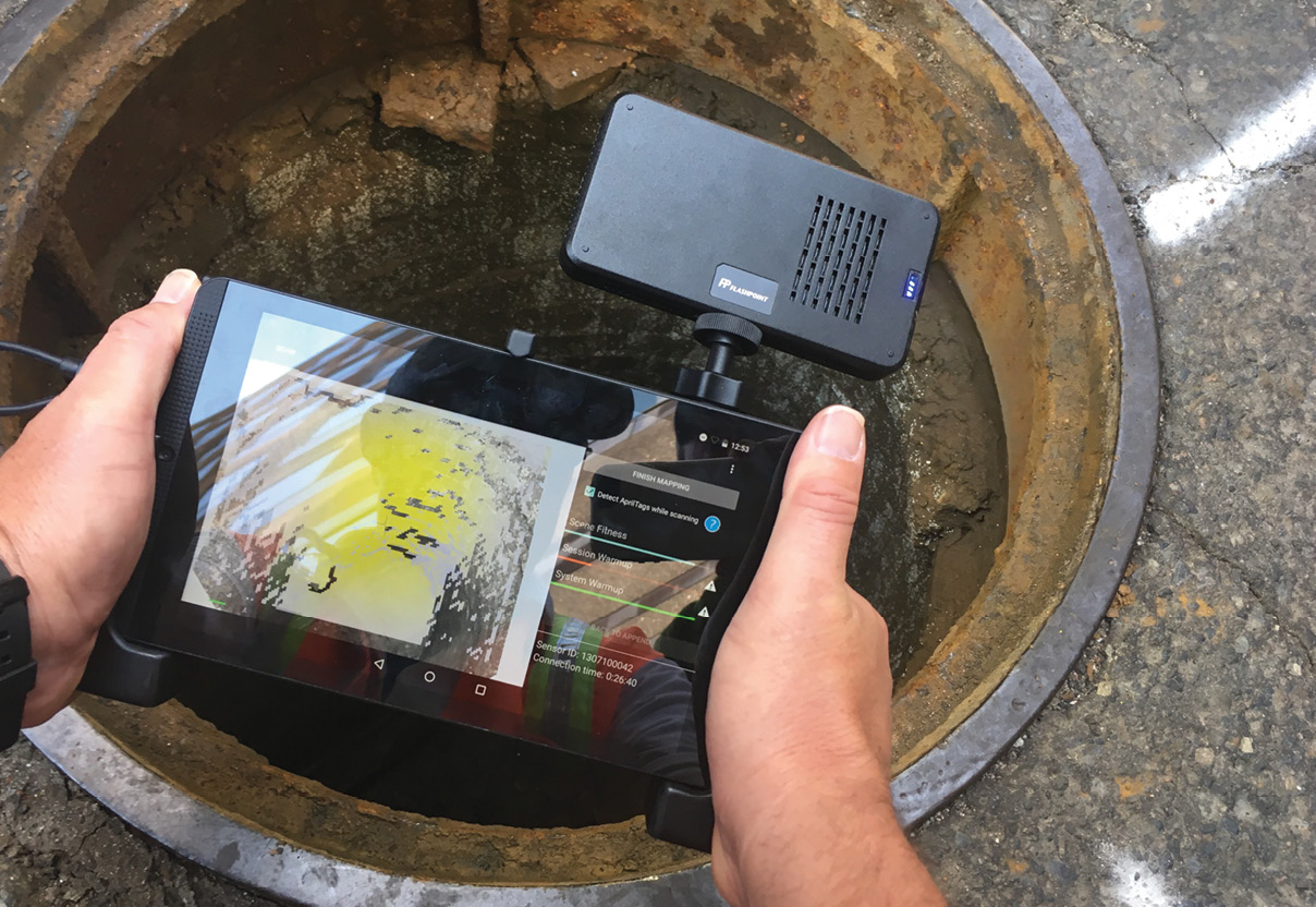
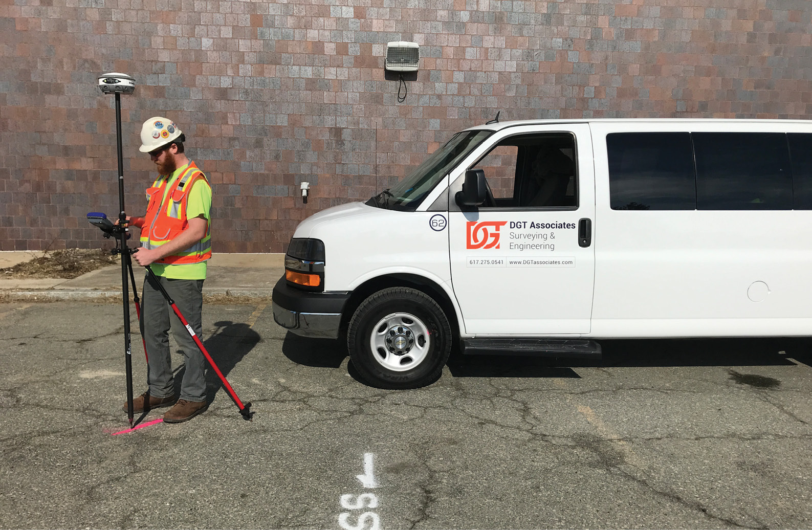
A DGT Associates crew member uses 3D imaging devices to map underground facilities.
The leadership team at DGT Associates, an SUE-capable surveying and engineering firm, believes that Subsurface Utility Mapping (SUM) is a more accurate term, and one that better recognizes the importance of what highly trained, professional mapping specialists do to set a strong foundation for projects involving below-ground work.
How SUE came to be
SUE as an industry term was born out of an effort in the 1980s to standardize methods of handling the underground environment. Until then, projects were regularly begun with little investment into discovering and planning for what lay under the ground, which led to overbudget projects, delays, and safety issues.
Initially, SUE was dubbed “designating and locating,” which was reflective of the core activity of finding and marking utilities with paint on the ground. Recognizing the need for industry support and more sophisticated methods, engineers ran with the discipline, and renamed it “Subsurface Utility Engineering.”
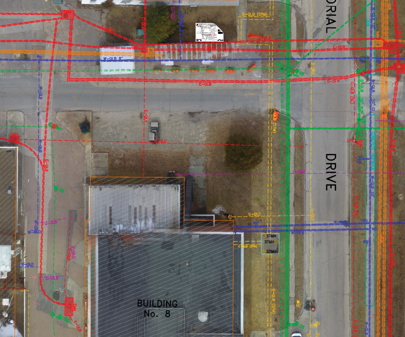
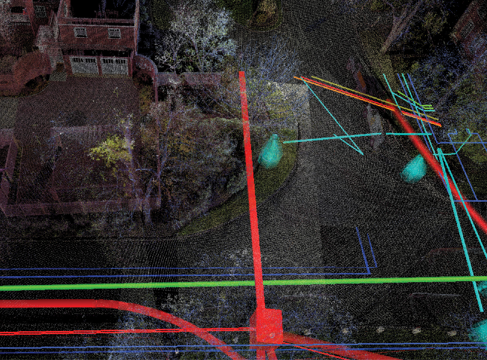
Drone imagery layered with subsurface utility maps of the underground environment in Weymouth, Mass., captured by DGT Associates.
In 1991, SUE gained an official endorsement from the Federal Highway Administration (FHWA) and a few years later, the famous Purdue study proved its value. This led to the American Society of Civil Engineers (ASCE) National Consensus Standard titled ASCE C-I 38-02, Standard Guidelines for the Collection and Depiction of Existing Subsurface Utility Data. These progressions further solidified SUE’s importance and prominence in the field.
The establishment of SUE as a regulated process was groundbreaking in integrating the underground environment into the initial design stage, moving project development away from a practice of digging without proper understanding of what lay below-ground, thereby creating risk of damage and injury, in the construction phase. The resulting ASCE standards also helped to unify and refine how all parties involved in a project approach the underground environment.
Despite the benefits that SUE standardization brought to the industry, it also introduced some confusion between professional roles.
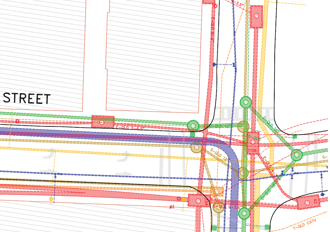
A 2D rendering of subsurface utilities, mapped by DGT Associates in accordance with American Society of Civil Engineers (ASCE) Standard 38-02 at Quality Level D.
The surveyor’s domain
The ASCE Standards list “utility mapping at appropriate quality levels” as the first activity associated with SUE. However, according to standard definitions, that’s a surveyor’s job.
Globally, the International Federation of Surveyors (FIG) specifies that a surveyor’s activities “may occur either on, above or below the surface of the land.”
In SUE, the word “engineering” connotes a specific activity that is confined to engineers, yet the first and core activity involved in SUE—mapping—is performed by surveyors. In this regard, SUE is not a new discipline, but rather an extension of an existing one: surveying.
Utilities and other assets in the underground environment have been discovered and documented by surveyors since the discipline of land surveying began to separate itself form the civil engineering discipline in the 1800s. Surveyors are usually the first on site for a project, and they have been recording what’s beneath our feet and communicating it to their partners—including engineers—since long before SUE was established in the industry lexicon with the FHWA’s official stamp in the late ’80s.
Some say SUE was a revolution. We see it as an evolution.
Subsurface utility mapping of underground environment on a university campus performed by DGT Associates.
Mixed messages with wide-reaching effects
Because of the natural congruency between SUE and surveying, it’s easy to see how the language surrounding the Subsurface Utility Engineering discipline has muddied the waters. The confusion also shows up in laws and regulations, which differ from state to state about which professions may perform the work. Some states recognize the limitations of engineers as mappers, and have barred licensed professional engineers from performing subsurface mapping work that gets categorized under SUE. Others have tried to delegate the practice in the opposite direction and make it the sole domain of engineers, causing even more confusion, and separating the disciplines involved in a typical project.
Many of the tools used in subsurface work, such as ground penetrating radar (GPR) and electromagnetic (EM) locators, are the same tools that geophysics professionals have used for years, making it even harder to delineate between the professions and enforce rules.
It is important that we make the terminology more clear and industry-wide comprehension better, because there are specific purposes involved in the work of surveyors and engineers that cannot always be combined just because the ultimate goal of a completed development is the same.
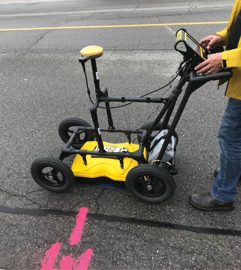
A DGT Associates crew member collects data of underground environment using a push-cart GPR system.
At its core, the work conventionally called Subsurface Utility Engineering is an exercise in mapping the underground environment for designers, engineers, and others to use in safely planning projects. But mapping and engineering are two distinct ideas, and they should be recognized as such.
Why high-quality mapping matters
Mapping the existing and man-made environment goes back to the definition of a surveyor. DGT takes this charge seriously and is committed to a holistic approach to the mapping process. That means going beyond the acquisition of data to also include coherent, precise presentation of that data.
Recently, we met recently with staff of a northeastern state’s Department of Transportation (DOT) to discuss their approach to utility mapping. One of the DOT engineers brought up recent utility mapping work that had been done by a consulting firm. The end result was a large, bound report that contained a wealth of information in the form of written text and imagery. What it didn’t contain was any kind of map, making it only partially usable by rest of the professionals on the project.
At DGT, our work includes maps, drawn to scale, in CAD or GIS format. We also produce a Digital Utility Atlas to help campuses and facilities of all kinds shift from clunky paper records to comprehensive digital maps of their underground environments that can be easily updated and used by any party. Those elements are instrumental to proper and effective development, and they’re also the kind of deliverable that only a qualified surveying professional can create.
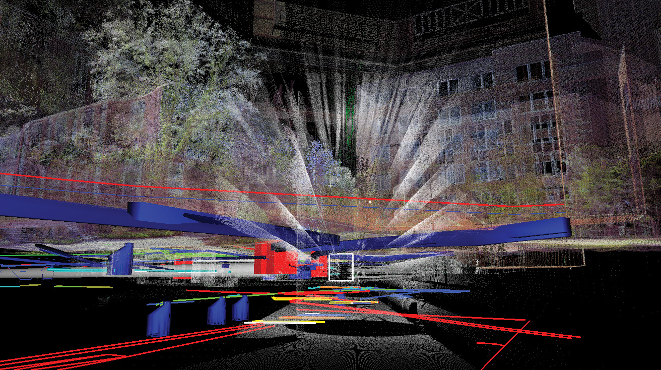
Advances in technologies and techniques allow us to measure and view elements below the ground in the context of what sits above-ground, as seen here in a DGT Associates subsurface utility map.
For us, the work goes beyond just locating and mapping the world, but also taking it a step further to present the information in a way that owners, designers and anyone else can use to make informed decisions.
Everyone has a place at the table
While we argue that the terminology of “Subsurface Utility Engineering” is problematic, we don’t advocate for eliminating it entirely. Instead, we suggest that adopting “Subsurface Utility Mapping” to refer specifically to the work of mapping underground infrastructure can help to better identify all of the different roles that must be played in development.
The best analogy is that if you were building a house, you would hire licensed professionals—an electrician, a plumber, a contractor. There are a lot of roles involved in a project in a building environment, and that’s especially true of the work the industry calls “SUE.” But the way we categorize and describe that work should not be discriminatory or exclusive of engineers, surveyors, or any other profession involved.
Surveyors have measured the land aboveground for centuries. It only makes sense that mapping the world below the surface be done by a qualified surveyor, using tried-and-true surveying tools and techniques.
This effort requires surveyors, GIS professionals, and others involved in mapping to recognize that they must take ownership of the subsurface work they do. That means pushing for the adoption of SUM work as a precursor to any SUE project.
Our history as surveyors is not based on something that was adopted in the ‘80s. It goes back to the best practices of our profession, which are more than 150 years old. Our justification for the Subsurface Utility Mapping terminology is this: we have been doing this work for a long time before the industry started using “SUE” to describe it.
Michael A. Twohig is the Subsurface Mapping Project Director for DGT Associates. He is an international subsurface mapping expert with over 35 years of experience in professional utility locating, mapping, damage prevention, and industry safety awareness. mtwohig@dgtassociates.com
Michael A. Clifford, PLS, is co-founder and principal of DGT Associates. He believes that the integration of cutting-edge technologies with the traditions of the past can thrust surveying and engineering into the 21st century. mclifford@dgtassociates.com
Robert S. Staples, PLS, is co-founder and principal of DGT Associates. He oversees survey and business operations, as well as evaluating and implementing new technologies to assure DGT Associates is not only best in practice, but also ahead of the curve. rstaples@dgtassociates.com