This 3D model can be seen at https://youtu.be/UfQdl7cXUx4
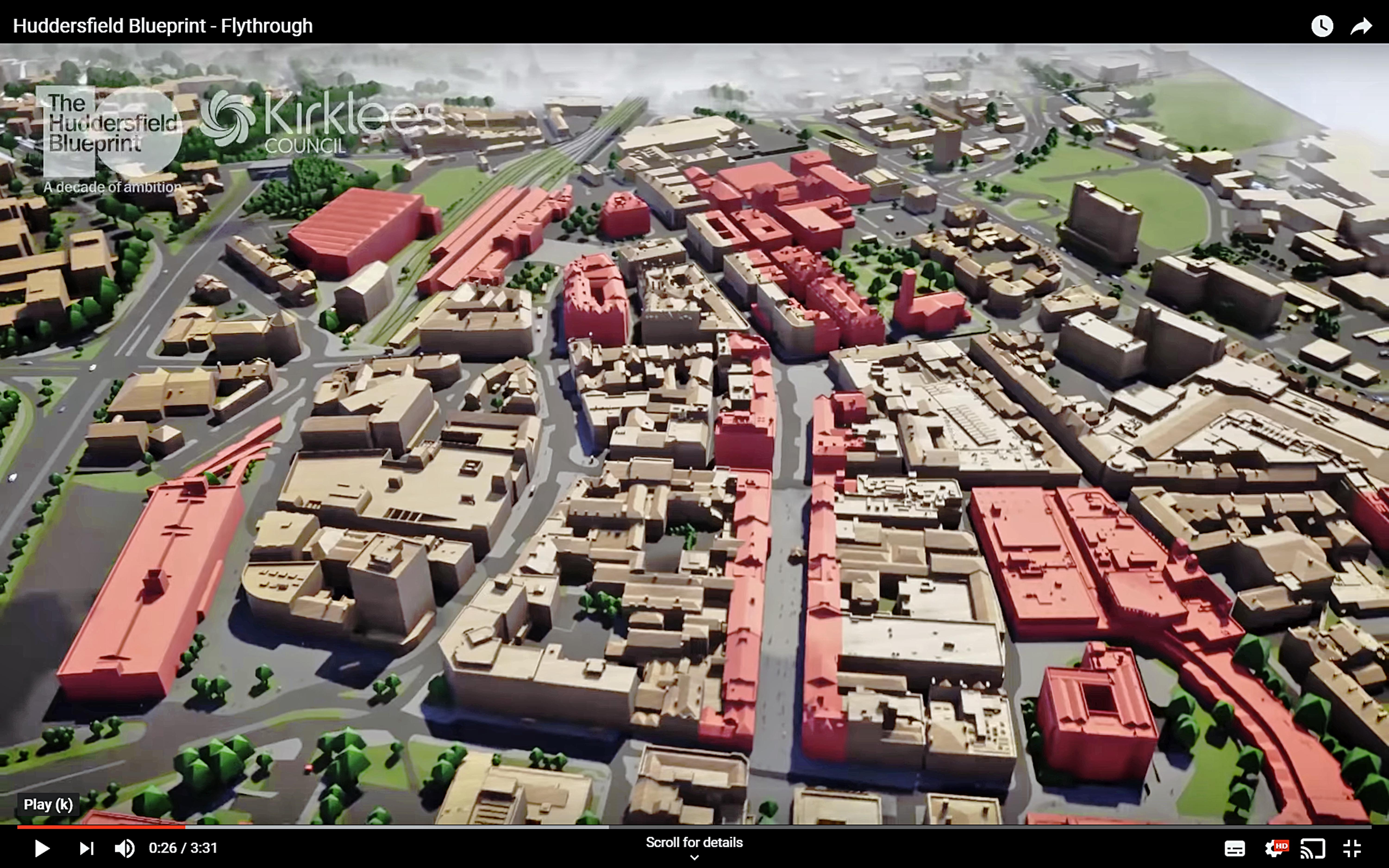
Leicestershire, UK, 09 July 2019 – A detailed 3D computer model from Bluesky is being used to communicate a £250 million transformation of the town centre of Huddersfield, UK. Created from the most up to date, nationwide coverage of aerial photography, the Bluesky model forms part of AECOM’s visualisation of plans prepared for Kirklees Council. Including a 3D fly through and realistic animations the AECOM presentation will form part of an online platform used to consult and engage with the community over the forthcoming months.
“Working with Kirklees Council we have been able to develop a strategy to transform Huddersfield town centre and identify specific projects to achieve this,” commented Becky Mather, Regional Design Director at AECOM. “The Bluesky model gave us an accurate, up to date base from which our specialist team was able to create a stunning visualisation which, it is hoped, will help to sell the Huddersfield Blueprint to the public, investors and stakeholders.”
Kirklees Council’s ten year masterplan, known as the Huddersfield Blueprint, will see six zones within the town centre transformed. These include the areas around the train and bus stations, St Peter’s Gardens, Kingsgate and King Street and New Street. The plans also include the creation of a ‘Cultural Heart’ between the library and university which will involve the demolition of the Piazza shopping centre recently purchased by the Council.
The ambitious plans were unveiled at a launch event last month which was attended by attended by more than 300 business owners, councillors, developers and other interested parties. Presentations were made by council leaders and former Iceland chief executive Bill Grimsey. The AECOM generated presentation, including the Bluesky model, was followed by a round of applause from the audience.
Following the launch Mr Grimsey commented, “I’ve had the chance to see what Huddersfield has put together as a blueprint for the next ten years. In anything I’ve seen over the course of this year…this is up there in the top echelon.”
AECOM is a fully integrated infrastructure firm with a project life-cycle offering that brings together architects, engineers, designers, scientists and management and construction consultants. One of the largest and most dynamic built environment practices in the UK, Urban design is a core component of AECOM’s offering to clients in both the private and public sectors.
About Bluesky
Bluesky is one of the leading and most successful aerial survey and geographic data companies in the UK producing and maintaining seamless digital aerial photography and height data on a national scale in both Great Britain and the Republic of Ireland. Bluesky operates the worlds most advanced airborne sensor, which comprises vertical and oblique cameras as well as a LiDAR, to create accurate and detailed virtual cities. Bluesky also operates the only LiDAR system in the world that incorporates a thermal sensor and survey grade camera. These combined with other systems puts Bluesky in the enviable position of being able to provide customers with unique and cost-effective geospatial solutions. As well as being an established and respected aerial survey company Bluesky is also highly innovative and continually strives to develop new products and services by embracing new technology and methods. This has resulted in the development of some unique products such as the National Tree Map (NTM). These datasets underpin long term contracts with local and central governments and many major blue-chip companies from a range of market sectors including financial services, utilities, telecoms, web portals, construction and environment. Bluesky has offices in the UK, US, Republic of Ireland and a dedicated production centre in India. https://www.bluesky-world.com/
