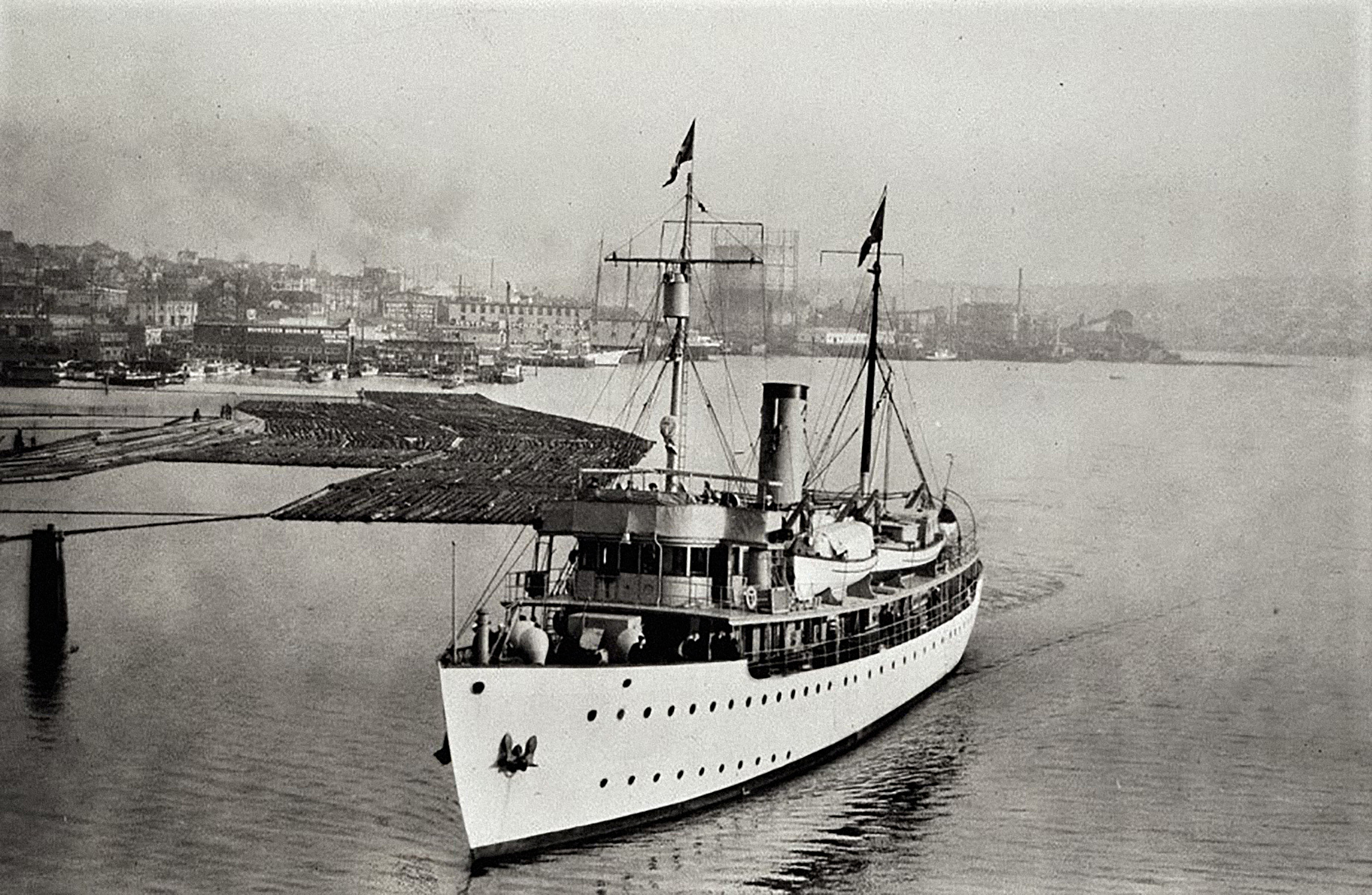
Surveyor departs its winter port of Seattle, Washington, en route to the surveying waters of Alaska in the spring of 1925.
In 1915, the United States Coast & Geodetic Survey (C&GS) found itself in need of upgrading and improvement in many areas. The precision field equipment was deteriorated and outdated. The Public Health Service declared the improperly lighted and overcrowded C&GS office buildings in Washington D.C. to be unsanitary. Painstakingly compiled data, maps, and charts were under constant danger of destruction while being stored in buildings with leaky roofs or in offices with no fire protection. Furthermore, the older employees’ vast knowledge was continually being lost through retirement. To worsen matters, a pattern of high employee turnover had developed. New employees were being trained by C&GS who then only worked for a few years before leaving for better paying employment. Departments throughout the agency were suffering from these same symptoms with low morale taking its toll on the historically-proud agency whose beginnings trace back to 1807.

Seven shipmates of Surveyor pose with a life preserver in this early photo while at sea.
The efficiency of the work performed on the vessels at sea was continually compromised not only due to insufficient equipment, but also due to a shortage of men. The enlisted men employed on the Pacific Coast by C&GS were paid less than any other employees whether it was government or commercial. Recruitment of Pacific sailors generally occurred in Seattle where many of the ships, particularly those working in the northern waters, were stationed during the winter months. The yearly race to recruit strong and hardy men who were willing to work the dangerous jobs was competitive due to the lumber, canning, and fishing industries also needing to hire summer employees. Those who did choose to work  on the C&GS ships quickly found the work to be arduous and complicated due to the complex equipment that required a higher level of competence than other summer employment. Each year, the older employees on the ships expertly trained a new crew to operate the equipment, only to have these new employees not return the following year due to finding higher paying jobs elsewhere.
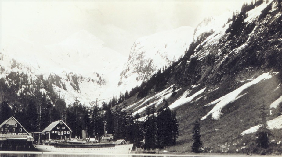
The surveyors who worked aboard Surveyor often found themselves in some of the most rugged, yet beautiful areas of Alaska. The ship is docked at Port Walter in 1924.
Two of the main C&GS ships that were working in the Pacific waters in 1915, the McArthur built in 1876, and the Gedney built in 1875, were so deteriorated that neither were seaworthy after forty years of continuous service. The superintendent of C&GS stated that the future existence of these ships would be a menace to human life and their further use would be without the slightest justification, so both ships were condemned and sold in 1915. The loss of these ships unfortunately coincided with a time when there was a great urgency to conduct surveys off the coasts of Washington, Oregon, California, Alaska, and Hawaii. At this time, the ship named Patterson was 33 years old and had been strictly confined to shoreline work. Likewise, a ship named Explorer showed severe structural weaknesses requiring costly repairs to keep it afloat. Explorer was confined to work only in protected waters of southeast Alaska for the safety of both the crew and the vessel. The agency therefore found itself without a vessel in the Pacific fleet capable of being exposed to the rigorous and treacherous work of the open waters. The Atlantic situation was nearly as dismal with the Pathfinder, at work in the Philippines, being the only ship strong enough for offshore work in that area.

In order to reach the shore, special boats known as launches were used to transport the surveyors from the main ship to land. Launch 168, shown here, was associated with the ship Surveyor.
Despite wanting to remain neutral, the United States came under increasing pressure to enter the First World War. The sinking of the passenger liner Lusitania on May 7, 1915, turned public opinion in many countries, including the United States, against Germany. During a span of fifteen minutes, the attack upon the Lusitania had caused the loss of over 1,200 lives, with many being young nurses. Despite a potentially expensive war looming, Congress eventually listened to the pleas of C&GS and appropriated money to purchase two new vessels for work in the Atlantic and Pacific oceans. The ship that would complement the Pacific fleet was to be christened Surveyor and would be assigned to specifically work the waters of Alaska. The new ship for the Atlantic was named Isis.
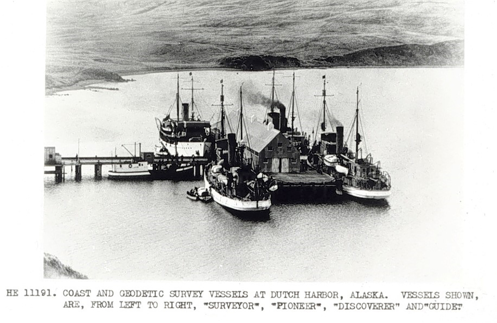
Four ships of the USC&GS fleet are docked together at this northern port. From left to right are Surveyor, Pioneer, Discoverer, and Guide.
Surveyor, a steamship whose keel was laid in the winter of 1915, was completed less than two years later in 1917. The Manitowoc Shipbuilding & Dry Dock Company in Manitowoc, Wisconsin, was the low bidder at a cost of $236,000. This fifteen-year-old shipyard, located along the western shore of Lake Michigan, had developed a reputation not only for quality workmanship, but also for quick delivery, rivaling any other shipbuilder in the country. Shipbuilders not located along the coasts were often viewed as inferior, but the Manitowoc builder proved they had the expertise to compete.
Surveyor was 186 feet long, had a 1,000-ton displacement, carried 75,000 gallons of fuel, and was driven by a triple-expansion engine of 1,000 horsepower allowing it to easily achieve 12 knots with a 10.5-foot diameter propeller. Its crew consisted of 11 officers and 58 enlisted men operating the usual equipment of a surveying vessel. The equipment on this modern ship included the latest technology for sounding at all depths down to the greatest ocean bottoms and carried the latest radio equipment making communication better than ever known before on a geodetic ship. Surveyor was the most modern ship in the fleet and became the first oil-burning steamer for C&GS.
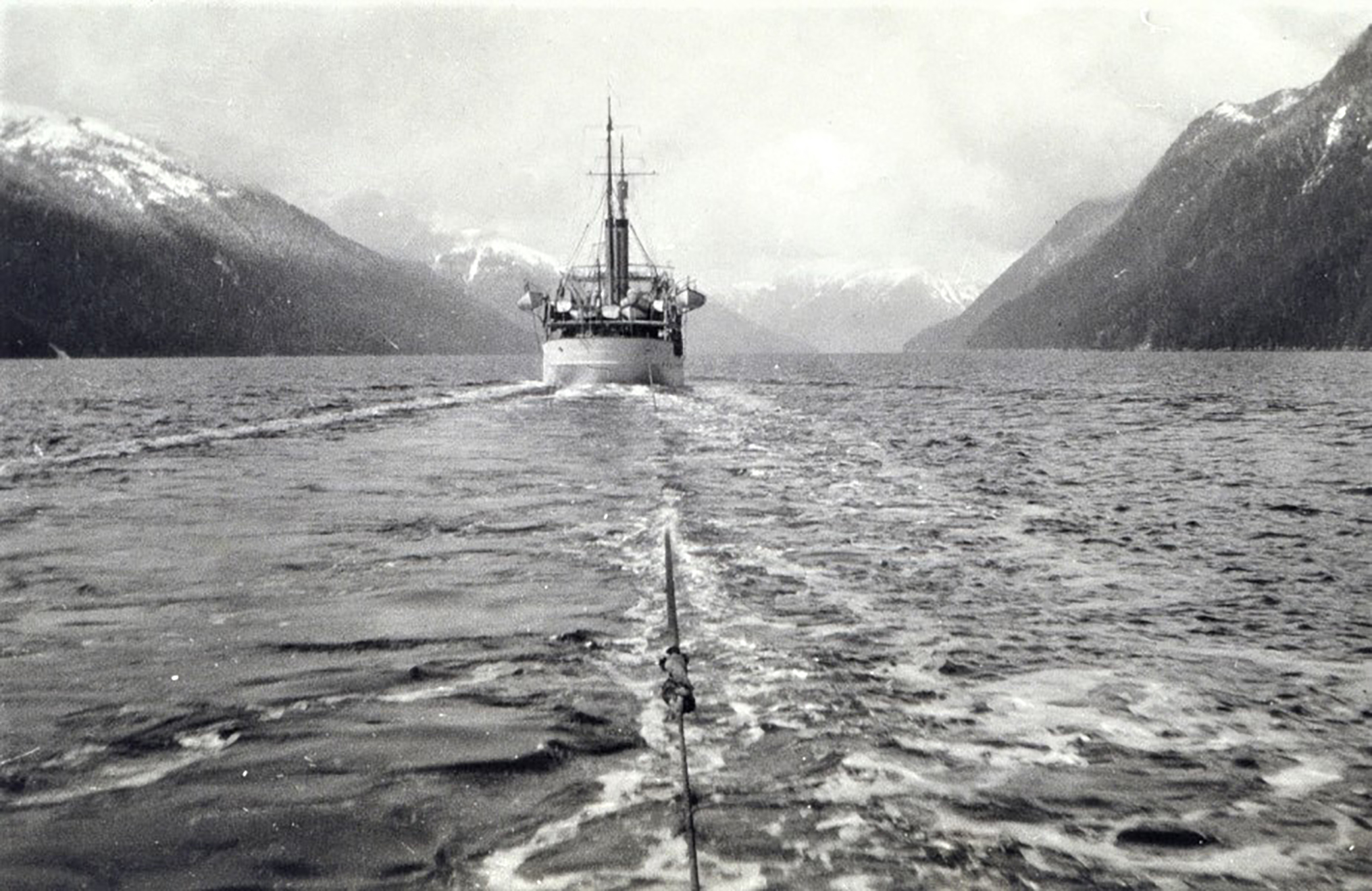
The stern of Surveyor as seen from the ship Cosmos. It is either being towed or possibly taking part in a wire drag operation to find submerged pinnacle rocks.
Once completed, Surveyor made its way through the Great Lakes on its first voyage in June of 1917. On July 1, 1917, while docked at Portsmouth, NH, Surveyor received special launches and fittings made especially for a geodetic ship. The ship then traveled to Norfolk, VA, and to Tompkinsville, MD. On July 24, 1917, Surveyor arrived at Washington D.C. where it was inspected by C&GS personnel. However, its duty as a geodetic vessel would have to wait because the U. S. Navy was eying this new ship for war purposes.
As atrocities committed overseas became too great to overlook, the United States began sending troops to aid the Allies in June of 1917. On September 24, 1917, soon after the delivery of Surveyor to C&GS, an executive order transferred this ship and two others, Isis and Bache, to the U. S. Navy to aid the war effort. Commissioning of Surveyor into the wartime fleet took place on October 22, 1917 and by November of 1917, Surveyor was ordered to report to the historically important base for the British Armed Forces at Gibraltar. On May 16, 1918, an executive order took two more ships, the Patterson and Explorer, from C&GS for use in the war. The remaining vessels in the C&GS fleet at that time were the Fathomer, Hydrographer, Marinduque, Matchless, Pathfinder, Research, Romblon, Taku, and Yukon.

Helicopter operations are taking place in the Bering Sea with the second ship designated Surveyor S 132. NOAA Photo Library
During the war, Surveyor mainly engaged in convoy and escort duties in both the Mediterranean Sea and the North Atlantic Ocean while at Gibraltar. During the course of service, Surveyor traveled over 26,000 miles, not including the many miles zig-zagging to evade German submarines. Surveyor participated in the escort of approximately 330 ships, of which only four were hit by enemy torpedoes and only sinking two.
Surveyor rose to heroic status during its service in the war on at least two separate occasions. The first occurred on May 11, 1918, when the German submarine UB-52 fired a torpedo which sunk the French steamship Susette Fraisinette. Surveyor, along with other nearby ships, dropped depth charges in order to hit UB-52, but efforts were unsuccessful since the submarine quickly dove to avoid any damaging blows. Despite not being able to hit UB-52, Surveyor participated in rescuing thirty-four of the survivors from the French ship.

The ships of USC&GS did not bear their names on the bow like was done with other ships. Surveyor is shown here in 1924. NOAA Photo Library
One week later on May 17, 1918, two German submarines attacked and sank the British steamship Mavisbrook. The same two submarines then damaged the British steamships Sculptor and Elsnick Grange. One of these submarines, U-39, took aim at Surveyor and successfully fired a torpedo. Fortunately, the aim was slightly off and the torpedo only grazed Surveyor’s bow without inflicting serious damage. (The U-39 was the notorious submarine that had earlier sunk the Lusitania.) During its participation in the war, the crew of the seemingly untouchable U-39 had sunk 158 ships and damaged 6 others. After the near miss of the torpedo, the wake of U-39 was quickly picked up by Surveyor’s crew who immediately went on the offensive. The finest hour for Surveyor arrived when one of two depth charges dropped by the crew successfully disabled U-39. The submarine and its crew were subsequently interned at a neutral dock in Cartagena, Spain, thus ending its bloody rampage on the high seas.
After the war ended, Surveyor came back to the United States where its warship armament was removed during January of 1919. An executive order by Congress on February 26, 1919, authorized the Navy’s return of all ships to their previous owners. Surveyor returned to the Department of Commerce on March 31, 1919, to begin operations for which it had originally been built with the Coast & Geodetic Survey.
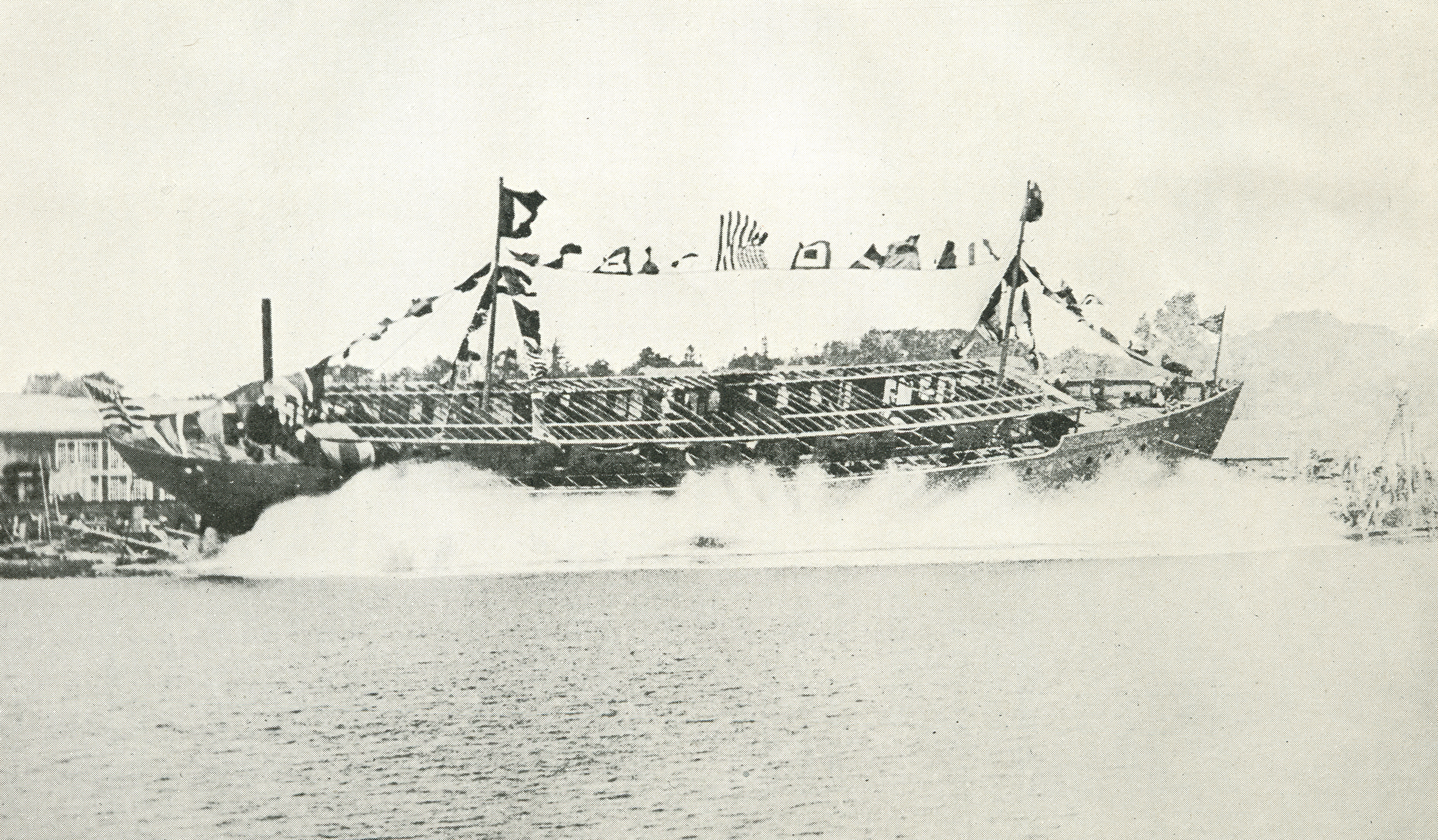
Touching the water for the first time, Surveyor enters Lake Michigan from the Manitowoc Shipbuilding & Drydock facility in 1917. NOAA Photo Library
Surveyor began its first official mapping operations at Shelikof Strait, Alaska, in July 1919. The main work performed was the extension of the triangulation at Kodiak Island that was already being carried northeastward from Unalaska. This provided control for the present and future surveys of the Alaskan Peninsula. One of the main mapping operations was to find obstacles that lie just below the water surface to safeguard commercial shipping.
After having worked the waters of Alaska for an entire decade, Surveyor continued surveys and mapping along the west coast of Kodiak Island into the 1930’s. Work extended from Cape Ikolik southward through Sitkinak Strait, including surveys of Olga Bay as well as Alitak Bay and its tributaries. Despite Surveyor originally being outfitted with the most modern equipment, it periodically needed to be upgraded as new technology came into use. In 1938, the Dorsey Fathometer No. 3, a precision echo-sounding instrument, was placed on Surveyor.
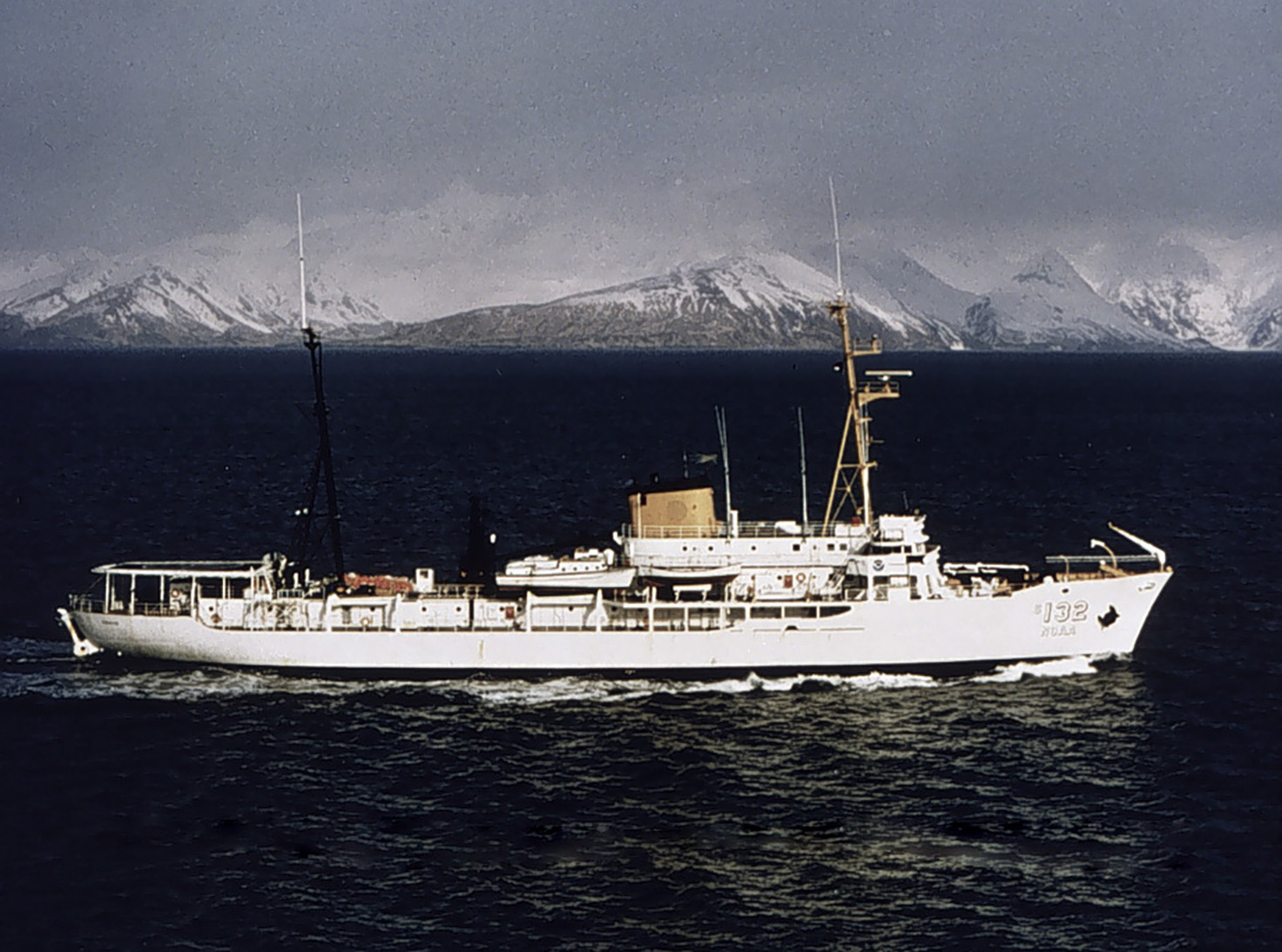
The second Surveyor ship was built in 1960 and is shown here post-1970 in Alaska after becoming part of the NOAA fleet. NOAA Photo Library.
By 1940, turmoil was again taking place on the European continent and many began to realize that Surveyor might be recalled into wartime service. That speculation was proven true when the United States entered World War II and Surveyor was taken over by the U. S. Navy. The ship immediately engaged in a hydrographic program in the vicinity of Port Townsend during the summer of 1942 and proceeded to the hostile areas of the Aleutian Islands for defense-related mapping operations. As in the previous war, Surveyor was fitted with armament that could be used for defensive purposes if needed.
By 1944, Surveyor undertook hydrographic surveys, along with four other ships, in the vicinity of the islands of Adak, Delarof, Amchitka, Kiska, Shemya, and Attu for the U. S. Navy. Surveyor also accomplished triangulation in Hood Canal and in the Puget Sound area to determine the positions of recently established navigational aids of the U. S. Coast Guard.
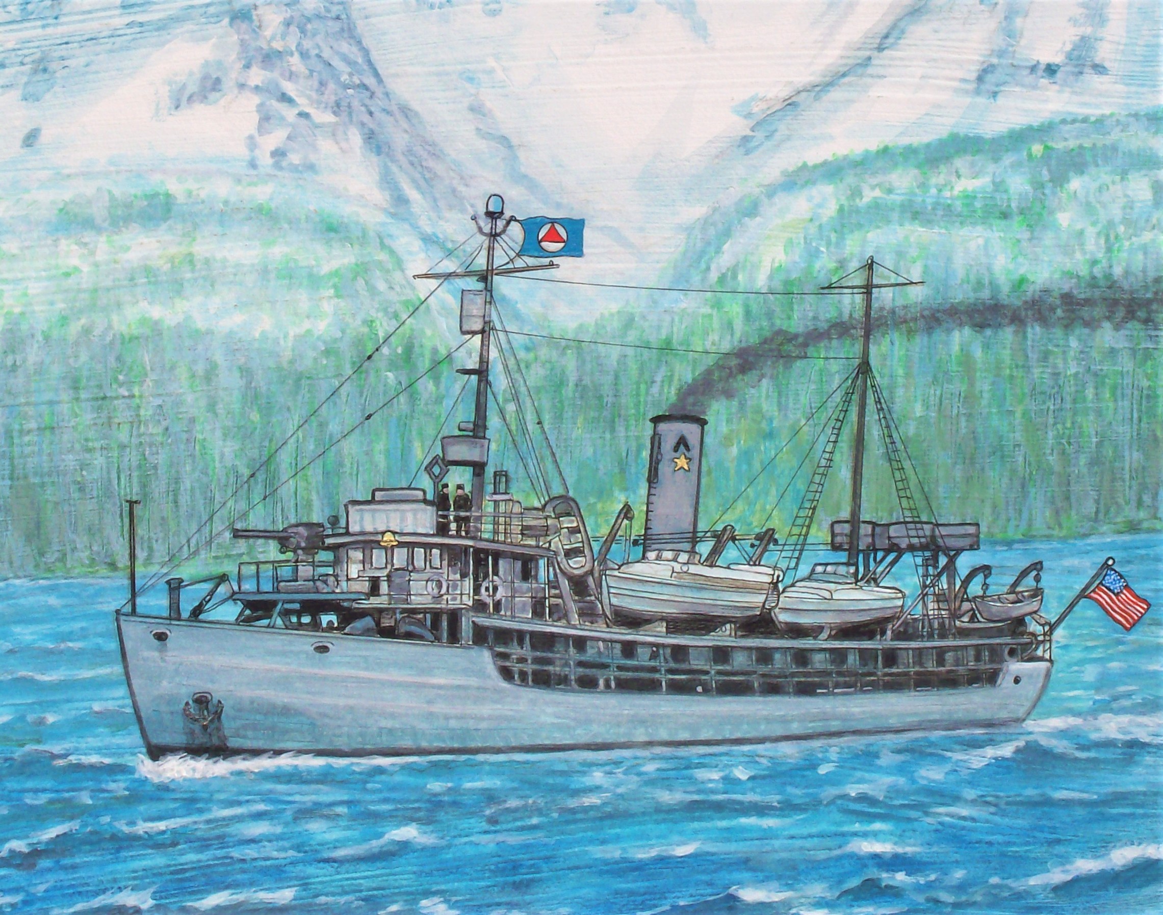
With forward mounted gun, this painting depicts Surveyor while at work in Alaska during WWII. The star and chevron on the smokestack indicates this ship had previously participated in wartime operations during WWI. Jerry Penry image
At the end of World War II, Surveyor was fortunate to have survived the world conflict after frequent proximity to some of the most intense battles of the Aleutian Islands. The guns and other armament were removed from the geodetic ship. Surveyor then carried on combined operations along the north and south coasts of Amchitka Island, in the Delarof Group between Tanaga and Amchitka islands in Tanaga Bay, and off the north and south coasts of Tanaga Island.
Upon reaching Seattle at the end of its thirtieth season, Surveyor was placed on inactive status with reduced complement due to insufficient operating funds. Surveyor remained docked in Seattle during the summer and fall of 1948 and all of 1949 which was the first time in its history that it had not been engaged in summer work.
After reactivation in 1950, Surveyor began field operations in the spring along the coast of Alaska. Tidal current surveys were made in the Aleutian Island Passes, in the Rosario Strait, and near the San Juan Islands of Washington. Age continued to take its toll on Surveyor, so boiler repairs had to be made at the end of the 1950 and 1951 seasons.
In April of 1955, Surveyor left for the familiar territory of Alaska and arrived to work on hydrographic surveys in the vicinity of Shumagin Islands where the survey of a large reef-studded area between Wosnesenski and Unga islands was completed. Shore stations were established in the vicinities of Cape Seal and Bay Point and a tide station was installed in Coal Bay.
By September of 1955, Surveyor was deemed no longer seaworthy, so the decommissioning of the famed ship was initiated. On November 10, Surveyor moved alongside Explorer after all of its remaining heavy equipment had been removed and stored. On November 18, 1955, the Commission pennant was lowered, all flags secured, and the ship was placed on final inactive status while under the command of Captain Frank G. Johnson. To commemorate the famous ship, a bay in Alaskan waters was named “Surveyor Bay”.
A new ship with the same name, Surveyor, was commissioned in 1960 as OSS-32 Surveyor. This ship was built by the National Steel & Shipbuilding Company in San Diego. The arrival of this new ship marked the beginning of a major effort to modernize the Coast & Geodetic Survey fleet and make it capable of conducting worldwide operations. The newer ship was 292 feet long and had 127 officers and crew along with a helicopter pad. When NOAA took over USC&GS in 1970, this same ship was renamed S-132 Surveyor. NOAA decommissioned this ship on September 29, 1995.