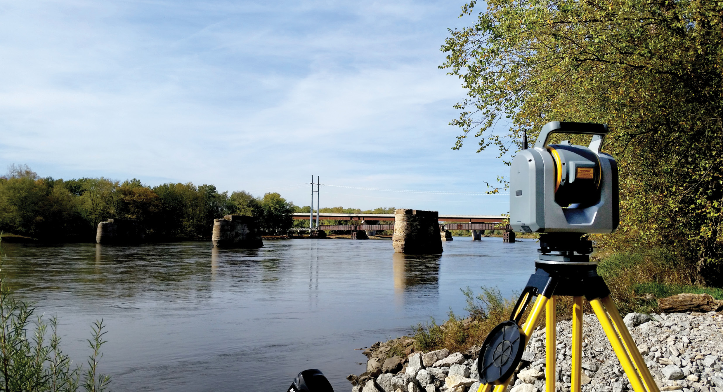
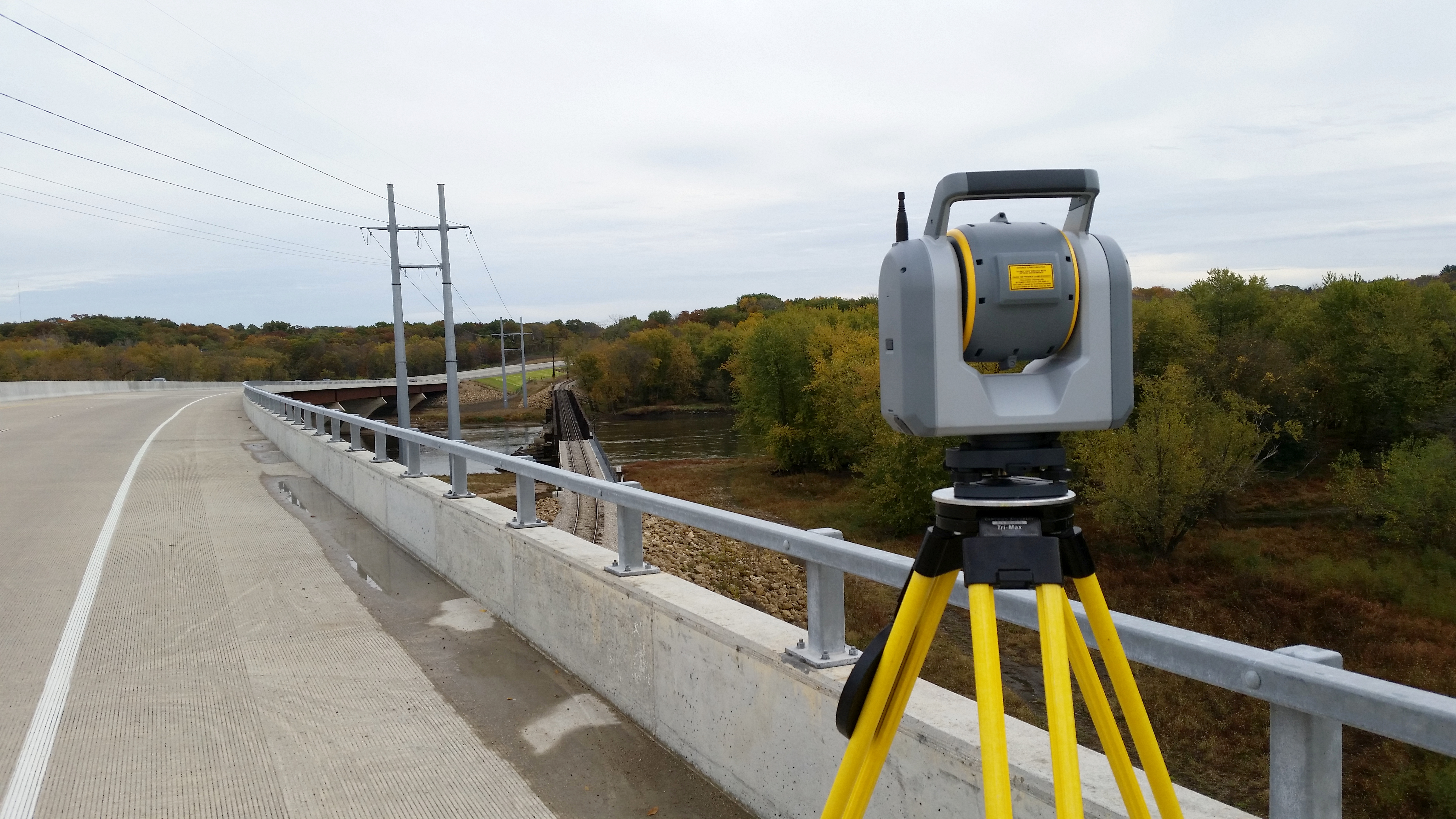
The SX10 sits ready to capture the features of the three old railroad bridge piers in the water.
With survey projects, there’s complex, there’s very complex, and then there’s the Cedar River Flood Control System (CRFCS) project in Cedar Rapids, Iowa. Launched in 2015, the 20-year, $750 million project is building a combination of permanent and removable flood walls, levees and gates along 11 km of the river’s banks.
As a survey consultant for the CRFCS, Cedar Rapids-based Foth Infrastructure Environment was tasked with an incredibly complex assignment: acquire railroad pier features for hydraulic modeling at one site accessible only by boat, and capture a topographic survey for flood wall design and clearance verification at a second site that would be accessible only for four hours.
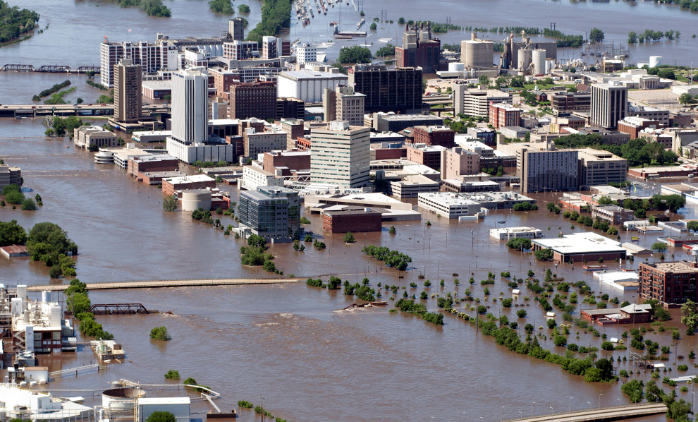
Flood waters deluged 10 square miles of Cedar Rapids, displacing 10,000 residents and swamping Iowa’s second-largest city with $6 billion in damages. Photo by USACE Rock Island District
Armed with advanced scanning technology and a solid plan, a small crew captured all the infrastructure elements needed and delivered more data than was initially requested. They also debunked an inaccurate assumption about the low point of a bridge, saving the city from a costly oversight.
Tackling Complexity
To prepare for the project, Foth first tested traditional survey technologies. Selecting a small area of interest (AOI) they used total station and scanning equipment to capture a bridge arch along the riverbank.
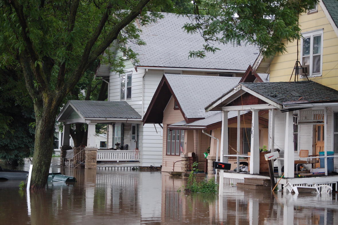
Cedar Rapids, Iowa’s “Flood of 2008” was the most devastating flood in the region’s history. Don Becker, U.S. Geological Survey.
“Although we acquired the data, it required extra steps to create an accurate, georeferenced point cloud,” says Jody Budde, a professional land surveyor with Foth. “We needed several trips to the site to establish control and targets and scan the bridge arch. Those additional setups would add time we didn’t have, and range limitations of the scanning technology wouldn’t allow us to shoot across the river.”
Based on the exercise, Foth determined they needed a single instrument that could integrate total station measurements with high-speed, georeferenced 3D scans. After evaluating available technology, they acquired a Trimble SX10 scanning total station. The SX10 combines surveying, imaging and scanning (up to 26,600 points per second with a range of 600m).
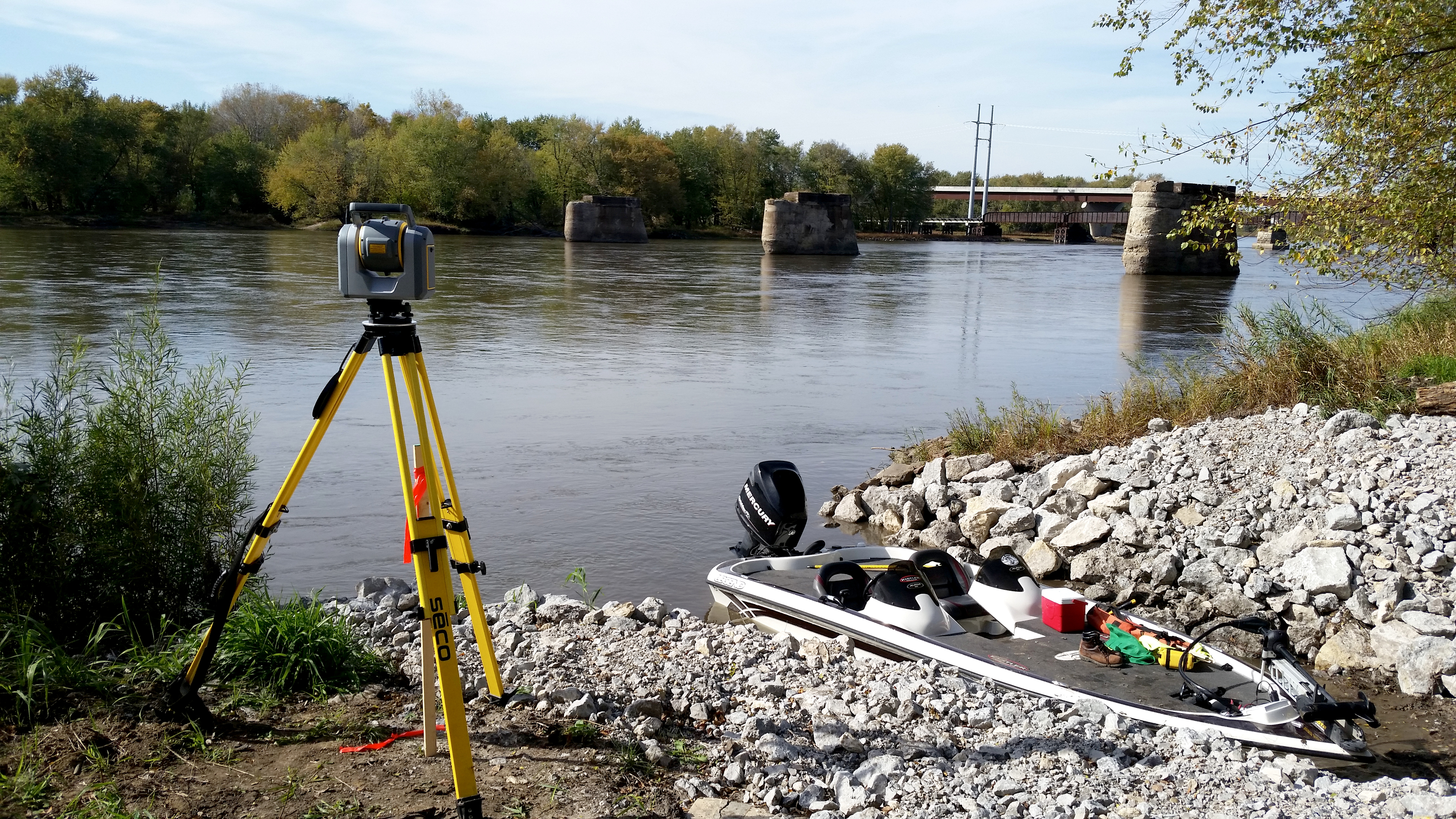
Because Site 1 was not accessible by foot, a crew had to navigate to control and scanning points by boat. Here the SX10 is set up to capture the railroad bridge in the distance and three old pier structures in the water.
Based on the CRFCS project schedule, Foth began with Site One, a 2.3-km stretch of riverbank about 9.7 km north of downtown. An operational railroad bridge crosses the river and several abandoned bridge piers dot the water. Foth needed to capture railroad track locations and shape and size of the active and inactive bridge piers to within 1.5 cm.
In the fall of 2017 a two-person crew launched their motorboat carrying a Trimble R10 GNSS rover, the SX10, a Trimble Yuma 2 tablet and a Trimble TSC3 controller. Criss-crossing the 150-m-wide river, they used the R10 to establish control points in nine locations.
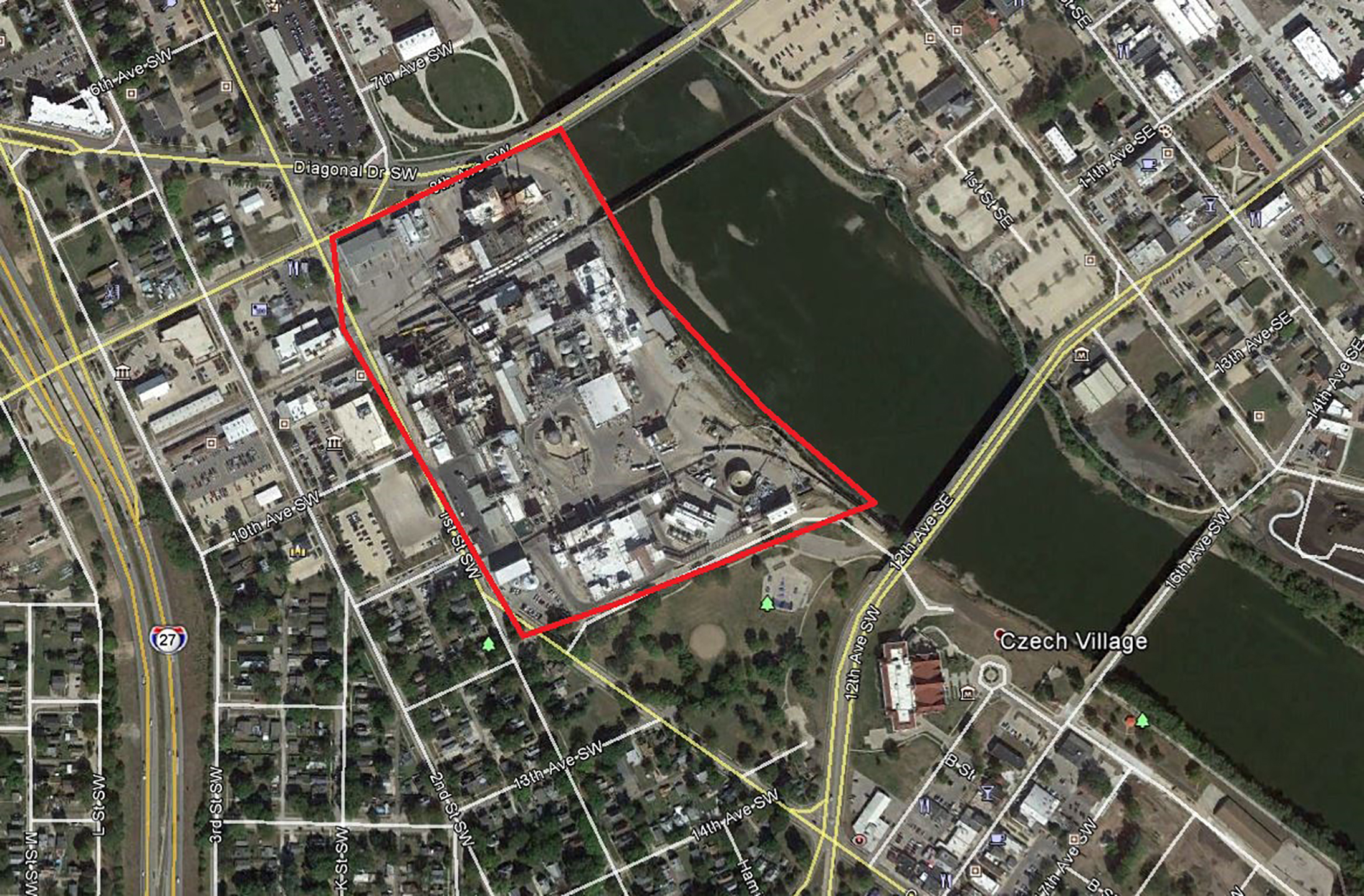
A section of the Site 2 as-built survey project. The area highlighted in red indicates a large industrial site that is inaccessible by foot because it’s lined by sheet piling walls. The long range of the SX10 enabled crews to capture that section from across the river.
Next the team set up the SX10 and captured the scene from the railroad bridge all the way downstream to the old pier remnants, collecting features along and across the river at distances of nearly 300 m. By using resection, all setups were georeferenced and the crew could acquire measurements to critical features from multiple locations. In total, it took two days to scan the tracks and 12 piers, collect 11.8 million 3D points and capture color photos with the SX10 built-in camera.
In the office, they used Trimble Business Center (TBC) software to integrate the GNSS and scanning data into one project. In a few hours, they created and delivered a 3D point cloud that the engineering design firm could immediately use in its own hydraulic analysis software.
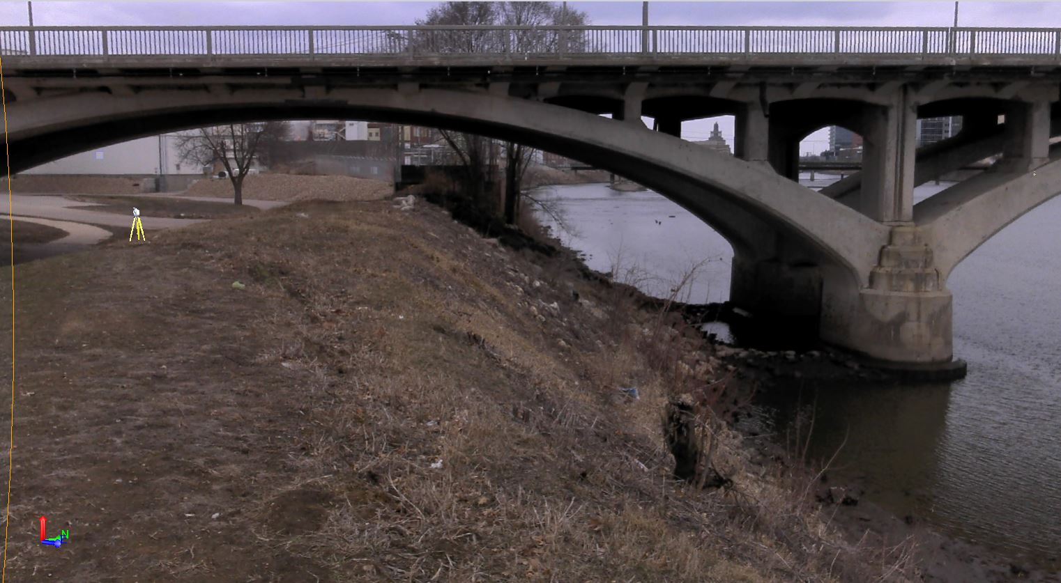
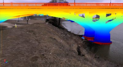
A shot of the 12th Ave Bridge from the SX10 internal camera with its equivalent point cloud view. This particular bridge had a 1.5-in clearance tolerance to the bottom of the bridge requiring a team to capture a 3D point every 0.125 to 0.25 inches.
Racing the clock
Foth returned to the Cedar River in spring 2018 to tackle Site Two. This 1.6-km stretch of riverbank will have a permanent floodwall and Foth needed to collect a topographic survey and as-built data of ground-level and submerged infrastructure as well as three bridges.
Collecting that information, however, required the city to close an upstream dam for the first time in its history. The dam would be closed for only four hours.
 Foth dispatched two two-person crews who set ten control points with the R10 and started scanning with the SX10 while the water level was lowering. To produce the required vertical precision—one bridge had a 3.8-cm clearance tolerance to the bottom of the bridge––the crews used a Trimble DiNi digital level at each control point to ensure elevations were within the project’s 3-mm specification.
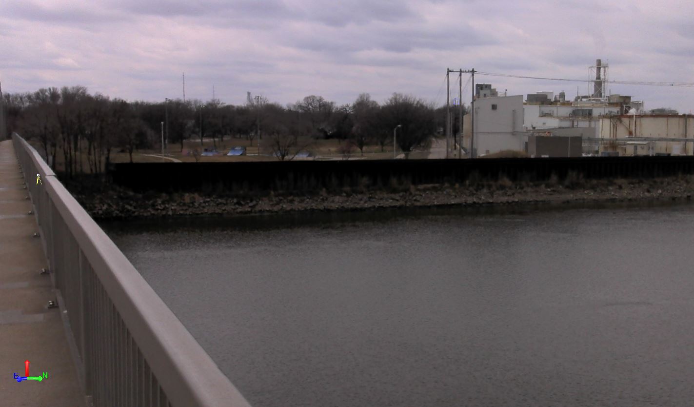
A view of the industrial site’s sheet piling wall and its equivalent point cloud view.
In parallel with the control crew, the scanning crew used project control to capture 3D points of the infrastructure. Using four separate locations on the east side of the river, they scanned the entire length of the west bank AOI. They captured features up to 245 m away including bridges and bridge arches, flood structures and utilities. As the water level dropped, they captured submerged features like underground pipe networks. For the 12th Avenue Bridge, the structure with the tight 3.8-cm clearance requirement, the Foth team made additional scans of its underside, capturing 3D points with 3 to 6 mm spacing. By the time the dam reopened, the crews had finished the job and collected 27.6 million points.
 “Without the speed and scanning range of the SX10, we would not have been able to do this job,” says Ben Sullivan, a lead geospatial specialist with Foth. “Conventional survey technology would’ve required up to three times more man-hours and we would’ve collected only about 20 percent of the data detail we captured with the scanner.” Had Foth used a dedicated scanner, they would have incurred significant additional time setting targets intervisible from the multiple setups.
In addition to scanning the railroad bridge piers, a team had to capture the railway track itself with the SX10.
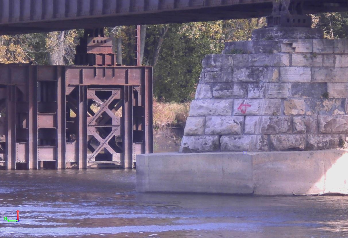
Similar to Site One, they used TBC to integrate data from GNSS, total station, scanning and digital level instruments allowing them to process and validate the data into one georeferenced project. Using TBC’s plane-definition and cross-section tools, the Foth team discovered a discrepancy on the 12th Avenue Bridge. Historical data indicated the lowest arch points were the lowest clearance point. The scanning data showed a support pipe under the bridge deck that was lower than the bridge arches, revealing the pipe as the true low point for vertical clearance. Had the city built the new wall based on the original assumption, it would’ve been a costly mistake.
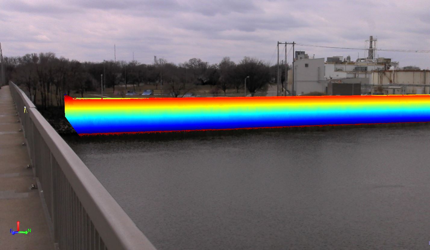
A close-up of one of the railroad bridge piers. Defining the size of the piers on one plane was a challenge because there were vertical height discrepancies of several feet between the old piers.
With many more phases of the CRFCS ahead, it’s a good bet that Foth will face its share of complexity in the future. Based on the results of its SX10’s scanning debut, they’re confident they have the right tools to succeed.
Mary Jo Wagner is a freelance writer who has covered the geospatial industry for 25 years. Email: mj_wagner@shaw.ca.