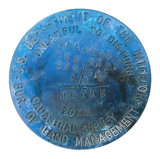
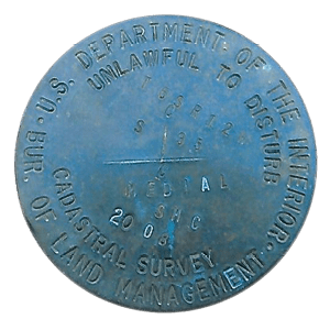
On property of Patrick Canan, BLM Monument on south bank showing Texas on one side and Oklahoma and U. S. sections on other side.
The boundaries of Texas have long been fertile ground for battles—some on the ground and some in the courtroom. The 539 miles stretch of the Red River serving as a part of the northern boundary has certainly contributed its share to the stream of troubles. Recently, the U. S. Department of the Interior Bureau of Land Management declared a substantial amount of land long-considered to be part of Texas as U. S. land. And the fight was on!
The lands in Texas have been granted out by four different sovereigns: Spain, Mexico, the Republic of Texas, and the State of Texas. Unlike other states of the Union, Texas retained its public domain when it became a part of the United States in 1845. Most of the Texas tracts fronting on the Red River were granted by the State of Texas in the 1870’s. The north boundary of these grants generally called to be on the Red River. That means where the boundary of the river is, there also is the common boundary of these uplands.
The epic battle happened in the early 1900’s when oil was discovered in abundant quantities in the Big Bend area of the Red River near Burkburnett and Wichita Falls, Texas and near Randlett and Lawton, Oklahoma. As usual, the discovery of oil served as a catalyst for arguments of all sorts. The exact boundary between Texas and Oklahoma/United States became critical as oil wells were being punched into the ground. The Oklahoma v. Texas lawsuit of that era involved hundreds of expert witnesses and filled thousands upon thousands of pages of evidence.
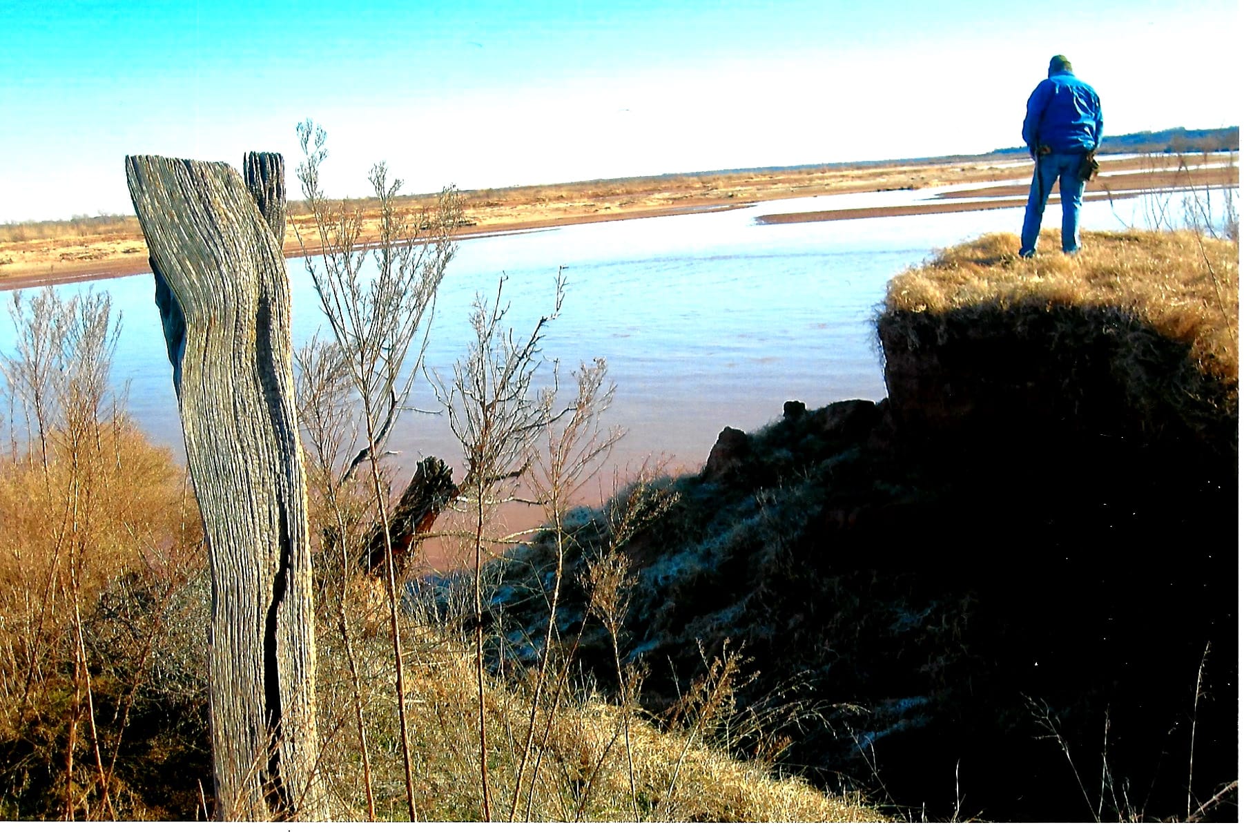
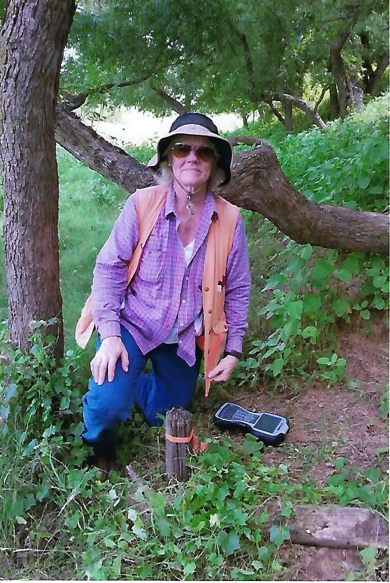
Alvin Lassiter standing in Texas—pondering life on the Red River.
For an in-depth discussion of events leading up to and including the Supreme Court case of Oklahoma v. Texas, 260 U. S. 606 (1923), see Part 1 of these two articles which was written by Dr. Richard Elgin of Rolla, Missouri, and was published in the April 2019 issue of this magazine. The outcome of this lawsuit ‘settled’ the common boundary of Texas and Oklahoma/United States on the South bank of the Red River at the gradient boundary.
But somehow it has not remained ‘settled.’ As Dr. Elgin pointed out, like Shakespeare’s Banquo’s ghost from Macbeth, “It will not down.”
From 2000-2009 the Bureau of Land Management, under the U. S. Department of the Interior, undertook a resurvey of portions of the Red River. In the course of this work, they requested permission to enter on the lands of some Texas landowners. Corners were monumented on these lands—much to the consternation of those landowners once the corners had been discovered. Through the course of meetings and conferences, it came to light that the Bureau of Land Management was claiming some 90,000 acres lying south of the Red River, west of the 98th Meridian (near Stanfield, TX.) and extending westward to the mouth of the North Fork of the Red River (approximately 34°19’58”N 99°12’33”W in Wilbarger County, TX).
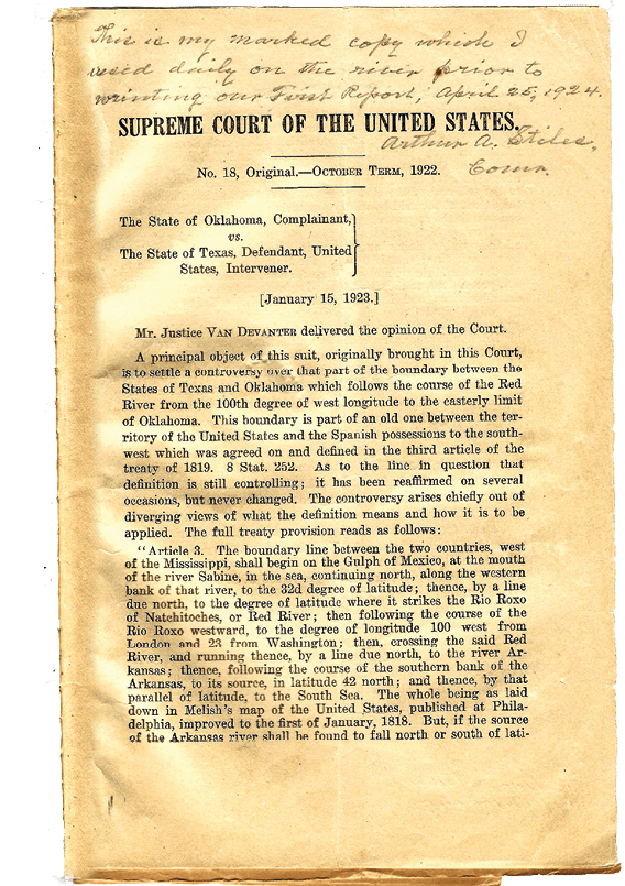
Copy of portion of Mr. Stiles’ field copy of Court’s Instructions
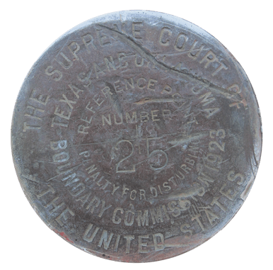
Stiles/Kidder Survey
In the Oklahoma v. Texas lawsuit of the 1920’s (addressed at length in Dr. Elgin’s Part I of this series), two preeminent surveyors, Colonel Arthur A. Stiles and Arthur D. Kidder, were appointed by the Supreme Court1 to determine how to go about fixing this boundary line on the ground. They were given instructions by the Court.
In my office I have Mr. Stiles’ original instructions from the Court which he carried to the field daily as they went about their task. He hand stitched the Court’s printed instructions into a booklet with a brown craft paper cover. This treasure looks like any information that has gone to the field with a surveyor for extended periods. Folded over and a bit worn in places. It has Mr. Stiles’ remarks and observations penciled in the margins as he and Mr. Kidder carried out their assigned work. They spent about three years in fulfilling the project given to them by the Court.
Surveyors today tasked with performing a survey on any river will benefit from reading the instructions and observations of the Court that guided these two surveyors.2 The Court pointed out that practical judgment must be exercised in making this boundary determination. Indeed! Several times the Court pointed out that ‘reasonable and practical’ judgments must be made. As is true in almost every survey endeavor undertaken.
Bureau of Land Management
The Bureau of Land Management is tasked with management of more than 245 million acres of public land as well as about 700 million acres of sub-surface minerals throughout the nation. As a part of this process, they develop and from time to time update Resource Management Plans. In the midst of updating part of their ‘management’ along the Red River, it was determined that Oklahoma sections should be retraced, some added, and mapped.
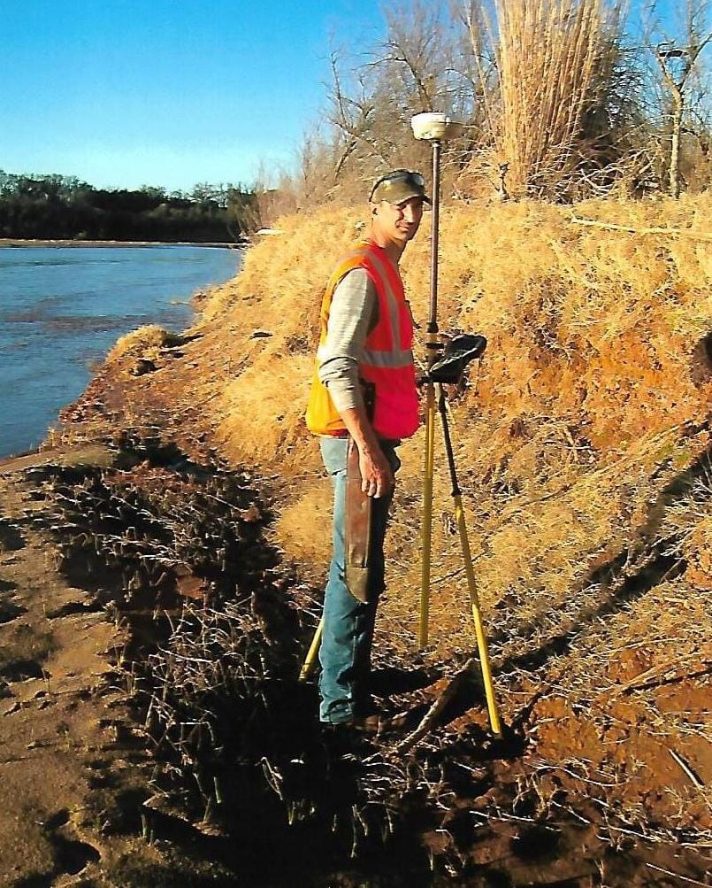
John Tucker of Shine & Associates on the gradient boundary of the south bank of Red River. On Kevin Hunter’s property, the south bank of the river as determined by BLM is more than 6500 feet south of boundary determined by Foster Townsend.
In 1970 Cadastral Surveyor Lane J. Bouman wrote, “Report on the Investigation of the Red River in Townships 4 and 5 South, Range 14 West, Indian Meridian, Oklahoma.” Mr. Bouman’s objective was to determine if a boundary established (in 1970) in accordance with paragraphs 5, 6, and 7 of the January 15, 1923 opinion of the Supreme Court (see footnote 2 for Court instructions) would coincide with the 1923 gradient boundary established by Surveyors Stiles and Kidder. Mr. Bouman concluded that the boundaries had not changed ‘appreciably.’ However, he did note that Surveyors Stiles and Kidder were using banks of one to three in height. Mr. Bouman reported that he was relying on banks one to ten feet in height in reaching his conclusion. Mr. Bouman did not report performing an actual gradient boundary survey, but simply relied on field observations and comparisons to the work of Stiles and Kidder. Mr. Bouman did note that in areas the ‘beds’ might remain untouched by scouring rains and “in about thirty years’ time, assume an upland appearance.” In actuality, this is a good description of accretion—the ground had risen in elevation by some seven feet and was gaining upland vegetation which would cause the banks to stabilize.
In 1994, the BLM published an Oklahoma Resource Management Plan that addressed the Red River Management. It was acknowledged in this report that the lands along the river could not be defined until the U. S. Congress established the ‘permanent’ state boundary between Oklahoma and Texas. In 2000, this jurisdictional boundary was established through the Red River Boundary Compact to be on the continuous vegetation line on the south bank. Following shortly after that, the BLM once more began updating their Resource Management Plan to address the issue of public domain along the Red River.
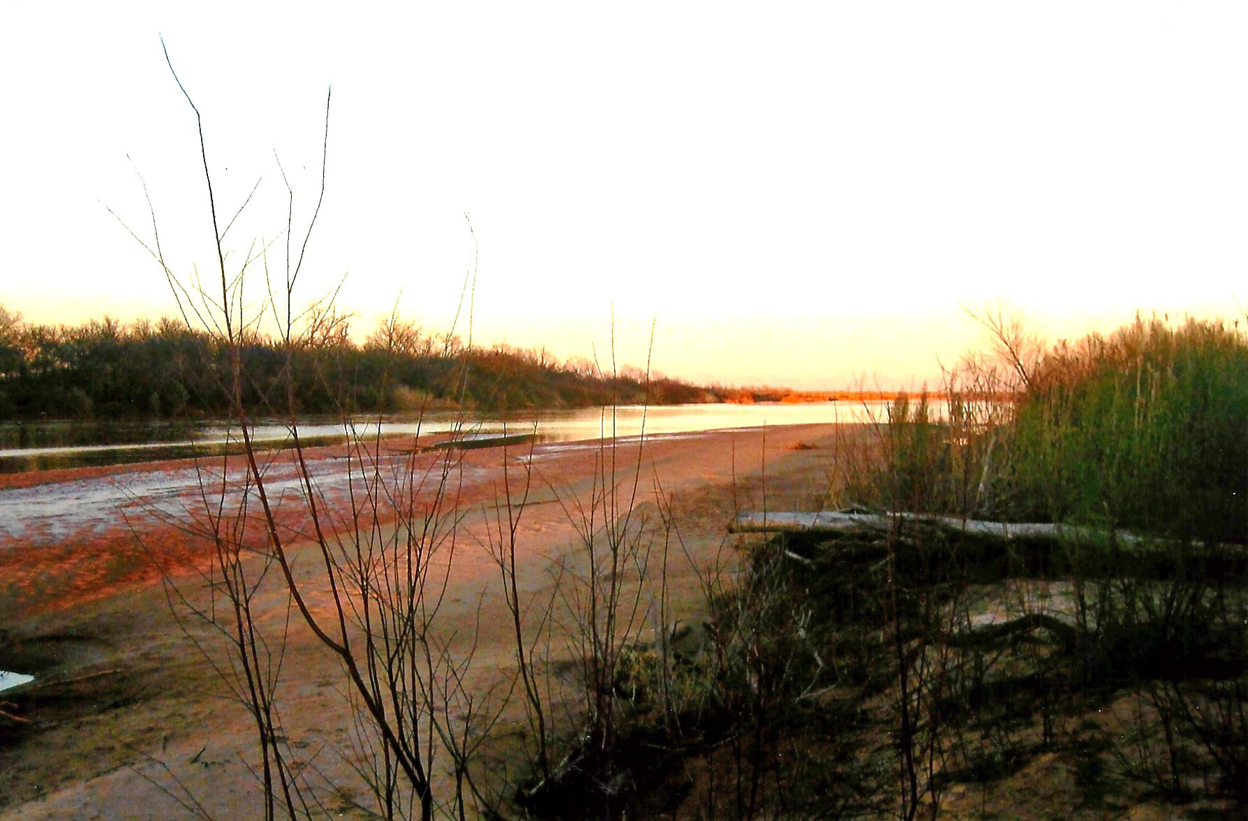
The Red River at sunset winding its way along between Oklahoma and Texas.
2000 Texas Oklahoma Boundary Compact
In 1996, Texas and Oklahoma agreed to create the Red River Boundary Commission to solve the border dispute between the two states once and for all. The goal of this Commission was to establish an identifiable political boundary between Texas and Oklahoma along the Red River without interfering with or otherwise affecting private property rights or title to property. The catalyst for the decision to undertake this effort was uncertainty in taxation and law enforcement issues. The game wardens and other peace officers wanted a better defined jurisdictional line from which to operate. When a body was dumped in the river, there could be uncertainty as to which sheriff was in charge of the investigation. This effort towards certainty of boundary once more involved much ink, many hours and words, and ultimately produced the Red River Compact. This resulted in the vegetation line along the south bank being declared as the political boundary for jurisdictional purposes alone.3 The gradient boundary of the river would remain the correct boundary for real property interests or title to property. So, it’s conceivable and likely that in places the property boundary and the political boundary will be in different locations. This does not yield certainty of boundary.
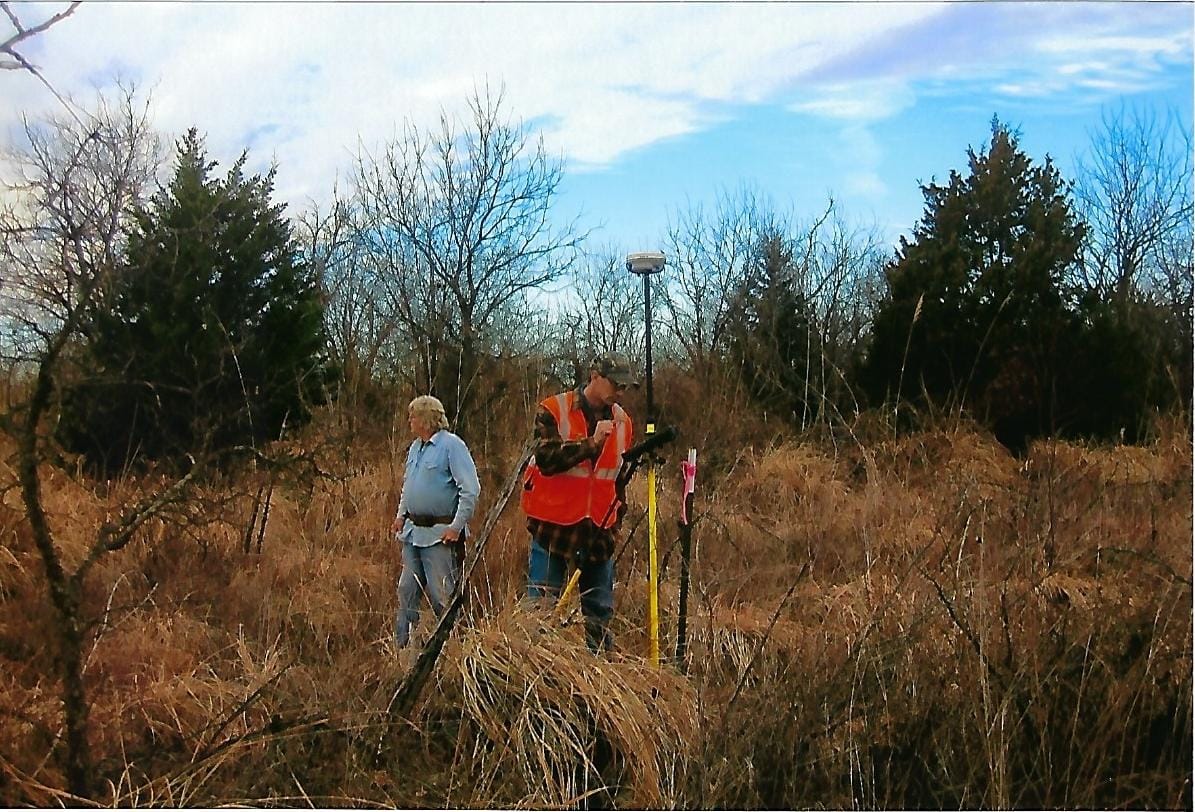
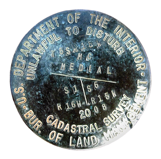
Photo of BLM Medial Monument on Canan property (below). GPS on same monument with Alvin Lassiter and John Tucker of Shine & Associates. Note the terrain in what BLM considers to be the middle of the river.
The good news is that the vegetation line may be near the gradient boundary—except for when it isn’t. On and along inclines (transverse slopes) the vegetation line may be hundreds of feet away. Article II (g) of the compact set out that if there is a change in the watercourse, the party states would recognize the rules of accretion, erosion, and avulsion. The states agreed that accretion or erosion may cause a change in the boundary between the states if it causes a change in the vegetation line. With regard to avulsion, the states agreed that a change in the course of the Red River caused by an immediately perceivable natural event that changed the vegetation line will change the location of the boundary between the states. It’s doubtful that this Compact worked as the ‘silver bullet’ in solving jurisdictional questions. It seems to have simply muddied the waters further in an already murky boundary situation.
 2008-09 BLM Survey
In the initial set of public hearings for the updated Resource Management Plan, the BLM stated that their “update” would impact up to 116 miles of the Red River and could include up to 90,000 acres of public domain along the Red River in Clay, Wichita, and Wilbarger Counties, Texas. Much of these 90,000 acres would have been on lands currently claimed by Texans. This did not set well with the Texans. The BLM subsequently lowered their estimate of public domain to 30,000 acres. But it is said, “If an acre of land is worth owning, it’s worth fighting for.” And Texans were definitely mad enough to fight!
The monuments set by the BLM surveyors on the lands in contention were dated 2008 and 2009. The field notes set out the methodology and which surveys were being retraced from the original 1875 and onward. I have had occasion to work with BLM surveyors through my career and have consistently found them to be people of highest integrity and very careful surveyors. The only explanation I have for this current work is that it was begun from a wrong premise. Quoting from BLM field notes associated with some of the land in contention, “….it is clearly evident that during the course of this resurvey the portion of the gradient boundary monumented and described within has not been changed since it was established and declared to be the true boundary by the Supreme Court on June 9, 1924.” This current BLM work begins from the premise that the boundary was fixed in place in 1924 and that little or no change had occurred in the seventy-five years intervening. However, this is the Red River—notorious for changing course! Some of that ‘practical judgment’ that the Supreme Court valued would have been well-placed in this retracement endeavor.
Qualified bank with one lathe at toe and higher one on gradient boundary.
Included in the BLM retracement work was that performed by the original surveyor, subsequent perpetuating surveyors, and Stiles and Kidder. Some of the Stiles/Kidder permanent monuments set back away from the river as well as some of the wood posts near the river were recovered. The BLM surveyor reproduced this 1923 survey work and in the field notes declared the south bank monuments set in 2008 to be “along the Gradient Boundary, identical with the Boundary Line between the States of Texas and Oklahoma.” Many of these were far removed—a mile or more—from the river.
Monuments of the 2008 era were also set marking the ‘medial’ line of the river—which should be in the middle of the river bed. These also were well inland—in some instances with substantial trees nearby. Even some of the BLM monuments marking the north bank were well south of the current south bank of the Red River, placed on the upland on lands claimed by Texans for generations.
Foster Survey Work
In 2016-17 I performed survey work on lands of eight different individuals and a ninth tract in which the State of Texas had interest. These were located in Wichita and Wilbarger Counties. They were all parties to the lawsuit which was filed by them against the U. S. Bureau of Land Management. I was privileged to learn gradient boundary methodology from my mentor, Darrell D. Shine, who learned from Irving Webb, a direct student of Arthur Stiles.
Nedra Foster Townsend at Witness Post 17 set by Stiles and Kidder in 1923 near to the river. From these posts, bearings and distances were taken to points on the gradient boundary.
The beginning point of any gradient boundary survey as set out by Arthur Stiles and Arthur Kidder is the location of qualified or key banks. In the Court’s writings the boundary bank was often referred to as a ‘cut bank.’ The qualified bank that contains the river will be an accretion bank that has been built by the deposit of alluvion as the river rises, deposits its load of soil, and recedes. In various survey projects along the Red River from 2001 through 2017, I have located twelve qualified banks on which I’ve relied to perform gradient boundary projects. The total bank height of these ranged from a low of 2.00 feet to a high of 3.43 feet. These were located in Cooke, Clay, Wichita, Wilbarger, and Hardeman Counties. The total bank height is measured from the toe (the break between river bed and bank) to top (the point where the water reaches but does not overtop the bank). This consistency was one of the objectives of the Supreme Court when they were instructing Stiles and Kidder on what they wanted—a repeatable, consistent method of determining a boundary on a river bank. The bank heights found by me are consistent with those of Stiles and Kidder who worked with banks from 1.0 to 3.0 feet in total height. Our work is separated by some ninety-five years and yet the Red River continues to flow along and form the same types of banks.
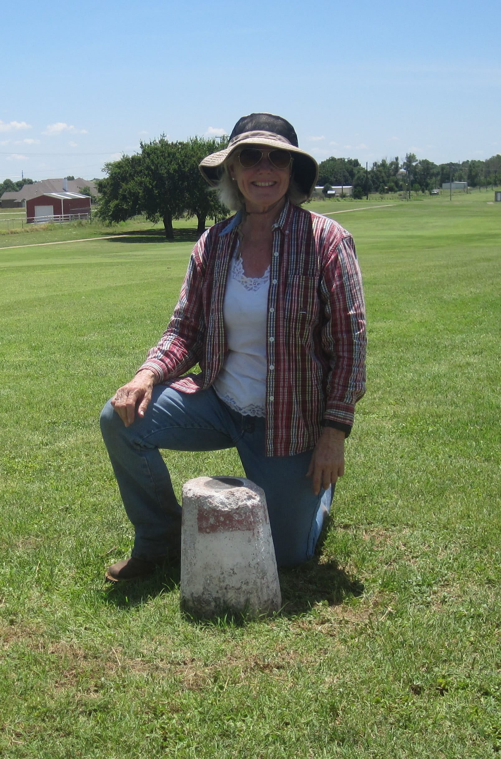
Nedra Foster Townsend at Stiles/Kidder Reference Monument 25 set back from river as a permanent monument.
I performed a survey on the property of Jimmy Smith in Wichita County. A qualified bank was located on the Oklahoma side of the river, and a gradient boundary survey was carried out in accordance with the principles set out by Stiles and Kidder and adopted by the Supreme Court. I also located ten BLM monuments on or near to the Smith property as well as recovering some of the Stiles/Kidder monuments. The two ‘medial’ line monuments I recovered on this property were from 900 to 1,000 feet south of the south bank of the gradient boundary of the river as determined in my survey. These were on upland with substantial vegetation in the area. These were far removed from what ‘practical judgment’ would determine as the middle of a riverbed.
This particular tract had both gained substantial acreage through accretion and lost a small amount of land through erosion compared to the description under which Mr. Smith purchased this property in 2006. Tract 2 called to be 131.948 acres and my resurvey found 534.14 acres. This increase in acreage was due to the large amounts of accretion along the northerly portions of the tract. On my surveying of this and the other tracts, I found substantial accretion that had taken place, but I also noted that in places the riverbed was in the process of being eroded back. It’s the nature of the Red River to move about, and it is certainly doing so.
 On the tracts belonging to six other individuals, I did limited surveying but performed a gradient boundary survey on the portion of the tracts fronting on the river. I located ten additional BLM monuments that had been placed on these tracts.
I also performed a survey on a tract in Wilbarger County in which the State of Texas has an interest. This tract also had gained acreage through accretion—268.8 acres worth . A qualified bank was located downstream of the subject property on the south bank of the river, and the gradient boundary portion of this work was performed from measurements of the qualified bank.
Addressing Erosion and Accretion
In the 2000’s era controversy, the Bureau of Land Management witnesses continually pointed out their opinion that the loose sand banks at the edge of the water could not possibly be what the Court intended because they would shift from time to time. They claimed that such an ‘impermanent’ boundary would be inconsistent with what the Supreme Court intended. I agree that some of the banks are composed of loose sand. Survey corners that I located miles away from the river were also in loose sand. It was an easy task to dig out corners in this area. Much of the soil in this part of Texas is loose sand, so naturally the banks of the river are also sandy.
John Tucker standing in Texas.
The 1920’s era Oklahoma v. Texas controversy extended over several years with some specific issues considered separately. One of these4 addressed avulsions, accretions, and erosions that occurred during the years that this lawsuit was grinding along. In the No. 15 portion of the 1924 Court proceedings, the Court considered an area that had been surveyed in 1920. In the intervening four years the river washed away a large section of the opposite bank on the north and shifted its principal channel to that side. There was gradual accretion added to the south bank. The north bank was cut away as much as 1400 feet from where it had been located in 1920 while the south bank gained from 60 to 80 feet of accretion which had reached the same elevation as the former bank, had similar vegetation on it, and appeared to be stable land. The Court determined that Stiles and Kidder had made the correct decision when they included this accretion in the upland and ran the boundary on the outer line (river side) of this accretion.
This interim decision strongly reiterated the Court’s stance that the boundary would be subject to the normal accretions and erosions that affect rivers. “The boundary between the two states is not an unswerving line, but a river bank, and where through the natural and gradual processes of erosion and accretion the bank is changed, the boundary follows the change. We so said in the opinion and decree which were to guide the commissioners.”
Medial Monument—Property of Kevin and Barbara Patton. This ‘middle of the river’ monument is 2360 feet south of the gradient boundary determined by Foster Townsend on the south bank.
The Outcome
On March 29, 2017, the Chief Cadastral Surveyor of the BLM New Mexico Office issued a statement suspending the surveys of T5S R15W; T5S R13W; and T5 and 6 R12W of the Indian Meridian, Oklahoma. Quoting from this document, “BLM has recently obtained new information that brings into questions whether the doctrines of erosion, accretion, and avulsion were appropriately considered, as directed by the Supreme Court’s direction in Ok v. TX…. Having reviewed this deposition testimony and other new information, the BLM believes the survey methodology used was in error, and may have caused errors in identifying the location of the Gradient Boundary.”
A Joint Settlement Agreement was reached on December 19, 2017, and so ordered by the judge on January 3, 2018, in which the Settlement Agreement offered by the Plaintiffs, Kenneth Aderholt et al, was incorporated in its entirety to be part of the Joint Settlement Agreement. The stated purpose for the Agreement was to settle litigation. It was set out that the field notes for Group Number 81 and 126 OK Surveys would be corrected to clarify that any references to the location of the Texas/Oklahoma border do not reflect Defendants’ position as to the present-day political boundary between the States of Texas and Oklahoma. Within 120 days after this Agreement, Defendants were supposed to remove from the monuments any references to the States of Texas or Oklahoma (that is, if the Texas landowners would allow them access to their property.) [The monument shown on the opening spread is one that should have references to OK and TX removed—if Mr. Canan would allow anyone from BLM on his property.]
From time immemorial people have been drawn to the water—want to live beside the water. This is all well and good, but folks must not lose sight of the fact that their waterfront will be subject to all the vicissitudes of nature. I try to warn clients who own property fronting on water that there is an inherent risk in that ownership—now, the Texas landowners’ whose rights were being threatened can rest much easier. Here’s to peace on the Red River!
Nedra Foster Townsend is President of Shine & Associates in Silsbee, Texas, and is the only woman to be a Licensed State Land Surveyor in Texas. She served nine years on the Texas Board of Professional Land Surveying, two of those as Chairman. She teaches various continuing education classes for surveyors in addition to keeping up with seven grandchildren.
1 Quoting from State of Oklahoma v. State of Texas, No. 15 (June 9, 1924), Originally there was a purpose to select three commissioners—one each to represent the interests of U. S., Oklahoma, or Texas. “The Court deemed it better and in the interest of economy to commit the work on the portions of the boundary….to two commissioners instead of three. The two were selected by the Court as its representatives, not as representatives of any of the parties. The Commissioners so understood.”
2 From the 1923 case (260 U.S. 606, 43 Sup. Ct. 376):
Paragraph 5. “The south bank of the river is the water-washed and relatively permanent elevation or acclivity, commonly called a cut-bank, along the southerly side of the river which separates its bed from the adjacent upland, whether valley or hill, and usually serves to confine the waters within the bed and to preserve the course of the river.
Paragraph 6. The boundary between the two states is on and along that bank at the mean level attained by the waters of the river when they reach and wash the bank without overflowing it.
Paragraph 7. At exceptional places where there is no well defined cut bank, but only a gradual incline from the sand bed of the river to the upland, the boundary is a line over such incline conforming to the mean level of the waters when at other places in that vicinity they reach and wash the cut bank without overflowing it.
“The foregoing specifications applied in the light of the opinion, admit of, and require the exercise of practical judgment in determining the line intended; but certain fundamentals, such as the following obviously must form the final basis for the exact location of the line. ‘The boundary line is a gradient of the flowing water in the river. It is located midway between the lower level of the flowing water that just reaches the cut bank, and the higher level of it that just does not overtop the cut bank. The physical top of the cut bank being very uneven in profile cannot be a datum for locating the boundary line, but a gradient along the bank must be used for that purpose. The highest point on this gradient must not be higher than the lowest acceptable point on the bank in that vicinity. The boundary line has been determined accordingly.’”
3 In 2000 the U. S. Congress adopted what the Commission had hammered out. (114 STAT. 919, PUBLIC LAW 106-288, OCT 10, 2000) According to the federal legislation, “(b) The permanent political boundary line between the states of Texas and Oklahoma along the Red River is the vegetation line along the south bank of the Red River except for the Texoma area, where the boundary does not change. For purposes of this compact: (1) the Texoma area extends from the east bank of Shawnee Creek (which flows into the Red River from the south approximately one-half mile below the Denison Dam) at its mouth to the upper end of the normal pool elevation of Lake Texoma (which is 617 feet); and (2) the upper end of the normal pool elevation of Lake Texoma is along the latitude of 33 degrees 54 minutes as it crosses the watercourse at the approximate location of longitude 96 degrees 59 minutes.
(c) The party states agree that the existing boundary within the Texoma area begins at the intersection of the vegetation line on the south bank of the Red River with the east bank of Shawnee Creek. From this point, the boundary extends west along the south bank of the Red River as the bank existed immediately before the commencement of the construction of Lake Texoma. From Shawnee Creek to Denison Dam, the boundary line is within the current channel of the Red River. Within Lake Texoma, this boundary line follows the south bank of the Red River as the bank was located and marked by the United States Army Corps of Engineers before the commencement of the construction of Lake Texoma.” It was also set out that the compact would not alter any of the present or future rights of the Kiowa, Comanche, and Apache Tribes, the Chickasaw Nation, and the Choctaw Nation of Oklahoma.
4 Quoting from State of Oklahoma v. State of Texas, 44 Sup.Ct. 571, No. 15 (June 9, 1924).