 Leicestershire, 25 March 2019 – Gatwick Airport, the busiest single-runway airport in the world, is using aerial photography from Bluesky to plan long term development and growth. The high resolution, map accurate imagery will feature highly in the Airport’s soon to be published Master Plan. The Plan, which explores options including the increased capacity for its existing runway, additional use of a standby runway and safeguarding for a new runway, outlines how the Airport will meet an increasing demand for air travel, create new opportunities for the region and manage its environmental impact.
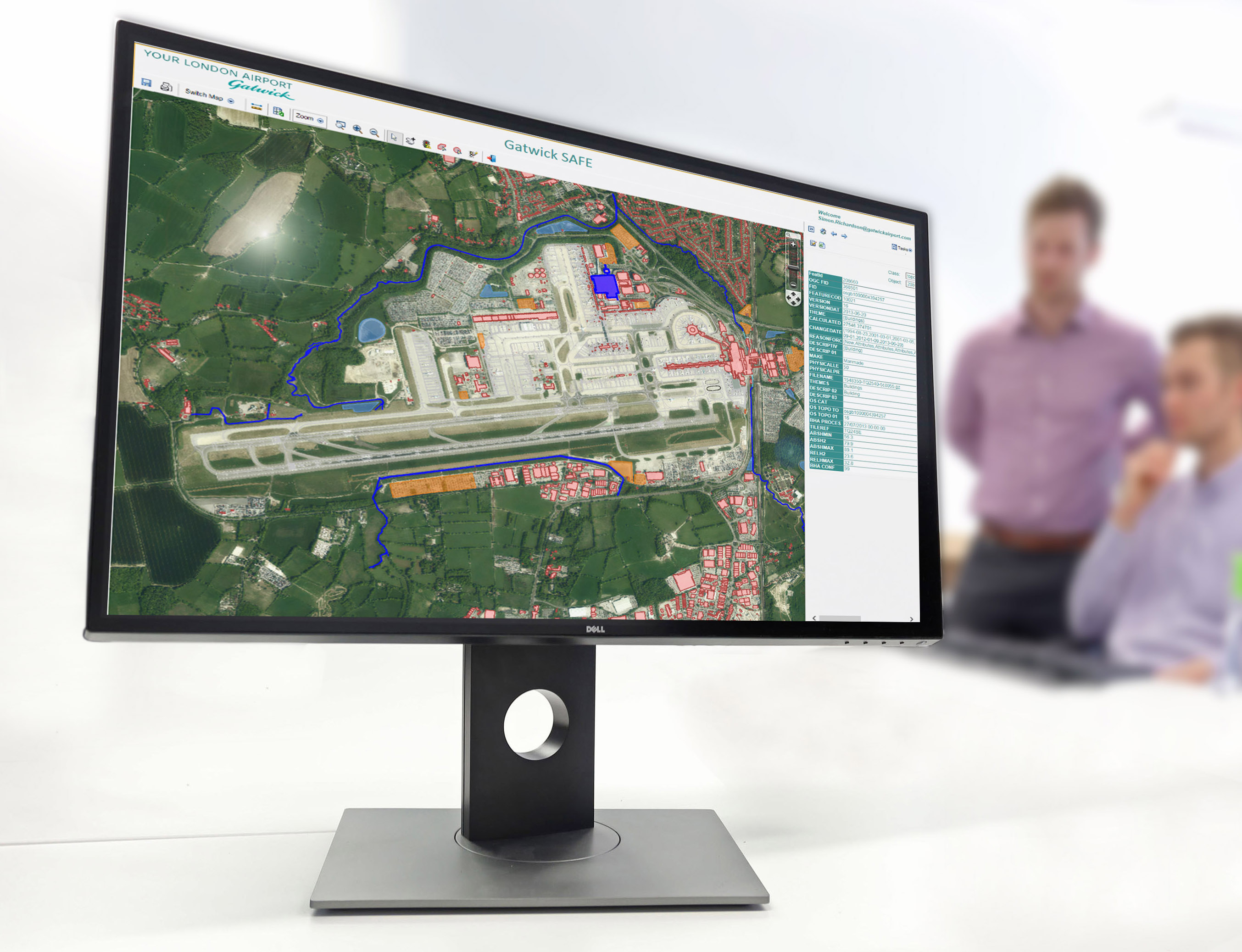
The Bluesky photography, delivered to Gatwick Airport as a 12.5 centimetre resolution digital dataset ready for use in desktop mapping, Geographical Information Systems (GIS) and Computer Aided Design (CAD) systems, is the most accurate and up to date record of the airport currently available. Used within Gatwick SAFE, a bespoke GIS based on Autodesk technology, alongside additional map layers from Ordnance Survey and more than 60 years’ worth of legacy data, the aerial photography provides a real world view of airport infrastructure and locale.
“Aerial photography has become the ‘go to’ map layer for a wide variety of applications,” commented Simon Richardson, CAD Manager within the Graphical Data Team at Gatwick Airport. “It provides real world context for otherwise potentially abstract information such as buried utilities, risk and future developments, and is used for both major projects, such as the Master Plan, and daily tasks.”
“Unlike traditional map data the Bluesky aerial photography is easy to interpret; water is blue and trees are green, and more detailed with features such as runway markings, car parking spaces and even evacuation points clearly visible,” continued Richardson. “It is also the most up to date record of the both the airport infrastructure and surrounding environment.”
Gatwick Airport is a long term user of aerial photography with digital archives dating back to nineties. Gatwick purchased the Bluesky 2018 imagery from its off-the-shelf, nationwide coverage that is updated on a rolling three year programme. Applications of the Bluesky data include flood risk assessment, emergency response planning, noise abatement, engineering and construction, development planning and control, for example.
“It is understandably getting more and more difficult to operate survey aircraft within the vicinity of an airport,” concluded Richardson. “So we were delighted when Bluesky was able to capture our location in such detail.”
About Bluesky
Bluesky is one of the leading and most successful aerial survey and geographic data companies in the UK producing and maintaining seamless digital aerial photography and height data on a national scale in both Great Britain and the Republic of Ireland. Bluesky operates the worlds most advanced airborne sensor, which comprises vertical and oblique cameras as well as a LiDAR, to create accurate and detailed virtual cities. Bluesky also operates the only LiDAR system in the world that incorporates a thermal sensor and survey grade camera. These combined with other systems puts Bluesky in the enviable position of being able to provide customers with unique and cost-effective geospatial solutions. As well as being an established and respected aerial survey company Bluesky is also highly innovative and continually strives to develop new products and services by embracing new technology and methods. This has resulted in the development of some unique products such as the National Tree Map (NTM). These datasets underpin long term contracts with local and central governments and many major blue-chip companies from a range of market sectors including financial services, utilities, telecoms, web portals, construction and environment. Bluesky has offices in the UK, US, Republic of Ireland and a dedicated production centre in India.
http://www.bluesky-world.com
