Trimble’s precise point positioning Trimble RTX can produce centimeter GNSS accuracy when RTK or real-time networks are not available.
Since the earliest days of satellite-based positioning, surveyors, mappers and other geospatial professionals have sought the holy grail of geolocation: Achieving centimeter-level accuracy whenever and wherever it is needed. Activities such as cadastral or engineering surveys, construction, monitoring, and infrastructure management demand high accuracy regardless of project location.
The push for accuracy led first to real-time kinematic (RTK) solutions and then to real-time GNSS networks (RTN). These solutions could provide positions at the centimeter level in real time, which gave users an enormous step forward in productivity and flexibility.
More recently, precise point positioning (PPP)—in which a single GNSS rover can produce accurate results without RTK or an RTN—is addressing the need for accurate geolocation in remote regions. For example, in South Australia surveyors working for Fyfe Pty Ltd (a major Australian consultancy) have used PPP for cadastral surveys in regions not served by GNSS networks. Fyfe crews used Trimble® CenterPoint® RTX positioning service to capture real-time positions on cadastral markers. As a check, they also captured static GNSS data on 40 of the markers. The positions obtained using Trimble RTX agreed with the post-processed static measurements to within 2 cm horizontal. The work demonstrated that they could meet local accuracy requirements while significantly reducing the time spent on site compared to other real-time techniques.
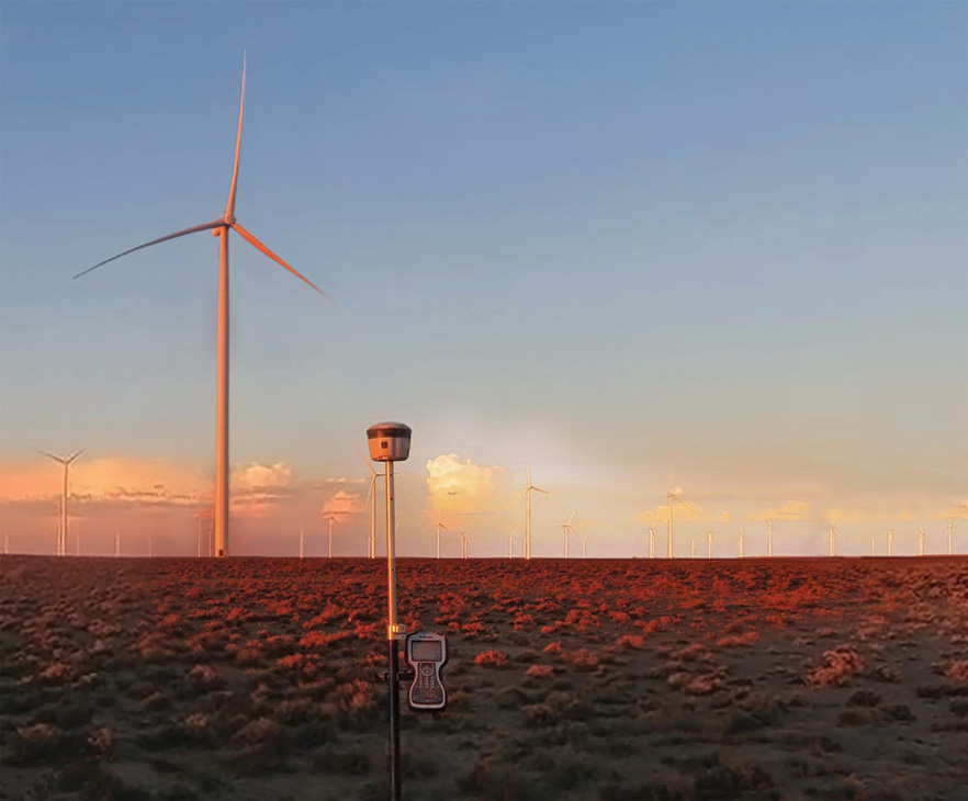
Surveying with Trimble GNSS at a wind farm in South Africa. By using advanced PPP technologies, surveyors can achieve high accuracy without any local positioning infrastructure.
RTK and RTN serve their users well and will continue to do so. But the approaches come with limitations. RTK users need to manage their own reference stations and stay within radio range of control points or establish new ones when needed. RTN eliminates the need for individual reference stations and allows users to cover larger—but still limited—areas. Both approaches rely on radio or cellular communications to deliver data to the GNSS rover. If a data communications link is interrupted, precise real-time positioning stops.
Precise point positioning (PPP) can solve the issues of geographic constraints and communication outages. Until recently, however, it has come with its own limitations in accuracy and time. Users often needed to wait 30 minutes or more to obtain a higher-accuracy GNSS position, which would still be accurate only to a few decimeters. That accuracy may be sufficient for a number of uses, but it’s not enough for many applications in surveying and construction.
Fortunately the limitations are fading. Improved PPP techniques are providing new levels of accuracy, flexibility and reliability. Recent advances in Trimble’s CenterPoint RTX positioning service illustrate the new capabilities.
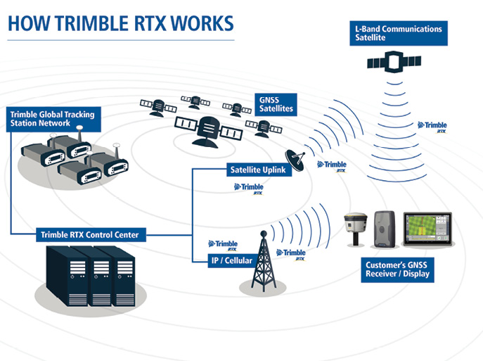
Diagram of Trimble RTX positioning solution. The CenterPoint RTX service provides 2-centimeter accuracy worldwide.
Making a Good Solution Better
In contrast to the differential techniques used in RTK and RTN, PPP develops positions by modeling and correcting for three main error sources: satellite orbits, clock offsets and atmospheric effects. The correction data is delivered to a GNSS rover, which combines the information with its own satellite observations to produce accurate positions. Users who subscribe to a positioning service receive the corrections via communications satellites. Depending on the provider, PPP accuracy is typically in the decimeter to meter range.
With the introduction of CenterPoint RTX, Trimble implemented a commercial service to provide high-accuracy PPP corrections. A service of Trimble’s RTX platform for global real-time positioning, CenterPoint RTX focuses on applications and users that require centimeter accuracy.
Introduced in 2011, Trimble RTX has provided reliable correction services for users on seven continents. In May 2018, Trimble released updated performance specifications for CenterPoint RTX: The system can produce horizontal accuracy of 2 cm RMS with a convergence time of 15 minutes. (In regions where Trimble CenterPoint RTX Fast service is available, convergence can take as little as one minute.) Once the solution converges, crews can use standard RTK workflows for data collection and setting out.
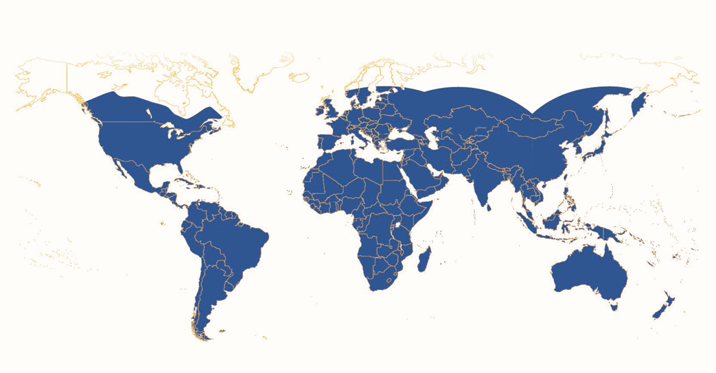
Coverage map of Trimble CenterPoint RTX service. Users can achieve 2-centimeter positions over most of the planet.
The improved performance is achieved through several factors. First, Trimble operates a network of more than one hundred GNSS tracking stations around the world that provide continuous GNSS observation data to the Trimble RTX servers. Second, Trimble RTX is not limited to GPS and GLONASS. It also utilizes signals from BeiDou, Galileo to provide a true multi-constellation solution, thereby enabling more robust modeling of error sources. Third, Trimble engineers and scientists have developed enhanced modeling techniques used for PPP. Improvements were also made to the correction streams carrying data to servers and GNSS rovers. With more data from more stations fed into ever-improving algorithms, overall system performance improves.
For example, Trimble can now model satellite orbits with accuracy of one to two centimeters in real time. Compare this to the broadcast orbit data that is accurate to roughly one meter. Precise orbit data from International GNSS Service (IGS) gives centimeter accuracy, but that information is not available for 10 to 15 days after fieldwork.
 The computations for atmospheric modeling and clock offsets are also improved. The atmospheric modeling works by analyzing the radio signals sent from known locations of a satellite to a known ground station. This approach, which leverages the high accuracy models for orbits and clock biases, is essentially a direct measurement of the atmosphere at a specific location. As the density of stations increases, the model can become more accurate. As a result, instead of using only global atmospheric models, Trimble RTX can also develop regional atmospheric models (RAM). In areas such as much of Europe and portions of North America where the density of tracking stations is sufficient, the regional atmospheric models are very accurate and provide higher resolution, thereby allowing significantly faster convergence times. Rapid convergence also utilizes the higher bandwidth available in these areas for transmitting correction data from communications satellites to the GNSS rovers. Positions can be obtained in these regions in less than one minute using CenterPoint RTX Fast.

Trimble RTS uses GNSS tracking stations and communications satellites to provide high-accuracy positioning for users in remote locations.
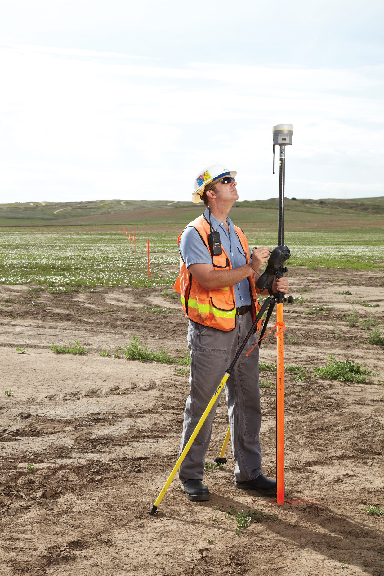
The ability to provide high-accuracy positioning also relies on increasing capability of hardware in the field. New generation GNSS rovers such as the Trimble R10 have the ability to track all available signals as well as the PPP corrections, which are delivered on L-band transmission. The new rovers also provide the computing horsepower needed to handle the volume of data and complex computations on the fly.
During the convergence period, CenterPoint RTX users can see the accuracy estimates displayed on the controller in a manner based on the patented HD-GNSS approach used by Trimble, which doesn’t require traditional ambiguity fixing as in previous RTK positioning techniques. This allows the system to no longer be vulnerable against ‘wrong’ fixes and leads to a more reliable solution. Also similar to RTK, crews can occupy a known position and use the Quick Start technique to reduce convergence time to less than five minutes in areas where CenterPoint RTX Fast is not available.
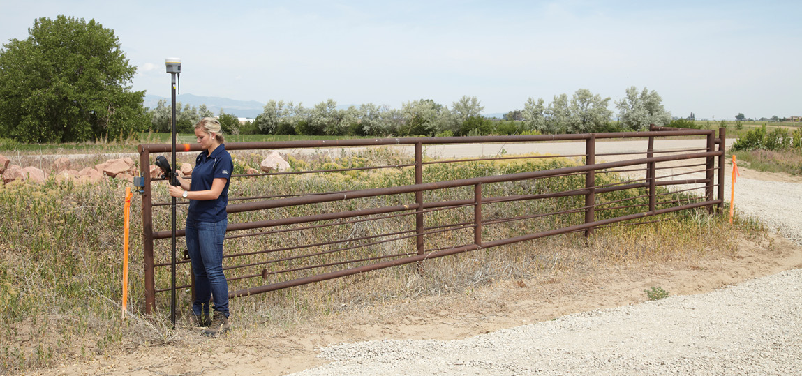
GNSS receivers such as the Trimble R10 can utilize PPP to achieve high-accuracy, real-time positioning.
Complementary Technologies
It’s important to note that Trimble CenterPoint RTX is not a replacement for RTK or RTN. Rather, it is a complementary technology intended to support those users by providing increased flexibility and reliability. For example, when working with RTK or RTN technology, users may encounter dead spots where the radio link to the base station or cellular connection with the VRS server is blocked or interrupted. In these cases, Trimble CenterPoint RTX provides a backup solution called Trimble xFill®. With xFill, real-time positioning continues to function for up to five minutes after loss of data link, enabling the user to continue operations such as stakeout with 2 cm accuracy. The five -minute coverage is provided with no fee; users who need more time can benefit from a subscription to Trimble xFill Premium.
Geospatial professionals who work in regions served by RTN or VRS may not need Trimble RTX. But for those who encounter limitations in RTK range and reliability, Trimble RTX provides an efficient, reliable alternative or backup that can keep field crews productive and on schedule.
For locations that lack sufficient ground control for GNSS surveying, PPP lets users bypass the need to establish local control points with suitable accuracy and density. That task can involve time-consuming static observations and processing before any real-time work can begin. This benefit was illustrated in South Africa, where surveyors from Cape Survey Ltd. used Trimble CenterPoint RTX to locate access roads serving a new wind farm. Even with on-site control points from earlier static GNSS surveys, crews planned for three days of work, much of which involved moving RTK base stations on a site more than 25 km across. Instead the crew used Trimble CenterPoint RTX to reduce time on site by at least two-thirds while collecting data with 2-cm accuracy.
In Australia, the accuracy demonstrated by Fyfe enabled the company to work with local authorities to enhance the accuracy of the digital cadastral database. By using Trimble CenterPoint RTX, Fyfe could establish positions on cadastral marks more quickly and at significantly lower cost than static or RTK GNSS. The project delivered reliable, spatially correct data for use by planners, engineers, utilities and the general public. Immediate improvements could be seen in corrected property boundaries overlaid on aerial and satellite imagery.
As the density of ground stations increases, performance of RTX will also improve. We may see increased regional modeling, which can directly affect convergence time in those areas. As a result, Trimble RTX users in remote locations around the world will be able to work faster and with survey-grade accuracy.
Mark Richter is the Strategic Marketing Director for the Real-Time Networks and Services (RTNS) business area within Trimble’s Advanced Positioning Division. He is responsible for the global business strategy and product marketing department for RTNS including Positioning Services (e.g. Trimble RTX, Trimble VRSNow), addressing core target industries of precision farming, civil engineering, construction, survey, mapping and OEMs. He holds a master’s degree in geodesy from the Munich University of Applied Sciences.