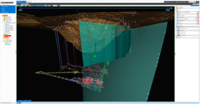
 New London, New Hampshire – February 18, 2019 – Canary Systems, Inc. is proud to announce a major update to its MultiLogger® Suite software platform for automated and manual data acquisition. For the first time ever, it is possible to collect, view, and analyze data from a multitude of sources – including geotechnical instrumentation as well as radar and InSar point clouds – in a real-time, web-based 3D platform.
Data. In A New Dimension.
MLWeb®’s 3D visualization engine allows for spatial data analysis of any sensor data, and display of 3D point clouds and surfaces right in your browser. Draw cross-sections on the fly; view surface and subsurface data from any angle; and use spatial filters to query underlying sensor and point data for charting and further analysis or alarming.
From Data Point to Map Pin. Just Drag and Drop.
The integrated feature-rich GIS component is capable of ingesting dozens of GIS format files and live map servers without any additional tools. It supports automatic conversions and reprojections on the fly between local, global and projected coordinate systems for data and layers. Additional dynamic options such as contours, heatmaps and vectors based on data values help visualize trends right on the map. It’s as easy as drag-and-drop!
Data Visualization. Automated.
Introducing MLSuite’s powerful Data Classing engine! Data Classing allows you to set up templates that define patterns, properties, calculations, locations and relationships for your data. Once classed, watch in awe how a newly installed instrument (or hundreds of them) automatically appears in the database with all charts and functions created for you.
Calculate the Future. Analyze the Past.
MLSuite’s advanced calculation engine opens the door to a powerful set of tools beyond just raw data: statistical functions, trendline forecasting, if-conditionals, runtime parameters, conversions, corrections, correlations and many other operations can be created and customized to suit each project’s specific needs.
Meaningful Alarms. For Meaningful Actions.
MLSuite’s alarming engine allows for setting simple threshold and rate-of-change alarms quickly: define the source, how many occurrences are needed to trigger an alarm, select from a range of on-alarm/off-alarm actions including email (with or without attached chart) and text.
Point-And-Click Data Acquisition.
MLSuite includes MultiLogger, an application designed to communicate, program, and collect from many makes and models of dataloggers and sensors directly, without the need for additional software. This single point of interaction means: robust data collection without manufacturer or vendor limitations.
About Multilogger® Suite
For more information about our Multilogger® Suite (MLSuite®) data management software, as well as our custom and standard hardware and communications solutions for data acquisition, please visit the Canary Systems website. MultiLogger® Suite is used at hundreds of projects worldwide across a number of markets and applications, including mining, dam safety, structural, environmental, industrial and others, as web based application, workstation tool, and on mobile devices.
About Canary Systems, Inc.
Formed in 1997, Canary Systems is the leader in providing integrated geomonitoring solutions for a broad range of industries including mining, dam safety, geotechnical engineering, structural, environmental, meteorological, industrial and others. We help clients better manage risk, monitor performance, and increase the safety of their operations by tying together all loose ends: the hardware required for automatic or semi-automatic data acquisition – and the software to collect, store, analyze and present the data in a simple and efficient way on a single combined powerful platform. We provide comprehensive all-in-one turnkey solutions – including system architecture, hardware and software development, database development, and instrumentation – as well as individual hardware and software components customized to existing project needs.
