 The last place a surveyor wants to be is in a courtroom. We are not trained in courtroom etiquette and a working surveyor is lucky to have one business suit for marry’ins and bury’ins. Once or twice in our careers we may have to face a court and demonstrate the evidence package supporting our location of a boundary. I had the opportunity to chat with Gary Nyhus about his role and experience in the case of Dykes v. Arnold. Gary formed Nyhus Surveying in 1993 and continues to work along with his sons Steven and Eric. The boys are both graduates of Oregon State University and licensed land surveyors. Gary’s dad and granddad were both loggers which fostered Gary’s intuition of the land and prowess as a surveyor. Gary credits his most valuable experience under the mentorship of another hero in our profession Robert Dahl. Yes, the same Bob Dahl that invigorated the 2009 Manual of Surveying Instructions with the life and breath of retracement work performed long after the federal pie is served up. Gary was the defendant’s surveyor and was kind enough to share his experience with The American Surveyor readers. We discussed the following questions.
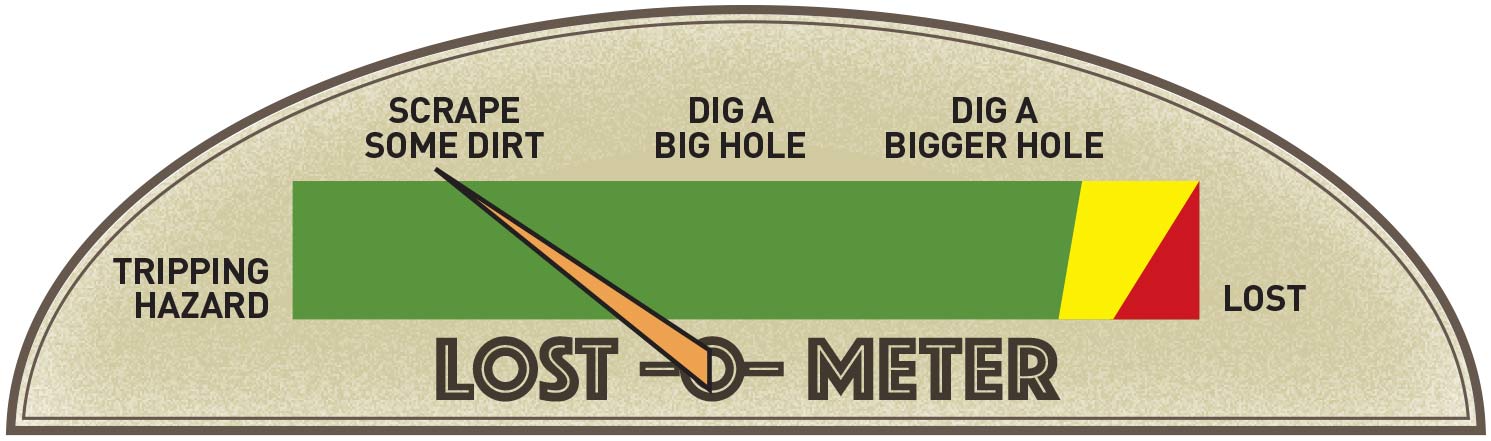
Nyhus’ experience and diligence toward recovering the local moss covered corner remnants barely even raised the needle on the old lost-o-meter.
Did you expect or know that you would be going to court when you did your survey?
Nyhus: While I did not expect to go to Court I realized there was a possibility of that happening when I performed this survey do to the hostility between my Client and his neighbors (Dykes).
Did you have any training in what happens in court?
Nyhus: I had very little knowledge about what happens in court. I had been an expert witness before, but that consisted of answering a few questions that I felt were straight forward.
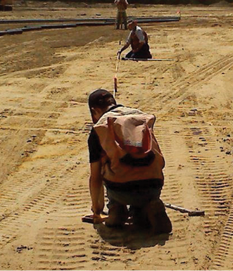
The Nyhus crew are no strangers to beating hubs on a construction site. Gary and the boys embrace and carry on the Nyhus work ethic passed down through generations of stalwart Oregon loggers.
On a scale of 1 to 10 how stressful was the experience?
Nyhus: I would say this experience would rate an 8 on the stress scale. Probably the most stressful part for me was the deposition with Dykes Attorney. He was well prepared to pick me apart and I did not know what I was walking into.
Did Dennison attempt to resolve the discrepancy or otherwise contact you?
Nyhus: As far as I know Chuck Denison did not try to resolve this discrepancy since he was certain that he was correct in his location of the Center ¼.
Did you have any sense that the owners may have come to some agreement rather than going to court?
Nyhus: Both parties (Arnold and Dykes) seemed to be adamant about the location of the Center ¼ corner and the old fence lines. Joe Arnold knew that he was correct in his knowledge of the property lines in this area and the Dykes’ were certain that the Survey by Denison was correct, so I never saw a serious effort to reach an agreement.
What did you think after the lower court said that “stubbing in” was not authorized in the G.L.O. instructions?
Nyhus: I was not surprised that the court did not feel the Derrick Center ¼ was established properly. In fact, at the time I was not sure if it was the center of the section. It certainly did appear as property rights were established to this location however.
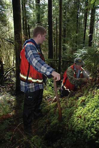
Steven watches Gary pick apart an old stump looking for GLO scribing, which was found.
How did you find the 1899 Derrick Survey and how did you determine that your function was to retrace that particular survey?
Nyhus: When I was first contacted by Joe Arnold he told me about old survey marks that he could remember when he was young. We met on site and he showed me the general location of the old center ¼. He told me how his Father had told the kids to leave the old wood stake alone since it was their property corner. This stake had disappeared at some point in time. I then did my office research and found County Surveyor Derrick’s ١٨٩٩ survey. I also found County Road deeds from 1931 that called to the center of the section. I was not able to find any other “old” surveys in this vicinity. That meant the Derrick corner must be what had been relied upon prior to the more recent survey work. I then tied the old fence lines running to the North and East in several locations and calculated an intersection point. It should be noted that the fence line in the actual center ¼ corner vicinity had been obliterated several years prior when a bulldozer had been used to clear brush. This also would have broken off Derrick’s old stake at ground level if it was still standing at that time. The existing as-built centerline of Tomjack County Road was also tied and I was able to match the existing location with the 1931 deeds. I also was able to locate an unrecorded iron pipe monument at an apparent deed corner southwest of the center of section. All of this information was used to calculate the search area for the old center ¼.
When you landed in the three foot circle at the center of section did you know
what you were looking for and if so how?
Nyhus: I had searched for numerous GLO corners in this county thru the years. Experience told me that if the point of the wood stake was not in existence, we had a good chance to find the outline of the rotted stake. The mineral soil in this area is typically brownish in color while rotted organic material is darker.
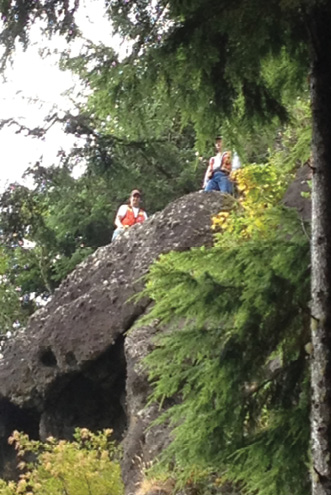
Eric and Gary stand looking down from the top of an 80 foot high “line bluff”
What experience in your career guided you to find something hidden for years? There is no set of written instructions to find the remnants of a rotted stake set by a hack method. How did you get it right?
Nyhus: Prior to starting my own Land Surveying Company in 1993 I spent a field season with a BLM Cadastral Crew where I was first exposed to “following in the footsteps of the Original Surveyor” by Robert W. Dahl. I then spent five years working for the Lincoln County Surveyor’s Office in the corner preservation program. This entailed corner search and the perpetuation of GLO corners. After starting Nyhus Surveying, Inc., our specialty became Cadastral work, mostly for the large Timber Companies in this area. Again, we spent a good portion of time searching for Original GLO corners.
What is your advice to surveyors regarding retracement work and litigation?
Nyhus: My advice is being diligent, do your office and field research to the best of your ability. Always remember that a retracement survey requires you to “follow in the footsteps of the original Surveyor”. Once you have completed your retracement it is very important to document your procedure and findings. It is extremely helpful to work with an experienced, knowledgeable Attorney during Litigation as the Courtroom is their domain and they can provide valuable insight for a Land Surveyor in Court.
I want to thank Gary for taking the time to share his experience with us. His heroic retracement stands in perpetuity to protect the rights of the landowners. He was the right person on the scene at the right time. The facts revealed that Nyhus’ faithful retracement was truly accurate and his function was served. But how did he get there?
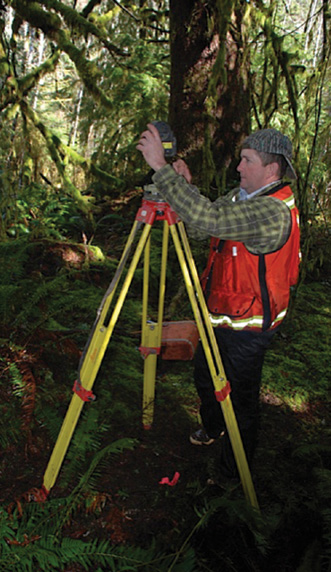
Gary is a hands on surveyor working tirelessly everyday in his forest lined and moss carpeted office.
You’ll notice that the first thing Nyhus did was gather potential evidence directly from the landowners. He exhaustively searched for records, not just the current deed or tax map, but many sources including old road records and surveys. Nyhus went to the field to search for physical evidence and remnants on the ground. He was able to correlate the oral, written, and physical evidence that substantiate a reasonable place to dig. Obviously he hit pay dirt but that doesn’t always happen. Coincidentally, evidence that guides us to “the spot” is some of the same evidence that substantiates a missing or obliterated corner, as well as the rare occasion to identify a lost corner.
Okay, so Nyhus finds his digging spot, what next? He knows what to look for, the condition it might be in, and how to archaeologically recover it. This is neither a guess nor luck. Nyhus went to great lengths to substantiate the evidence that placed him here and has “just cause” to be at this spot. Furthermore, his experience, knowledge, training and discipline point to Nyhus being the most proficient person to recover any remaining evidence of the original corner. He knew that a rotten stake bottom could maintain its organic pigment and present itself among mineral soils like a soft fossil. He also knew that a Schonstedt and a backhoe were not the right tools for this job. The court summed it up best “He carefully removed the topsoil in that area and found a square stain of dark wood organic material that tapered to a point roughly one foot down…” Nyhus concluded his retracement survey by resting on evidence directly relating the original survey marks with the original record together with the landowner’s reliance on the mark.
So there we have it lock, stock, and barrel. 1.) An original survey was made in 1899 under authority and documented. 2.) The property owners occupied the land and built things accordingly. 3.) The original mark was degraded through natural and unintentional action. 4.) A century later confusion arose between landowners and retracement surveys were requested. 5.) The remains of the original mark were unveiled by reconstructing reliable evidence and records. 6.) The court recognized the stability of the boundaries affirmed through the five aforementioned events. I think that’s about as good as it gets when we talk about the brilliance of the PLSS after land is patented. I’m sure this was not the most pleasant experience for Dykes, Arnold, Nyhus, and Dennison. Regardless, old T-Jeff’s chessboard has withstood another test of stability under private ownership. Interestingly enough the damage needle on the “lost-o-meter” barely touched “obliterated”. However, the plaintiff paid for, and was handed a bill of goods that included a lost corner. Gnaw on that for a while.
I have a few parting thoughts regarding the surveyor’s awareness of law, evidence, and stability of boundaries. I think it’s important to remember that the plaintiff’s surveyor Dennison followed laws that led him to subdivide the section “by the numbers”. Dennison’s map appeared very thorough, with accurate measurements, and in conformance with the reporting standards, or in other words, a good mechanical survey. His actions indicate that he felt that the original county work was invalid. Not just done incorrectly by the numbers, but legally invalid. That’s a big claim and outside of us disagreeing with another surveyor’s opinion, I’m not sure we have the authority to actually invalidate another survey. It’s not hard to cherry pick a few statutes pointing at “the Manual” and talk yourself into a lost corner. Regardless, the law really has a high standard of a lost corner and it’s less likely to happen outside of the federal arena when land owners are in the mix. Nyhus showed us how a few inches of topsoil made the difference between lost, obliterated, and existing.
See full-size images of the Dykes plat at:
archive.amerisurv.com/docs/P1j.jpg
archive.amerisurv.com/docs/P2j.jpg
The corner record from the Dykes survey: archive.amerisurv.com/PDF/MON_PED.pdf