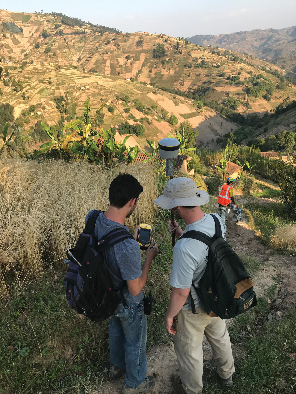
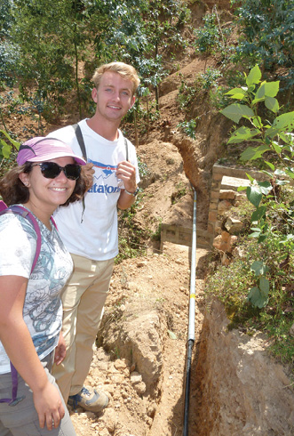
Christian Brodbeck and students with Engineers Without Borders use a Trimble® R2 GNSS receiver and Trimble CenterPoint® RTX to design water distribution systems in Rwanda.
Christian Brodbeck is standing in a small village in western Rwanda. It’s hot and dry. There is no air conditioning in the buildings and no breeze outside. Actually, there isn’t any running water or electricity either. And, of course, no WiFi. Yet Brodbeck is receiving some of the highest accuracy positioning data possible in a region as remote as any in the world.
“It’s mind-boggling to me that I am out in the middle of nowhere and this piece of equipment is getting amazing accuracy,” Brodbeck says.
Brodbeck is using a Trimble® R2 GNSS receiver and Trimble CenterPoint® RTX satellite-delivered correction services, a powerful combination that lets users perform positioning fieldwork in the most remote locations without relying on traditional VRS networks or a local RTK base station.
Trimble R2 is a compact, durable GNSS receiver that provides an easy-to-use solution for GIS and survey professionals to collect precise data in a range of geospatial applications. The R2 supports real-time time correct services, with CenterPoint RTX capable of delivering accuracy of 2 centimeters horizontal and 5 centimeters vertical.
Helping Developing Communities
For the last two summers, Brodbeck has spent two weeks in Rwanda where he and six students from Alabama’s Auburn University get up at dawn to install water distribution systems in underdeveloped communities. The project is part of Engineers Without Borders, a nonprofit organization that delivers sustainable engineering solutions to developing countries. Brodbeck is an engineer in the Biosystems Engineering Department at Auburn University, which formed a EWB chapter in 2014. It’s grown to 200 student members and six faculty advisors.
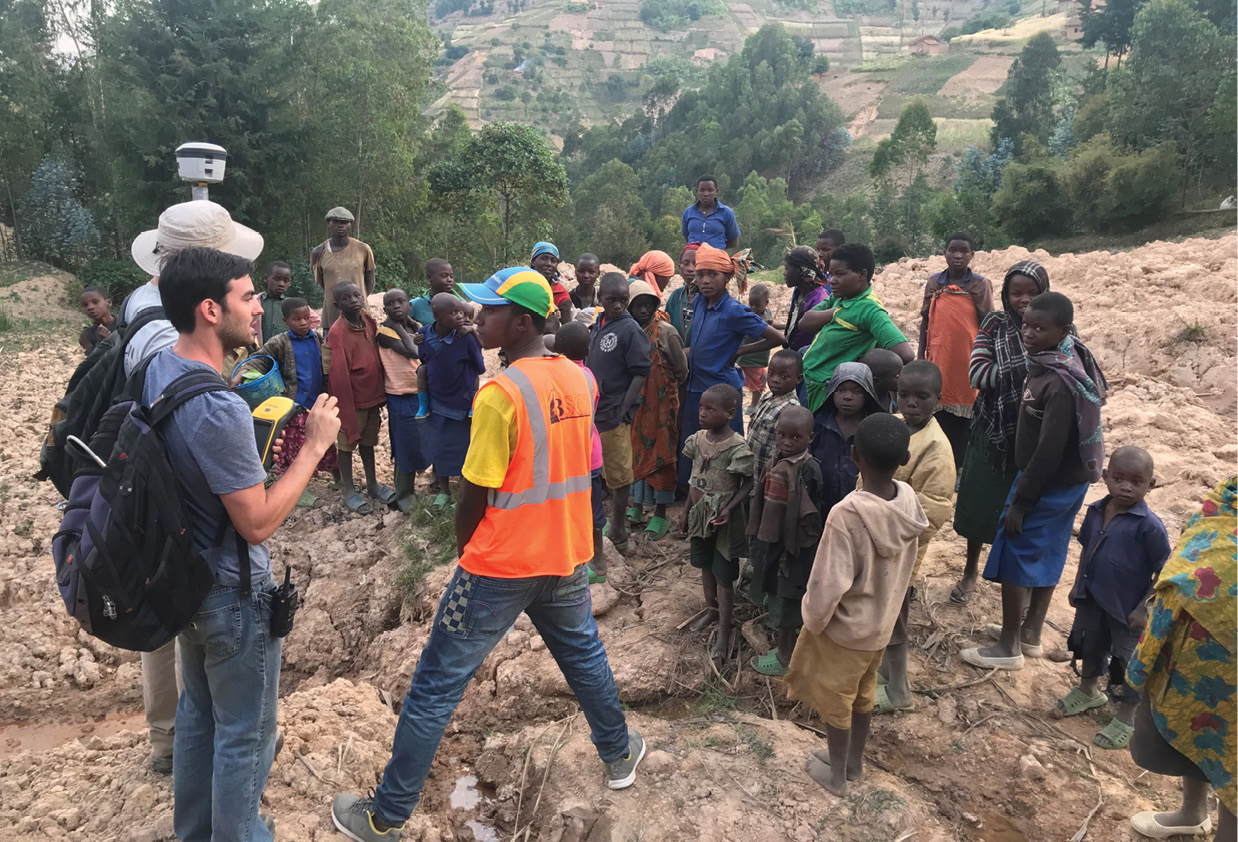
Building the water distribution system was a community event, with locals helping to construct the system and students with Engineers Without Borders ensuring the design followed specifications.
Brodbeck got involved in EWB when several engineering students contacted him for help with processing GPS data from one of the assessment trips. EWB attracts students from all facets of engineering—including aerospace, mechanical and civil—and though few know geospatial technology, they learn it as part of their projects.
For the 2017 implementation trip, Brodbeck helped the students by providing technical support in the geospatial arena. During this implementation trip, Auburn University students built a spring box and pipeline to catch water from a groundwater spring and pipe it to the Kabaya Technical Secondary School (KTSS) in Rwanda for cooking and drinking. The engineering students designed the distribution system in Alabama before arriving in Rwanda. The KTSS project was successful, with work finishing ahead of the deadline, allowing the team to conduct assessment in neighboring communities for a possible 2018 implementation trip.
Brodbeck realized the team needed high accuracy for these projects so he contacted the university’s Trimble distributor, Navigation Electronics, Inc. (NEI), who recommended the Trimble R2 and CenterPoint RTX. “They said the Trimble R2 and CenterPoint RTX would be perfect for the work and would have the accuracy we need,” he noted.
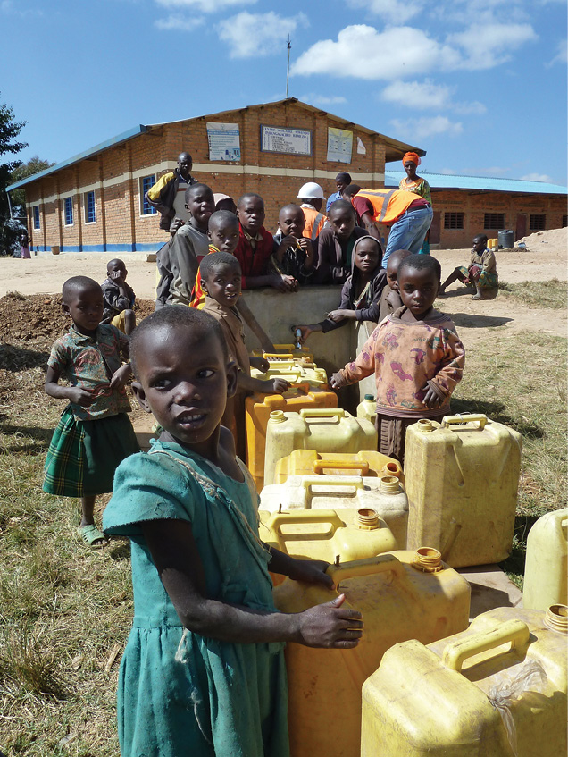
Before the distribution system was built, residents of Mwendo had to walk 30 to 45 minutes carrying 20-liter jerry cans to access water.
The Project Begins
By now Brodbeck had accepted the role of Responsible Engineer in Charge and became the lead advisor to the Rwanda team. “I loved the work,” he said.
During the 2017 implementation trip, Brodbeck trained the team to use the R2 to generate an as-built map of the water distribution system. The team also performed an assessment for future projects and discovered Mwendo, a nearby community of 3,000 living at 8,000 feet above sea level. To access water, residents had to walk 30 to 45 minutes carrying 20-liter jerry cans. “The water flowrate was very low and the community did not have any storage capacity,” Brodbeck said. “The plan was to rehabilitate a 10,000-liter tank, utilize it for water storage and install a pipe directly to the Mwendo Primary School for drinking water.”
The location of the proposed pipeline was mapped as a line feature using Trimble TerraSync software. Using Trimble Pathfinder Office software, Brodbeck exported the line data as positions only, with one point per GNSS position, allowing the line feature to be exported as points with x, y and z attributes. Exporting the data in this manner allowed it to be opened with Microsoft Excel to create a table that displayed each point’s actual elevation and its relative distance from the start of the pipeline. “We used this data to model water flow to ensure the water would be distributed as we had designed it,” he said. Along the pipeline they mapped areas of interest, such as elevations at certain crossings and locations of potential springs.
The location of the pipeline had first been mapped as a line feature using Trimble TerraSync software. Using Trimble Pathfinder Office software, Brodbeck exported the line data as positions only, with one point per GNSS position, allowing the line feature to be exported as points with x, y and z attributes.
“This all worked extremely well,” Brodbeck noted. “The data collected with the R2 was the backbone of the design the students conducted over the next few months. Trimble CenterPoint RTX provided reliable data when we needed to know the data is accurate and everything works correctly. Without this accuracy, our design would have been incredibly difficult.
“The Trimble R2 with CenterPoint RTX allowed us to collect 4-cm accurate elevation data, which we fed into a Storm Water Management Model (SWMM) model to determine flow distribution under a variety of conditions,” Brodbeck added. The team planned to return in August 2018 and needed accurate data to ensure the design would work.
New Challenges
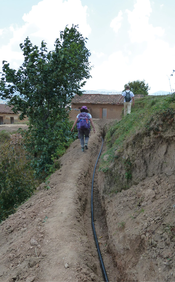
But when the team went back to Rwanda in August 2018, there were some unexpected challenges. Work on digging the trench for the new pipeline started before the team arrived in Rwanda, and the trench did not follow the path the students had laid out. “This was a big deal because the trench that was dug required water to flow uphill, which as we all know, generally does not work very well,” Brodbeck said.
But using the GPS equipment the team verified that the path was incorrect and that the location identified in 2017 would still work. “We used the R2 to verify elevations at five high-points along the pipeline, ensuring elevations were lower than the source point. The individual points were viewed on the Map screen of Trimble TerraSync so that we could view the elevation. Later, we would download this using Pathfinder Office and export it as an Esri Shapefile to view the data in ArcGIS.”
The second hiccup was that the community had decided they wanted water in a third location, which the team had not planned. It meant an additional 600 meters of pipe and re-running the scenario with a computer model to check water flows. They worked late nights to complete the addition. Once assured everything would work, the team looked at funding. Thankfully, the team had budgeted contingency funds, which covered the additional expenses.
Only a few students working on the water distribution system had geospatial experience, but the equipment, like the R2, was easy to set up and operate, and the students picked it up quickly.
“We were able to accommodate the desires of the community, with the biggest challenge being trying to grow the project by 50 percent without going over budget,” Brodbeck said. “We were able to accomplish this and the team was very proud.”
Elevation Issues
Not surprisingly, working with the elevation change proved difficult. “For the first 300 meters of the pipeline, we only had about three meters of elevation change. After that, the terrain started to drop off so the elevation was not as critical,” Brodbeck said. “However, within those first 300 meters we had to ensure that all points were lower than the start because we were implementing a gravity-fed system. Given that the terrain was very difficult, following traditional survey techniques or using an auto-level would have been incredibly challenging.”
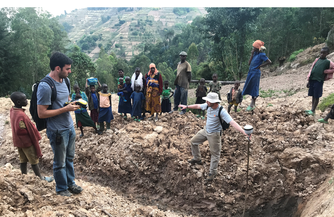
The R2 was used extensively for assessment for future work, Brodbeck said. Much of the data collected was similar to what was collected in 2017. The team mapped locations of springs already tapped and their pipelines. When meeting with community leaders, they visited untapped springs to map them as well as the possible water tap locations.
“All this data would be downloaded with Pathfinder Office and exported as SHP files to ArcGIS. Within ArcGIS, we could look at the data and start to make plans for next year. We also used the R2 to map and create an as-built map of everything we built during our current project.”
Only a few students had geospatial experience, but the equipment, like the R2, was easy to set up and operate, and the students picked it up quickly. Brodbeck has been using Trimble equipment for more than two decades. “We got a few pointers on using CenterPoint RTX, to help with adjustments, but it was very easy to operate.”
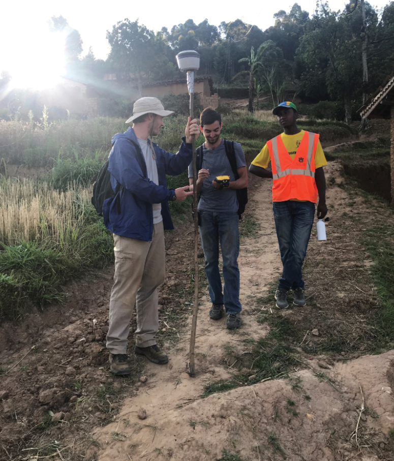
Brodbeck didn’t need a full-range pole, which splits in half, so he took one half and put it on a pipe for balance and then screwed in the R2 so he didn’t have the weight of a full pole for traveling.
The team used local workers for much of the construction, hiring 94 day laborers to dig the 1,600-meter trench and two skilled laborers—a mason and a plumber—for much of the installation. “By hiring local workers, we were able to provide them with daily wages in an area where finding work is nearly impossible.”
Long Days
The EWB team put in long days. Lodged at a Catholic Church Parish, they started their day with breakfast at 7 a.m. before piling into Land Cruisers for a rough 45-minute drive to Mwendo, where the work was taking place. At 9 a.m. everyone gathered in a small building that served as EWB headquarters and each person would grab their tools and set off to work on their daily task.
“We would spend the morning working in our respective areas, then gather at 1 p.m. for lunch at EWB Headquarters,” Brodbeck said. After lunch they continued to work until it got dark around 6:30 p.m., when everyone met back at headquarters, stored their tools and drove back to the Parish. After dinner, they would review the day’s progress by looking at the GPS data gathered, doing some analysis on how things were progressing, reviewing and updating the budget, and laying out a work plan for each team member for the following day. In addition to the engineering work, they collected water samples, incubating them to determine if the water was safe to drink.
The community wanted water in a third location, which the team had not planned. It meant an additional 600 meters of pipe and re-running the scenario with a computer model to check water flows. They met the request and still stayed within budget.
Part of the evening review also included identifying areas needing work. Usually there were two students supervising the pipe installation, two working with the mason to ensure the boxes he was building were to spec and two students doing assessment. “We would rotate job assignments daily so everyone had an opportunity to see and help with different parts of the project,” Brodbeck said. “We would wrap up around 11 p.m., by which time we were all quite exhausted.”
Future Plans
The team plans to return in summer 2019. Once post-trip reports are complete, they will determine the next project.
Brodbeck says the students deserve the real credit for the Rwanda success. Not only do they perform all data collection and then work countless hours on the design, they also spend much of the year fundraising because the work is conducted using donations. In addition, the work is extracurricular, so they don’t receive school credit for it. They design the projects on their own time, and implement them on school breaks between semesters. But the work is also rewarding. Each project allows the students to learn engineering skills and geospatial technologies while helping to make the world a better place.
Kristine Carber-White is a writer based in Silicon Valley. A former editor for the San Jose Mercury News, White writes extensively on geospatial technology.
Note: The 2018 EWB travel team consisted of Stephanie Parson (Team Lead), Beth Prior, Zach Johnson, Katelyn Jenkins, Caleb Daniels, Andy Bowling, Morgan Bell (Advisor) and Christian Brodbeck (Advisor).