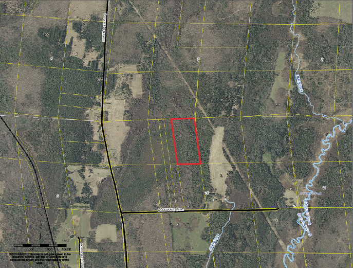
The red polygon is not geometrically retangular but it is most certainly the east half of the northeast one-quarter of the northwest one quarter of Section 10.
We recently spent a lot of time in Butternut, Wisconsin, and I’m still not sure we are walking away with a full bag of groceries. Regardless, it’s time to move on to higher ground and inaugurate the greater landscape. The geometric dependence on the PLSS rules is inadvertently proving to be destructive under state authority.
Let’s start with an observation by Jerry Broadus, Esq., P.S. from his work titled “Boundary Law: The Rule of Monument Control in Washington” published in 1984 by the University of Puget Sound Law Review. Broadus observes “The case of Town v. Greer represents the culmination of a lengthy boundary dispute which arose from such a sale, and raises serious questions of the wisdom of presuming that the federal rules should control private land sales.” Well Mr. Broadus, I’ll see your Greer question, and up the ante with some misaligned state statutes. I too question the wisdom of introducing federal restoration rules when owners have respectfully stabilized a government line between competing chains of title.
Both Broadus’ reference to Greer and our previous outing in Wisconsin with Boerst were mashed around in appeals after the lower courts “got it right”. Regarding Greer, Broadus also says “The actions of the parties to the first sale evidenced a construction of a boundary line that represented a reasonable interpretation of the deed. Fairness would require adherence to the expectations of the parties to the transaction first creating the boundary. The court’s earlier presumption, however, that a deed using such a description would be controlled by the federal government rules, essentially allowed the grantee to attempt a form of “land-grabbing” when the quarter corner was finally discovered. If the court had, in the original case, held the parties to an equitable solution, a wasteful and lengthy dispute would have been avoided.” Greer involved an original homespun aliquot division by the owners after the patent, where Boerst focused on acquiescence in lieu of original corners. The comparisons might seem a little apple-orangey until we see the appellate courts’ bad habit of dialing 1-800-BLM-RULE and ordering a rectangular pizza. Broadus touches on something very important in Washington State “Many boundary disputes could properly be resolved by using the rule of monument control as a rule of construction, thereby allowing the court to weigh the equities of the dispute before it, rather than as a rule of law to be contrasted with the Statute of Frauds.”

Examples of a delaminated cadastre fester up in the GIS. We have three interpretations with the road, the yellow local parcel lines, and the white township layer.
Now I’ll be the first to admit that I think Cajun Style Visine sounds like a winner until you actually use it. I look at the following statues with experience and come to a similar conclusion. Colorado has codified C.R.S. 38-44-113 as follows: “Establishment of boundary corner.-The establishment of a boundary corner through acquiescence confirmed by a court of competent jurisdiction, or by written agreement pursuant to section 38-44-112, shall not alter the location or validity of any existing or properly restored public land survey monument in the vicinity. Such existing or properly restored public land survey monument may be used to control future land surveys in the region when such surveys are not related to the boundary corner established by acquiescence or agreement.” I have two hang ups with this. 1.) Chains of title are disrupted by a legislative assumption that owners have occupied something other than their deeded lands. This forces an adverse possession where one may not exist and new descriptions may unnecessarily be ordered.
2.) Subjective methods of subsequent subdivisions were employed after patent. This includes a “no survey at all” option accompanying a conveyance. Establishing a proper restoration standard of an original aliquot portion that was cut and marked after patent is as equally subjective. One of the very few written standards a court can refer to is the BLM manual. Unfortunately the manual’s instructions are intended to restore corners on untitled land whereas we are retracing the boundaries marking chains of titled land cut after the patents.
We previously touched on Wisconsin Statute 893.24 “Adverse possession; section lines” which reads:
“(1) A written instrument or judgment that declares the boundaries of real estate adversely possessed under s. 893.29, 1995 stats., or s. 893.25, 893.26 or 893.27 does not affect any section line or any section subdivision line established by the United States public land survey or any section or section subdivision line based upon it.” This seems like a no brainer to me and I wholly expect adverse possession would require a defiance of title lines. However we saw an appellate court in Wisconsin coagulate extrinsic evidence of acquiescence into a definition of adverse possession and shoehorn it into this law. The local chains of title are now apparently decoupled from the PLSS in what appear to be metes and bounds descriptions. The descriptions walked into the courtroom as aliquot and magically left as colonial. Sounds like a step backwards for the PLSS.
It is ironic that laws seemingly put in place to stabilize the PLSS under state authority are actually decoupling the cadastre from land titles. Ill-conceived legislation does nothing more than attempt to promote measurements as some higher form of evidence in the order of precedence. We see the C.R.S. try to soften the blow to the owners by detaching what owners occupy from their title merely based on a “proper” restoration of the PLSS. When the function of the PLSS becomes self-serving, it no longer suits it intended purpose of stabilizing the boundaries of private land titles and could over time fade away from the law like the ceremonial livery of seisin. The need to perpetuate land title with stability is nothing new, nor is it dependent on a national or square cadastre. This continent has seen non-rectangular title pass over four centuries in the colonial states, as well as the latter formed states of Kentucky, Ohio, West Virginia, Tennessee, and Texas. However, the legislative presumption that acquiescence is somehow prohibited from supporting a PLSS line is undermining the chains of title that are dependent on aliquot descriptions. Respectfully, original monuments can limit the bounds of a grant and adverse possession would include the transfer of extra land beyond a title line harmonized with a PLSS line. However as Broadus points out boundary evidence is best employed under rules of construction rather than the rule of law and the federal rules for surveying in a vacuum of title may contrast the Statute of Frauds.
SELF-STUDY GUIDE (References)
- Google the following search terms to find the article references:
- Jerry Broadus Boundary Law: The rule of monument control in Washington
- Boerst v. Opperman for both appellate and Supreme Court decisions
- San Juan County v. Ayer
- Town v. Greer, 53 Wash. 350,102 P.239. (You may have to dig through a review journal to find this gem from 1909.)
- Boundary agreements Colorado C.R.S.
- Livery of seisin
- Statute of Frauds
- Boundary dispute sheds light on complex issue-David Ziemer
Feel free to send feedback to me at rls43185@gmail.com or to the editor.
 The Barbershop Barrister
The most profound thing that I’ve read thus far in three years of writing Decided Guidance came out of the circuit court in Boerst. “If you are going to treat the line as being acquiesced to, you have to treat the corner as being acquiesced to.” That sounds as simple as two knuckleheads yamming it up on the street corner, doesn’t it? Well, I assure you it’s a heck of a lot deeper than Lenny and Squiggy cat callin’ at the dames from the stoop. The depth of that sentiment stabilizes the ground, with the record, with the actual notice, and harmonizes the competing chains of title. Jim Hankins PLS, of Illinois just stepped in to the barbershop this month looking to offer his two cents on Boerst. I yield the megaphone to Jim:
Jason,
Every once in a while something comes along that grabs your attention. I have long enjoyed your opinions, but Boerst v. Opperman got my attention. I have researched and included this case in one of my seminars. You are absolutely right about the folly of the parties to this case. It amounts to what has to be a multi-generational dispute between neighbors. You must be aware of the location of Ashland County. It being on the southern shores of Lake Superior, the Packers must seem like Southerners. It appears to me that in the long winter months they must dream about something to fight about.
What I don’t understand about this case is why the court did not rule “what part of no don’t you understand?” You will recall that the original GLO surveyors did not set “concrete monuments” at corners; so where did this 600’ out in space monument come from? This also an interesting case in “you get as much justice as you can afford”. To take a case to the Supreme Court costs a lot of money. Is the value of a triangularly shaped piece of farmland on the shores (not littoral) of Lake Superior worth that kind of money? This is more of a classic case of one land owner beating the other over the head with the judiciary until one of them runs out of money.
I have enclosed a copy of an article that I read in my research of this case from the Wisconsin Law Journal that might fit into your closing arguments (see self-study for google search terms). It cuts a very thin piece of cheese between Boundary by Acquiescence and best available evidence. I think that after 80 some years after the lower court ruled that the road was the section line; it would be hard for the Wisconsin Supreme Court to find that anyone’s constitutional right beyond what is occupied would hold any water.
Thanks for an interesting article. I look forward to your conclusions.
Jim Hankins, PLS
This month’s column features a Colorado Statute. Back in 1984 Jerry Broadus of Washington called foul. He observed “The court’s earlier presumption, however, that a deed using such a description would be controlled by the federal government rules, essentially allowed the grantee to attempt a form of “land-grabbing” when the quarter corner was finally discovered.” Well, unfortunately the worst thing about being a pessimist is when you are right and Broadus hit the nail on the head. Lana Shore submitted her account of a recent attempt of land grabbing under the rubber band of righteousness. Her neighbor presented his winning lottery ticket in the parcel pick four by hitting the Powerball on the center of section. Lana was able to stand her ground while the ink was still drying on the Mylar. My thoughts on tip-toeing through the federal tulips when retracing private claims? Well, there’s nothing like bowling a strike in the wrong lane.
Check out “Rising to the Challenge-The Professional Land Surveyors of Colorado Help a Homeowner in a Property Dispute” on the newly-formatted TAS website in the July 2018 issue.
A PDF of this article as it appeared in the magazine is available by clicking HERE