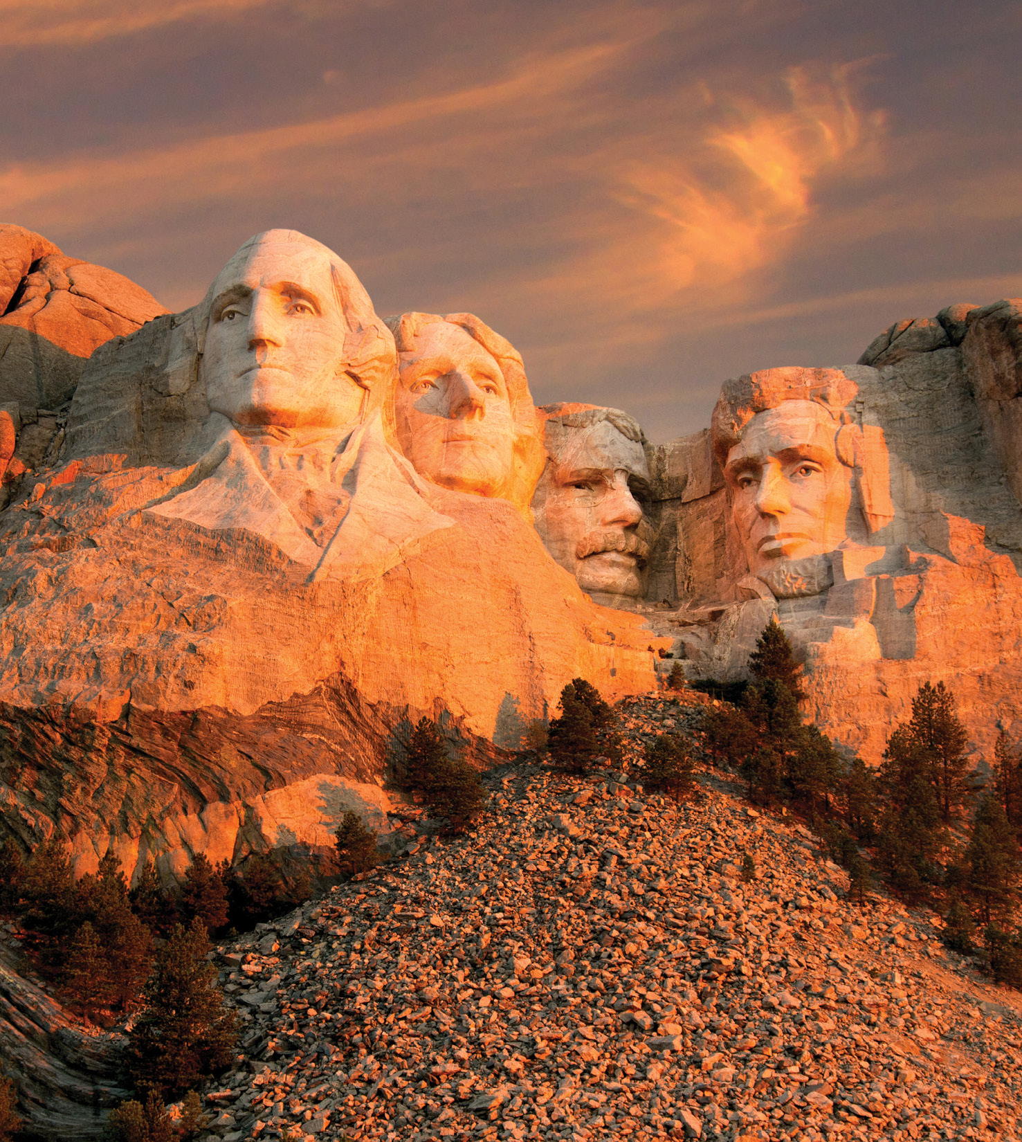
 If you’re a Land Surveyor, you’ve probably heard Mount Rushmore described as “3 Surveyors and another guy.” While Washington, Jefferson and Lincoln were technically surveyors, the full history may surprise you.
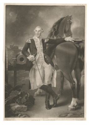
George Washington
The Washingtons were a well established family who could trace their lineage in the Virginia Colony back to 1630 when Mary gave birth to George in 1732. The family was considered as a part of the “middle gentry” with prominent land holdings, including a number of plantations.
George’s older step-brother, Lawrence, fought alongside the British against Spain in the “War of Jenkins Ear” in the late 1730’s and regaled him with stories of adventure. In 1746, when George was only 14 years old, the two tried to convince George’s mother to allow him to join the British Navy. After initially consenting to their plan, Mary had second thoughts and ultimately rejected the idea.
Yearning for adventure after not being allowed to go to sea, George turned to Land Surveying. He didn’t possess what would be deemed as a formal education by today’s standards, but had studied mathematics and trigonometry and was considered a talented draftsman with an affinity for mapping. It appears that John Love’s surveying manual, “Geodesia: or the Art of Surveying and Measuring of Land Made Easy” (published
in 1731), exposed him to the profession.
 According to the Mt. Vernon historical society, “Washington’s big break as a surveyor came in 1748 when he was invited to join a survey party organized by his neighbor and family friend, George William Fairfax of Belvoir.” The job entailed subdividing a large parcel of land Mr. Farifax had acquired along the wild western border of Virginia.
One year after his first surveying expedition, George was appointed to the position of County Surveyor of Culpeper County, Virginia at the age of 17. Over the next 3 years he completed an astounding number of surveys, around 200 for a total of approximately 60,000 acres surveyed and mapped.
Land was a form of currency at this time in the Colonies. As the County Surveyor, George was privy to the best parcels and acquired them as payment for his services. In 1752, at the age of 20, he gave up his post as County Surveyor. Some speculate that he resigned because he felt that the best parcels of land had all been taken. Others believe that the death of his brother Lawrence was the cause. Most likely it was a combination of the two.
Although Washington never surveyed again in an official capacity, Surveying & Mapping seemed to be something he genuinely enjoyed doing. During his post-“professional” career, he completed around 50 private surveys, mainly for acquiring new land, defending himself against boundary disputes and subdividing his land into farms to sale or lease. The last survey he performed was completed 5 weeks before his death in 1799.
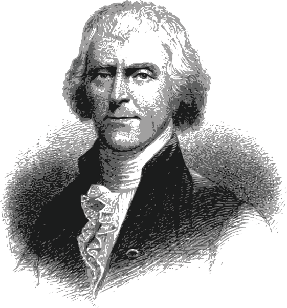 Thomas Jefferson
In 1743, Thomas Jefferson was born about 100 miles east of the Washington plantation in Shadwell, Virginia Colony, the third child of Peter Jefferson a “Land Surveyor for the Crown.” Peter was a substantial land owner and prolific surveyor who helped produce the first accurate map of the Colony of Virginia and surveyed the boundary between North Carolina and Virginia.
Thomas studied natural sciences, Latin, Greek, French, law and philosophy and was eventually admitted to the Virginia Bar in 1767 at the age of 24. Six years later, he was commissioned as the County Surveyor of Albemarle County in the Virginia Colony in 1773. However, he seemed to take little interest in the position and discharged his duties through deputy surveyors. He resigned the post one year after accepting it.
According to the Thomas Jefferson Encyclopedia, land surveying for the “younger Jefferson was primarily a tool for imposing order on his farms.” As the son of a surveyor he respected the profession and in his later years taught his grandchildren the finer points of land surveying.
Jefferson’s passions were farming, linguistics and inventions, but his early years surveying proved invaluable when he made one of the greatest contributions to Land Surveying in American history.
With the signing of “The Treaty of Paris” in 1783, the British Crown not only recognized the independence of her former colonies, but also relinquished the unsettled area of British America known at the “Northwest Territory” to them. This essentially doubled the size of the fledgling nation.
At this point in US history, the country was bankrupt and desperately needed to add to their Federal Reserves. The federal taxation of land was prohibited in the “Articles of Confederation,” so in order to generate revenue for the federal government it had to be sold. Thomas Jefferson was appointed to a committee tasked with creating a standardized system to break down the newly acquired “Northwest Territory” into saleable units.
Jefferson recommended a rectilinear system comprised of Townships, which were to be 6 mile squares. It was thought that the large Townships would be too difficult to sell, so the committee subdivided the Townships into 36 sections. Each section would be a 1 mile square, containing 640 acres, with Section 16 being reserved for public education. On May 20, 1785, the Federal Congress passed the “Land Ordinance of 1785,” which was the basis of the Public Land Survey System we know today.
16 years later, Thomas Jefferson was elected to his first term as President of the United States of America. His main concern was their neighbor to the West: France, who controlled a large swath of the central portion of the continent between the Mississippi River and Rocky Mountains known as “Louisiana Territory.”
Jefferson strategized that if the United States could control the port city of New Orleans, it would be in a better position to defend itself against French expansion. In 1802, he sent future president James Monroe to Paris to make an offer to purchase the city of New Orleans. After initially being ignored, the French, to Monroe’s great surprise, not only offered to sale New Orleans, but all of the “Louisiana Territory,” an area over 2,400 times larger than what he had asked for.
Despite opposition by much of the citizenry and some members of the Congress, the “Louisiana Purchase Treaty” was ratified on April 30, 1803 and the United States of America doubled in size again. One year later, President Jefferson commissioned Captain Meriwether Lewis and William Clark with the “Corps of Discovery Expedition” to explore and map the newly acquired “Louisiana Territory.”
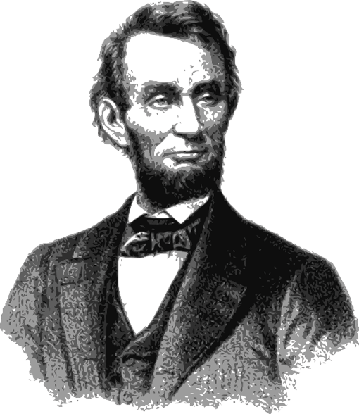 Abraham Lincoln
Shortly after Lewis and Clark completed their expedition and as Jefferson was finishing up his second term as President, Thomas and Nancy Hicks Lincoln had their second child in 1809, a baby boy named Abraham.
Thomas Lincoln was illiterate and held a variety of ill-paying jobs in several different areas of Kentucky. By 1811, he had acquired title to 816 acres in different areas of Kentucky. By 1815, he had lost all but 200 acres as a result of land title disputes. Discouraged with the land title system in Kentucky, Thomas moved the family to Indiana, a state which he felt had a more honest land title system in place. The family bounced around Indiana from 1816 to 1829, then moved to Illinois.
In 1832, at the age of 23, Abraham was part owner of a general store in New Salem, Illinois after serving as a captain in the Illinois militia. That year he also threw his hat into the political ring for the first time and ran for the Illinois General Assembly. Despite receiving 277 of the 300 votes from his district, he lost the race.
After the defeat, Abraham’s friend, Pollard Simmons, a Democratic politician and farmer living near New Salem, spoke to the Sangamon County Surveyor and suggested that he take on Abraham as his assistant. There was one problem, though, Lincoln knew nothing about surveying.
Aided by Mentor Graham, the local school master of New Salem, Abraham studied A System Of Geometry And Trigonometry With A Treatise On Surveying by Abel Flint and The Theory And Practice Of Surveying by Robert Gibson. Six weeks later he was hired and sent to work.
Surveyors in that era were paid by the area of land they surveyed and mapped. Lincoln’s wages were set at $2.50 per quarter section, $2.00 per half-quarter and 25 cents to 37.5 cents for each small town lots
According to the historian Kenneth Winkle, “Lincoln divided at least five new towns into lots for various speculators. He thus became involved in the buying and selling of land, rather than simply working it with an axe or hoe, and he began to invest in local real estate.” Lincoln’s career as a surveyor was short lived. He held the position for 1 year and eventually sold his surveying equipment in order to pay a debt.
It can be argued that Lincoln’s surveying job benefited his political career. According to the US Census Bureau, the US population had increased by 33% from 1820 to 1830. The vast majority of immigrants were looking to own and work their own land. The surveyor, especially in the undeveloped parts of the country, was in a position to interact personally with every member of the community. It might strictly be coincidental, but one year after his County land surveying job, Lincoln ran his first successful political campaign for state legislature in 1834.
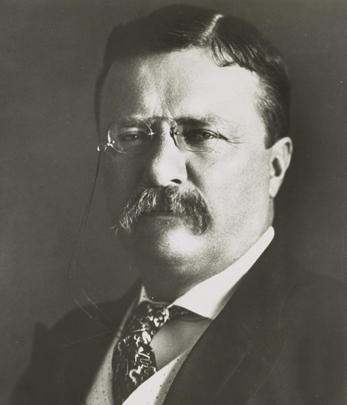 The Other Guy
While Lincoln was running for the Illinois Senate and engaged in the final round of the “Great Debates of 1858,” Martha and Theodore Roosevelt, Sr. welcomed their second child, Theodore Jr., into the world.
The young Theodore was a sickly child who suffered from asthma. To combat his ailments, he became obsessed with physical activity and pushing his limits as far as he could. Throughout his life, he believed in the “virtues of a strenuous life.”
Although he never surveyed professionally, Roosevelt indirectly contributed to the profession by creating jobs through his role in the greatest engineering project of the century, the Panama Canal, and conserving Public Lands by creating National Parks, the boundaries of which had to be surveyed and mapped.
Theodore Roosevelt (who disliked the nickname “Teddy” and preferred “TR” or “the Colonel”) served 2 terms as President of the United States from 1901 through 1908. In 1912, he ran for a third term as the candidate for the Progressive Party, also known as the “Bull Moose Party,” eventually losing to Woodrow Wilson.
After his defeat, in typical TR fashion, he turned his vigorous energies to an Amazonian adventure: navigating and mapping the limits of the unknown “River of Doubt.” The expedition was led by Roosevelt and Candido Mariano, a Brazilian military officer, engineer and surveyor.
Although Candido was the surveyor in responsible charge and had his own survey crew, both Theodore and his son, Kermit, helped out with many of the surveying tasks during the expedition.
The “Roosevelt-Rondon Scientific Expedition” proved to be disastrous and entailed disease, starvation and murder. Theodore’s health never fully recovered after the adventure. He died five years later in his sleep at his home in Oyster Bay, New York.
Conclusion
The 3 surveyors immortalized on Mt. Rushmore combined for a total of 5 years of Surveying and Mapping experience in an official capacity. Washington was certainly the most prolific surveyor, as Jefferson contributed the most to the profession. For Lincoln, surveying seemed to be a well paying stop-gap job and Roosevelt’s only experience on a survey crew almost killed him.
Mr. Jaquess is a licensed Land Surveyor in California and holds a Bachelor’s of Science from New Mexico State University in Survey Engineering. He enjoys baseball, Irish Pubs and Siberian Huskies.