 WingtraOne PPK
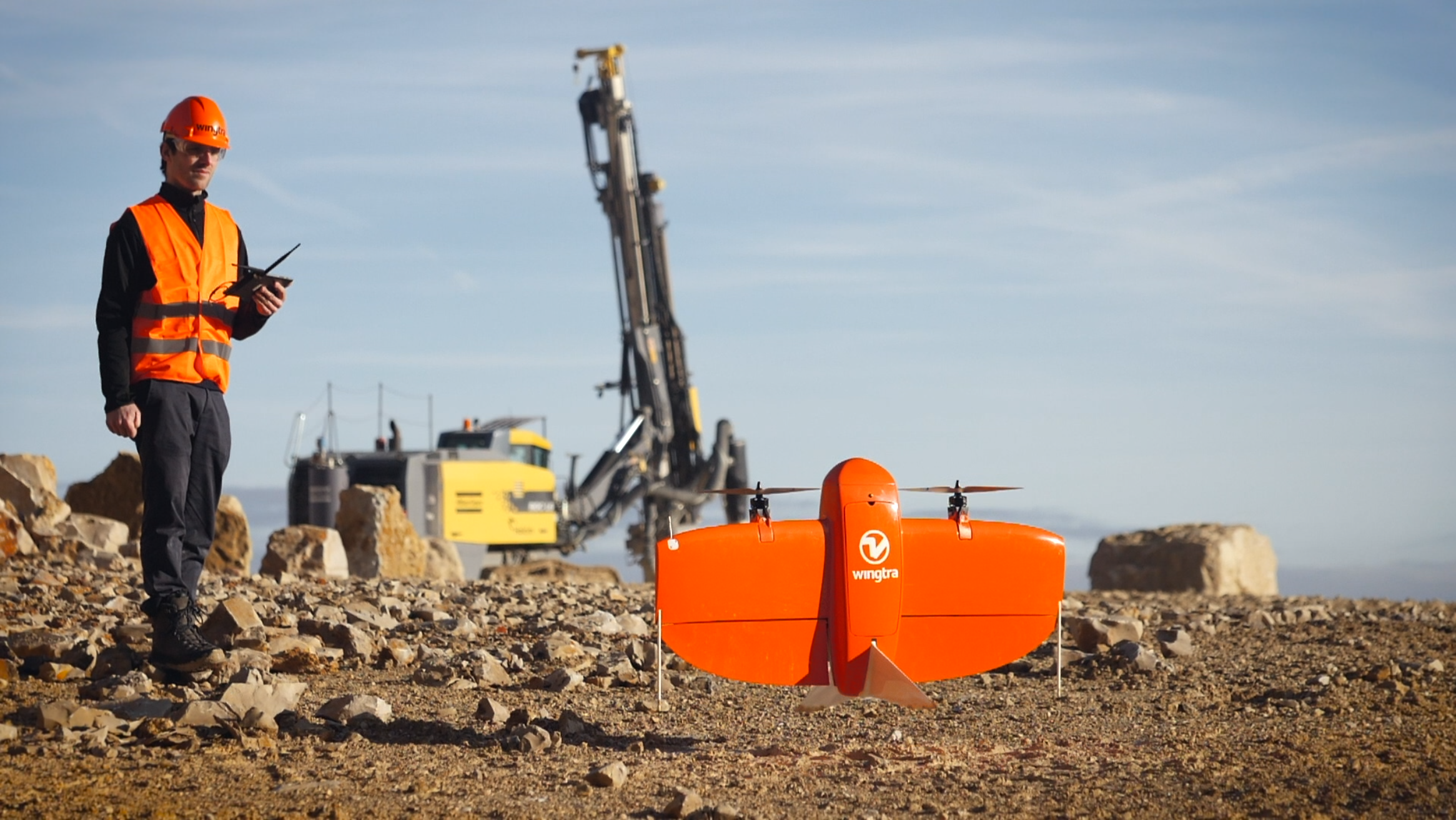
With the launch of WingtraOne PPK (Post Processed Kinematics) drone, the Swiss UAV manufacturer Wingtra is setting a new benchmark in large scale surveying and mapping applications. With the help of its industry-leading partners–photogrammetry software provider Pix4D, and the GNSS board and PPK provider Septentrio–WingtraOne PPK is now able to deliver orthomosaic maps and 3D models with an absolute accuracy down to 1 cm (0.4 in) without any ground control points. www.wingtra.com
 Optimized Workflow for Drone Operators
senseFly announced new software integration with the Trimble® Business Center Aerial Photogrammetry module. The senseFly S.O.D.A. is the first camera to be built for professional drone photogrammetry work. This 1-inch, 20-megapixel RGB camera captures amazingly sharp aerial images, across a range of light conditions, allowing senseFly fixed-wing drone operators to produce detailed, vivid orthomosaics and ultra-accurate 3D digital surface models. senseFly S.O.D.A. is compatible with most senseFly fixed-wing mapping drones, including the large-coverage eBee Plus. www.sensefly.com
 Carlson Software’s Precision 3D Hydro 2018
New to P3D Hydro 2018 is the introduction of Dynamic CAD automated plan and profile CAD design documentation. Hydraulic Grade Line, Energy Grade Line, Gutter Speed, and By-Pass design calculations in real time. Environmental Assessments of large basin areas using Point Clouds and Lidar to create TIN’s, including Watershed Areas, Multiple Time of Concentration Methodology, Calculating Weighted Curve Numbers and Coefficients for Pre-Construction and Post Construction Calculations by drag and drop surface textures. www.carlsonsw.com/products/precision-3d/p3d-culverts/
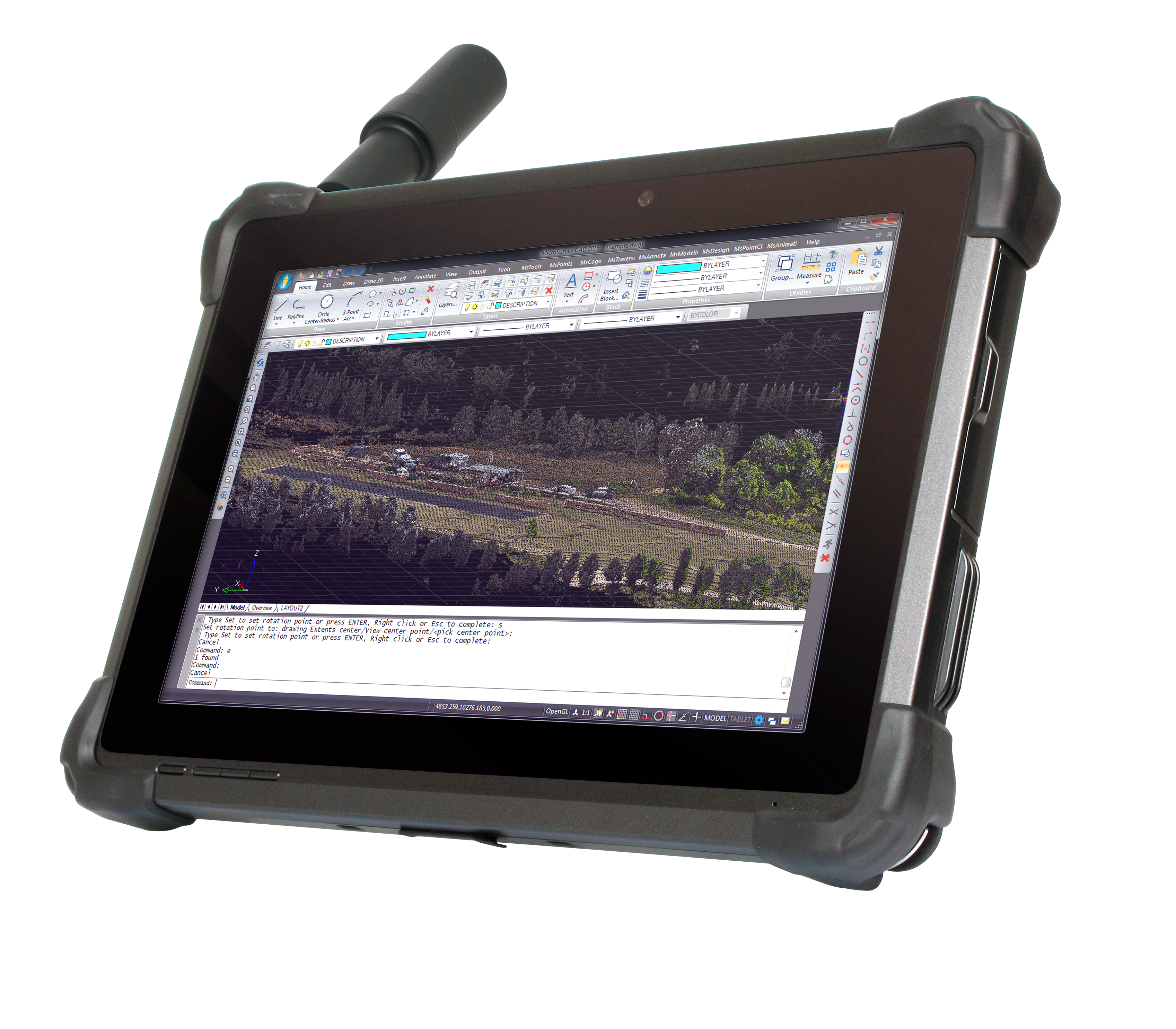 Rugged Tablet with Scientific-Grade GNSS
DT Research announced the DT301T Rugged RTK Tablet, a lightweight military-grade tablet that is purpose-built for GIS mapping applications with RTK. This unique tablet enables 3D Point Cloud creation with centimeter-level accuracy–meeting the high standards required for scientific-grade evidence in court. The unit features Dual Frequency GNSS Module; High Performance CPU and Windows OS; Brilliant Sunlight-readable Display; and Superior Wireless Connectivity. Uses include forensics, land surveying, e-construction, and BIM. www.dtresearch.com
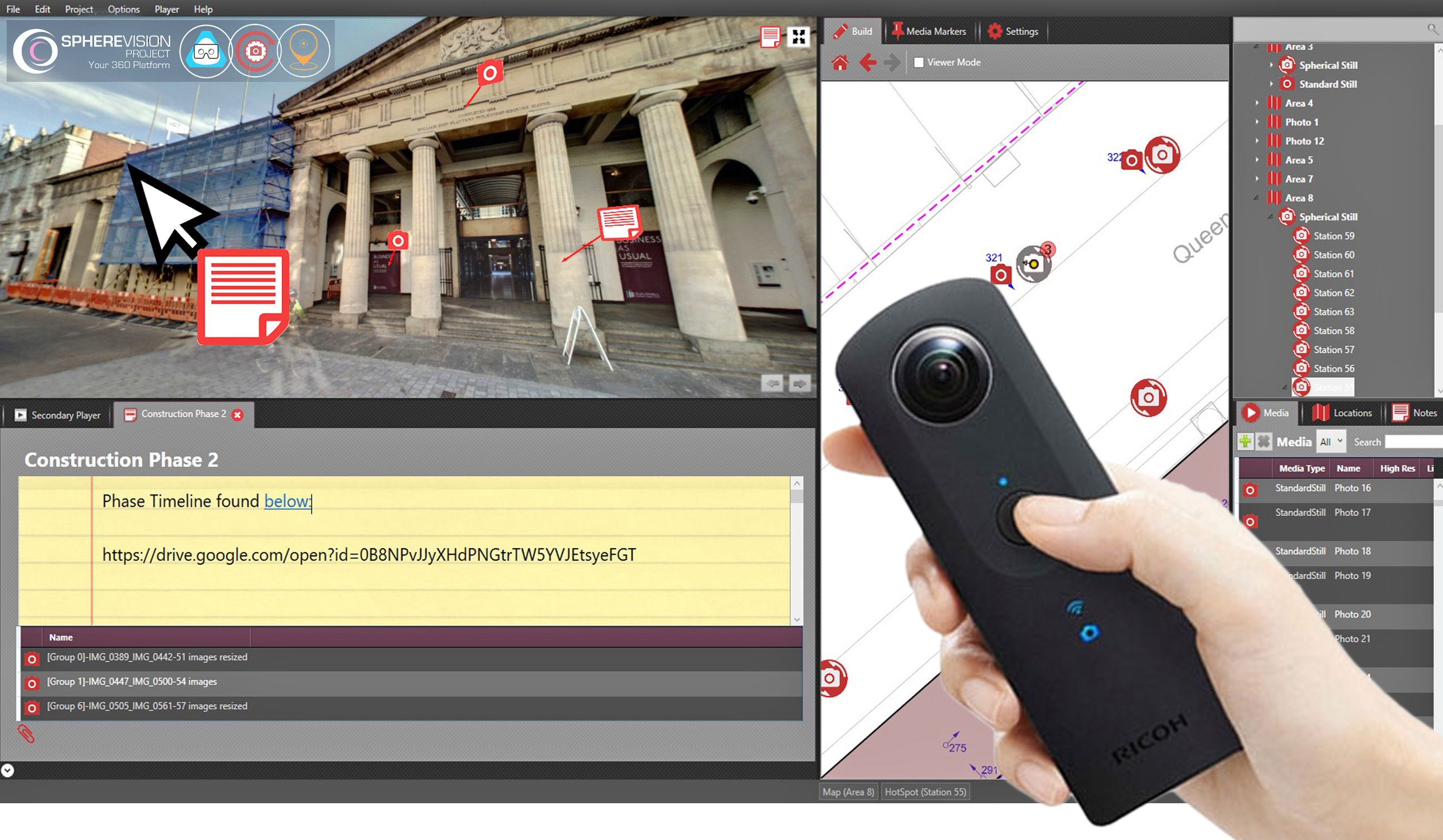 SphereVision Launches SphereVision Project
An intuitive end to end solution, the SphereVision Project suite is designed to bring together 360 degree imagery with site specific information such as still photography, documents and maps. Complete with a modularized project builder and easily distributable viewers, the desktop software suite includes three brand new modules; Virtual Reality, Geospatial and Timelapse Capture. SphereVision Project also includes a range of other new features and functionality including an automatic 360 tour generator, user defined iconography and interactive web links. www.spherevision.com
 Free Aerial Data Processing Service
SimActive announced a new free data processing service using Correlator3DTM. New users can upload their first UAV, satellite or aerial image project to obtain DSM, DTM, point cloud and orthomosaic outputs. Along with optimal results, users also receive tailored feedback. The service requires no obligation and builds on more than a decade of innovation with computer vision algorithms, a subfield of artificial intelligence. Quick turnaround is also possible due to the speed of the software and extensive use of GPU. www.simactive.com/start-mapping.html
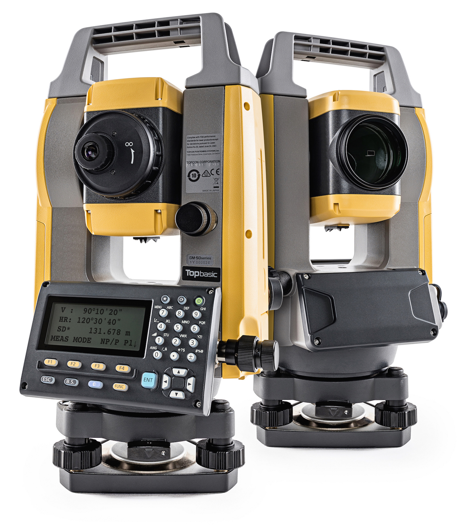 Topcon Announces GM-50
Topcon Positioning Group announces an addition to its GM line for tasks such as site layout or as-built survey. The beam is designed to offer a rapid distance measurement of 0.9 seconds regardless of the target. The iM-50 EDM features a prism range of up to 4,000 m and up to 500 m in reflectorless mode with ±1.5 mm/2 ppm. Additional features include Bluetooth connectivity, as well as 50,000 points of internal memory, or up to 32GB USB flash drive external support. www.topconpositioning.com
 New Indoor Mobile Mapping System
The NavVis M6 is an all-in-one system that captures 360 degree immersive imagery, photorealistic point clouds, Bluetooth beacons, WIFI signals and magnetic field data. The M6 features a mobile LiDAR system that lets it scan up to 30 times faster than stationary devices, letting users capture up to 30,000 square meters in a day. Also featured is 6D simultaneous localization and mapping (SLAM) technology, which significantly improves the quality of data captured. www.navvis.com
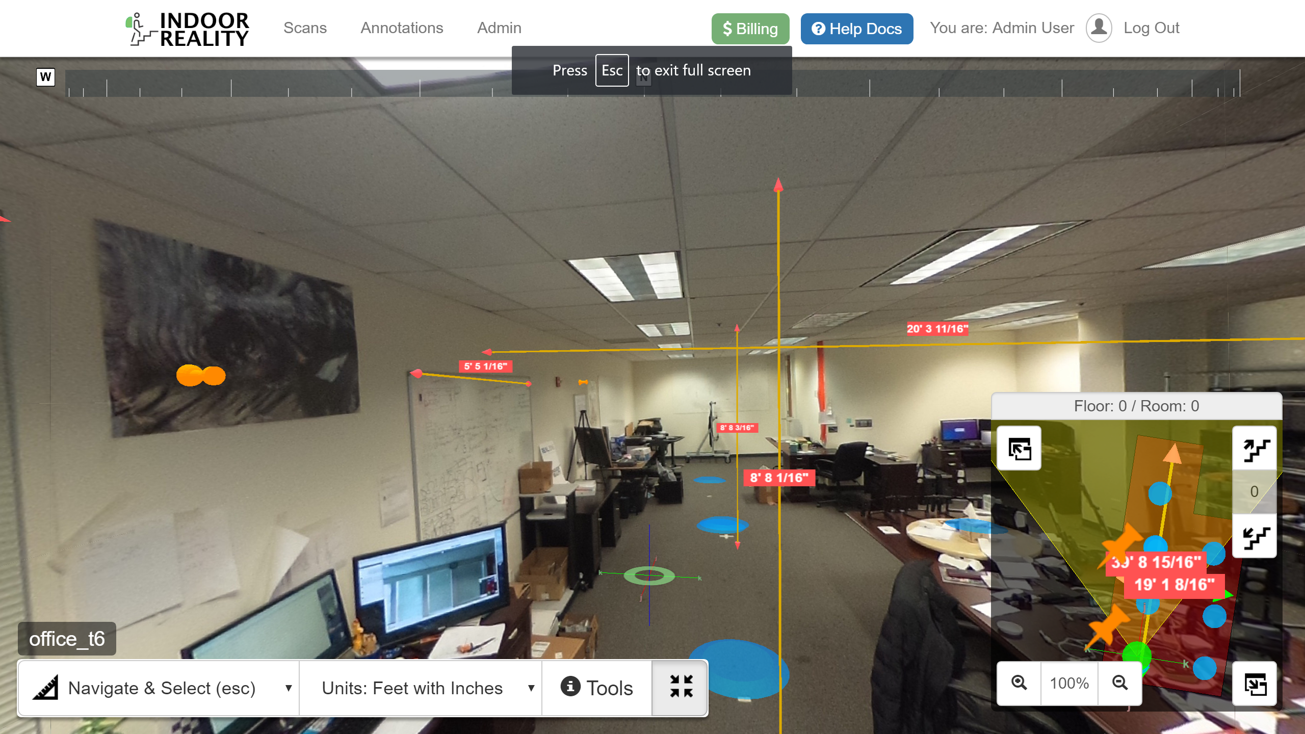 Indoor Reality Announces Phone Based IR-200
Indoor Reality announced the IR-200, a phone-based 3D reality capture systems which can be used for rapid, affordable 3D floor plan generation of buildings and assets. The new system can be used as a standalone Android or IOS app on mobile phones, or in conjunction with an additional camera. It is a progression from the existing handheld product IR-500, and the backpack IR-1000; it provides an unprecedented price/performance capability for 3D reality capture for facilities management, real estate, or AEC. www.indoorreality.com
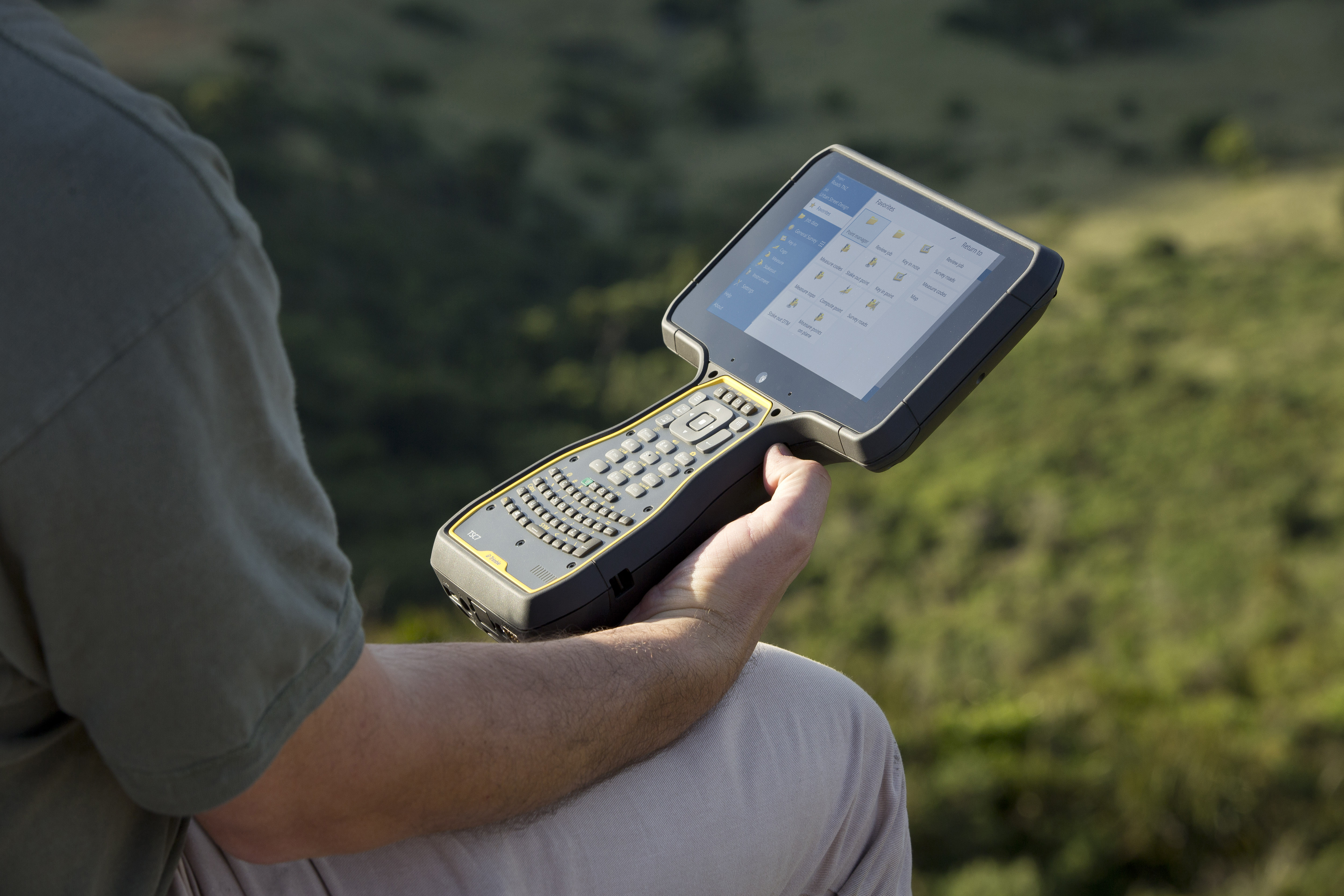 Trimble Introduces TSC7 Controller
The TSC7 provides a tablet experience with a physical keyboard and a sunlight readable 7-inch touchscreen. Front- and rear-facing cameras allow users to video conference their office from the field for on-the-job support, and capture high definition videos and images. The TSC7 runs Windows® 10 Professional, driven by an Intel Pentium 64-bit quad-core processor. Trimble also announced a new version of its field software, Trimble AccessTM 2018. Access 2018 integrates with the Trimble Sync ManagerTM application to enable cloud-based data management between the office and the field. geospatial.trimble.com/TSC7_Access
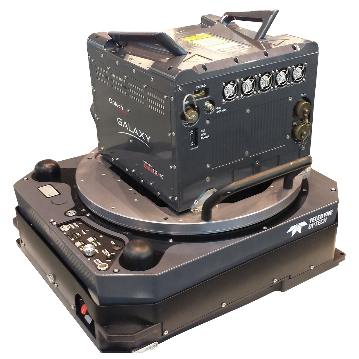 Teledyne Optech Galaxy PRIME
The new ALTM Galaxy PRIME is the ultimate wide-area lidar sensor, with bestof-class point density performance and collection efficiency. The Galaxy PRIME continues to build on the unique strengths of the Galaxy T1000: PulseTRAKTM for continuous coverage and full point, and SwathTRAKTM with its dynamic FOV that enables “flat terrain-like” topo efficiency and constant point density even in steep mountains. In addition to these standard features, the Galaxy PRIME now extends range performance by up to 30% and improves vegetation penetration. www.teledyneoptech.com