 “Having our own in-house mobile mapping system enables us to capture imagery once and use it often, which saves the taxpayer a lot of money. The MX7 is stable, flexible and dependable and can be used on water and land. The imagery is accessible to both citizens and stakeholders.”
—Ries Visser, Senior Advisor Basic Information, City of Amsterdam.
When mobile mapping solutions were introduced in the year 2000, the city of Amsterdam saw many uses for the 360-degree geo-referenced images. Mobile mapping gave a better view of the state of the built environment than aerial imagery by providing a different angle and higher detail. The city initially outsourced the imaging, which resulted in high costs and limited usage and update possibilities. To eliminate these issues, they purchased their own mobile mapping system.
Providing Value for Taxpayers
Prior to purchasing the in-house system, the Dutch Cadaster commissioned a contractor to collect nation-wide street level imagery. Amsterdam would license part of that material for its own use. Over time, the city became dissatisfied with the contractor´s working methods. “To me, it seemed exploitive to grow a business by making governmental agencies use tax money to pay for the same product over and over again. Paying for the data collection with tax money is one thing, but doing the same for each separate use is simply too much,” said Ries Visser, Senior Advisor, Basic Information at the city of Amsterdam.
 Using a contractor for the imagery also meant abiding by strict terms of use, as well as limited flexibility in choosing when the data was captured. “We´d receive a timeslot for the coming two months from the contractor. If the weather was bad during that time, it would show on the street level imagery, diminishing its usability,” Visser said. The city wanted more flexibility.
Bringing Mobile Mapping In-house
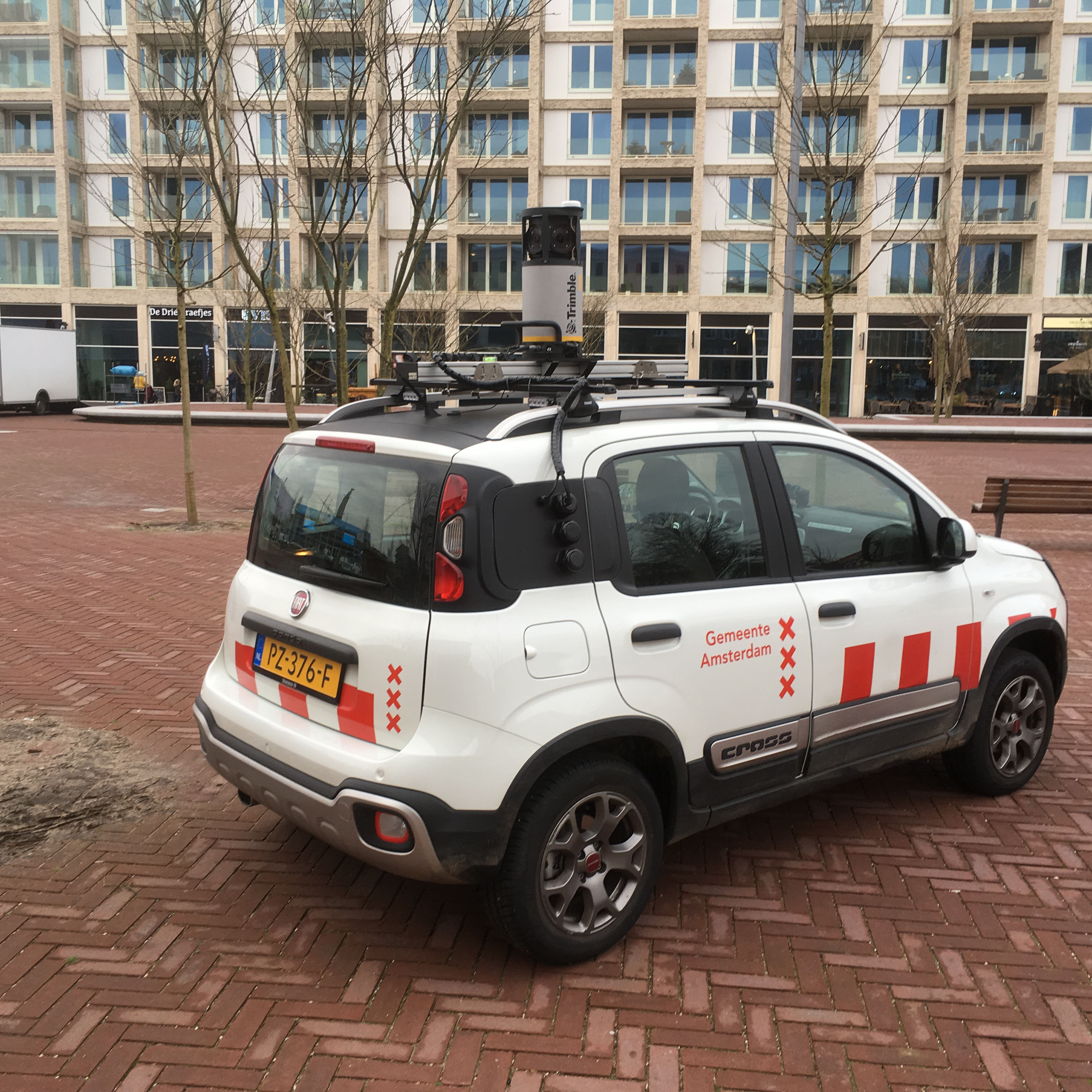
To be more independent and to have more control over the imagery, the city of Amsterdam decided in 2016 to acquire an in-house mobile mapping system. After extensive market research, they chose the Trimble MX7 Mobile Mapping Imaging System, making Amsterdam the first worldwide user of the system. Amsterdam selected the MX7 because it provided a single integrated system that was easy to mount on a car; it could also be used on water, critical for the elaborately canaled city. They also wanted an open system so third-party vendors as well as single viewers could access the imagery.
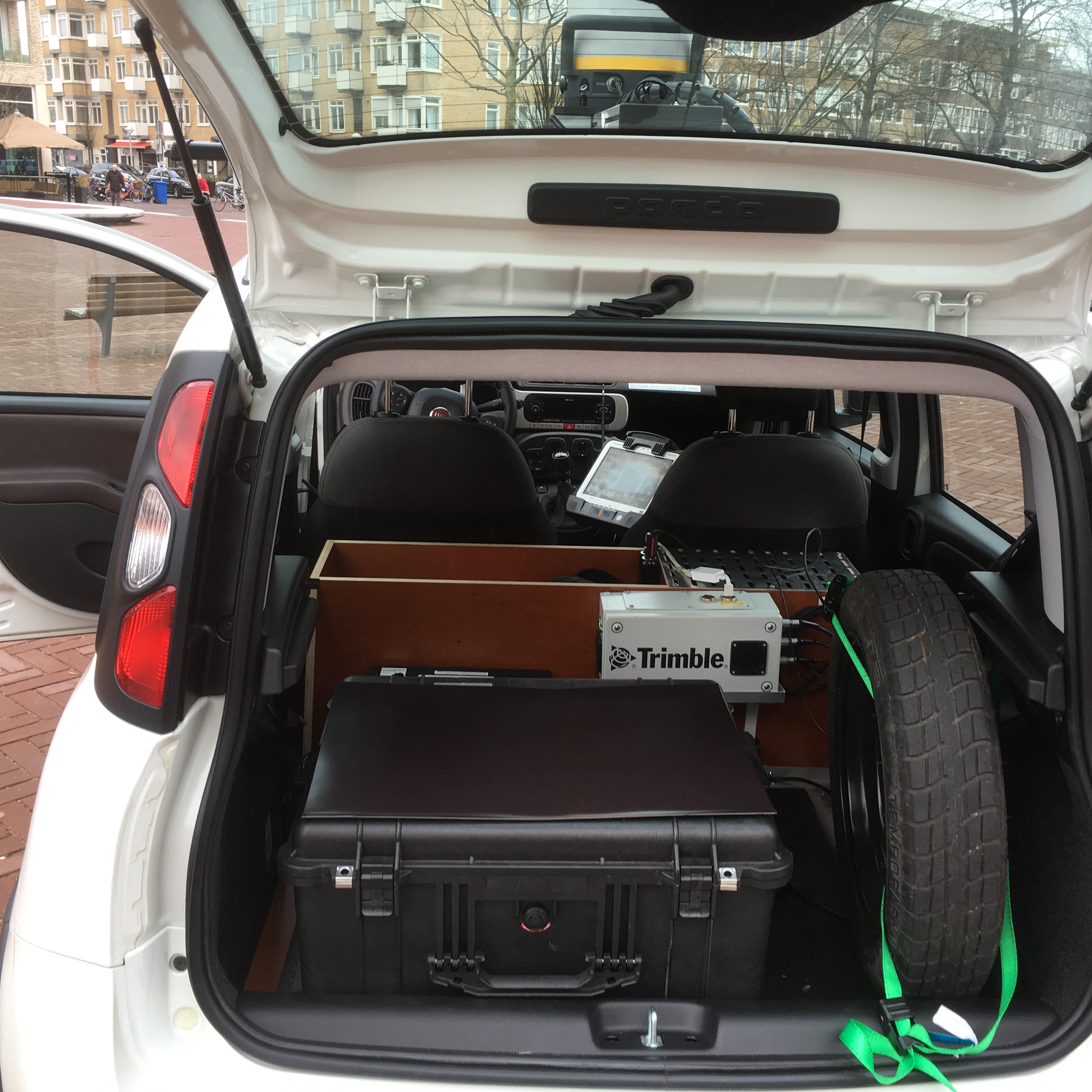
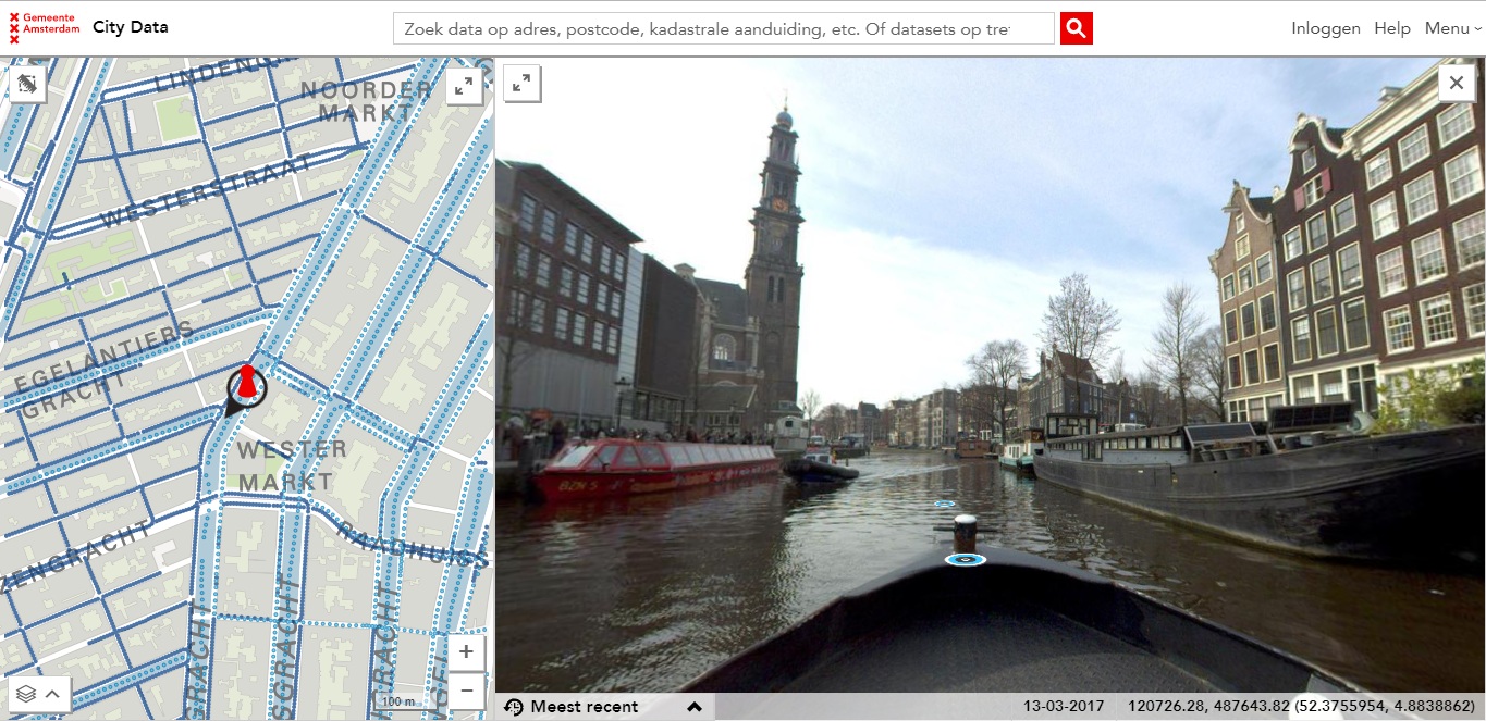
The city uses Trimble POSpac Mobile Mapping Suite and Trimble Business Center (TBC) Survey CAD software for the workflow. The POSpac Mobile Mapping software is used for georeferencing the imagery, whereas TBC helps deliver highaccuracy GNSS data. After processing, the data is copied to a server and recognizable faces are automatically blurred. The imagery is published and shared with external users through a web application. Having its own mobile mapping system meant that the city of Amsterdam could capture street view imagery anytime, anyplace and share it with any stakeholder inside the organization. This was important because many departments rely on the imagery for their daily work.
 The city hired three drivers to capture the imagery as part of a corporate social responsibility initiative subsidized by the city of Amsterdam. This created jobs and reduced expenses since operating the system doesn’t require technical skills. By outsourcing the collection work, Amsterdam provided employment to the unemployed.
More Flexibility, Higher Efficiency and More Updates Per Year
To increase efficiency, the MX7 is used almost daily. The system can be mounted on a boat to navigate Amsterdam’s famous canals, which allows the city to monitor the quays and see where maintenance might be necessary. The system is also mounted on a Port of Amsterdam boat to monitor the port.
By owning its own system, Amsterdam can capture the entire city twice a year, instead of just once a year as they did with the contractor. Updating the imagery often is necessary as the city changes rapidly. Having panoramic imagery that provides a recent view of the city is important so firefighters and ambulance drivers can view the surroundings before they arrive, enabling them to act faster.
In addition, having an in-house mobile mapping system saves taxpayer money. Panoramic imagery is captured once and used multiple times. The concept of open data is very important to the city, says Visser. “The imagery is paid with tax money, and we think citizens are as much owner of the imagery as we are. This is why the imagery is accessible to everyone through our web portal.”
 The city of Amsterdam is a pioneer in mobile mapping, and other Dutch cities have expressed interest in trying it. When Amsterdam is not capturing images with the MX7, they share it with nearby suburban districts, which put it to good use.
Eric van Rees is a freelance writer currently based in Spain. He writes about geospatial technology, programming and web development.