 As surveyors, we encounter tracts of land that have different values depending upon who is making the assessment. Today’s example relates to a property (Lot 2) in the rural southern part of New Jersey with limited frontage on a state highway, situated behind a lot that was divided out of it in 1976 (Lot 2A).
One of New Jersey’s agencies is interested in acquiring Lot 2 and asked the open space acquisition program within the State’s Department of Environmental Protection (DEP) to look into negotiating a purchase on its behalf. Like any wise purchaser, one of the first steps that DEP takes before acquiring land is to secure a title search to check on possible liens, encumbrances, or other aspects that might affect marketability and/or usability of the intended acquisition. During the one or two days a week that I am in their office, I’m often called on to look through these documents and explain them to the negotiator and the legal team, as well as explain what some of the repercussions might be. While these “non-title” people easily understand the implications of outstanding mortgages or tax liens, other documents attached to the title search and commitment sometimes raise less obvious warning flags–like this time.
The 1976 minor subdivision of Lot 2 into Lots 2 and 2A is reflected on a plat recorded with the deed creating new Lot 2A, although as a bit of a jigsaw puzzle since it is printed in pieces on different pages in the deed book. What it clearly shows, however, are lines and a label along the western line of parent Lot 2 indicating it as the centerline of a 25-foot wide road named “Turnpike Road AKA Old Tuckahoe Road.” And that is the centerpiece of the varying views of Lot 2. (“AKA” stands for “Also Known As.”)
Title companies mention and exclude roadways from title insurance coverage. But the lengthy schedule of exceptions in this title commitment did not mention this road at all. From this title company’s perspective, the road does not exist; therefore it need not be excluded from coverage. That’s a plus for any purchaser wanting insurance. This is View Number One of the property’s status.
But a purchaser also needs to be aware of any possible claims regarding the right to use a road that crosses the land. Does that road shown on the subdivision plat currently exist? If so, is it a public road or a private road? If it is a public road, what kind of maintenance and liability arise from its presence? If it used to be a public road but no longer is, are there prescriptive rights from long time use by the public or by adjoiners that the purchaser would need to acknowledge and honor? If it never was a public road but was private, who was the beneficiary, and are there any conditions related to the road’s presence or use? As a private road or easement, there are all kinds of possible variations regarding exclusive use, shared use, and responsibilities affecting both the dominant and servient estates. The answers to these myriad questions can affect the purchaser’s planned use of the land. This is View Number Two of the property’s status.
View Number Three is through the seller’s eyes. Any road, whether public or private, crossing a property can affect the appraised value of the tract. That can affect the price the purchaser is willing to pay for it. Here is where we get into the difference between insurable title (meaning a title company is willing to issue a policy for coverage) and marketable title (meaning an informed purchaser is willing to acquire the parcel). It is entirely possible for title to be either marketable or insurable but not both.
The road in question does not appear on current tax assessment maps, but was on maps existing at the time of the subdivision. The municipality hasn’t been able to find any documents about the road having been vacated or why it was removed from the assessment maps. The county has no records about this road’s vacation. Neither does the Department of Transportation.
No one seems to have records about this road’s creation, either. Searching old maps in the State’s archives has revealed nothing in the area of the curiously disappearing road, so perhaps it was never a public road. Maybe one of the clues lies in one of its names: Turnpike Road. Historically, turnpikes were privately owned roads, chartered by the State to operate and charge fees as any business is. Perhaps this was one that went out of business, or was intended to be a turnpike but never constructed and used.
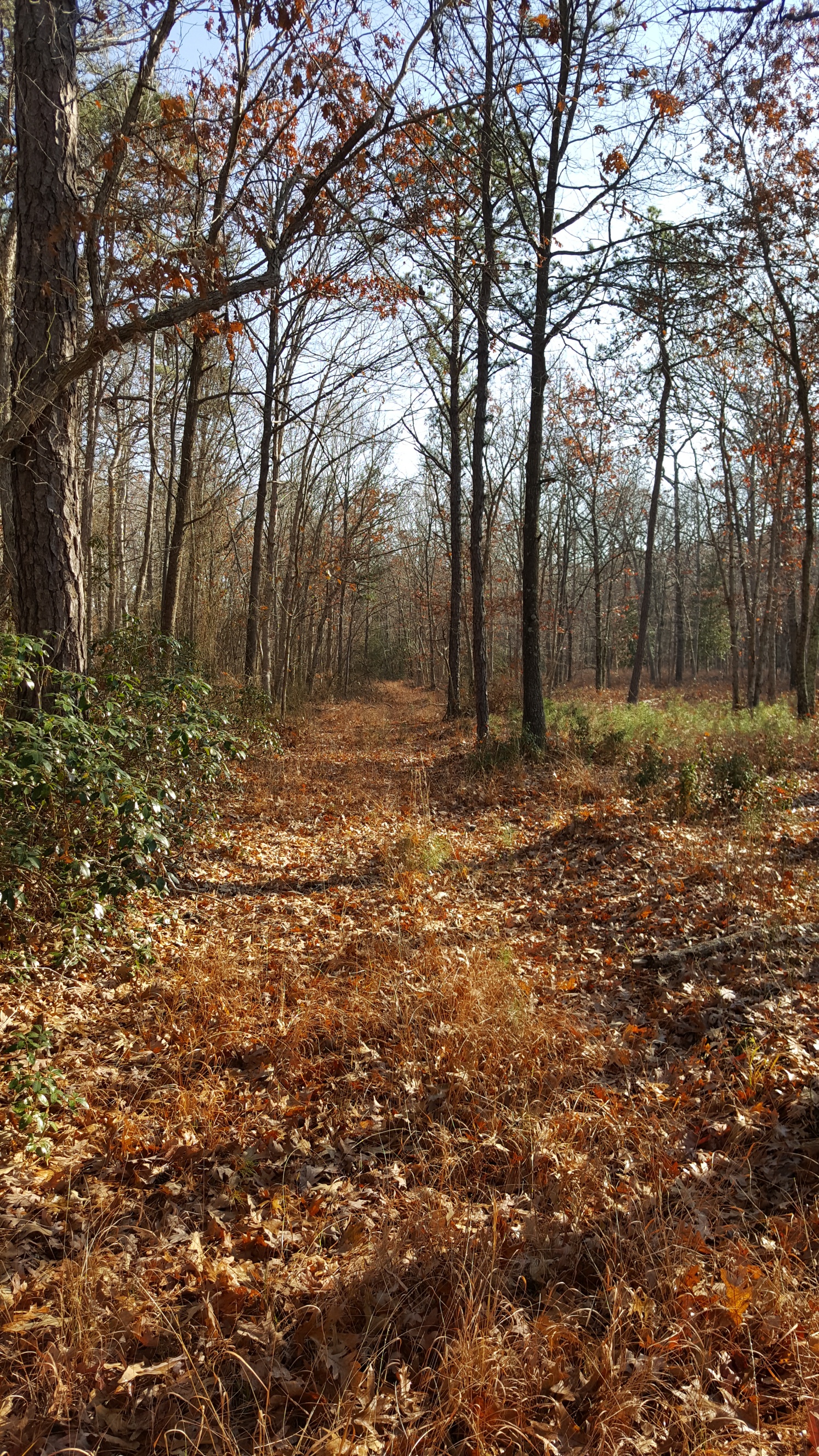
This is an article about views of title, but here’s another piece to the mystery: the physical condition of the land. See the accompanying photograph to decide if you think that this is a road or not.