A Franco-Chilean team of cave divers used the Nautiz X8 rugged handheld for marine cave surveying.
A Franco-Chilean team of cave divers used the Nautiz X8 rugged handheld for marine cave surveying, gathering data to classify the inaccessible northern half of Madre de Dios for UNESCO World Heritage
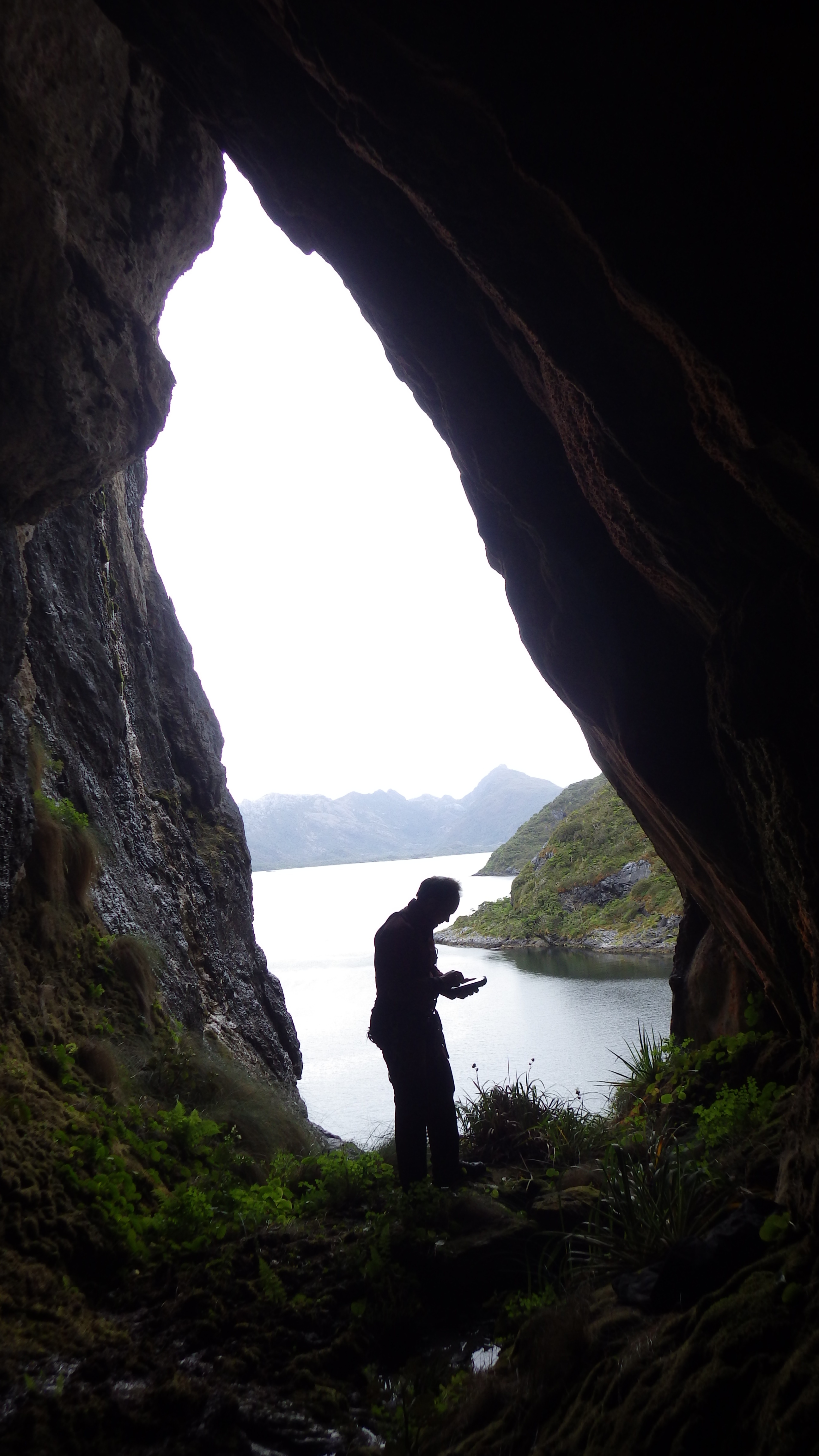
The team of cave divers used the Nautiz X8 rugged handheld mainly for marine surveying and for locating cavities.
Challenge
The Ultima Patagonia 2017 team needed a device rugged enough to handle the extreme conditions of unexplored parts of Chilean Patagonia.
Solution
The ultra-rugged Nautiz X8, designed for extreme environments, joins the team.
Result
The Nautiz X8 replaced many fragile devices to handle GPS, data collection, topography, telephone, photography, and note taking. The robust design of the Nautiz X8 rugged handheld meant that explorers could take it with them everywhere.
The Handheld Nautiz X8 rugged data collector joined the Ultima Patagonia 2017 expedition.
Cave exploration and surveys, data collection, and GPS were just the start of the tasks this rugged PDA took on. According to cave explorers and divers from the Association Centre Terre: “Over the course of twenty years and seven successive expeditions to the limestone islands of the western Patagonia Archipelago in the far south of Chile, we have discovered the Marble Glaciers, the largest cavities in South America, new animal species, unknown rock paintings and the archaeological remains of the first inhabitants of these hostile lands. We have travelled across the Madre de Dios and Diego de Almagro archipelagos, in search of caves and sinkholes.
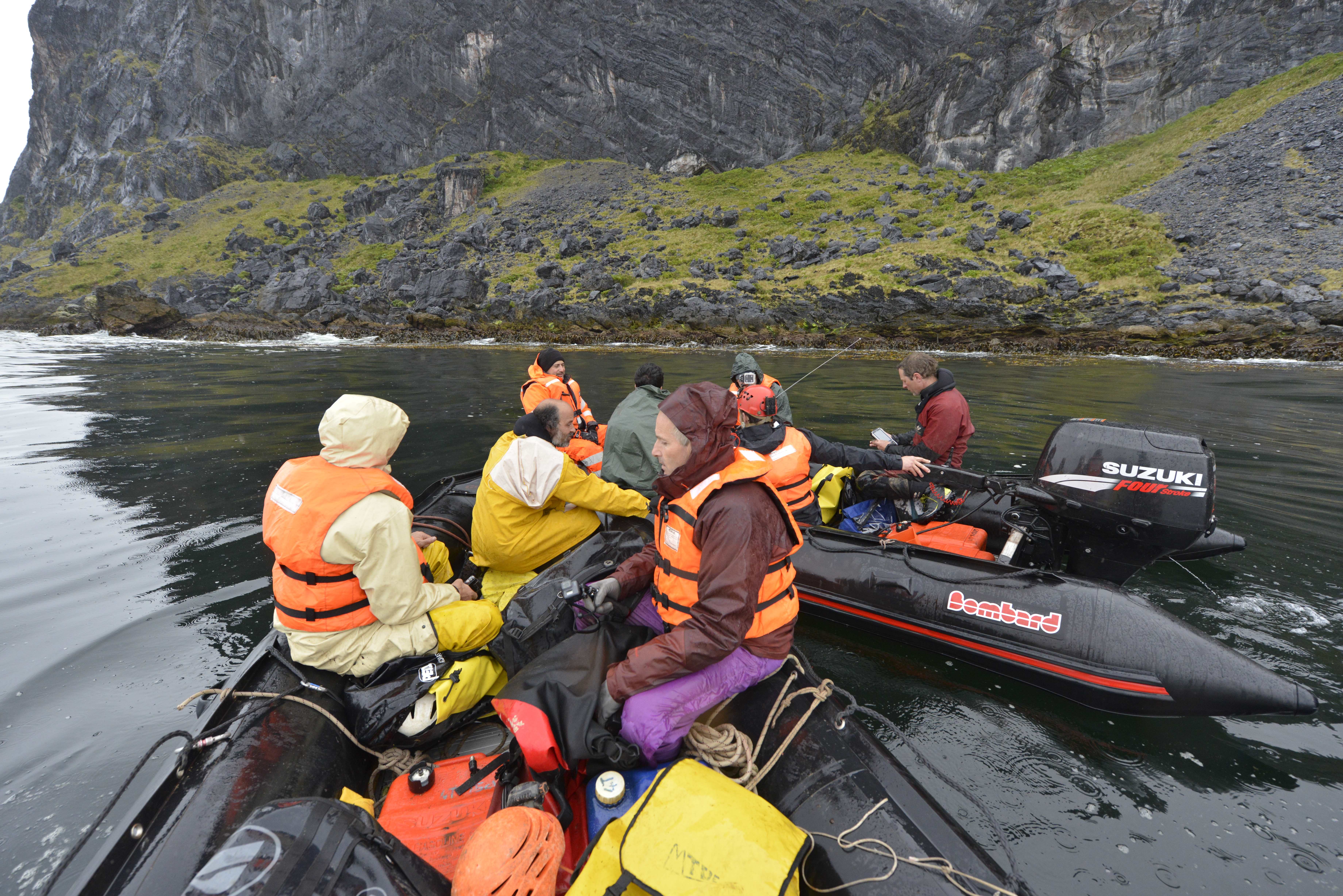
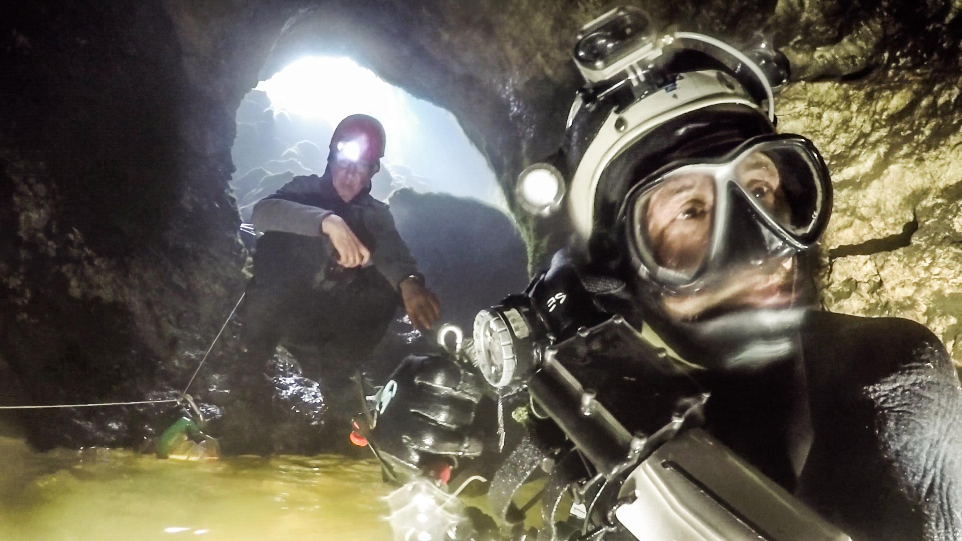
The team explored freshwater springs on the seashore or directly under the sea. They collected data when sailing along the coastline in Bombard inflatable boats.
“Being so isolated, the entire northern half of Madre de was inaccessible. Beyond latitude 50° south, the Barros Luco fjord and its unexplored karst presented us with a challenge. In 2006, 2008 and 2010 we were only able to touch upon the southern shore, taking advantage of tiny weather windows, carrying our boats on our backs across the mountain or assisted by helicopter drops by the French and Chilean armies. But in the north, there was still a 150 km² unexplored plateau, potentially offering exceptional discoveries.”
The team of cave divers used the Nautiz X8 rugged handheld mainly for marine surveying and for locating cavities.
Franco-Chilean exploration team
“The Ultima Patagonia 2017 expedition brought a multidisciplinary Franco-Chilean team of 25 speleologists to explore this unknown area. It required building a scientific base, enabling our team to live entirely on our own for two months in some of the harshest conditions on the planet. The objectives included surveying, exploration and the topography of the caves and chasms of the island, including cave diving, as well as scientific studies in fields as diverse as climatology, hydrology, geology, geomorphology, botany, zoology and archaeology. We also devoted time and effort to communication, through our Internet site or through video conferences with schools and colleges throughout France. A documentary was shot and produced for television. We also gathered data to classify the island for UNESCO World Heritage.”
In spite of having a professional photographers on staff, divers took some photos with the Nautiz X8 because it was always at hand while other cameras stayed well-protected in watertight cases.
Nautiz X8 rugged handheld joins the team
“While preparing for the expedition, the robust nature of the Nautiz X8 rugged handheld and its potential uses were of great interest to us. Before departure, we installed a GPS application with georeferenced satellite images, cave-mapping software, software for calculating decompression stops and planning dives, a tool for calculating gas mixtures specific for deep dives, software for taking and processing images, a compass, etc.
The team used a GPS application with geo-referenced satellite images, cave-mapping software, software for calculating decompression stops and planning dives, a tool for calculating gas mixtures specific for deep dives, software for taking and processing images.
“The team of cave divers used the Nautiz X8 rugged handheld mainly for marine surveying and for locating cavities. We explored freshwater springs on the seashore or directly under the sea. The surveys were undertaken when sailing along the coastline in our Bombard inflatable boats. We had to cope with heavy rain, strong winds and difficult sailing conditions at all times, even inside the channels.”
Extreme environments require extreme ruggedness
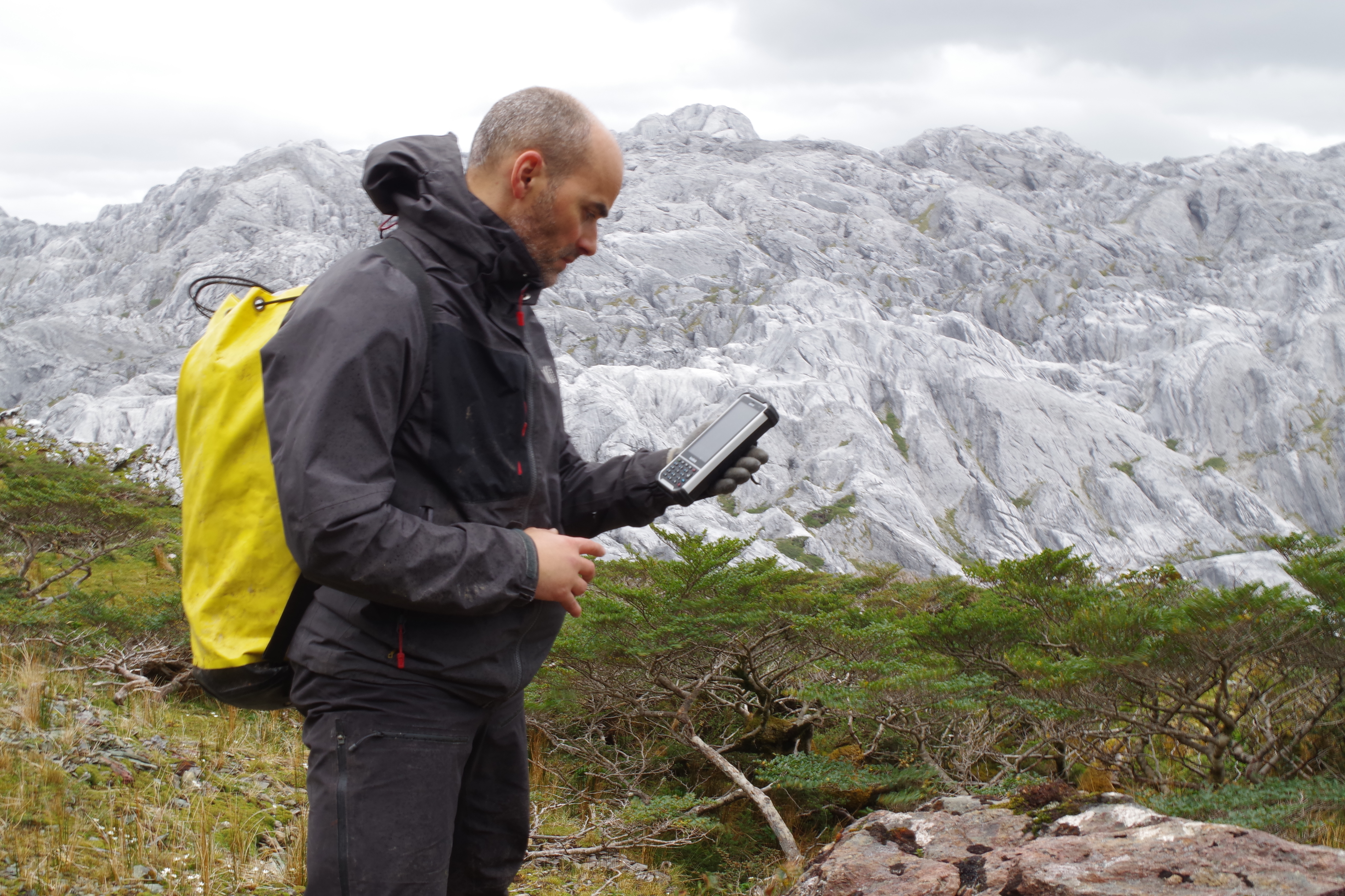
“The robust design of the Nautiz X8 meant that we could take it everywhere with us and use it even on our boats. The devices were sprayed with copious amounts of both fresh and salt water. They stood up well to this treatment.
The robust design of the Nautiz X8 meant that it could go out even on the boats. The devices were sprayed with copious amounts of both fresh and salt water. They stood up well to this treatment.
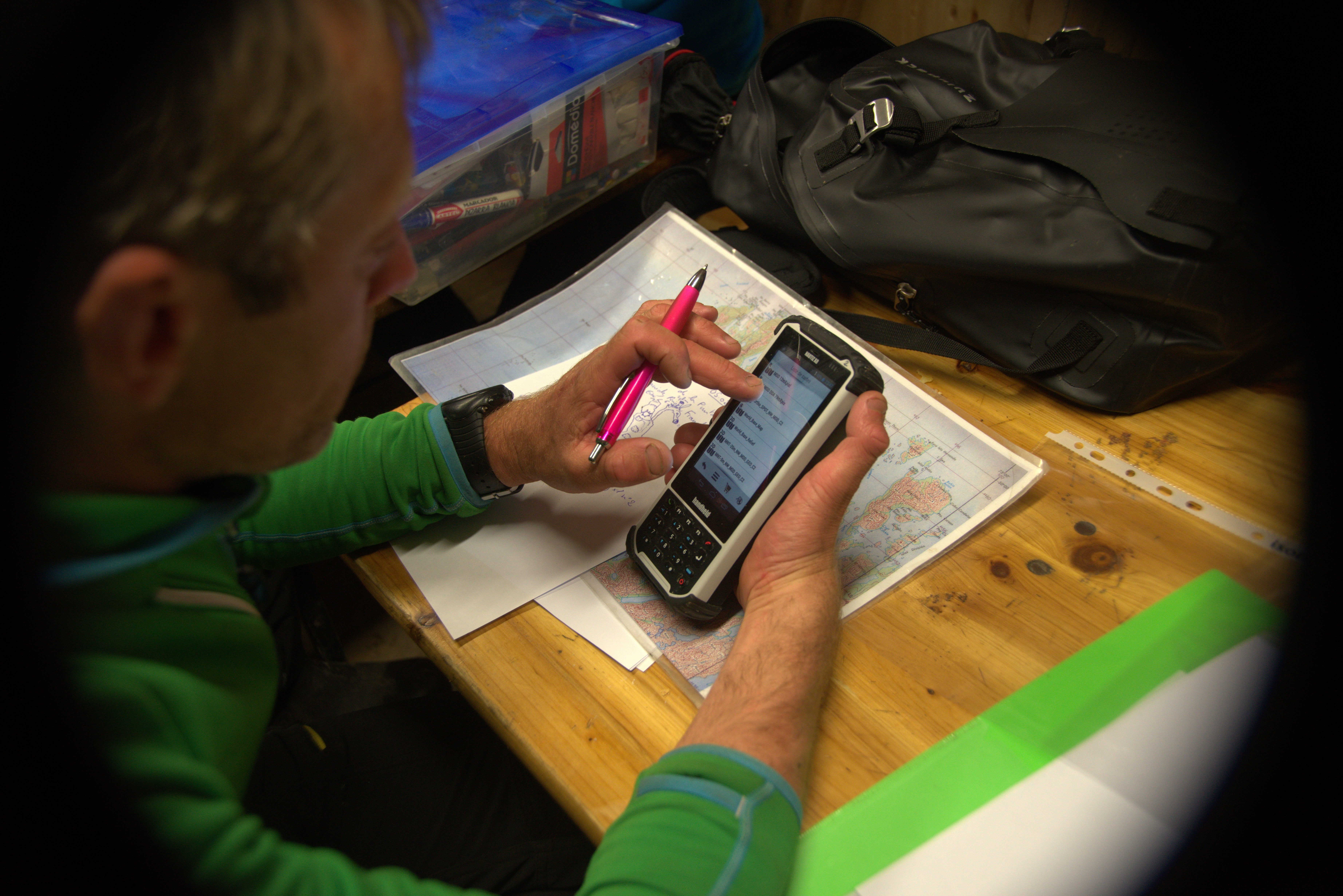
“The Nautiz X8 rugged PDA is welldesigned ergonomically and has a really large display, which made spotting objects on the pre-loaded satellite images easy. The display is easily visible, regardless of the lighting conditions. It is large, bright, and with good definition. As you’d expect, the touch function quickly became unusable in heavy spray. In this case, the physical keyboard is really useful, and proved easy to use.
“We had software to calculate the pressures for producing the air-, oxygen- and helium-based gas mixtures for deep dives. This software installed on the Nautiz X8 rugged handheld proved to be very useful, because we could calculate the different parts of air, oxygen or helium to put in our bottles at our filling station which was far from the scientific base.”
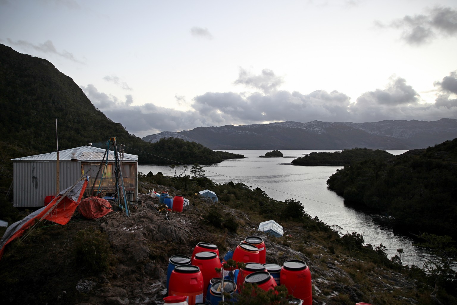
The expedition required building a scientific base, enabling the team to live entirely on their own for two months in some of the harshest conditions on the planet.
Nautiz X8, a versatile team tool
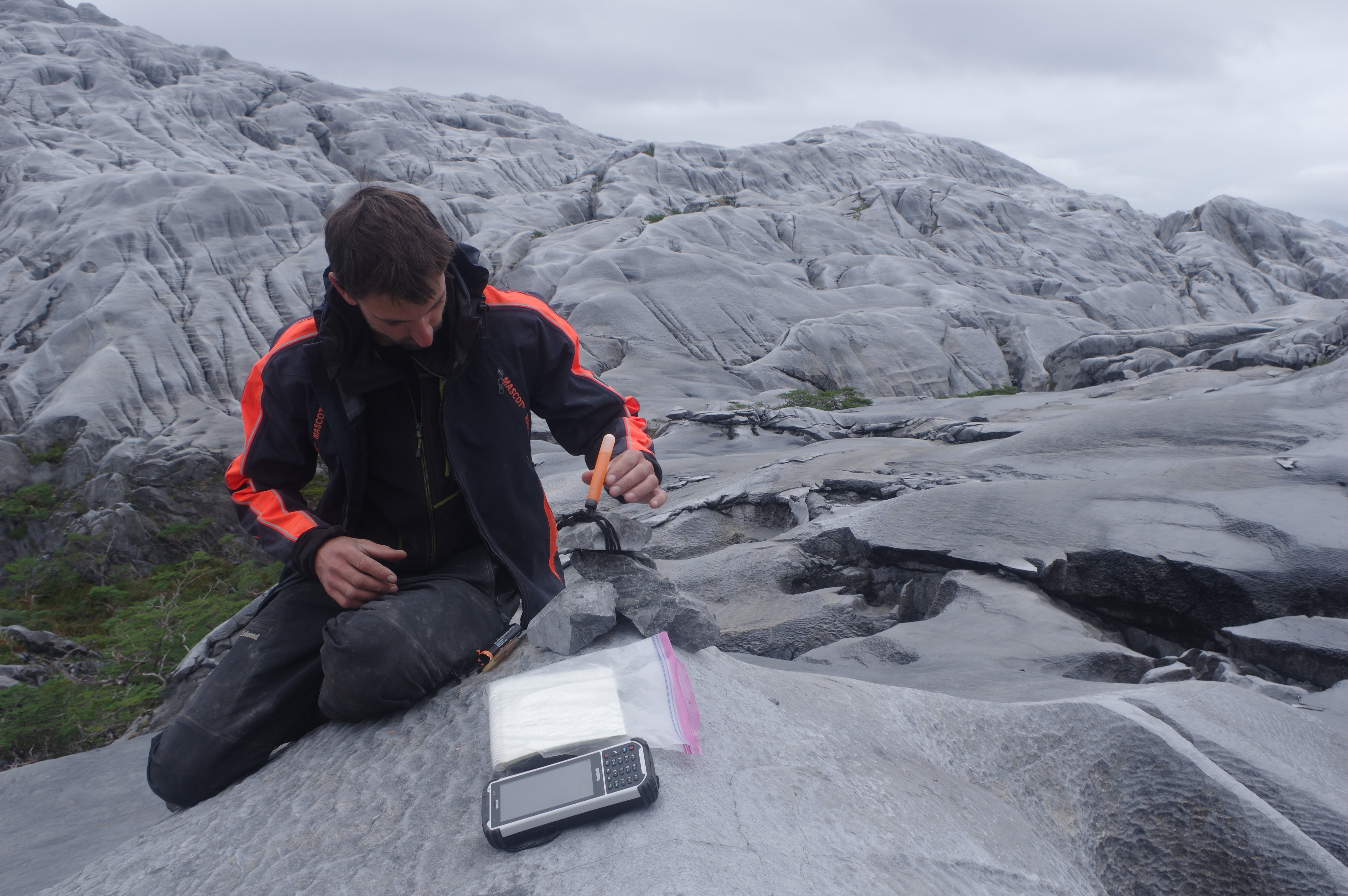
“We also took the Nautiz X8 handhelds with us to our forward camps in the middle of the island. We mainly used their GPS and compass facilities for pinpointing newly discovered cavities. We usually spent 3 to 6 days at these camps, and the reliability of the devices was excellent even in the cold temperatures at altitude.
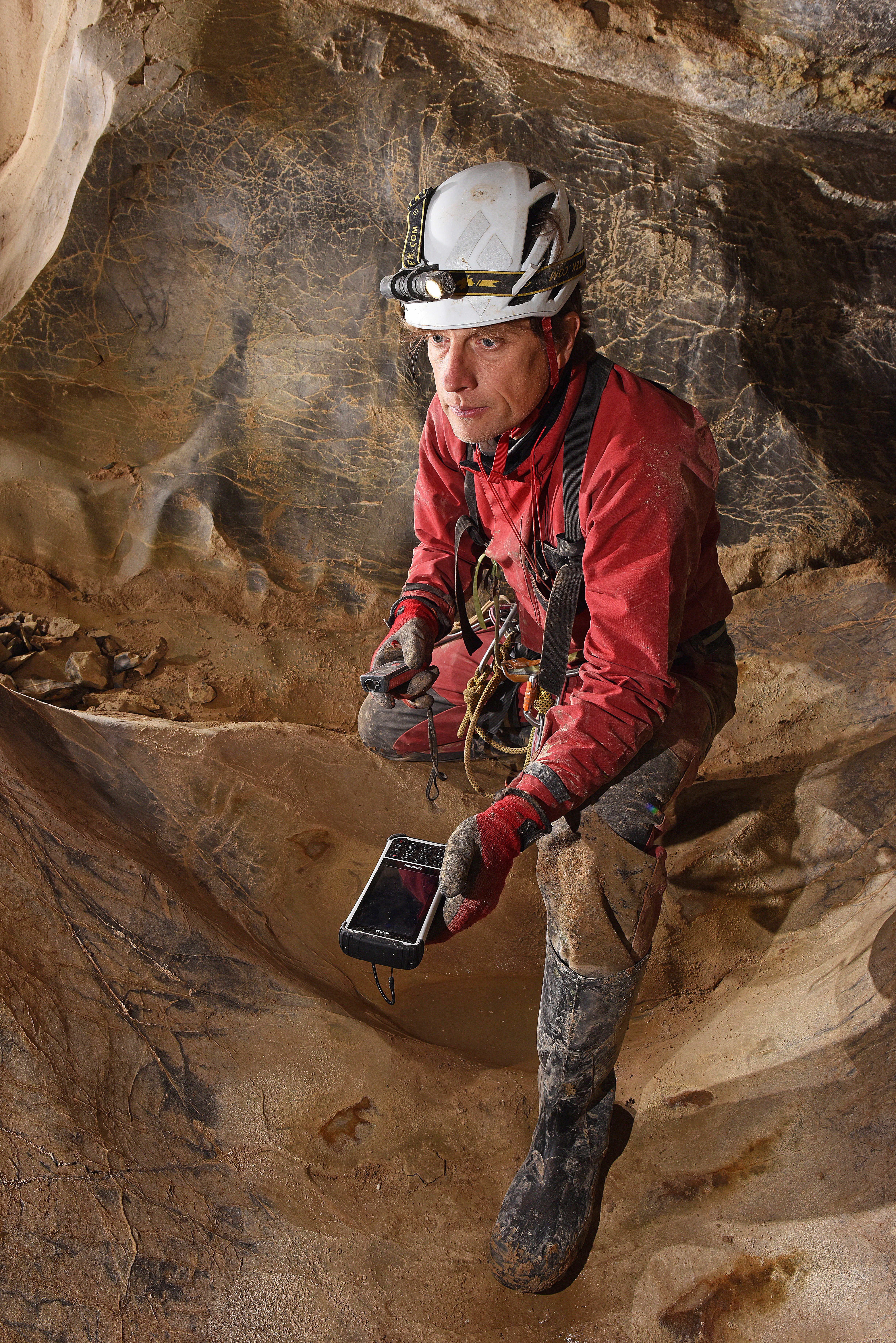
“All cavities we explore are subject to topographical survey. Topography requires making a skeleton of the cavity, taking the distance, slope and azimuth between each station, and the height and width values of the underground galleries. All these data enable us to then make a cross-section, a plan and a 3D view of the cavity. The caving software enables readings and precise measurements to be recorded directly from the laser range-finder via a Bluetooth connection with the Nautiz X8. The software also enables you to make freehand drawing profiles of galleries. These two functions worked perfectly and it was possible to take readings even in the wettest shafts. Having a stylus is extremely useful for drawing the detailed shapes of the galleries and the infill accurately.”
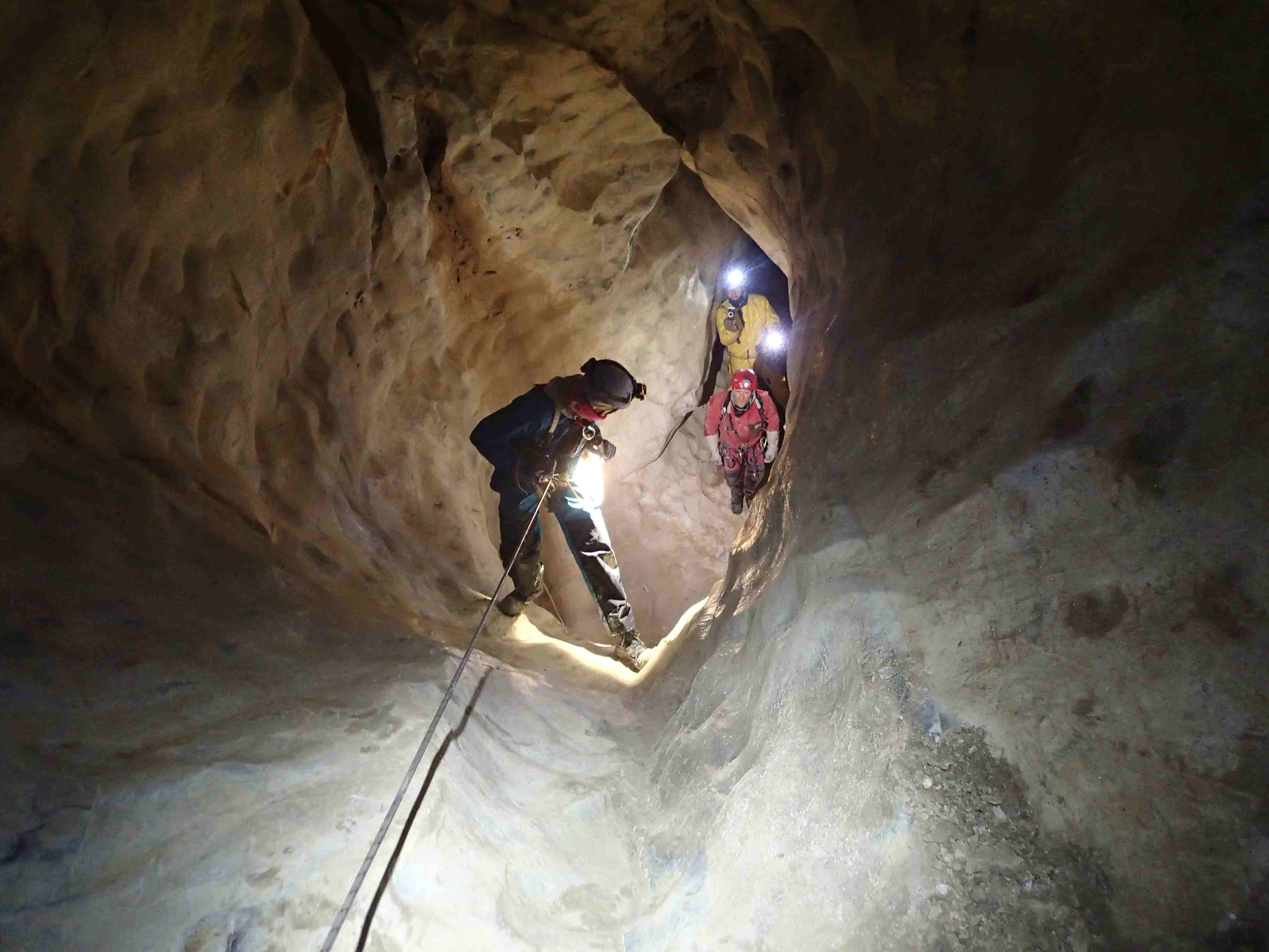
Topography requires making a skeleton of the cavity, taking the distance, slope and azimuth between each station, and the height and width values of the underground galleries.
Replacing more fragile equipment
“Having returned to base camp, the Bluetooth transfer of data from the Nautiz X8 to the computers was done without any problem. Everything worked extremely well, the device stood up to the cold, the humidity and the mud, as well as to the rough treatment inflicted on it by the cave explorers!
“We took some photos with the Nautiz X8, which should have been merely of passing interest, because we had professional photographers with sophisticated, high-quality photographic equipment! But, because it was always at hand, the Nautiz X8 rugged handheld allowed us to capture moments when other devices stayed well protected in watertight cases.
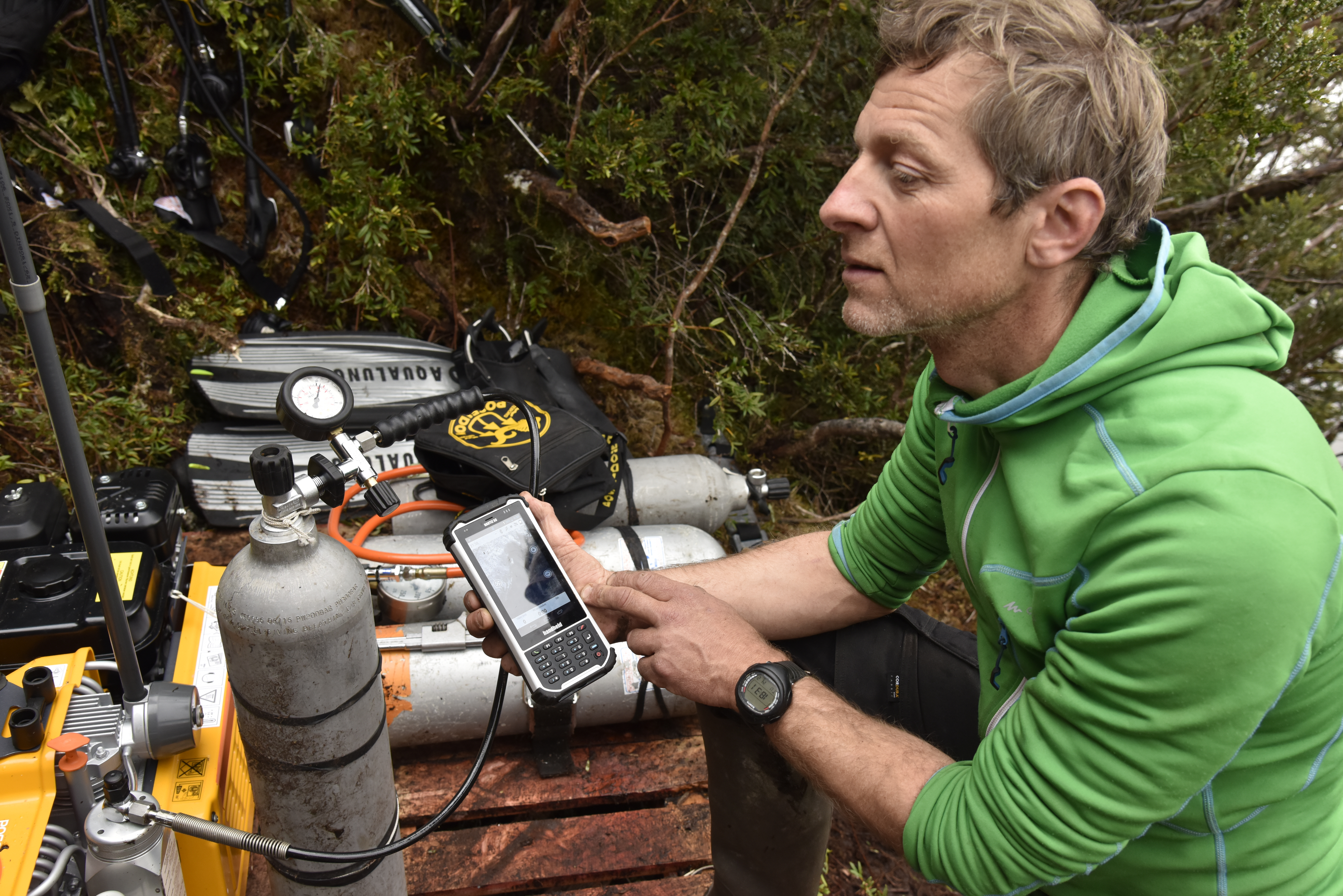
The team had software to calculate the pressures for producing the air, oxygen and helium-based gas mixtures for deep dives.
“The Nautiz X8 is a reliable, multi-purpose tool that can perform many services on an expedition. One thing is certain; we put it seriously to the test in Patagonia! It is robust, waterproof, and reliably self-sufficient. It did not give up when many of our photographic devices, cameras or radios became unusable due to being knocked or submerged. Its reliability is indispensable for an adventure such as ours. It is heavy and bulky, but this must be set against all the services that the device can provide: GPS, topography, telephone, photography, note taking, etc. Fully optimized, it replaces so many devices that its size and weight are no problem, and you can take full advantage of it being easy to hold and of its large display.”
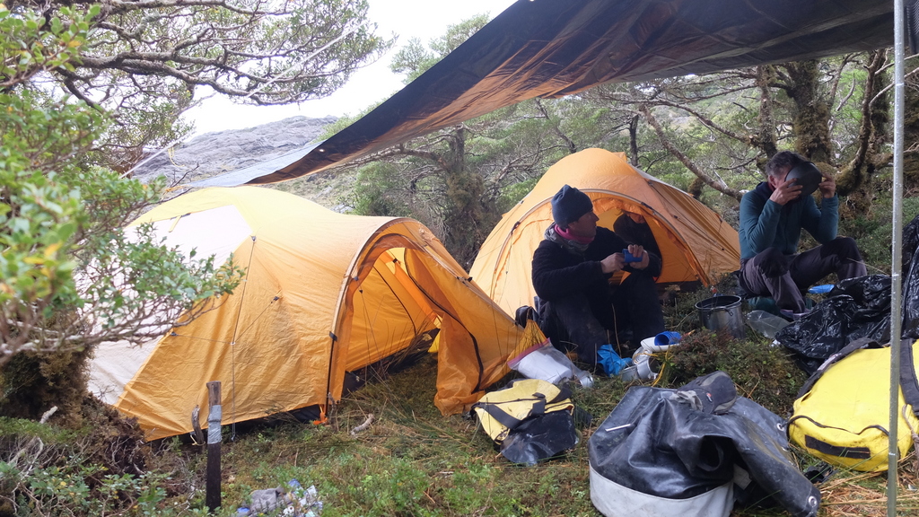
The Ultima Patagonia 2017 expedition brought a multidisciplinary Franco-Chilean team of 25 speleologists to explore this unknown area.
Michel Philips is a French cave explorer and cave diver. He was recently part of the Ultima Patagonia 2017 exploration in Chile, a project which may make the area one of UNESCO’s world heritages. Over the past 25 years Michel has taken part in several major expeditions. Among them the exploration of Muruk; the deepest cave and longest underground crossing of the Southern Hemisphere, located in the Nakanaï ranges in Papua New Guinea. When not abroad, he enjoys deep subterranean dives in European sumps and resurgences.
Note: Sump or siphon is a term used in caving to describe a passage in a cave that is submerged under water. Resurgence: A spring where a stream, which has a course higher up on the surface, reappears lower down at the surface.