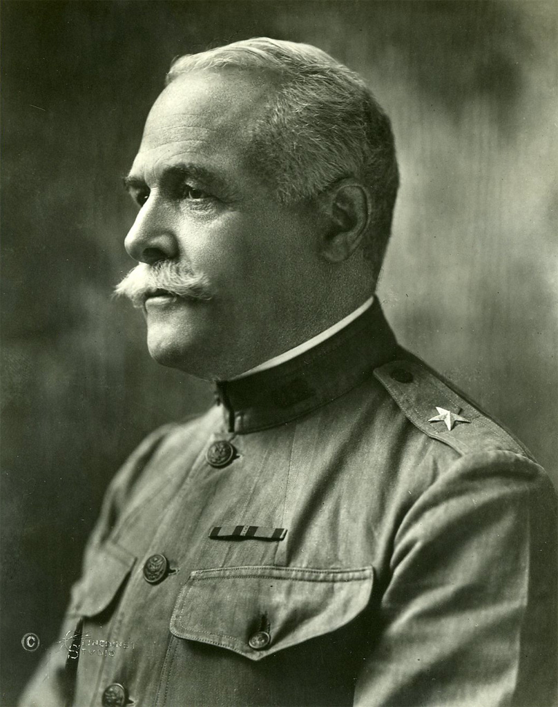
Montgomery M. Macomb took part in the Wheeler Survey of the western United States. He reached the rank of Brigadier General in the U. S. Army.
When First Lieutenant Montgomery M. Macomb arrived in Carson City, Nevada, from Washington D.C., on July 28, 1878, his assigned survey crew from the 4th Artillery was waiting and ready for the new field season. At age 25, Macomb was the leader of Party No. 2 of the California Section of George M. Wheeler’s Geographical Surveys West of the 100th Meridian. Just four years out from graduating fourth in his class at the West Point Military Academy, the young lieutenant had already served in Alaska and in Europe as aide-de-camp to Montgomery C. Meigs, the former Quartermaster General of the Union Army during the American Civil War. Macomb’s primary assignment in California involved the triangulation and topography in the Sierra Nevada Mountains of western California.
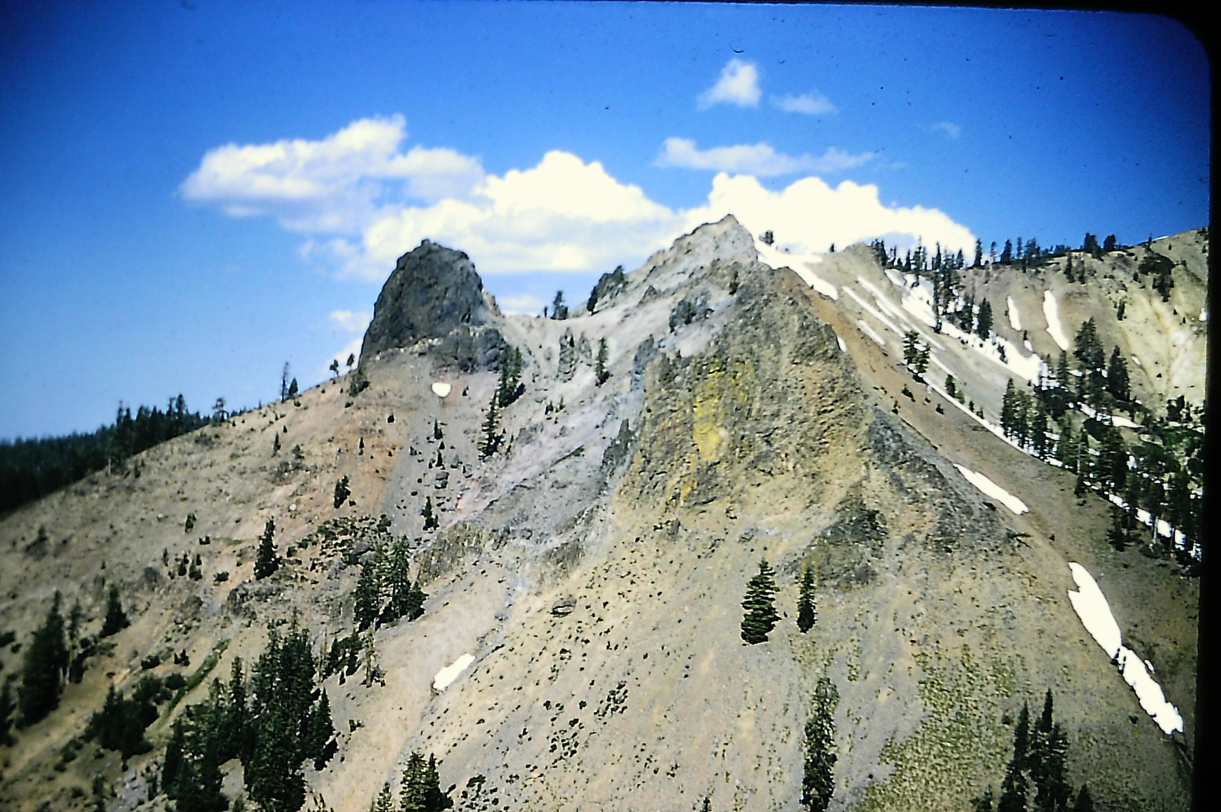
Spectacular peaks like this one in the Sierra Nevada Mountains of California were mapped by Lt. Macomb and his surveying party in 1878.
The survey party consisted of Macomb as executive officer and field astronomer; J. Calvert Spiller, topographer; J. H. Morgan, meteorologist; J. B. Callahan, odometer recorder; Charles B. Howell, chief packer; Henry B. Medlicott and N. F. Dow, assistant packers; R. Raycraft, man of all work; and Alexis Bochet, cook. The instruments were one sextant for latitudes, two ten-second transit theodolites for triangulation, two Young & Son’s topographical transits for meander lines and fill-in topography, two Green’s mountain barometers, three aneroid barometers, two sets of psychrometers, a maximum and minimum thermometer for meteorological work, and an odometer and vehicle for measuring road distances. The outfit also included 22 animals: twelve pack mules, nine riding mules, and one bellmare. The latter was a female mule wearing a bell at the head of the pack to keep the others moving.
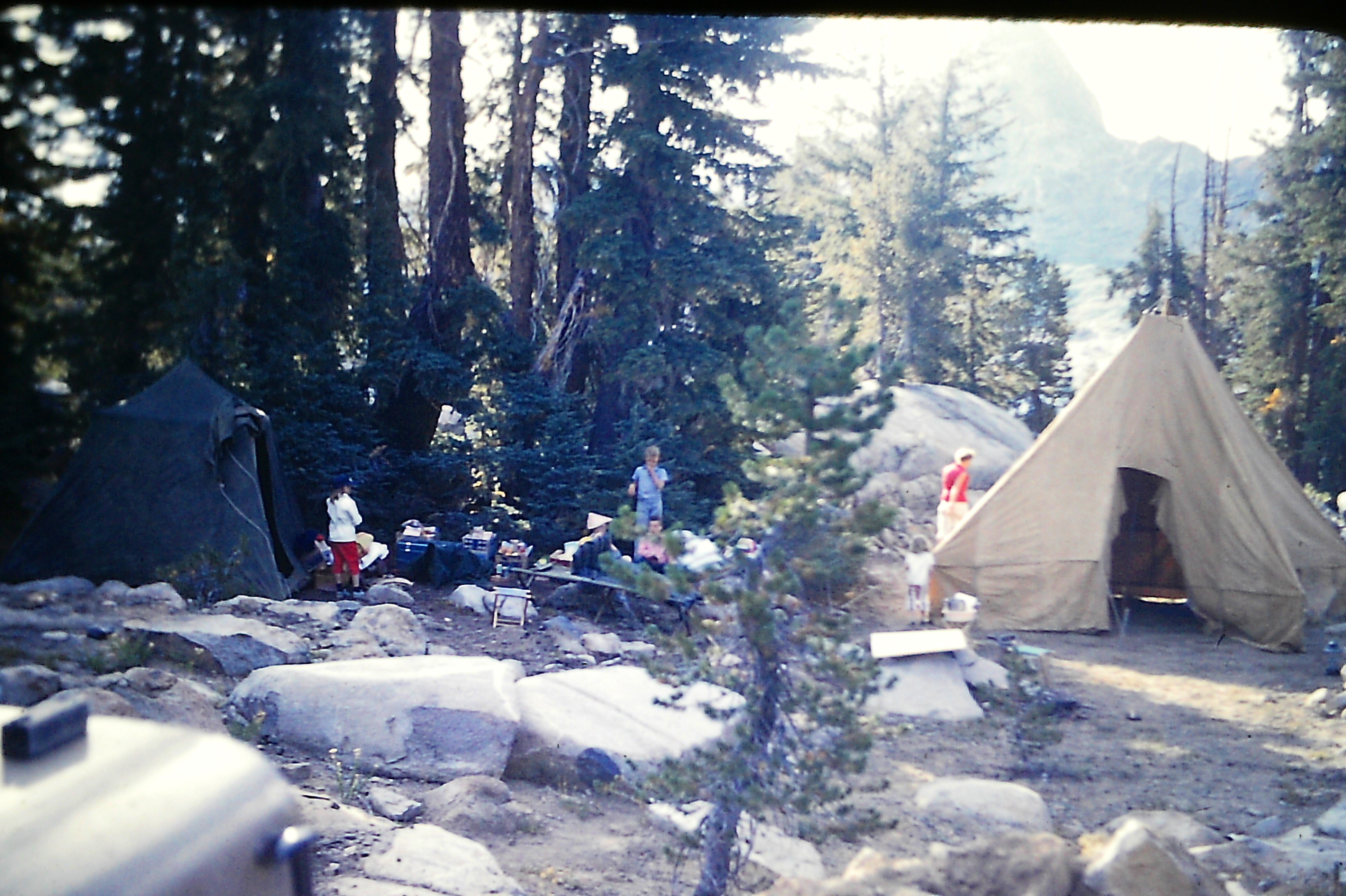
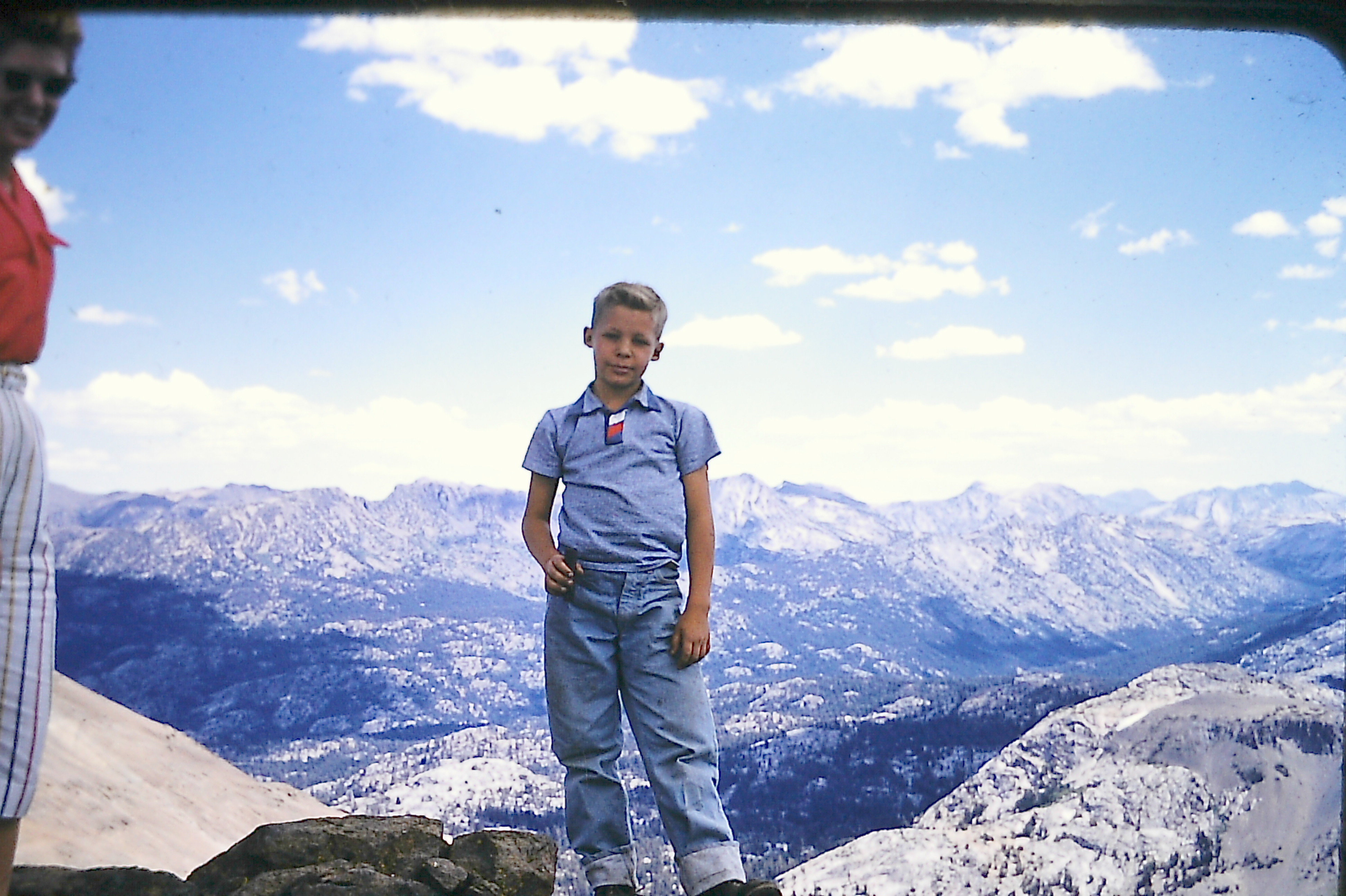
The family campsite near Grizzly Peak in September of 1955. Ron McClintock is at left.
Macomb divided the crew into two groups to utilize each man effectively. He led one and J. Calvert Spiller led the other with each party taking one month’s rations. One group focused on the main triangulation and topography, while the other did the meander work and secondary triangulation. There were two objectives. One was to continue the triangulation of the previous season far enough south to connect with the 1875 baseline established in the Panamint Valley of California. The second objective was to join the triangulation previously carried eastward to Austin, Nevada, in 1876 by Lieutenant Rogers Birnie, Jr. The party then moved westward to carry the network into the foothills of the Sierras and connect with the work from Fresno, California.
The McClintock and Boice families near Grizzly Peak on a mountain trail while on an outing to search for uranium.
Macomb’s party moved up Wolf Creek, then over the divide into the Hermit Valley of California. The Big Tree Road was surveyed to Blood’s tollhouse where it connected with the meanders that Macomb had run the previous season from Big Tree Grove. The Amador Road was surveyed to connect with the work completed in 1877. The discovery of a profitable line of gold near Bodie, Calif., in 1876 had created a boom. The routes were busy with hopeful prospectors and stages that brought more and more people into the area.
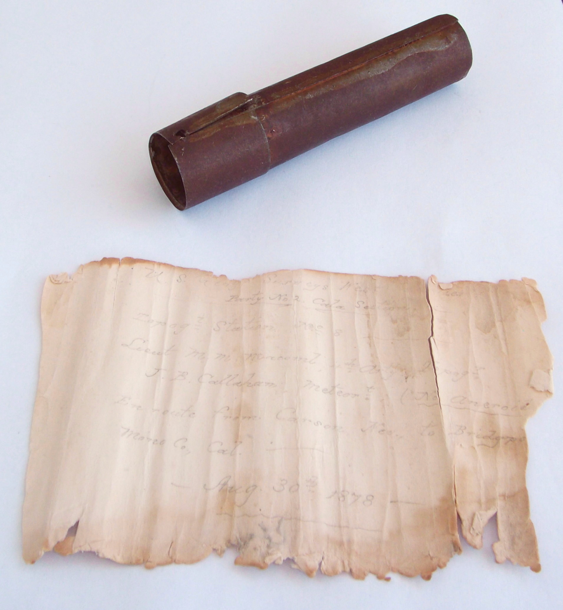
The note and metal tube placed on Grizzly Peak on August 30, 1878, by Lt. M. M. Macomb and J. B. Callahan.
Near the end of August 1878, the crew finished the topography in California south of the Sonora and Mona Road. Six peaks were occupied in this area including one that was just over 10,365 feet in elevation known as Grizzly Peak. The location of this peak is approximately 67 miles south of Carson City, Nevada, or 100 miles southsoutheast of Sacramento, California, on the Tuolumne/Mono County line in Section 13, T4N, R21E, Mount Diablo Meridian. Since J. H. Morgan, the meteorologist, was with the other crew, J. B. Callahan assisted Macomb in this capacity as they worked their way toward Bridgeport, California. While on Grizzly Peak on August 30, 1878, Macomb and Sullivan constructed a small rock cairn which was used as topography station No. 8. Before leaving, the two men recorded their presence there on a piece of writing paper and marked their movements. The note was placed in a metal tube slightly less than one-inch in diameter and 4 inches in length and slipped it into the rock cairn.
Young Ronnie McClintock holds the metal tube that contained the note from Lt. Macomb. Chuck and Deanne Boice stand next to the small rock cairn where the tube was found.
The surveyors finished their work at Sonora, California, on December 11, 1878. They then traveled to Milton, California, where they disbanded and boarded the train for their homes. They were in the field 135 days, made 100 camps, established 22 primary triangulation stations, 14 secondary stations, and 163 three-point stations. In addition, 216 cistern and 858 aneroid barometer readings stations were made.
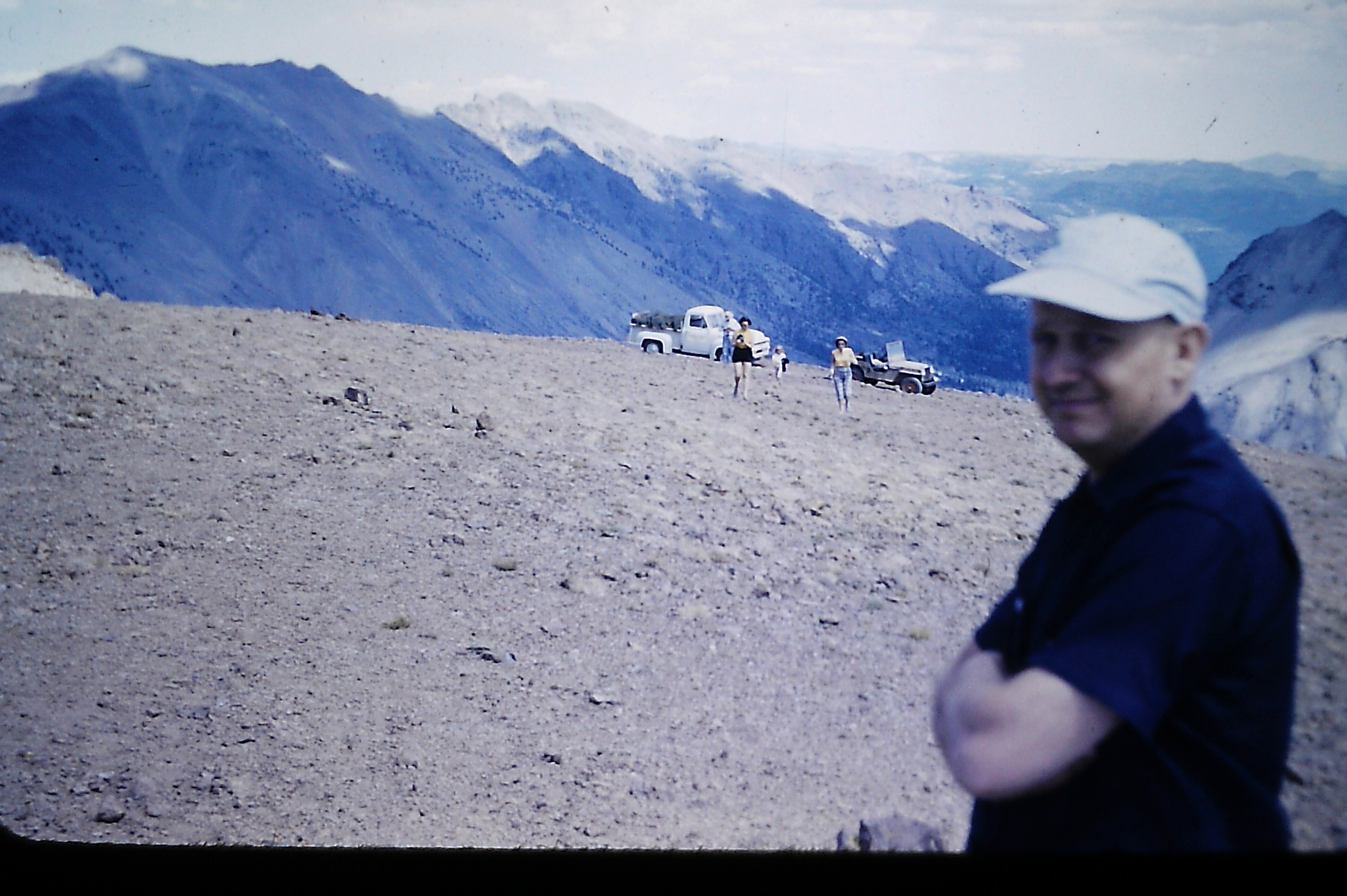
A mining expert with a Geiger counter along on the expedition.
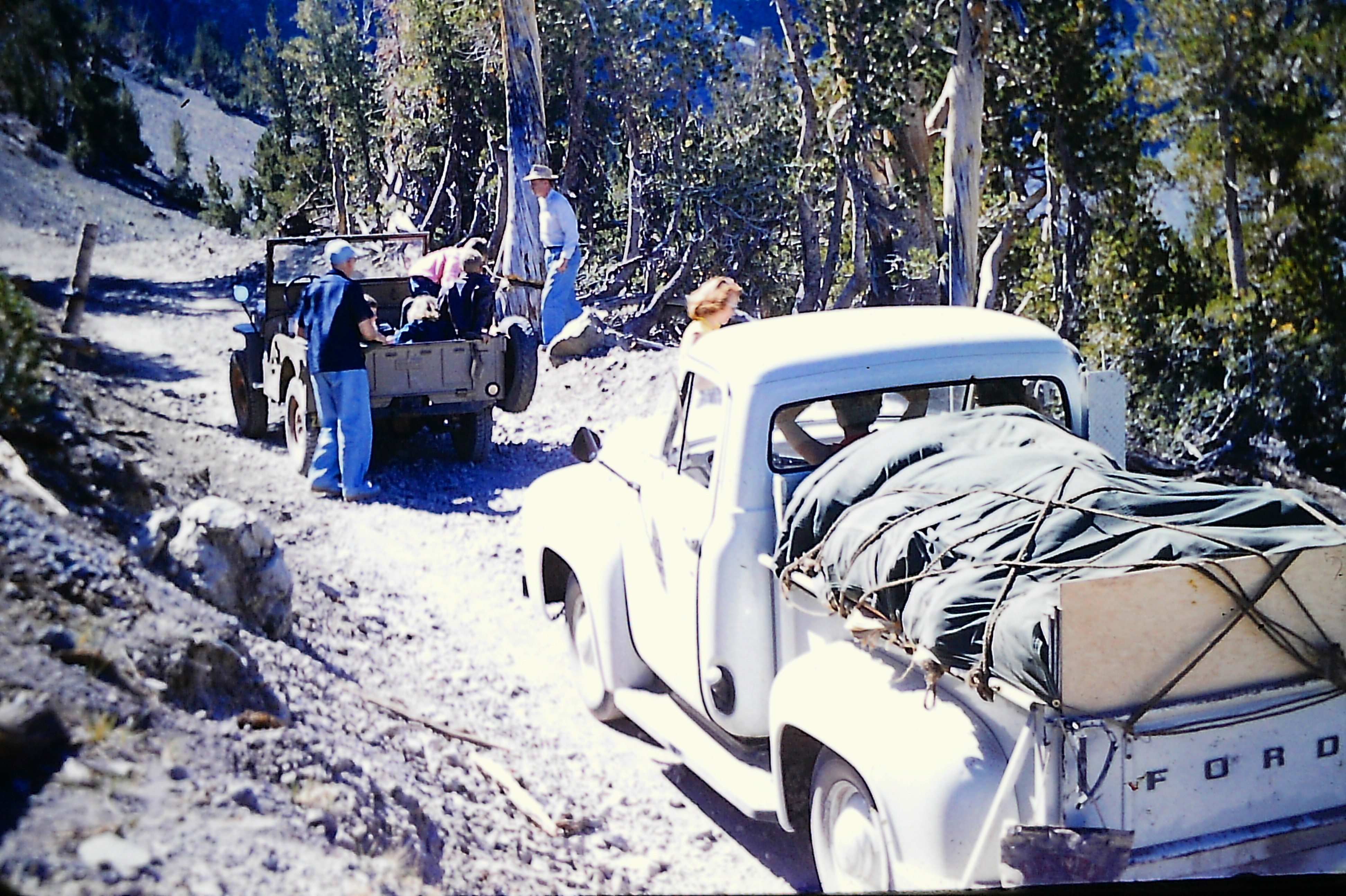
The note left on Grizzly Peak by Macomb and Callahan somehow remained hidden in the rock cairn for the next 77 years, unnoticed by countless hikers until September of 1955. Nine-year-old Ronnie McClintock of Sonora was excited when his father, Robert McClintock, announced that the family would make an outing to the mountains. His father and a family friend, Dr. Ben Boice, received information that uranium might be found in the vicinity of Grizzly Peak. Together with their wives, Ronnie, and two Boice children, Chuck and Deanne, they loaded their tents, camping gear, blasting equipment, and a Geiger counter and headed for the peak. While exploring the area, it was decided to climb to the summit of Grizzly Peak which the children naturally showed no hesitation in doing.
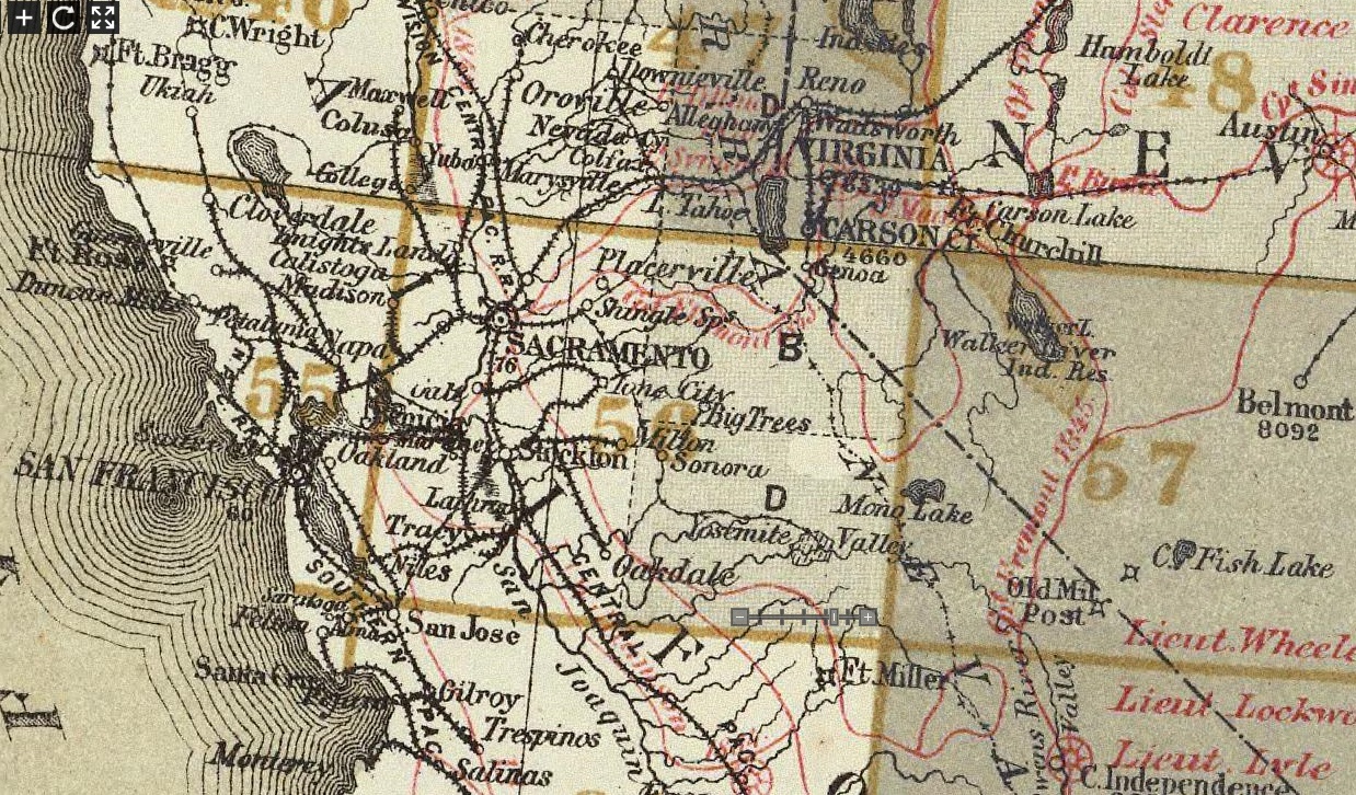
The note was found in the lower area of Quadrant “B” of Atlas Sheet 56 that was published in 1883.
The small rock cairn was a natural curiosity which brought them to investigate. Ronnie spotted something within the rocks and pulled it out. With the adults’ help, the tube was opened and the fragile note carefully unrolled to reveal the words left by Macomb. The Sonora Daily newspaper published a story of their find, but no one really knew who the authors of the note were or why they were there. The excitement faded after the initial discovery, but Ronnie kept the metal tube and note as a souvenir of their trip.
 While going through some items at his house 62 years later, Ron McClintock rediscovered the metal tube and note. His interest was piqued so he decided to search for answers. His quest led him to surveyor David Ingram in Virginia who in turn contacted the author to inquire about further research. Before long, research uncovered the official report written by Macomb following his 1878 survey. While Macomb’s report does not go into specific detail about each peak occupied for topography, it does mention ascending Grizzly Peak between August 20 and September 2, 1878, which agrees with the date written on the note.
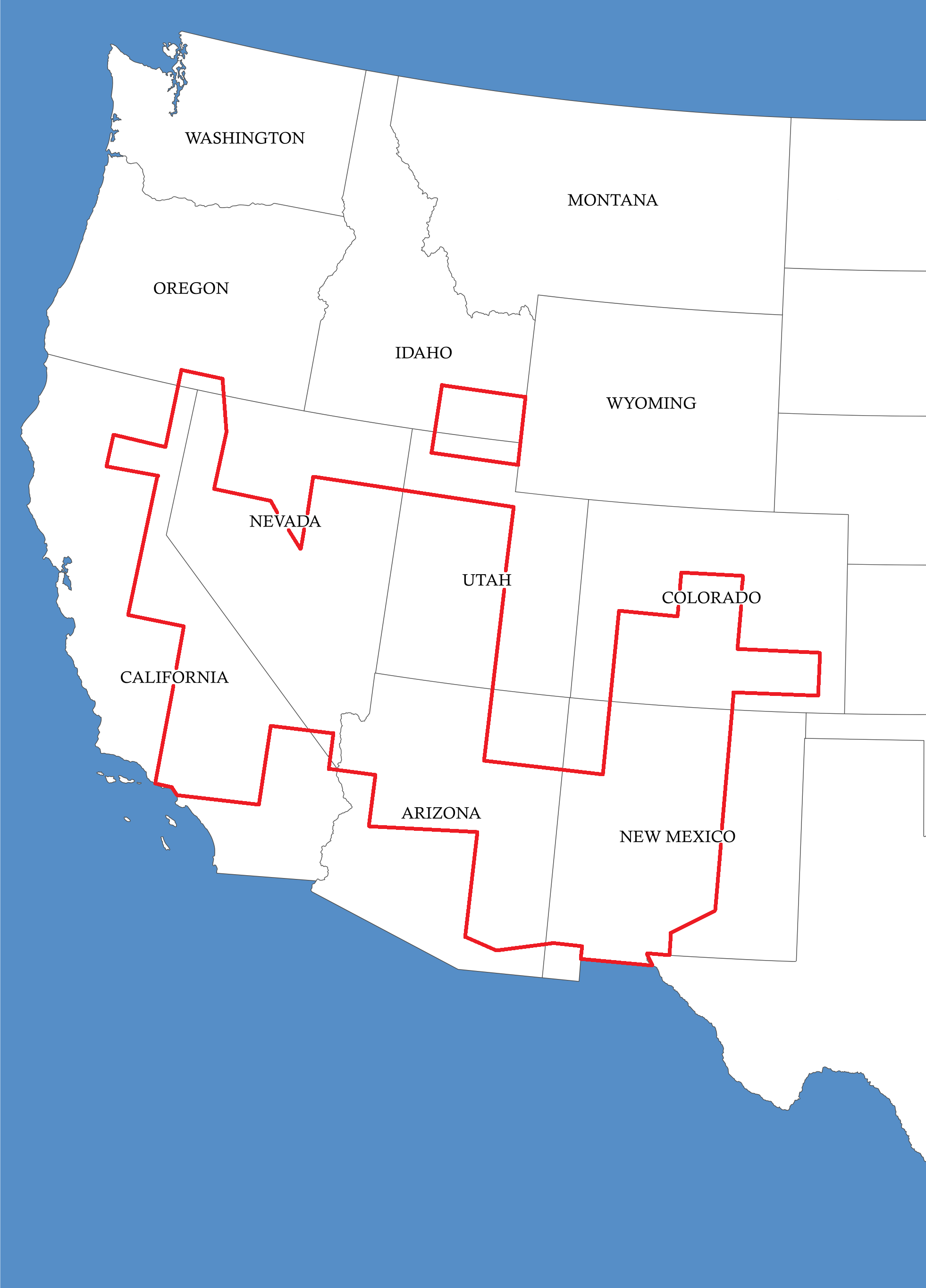
The Wheeler Survey mapped the western areas of the United States between 1876-1883 within the area of the red lines.
Beginning in 1869, the Wheeler Geographical Surveys West of the 100th Meridian lasted an entire decade, until 1879. The original plan was to topographically map all areas west of the 100th Meridian. Sections were divided into numbered areas bounded by 3°20’00” latitude and 5°15’00” longitude. These areas were further divided into four equal parts from which 1 inch to 4 mile (1:253,440) maps were made and designated by letters A through D. The lower portion of Atlas Sheet 56B, published on March 31, 1883, shows the area where the metal tube and note were found.
The Wheeler Survey, along with the topographical surveys of Clarence King and John Powell, and the geological survey of Ferdinand Hayden became known as the “Four Great Surveys of the West”. Their work was terminated and reorganized as the United States Geological Survey. Montgomery M. Macomb went on to serve in the Spanish-American War, reaching the rank of Brigadier General in 1910. He remained active in the military until his death at age 71 in 1924.