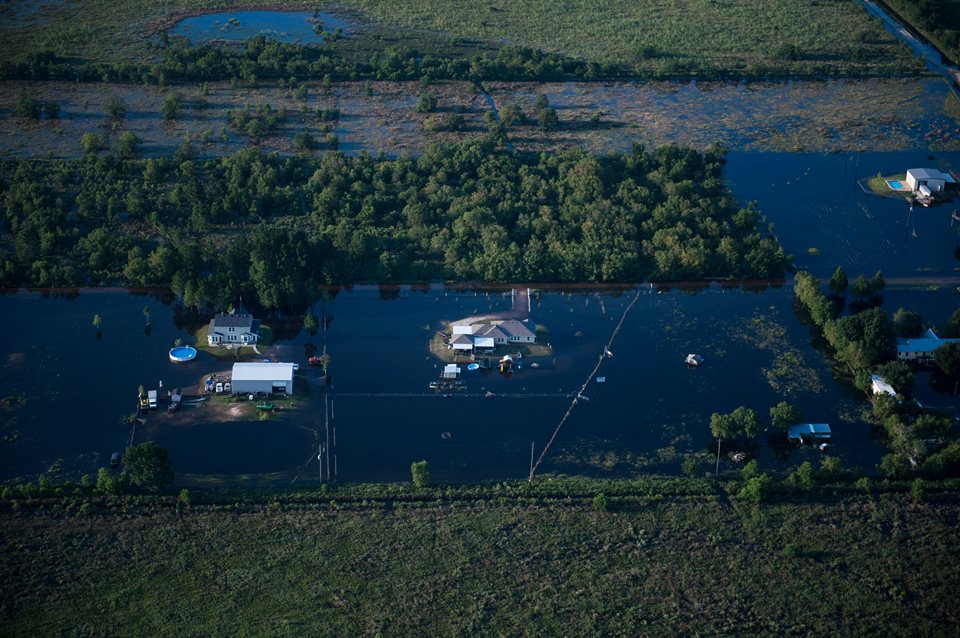
An aerial view of the flooding caused by Hurricane Harvey in Houston, Texas, Aug. 31, 2017. Hurricane Harvey formed in the Gulf of Mexico and made landfall in southeastern Texas, bringing record flooding and destruction to the region. U.S. military assets supported FEMA as well as state and local authorities in rescue and relief efforts. (U.S. Air Force photo by Tech. Sgt. Larry E. Reid Jr.)
Speed is crucial in responding to a disaster. The geospatial industry has risen to the challenge and become remarkably adept at quickly gathering vital data revealing conditions on the ground and in coastal environments following hurricanes, earthquakes, wildfires and other catastrophes–and delivering that information to people onsite and nearby command posts who can use it to save lives and property. Image asset handling technology plays an increasingly vital role in this critical data pipeline during times of crisis.
By the time Hurricane Harvey made landfall in Texas on August 24, 2017, Woolpert had already deployed an aircraft to the region for rapid collection of imagery after the storm. The plane was in the air over Houston as soon as the skies cleared, capturing one-foot-resolution imagery of the devastation. Less than 24 hours after collection, processed images along with archived pre-event data were on a Woolpert server to give emergency response organizations free access to the near-real-time information.
“Often for the data to be most valuable, it has to be captured as early as possible after the event,” said Jeff Lovin, Senior Vice President for Woolpert, an architectural engineering and geospatial services firm based in Dayton, Ohio.
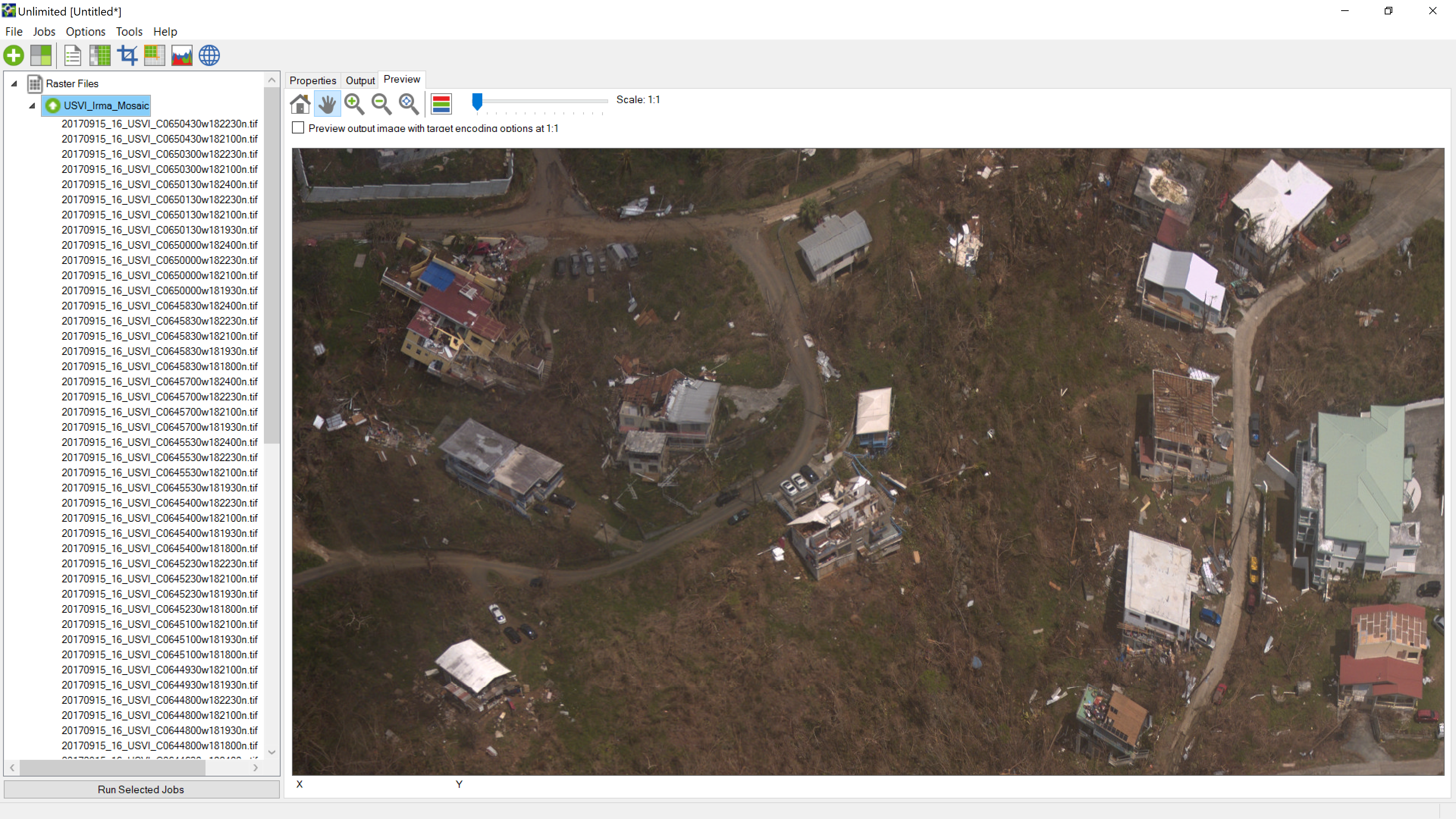
High resolution imagery provided by NOAA depicting Hurricane Irma wind damage to residential structures in September, 2017 on St Thomas, US Virgin Islands.
Government agencies at every level understand the value of timely geospatial data. Although Woolpert performed the post-Harvey collects pro bono, the firm has contracting vehicles in place with many of its government clients that include provisions for disaster mapping. This is true of several surveying and mapping organizations whose customers don’t want red tape standing in the way of successful response and recovery operations in the aftermath of catastrophe.
Applications of geospatial data vary with the type of emergency and the phase of recovery, Lovin said. A high-resolution pre-event image, for example, can help the first boots on the ground get their bearings where a tornado has torn away street signs and landmarks. Imagery collected just after the event is often used by emergency operations managers to stage resources, determine access routes to hardest hit areas, and plan for clean-up after search-and-rescue is completed.
While high-resolution color imagery is the most sought-after aerial data set in the wake of nature’s wrath, other collection technologies have become prevalent. In the post-Katrina flooding of New Orleans, the U.S. Army Corps of Engineers contracted aerial LiDAR collection to map the Mississippi River coastline. For wildfires, thermal infrared imaging is being used to see through the smoke and delineate burn zones and denuded areas subject to significant erosion and mud flows post event.
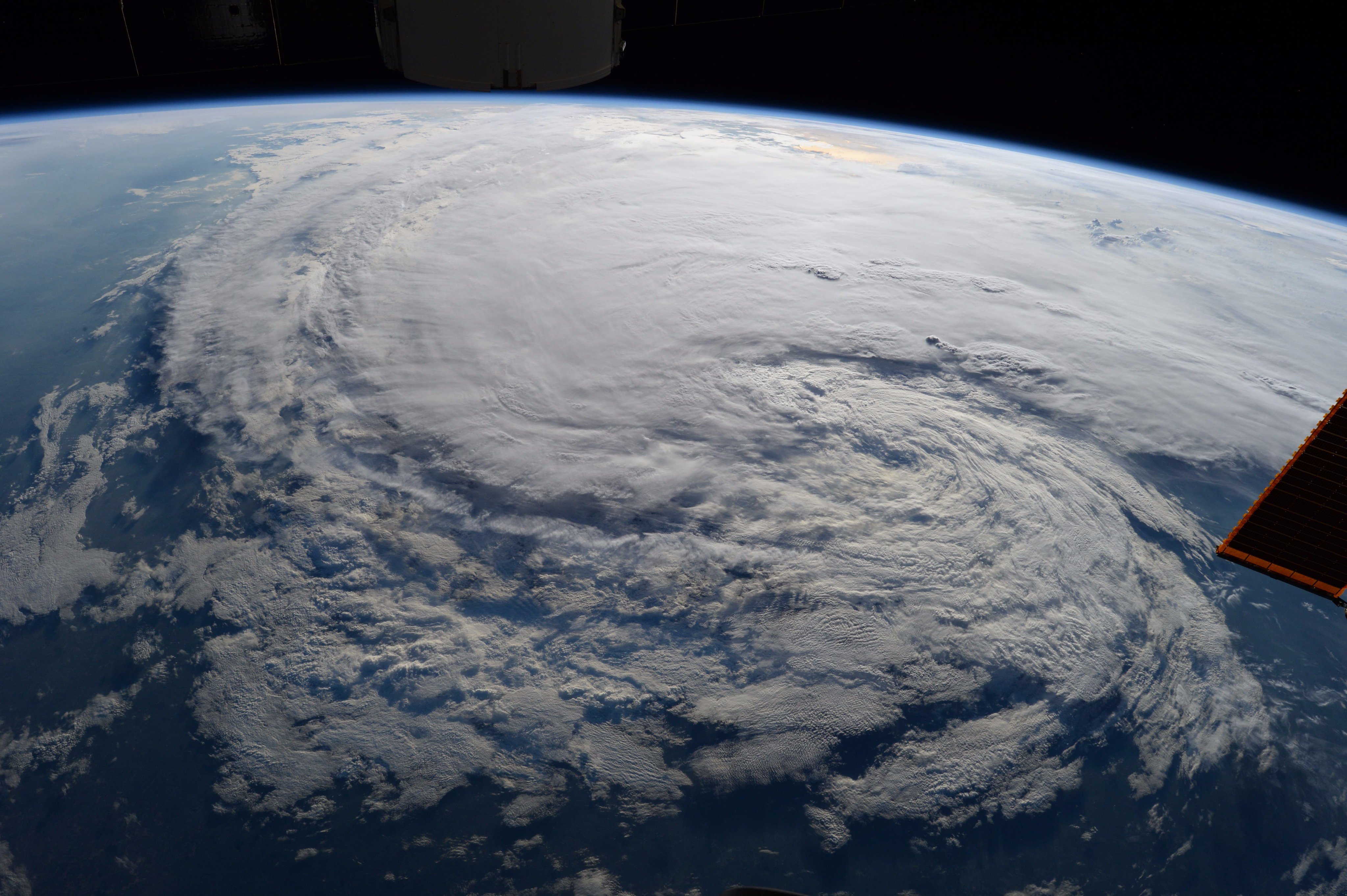
View of Hurricane Harvey from the International Space Station. Courtesy NASA Astronaut Randy Bresnik
Not only do public safety personnel now have a wide selection of data sensing capabilities to rely on, the number and types of remote sensing platforms are increasing too. UAVs, or drones, have assumed their position as primary data sources along with aircraft and satellites. During Hurricanes Harvey and Irma, all these resources were reportedly activated to provide support. One estimate put nine aerial mapping firms onsite in Houston immediately after Harvey.
But just as the growing number of acquisition platforms and ever-increasing instrument fidelity ease some challenges in the information pipeline, they create additional stressors at other points in the data flow.
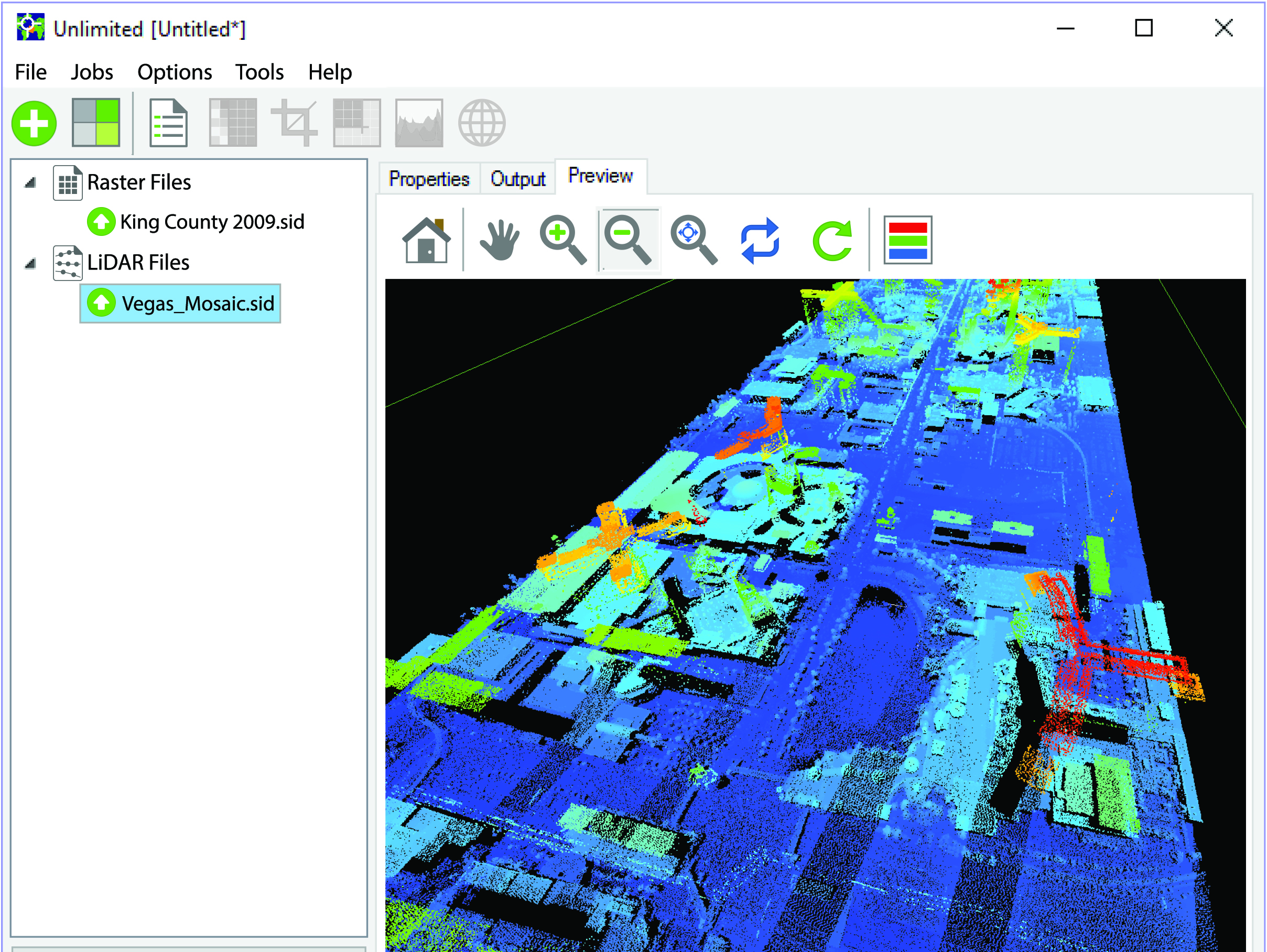
“Just because raster data is easy to obtain doesn’t necessarily mean it’s easy to get into the hands of the responders who can actually put it to use during a national event,” said Terry Ryan, LizardTech Federal Government Sales Manager. “Raster files, both imagery and LiDAR point clouds, are enormous and getting bigger all the time due to enhanced spatial and spectral resolution, which makes processing, exploiting and disseminating imagery products an ongoing challenge.”
LizardTech, which was launched 25 years ago to make raster asset management easier, sees demand jump for its flagship image asset handling product, GeoExpress, in the wake of catastrophes. Such was the case in the aftermath of Harvey and Irma.
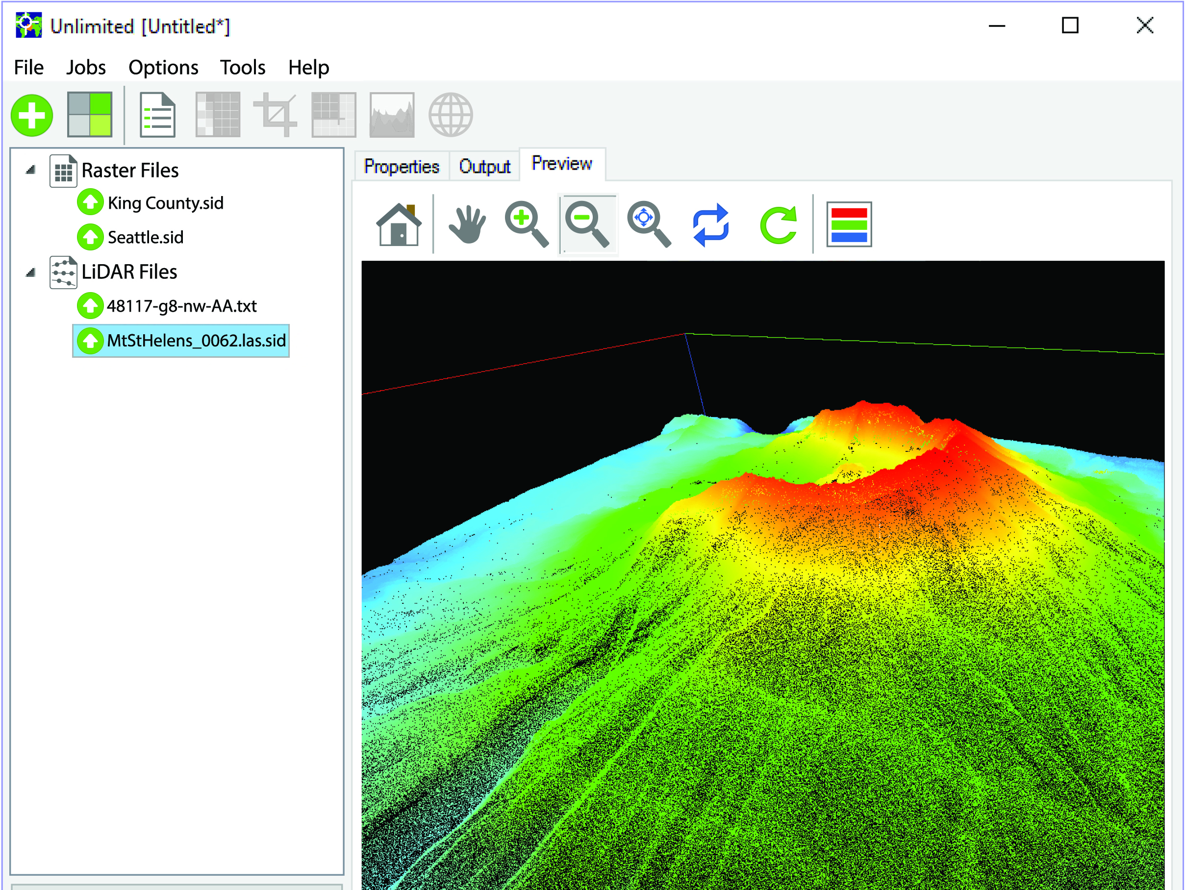
Mount St Helens. Point cloud data sets in LAS format and subsequently compressed into MrSID provide disaster preparation planners and post-event responders with the ability to mosaic multi-sensor collects; to selectively extract portions of interest for further interpretation and exploitation; and for modeling and related visualizations.
Compression Equals Speed
At the core of GeoExpress is a lossless wavelet transformation algorithm that compresses image and LiDAR data sets to a fraction of their native sizes without loss of information content. Imagery files can be reduced to one twentieth of their original size while LiDAR point clouds can be compressed to about one quarter. Compressed files are stored in the industry-standard MrSID format, as well as others. Reducing massive files that are typically gigabytes in size facilitate their sharing and use in nearly any application.
“Compression technology and associated geospatial image asset handing tools bring tremendous operational value and flexibility to front line geospatial data practitioners,” said Jeff Young, LizardTech Global Business Development.
During times of calamity, the technology can be a life saver because compression equals speed. Smaller files can be transmitted much faster and more efficiently than massive ones over either wireless or wired communications channels. But more importantly, compressed data sets can often be transmitted over networks where throughput has been diminished as a result of the disaster.
“Bandwidth is a huge issue,” said Woolpert’s Lovin, explaining that when cell towers and other infrastructure are damaged, data transmission capacity is attenuated. The situation can be even worse in remote areas where bandwidths are narrow to begin with.
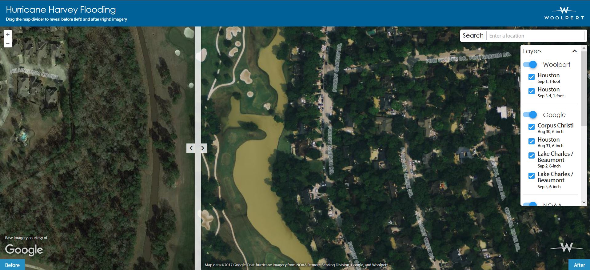
To help the millions affected by Hurricane Harvey and subsequent flooding in the state of Texas, Woolpert collected, processed and delivered high-resolution, before-and-after aerial imagery. These maps—aggregated with data from the National Oceanic and Atmospheric Administration (NOAA) and Google to provide the most comprehensive product—allow viewers to navigate and zoom in on sites throughout the city of Houston.
Lovin points out there is no `typical’ disaster, but the response by geospatial organizations often proceeds as follows: Aerial image data is collected and processed to an end product that is easily understandable by first responders. After compression, the images are loaded onto an open web server for direct access by public safety officials or hand delivered on hard drives to emergency operations centers (EOCs). From there, data is distributed to responders on the ground.
“Compression software is critical to get the files sizes manageable so folks can actually download and use them on mobile devices in the field,” said Lovin.
In addition to the data compression, Woolpert relies on GeoExpress to ensure the data is universally compatible on the scene of devastation. In disaster response situations from one area to another, responding agencies differ in their ability to use geospatial information. An EOC in a big city might be a sophisticated GIS user while the responders to rural wildfires might not be. A provider of geospatial information usually has no idea what level of imagery handling capabilities will exist in the operations centers where the data is being delivered. GeoExpress provides interoperability for nearly all users.
“These ops centers often set up some level of map production capability, sometimes with basic software but other times with full-scale GIS,” said LizardTech’s Young. “MrSID is commonly read by these systems, but GeoExpress can also save files as JPEG 2000 or NITF.”
 Most commercial geospatial processing packages, such as Esri, ENVI, ERDAS and SOCET GXP can read these compressed file formats, ensuring compatibility and usability almost everywhere, Young added. And LizardTech SDKs are available to incorporate MrSID reading capability into regional and agency specific mapping applications, which are prevalent in many parts of the world.
EOCs are seldom the final users of geospatial data, however. Whether data arrives at the center by server or hard drive, the imagery usually must then be disseminated to hundreds or thousands of first responders who use it to guide their efforts. Sometimes maps are printed by the EOC and handed to emergency workers, but in today’s digital world, the data usually must be delivered wirelessly to tablets, laptops and mobile phones.
“The transmission constraint is an issue that must be overcome at this point in the rapid response workflow as well,” said Young.
To facilitate the delivery of imagery, LizardTech has supplied many public safety and national security clients with Express Server, a commercially available web-based solution designed to rapidly distribute compressed high-resolution multispectral imagery and LiDAR points clouds to end users. The software runs either as a standalone or beneath an existing geospatial information server. It delivers image files directly to mobile devices or into GIS environments as web mapping services (WMS).
“Delivery is rapid, even over low bandwidth channels, and there is no loss of geospatial content and georeferenced context during transmission,” said Young.
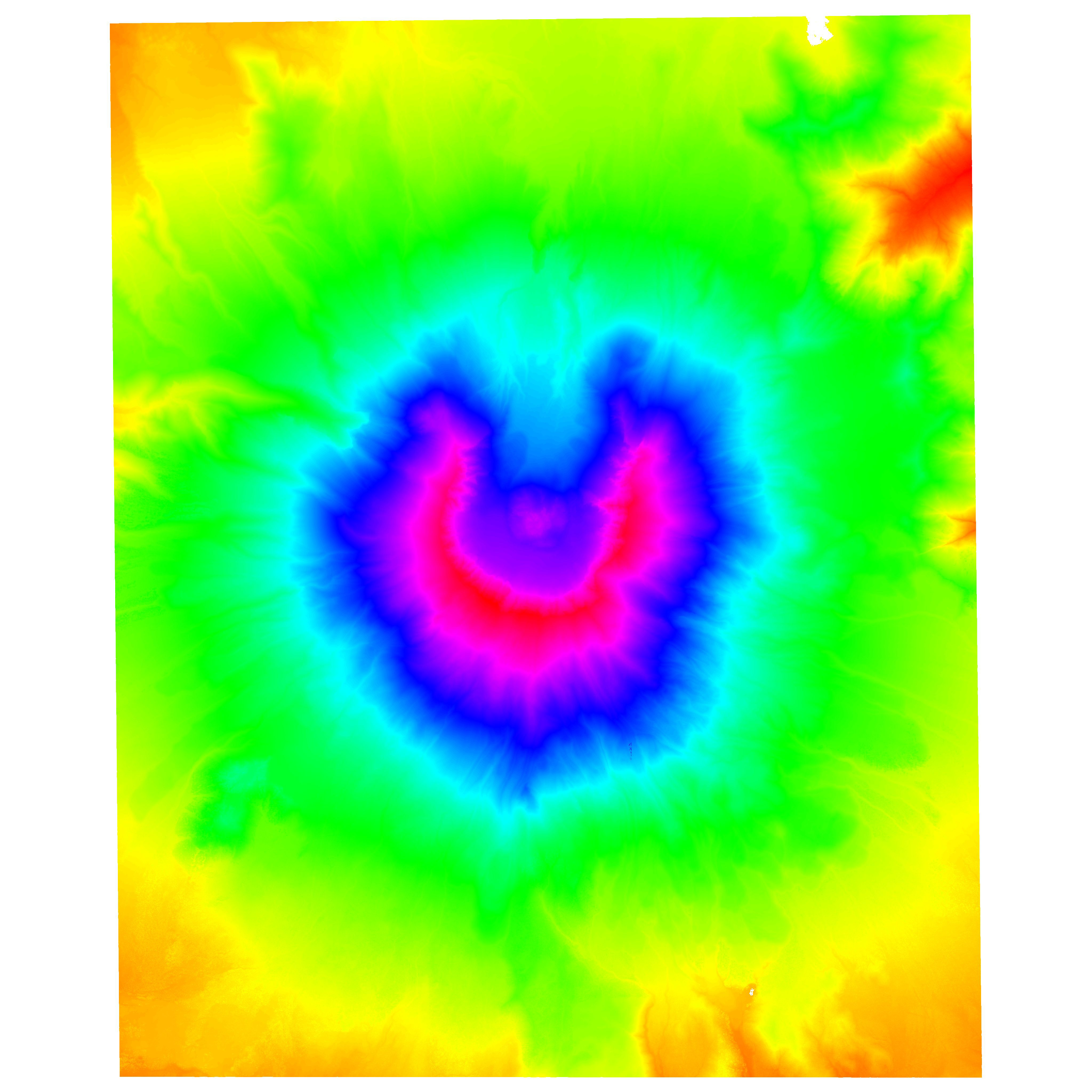
Derivative terrain representations depicted as elevation ranges, in this case of Mount St Helens, are useful to assess potential for slope erosion from denuded mountain slopes where long-term forest restoration is of importance.
Most importantly, once the compressed MrSID geospatial files reach responders on the ground–regardless of how the files are delivered–they are readily opened on nearly any mobile electronic device. To make this possible, LizardTech created MrSID viewing apps for Android and Apple iOS products that are freely available through online app stores.
“The combination of advanced geospatial data acquisition, processing and compression technologies is rapidly bringing us to the point where every responder to a disaster should have geographically relevant imagery on their mobile device within hours of acquisition–anywhere in the world,” said Young.
Coming to a Sensor Near You
The time from geospatial data collection to first-responder application will continually be shortened as technologies evolve. Among the most likely breakthroughs to make this reality is ongoing research into moving processing and compression closer to the sensors, whether on an aircraft, satellite or drone. LizardTech acknowledges its tools could support the evolution toward onboard processing, which could put imagery, video and LiDAR data into the hands of responders within minutes of collection.
“The next generation of image asset handling tools will play a part in shortening the step between geospatial data acquisition and usefulness in the field,” said Young.
Kevin Corbley is a business consultant specializing in geospatial technologies who may be reached at kevin@corbleycommunications.com.