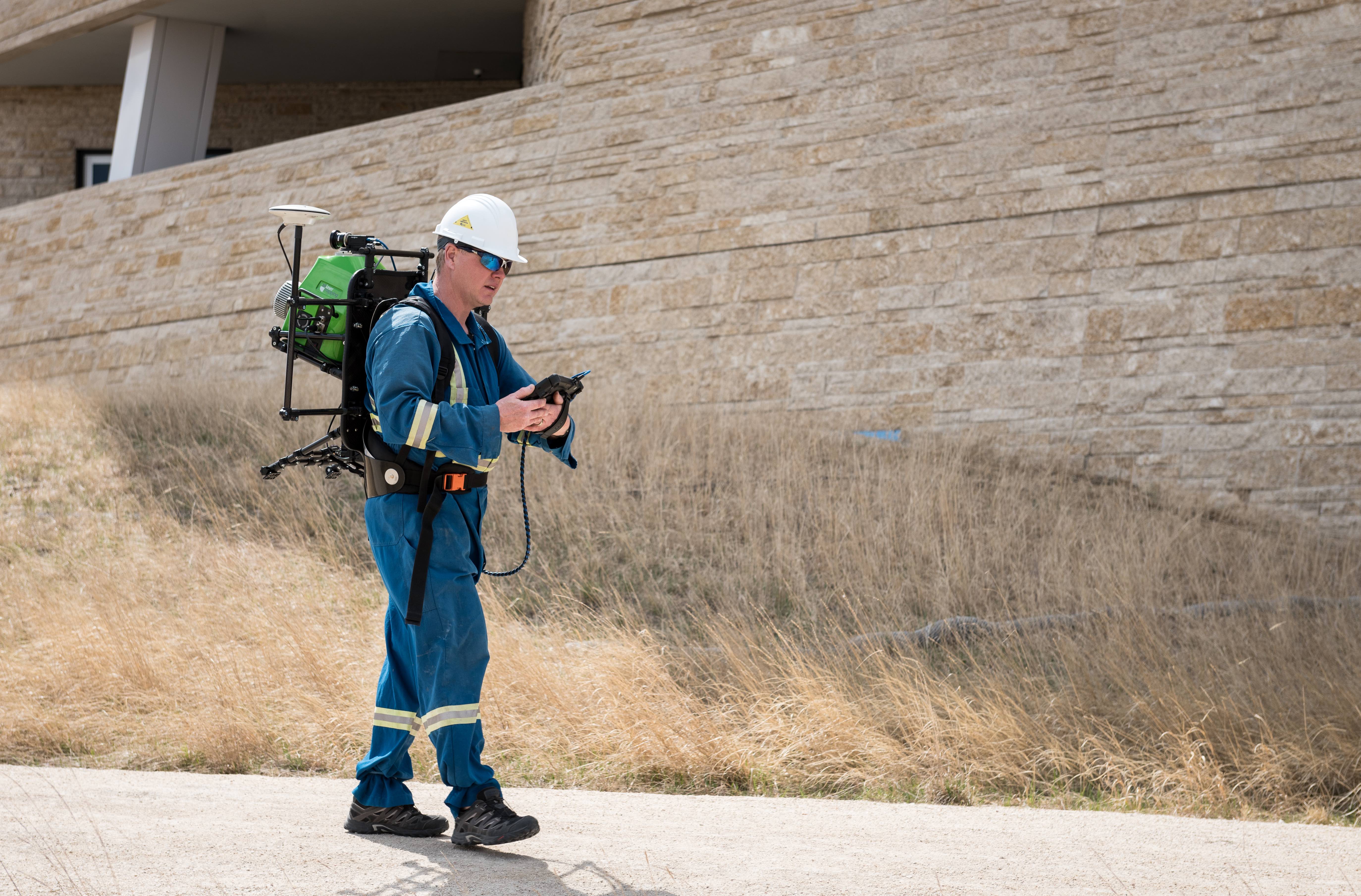
The ROBIN Mobile mapping system being used in backpack set-up.
From smartphone apps for 3D mapping, to UAV photogrammetry, surveying technology just hit the mainstream. It’s never been easier for individuals to inspect, measure and monitor their environment, so surveying businesses need to stay ahead of the curve if they are going to combat the wave of DIY equipment now available on the market. Mobile LiDAR systems are one such technology which stand to differentiate the experts from the amateurs when it comes to delivering the best service and data to the ever-growing number of paying clients, and here’s why mobile LiDAR systems are having such a big impact.
In the early 1980s, LiDAR was itself a ground-breaking technology. As with drones, the technology was originally prohibitively expensive and reserved for military or scientific applications such as NASA’s Apollo 15 mission in 1971. The first commercial LiDAR systems appeared on the market in the early 1990’s with the technology rapidly evolving over the next two decades. Nowadays, LiDAR systems are used for hundreds of applications–from cave mapping to the navigation of autonomous vehicles.
LiDAR is similar to radar but uses a different part of the electromagnetic spectrum. Where radar uses micro or radio waves, LiDAR uses the beam from a laser to scan the object or environment, creating a collection of accurately measured points in seconds. Together, these points are known as a point cloud, which can contain trillions of measurements that can be accurate down to fractions of a millimetre.
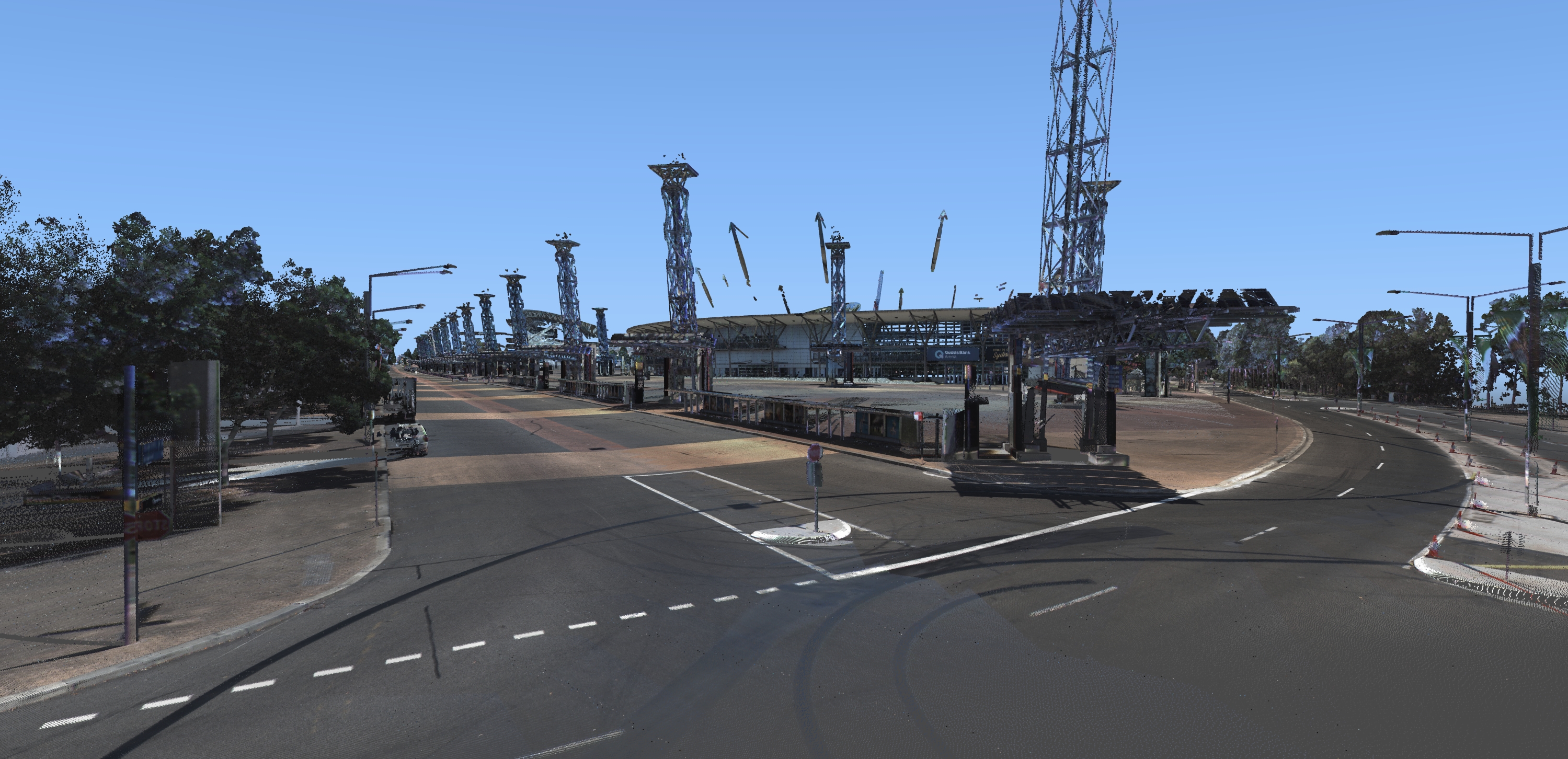
Colorized point cloud of the Sydney Olympic Stadium collected using ROBIN and the FLIR Ladybug5.
Each point in a point cloud is precisely referenced with x, y and z co-ordinates relative to all other point locations. These coordinates are gathered from the integrated IMU (inertial measurement unit) which allow for positional accuracies to be established down to a sub-millimetre level, something which is impossible to achieve with photogrammetry or a smartphone.
Over the last decade there have been many discussions and articles written to evaluate the benefits of LiDAR over traditional topographic methods of surveying. Many of these focussed on the accuracies and time saving advantages of laser scanning versus conventional surveys, and despite the obvious cost implications, LiDAR is generally proven to be the more accurate and efficient tool for the job.
In reality, it is now the flexibility of LiDAR systems that really stands out when it comes to choosing a surveying method. Mobile laser scanning has become a game-changer for surveyors looking to provide services across a range of sectors. The ability to survey large areas, across almost any terrain means that surveying businesses can deliver results faster and in much greater detail that previously possible.
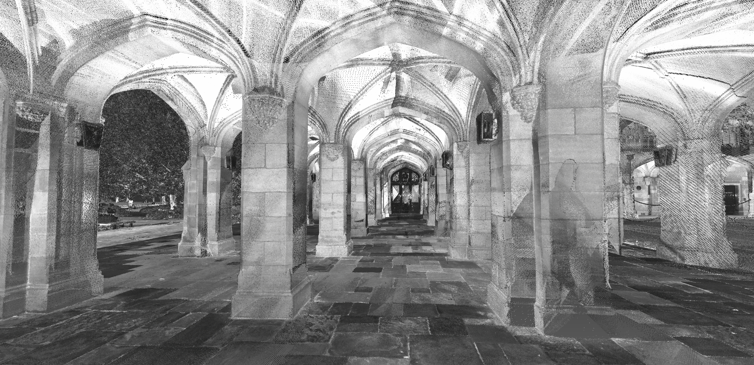
Point cloud of the Cloisters at Melbourne University, Australia. Data collected using ROBIN +PRECISION mobile mapping system.
Amongst the first types of mobile laser scanners available were airborne systems. Since the mid-1990s, airborne laser scanning (ALS) has been used to generate detailed three-dimensional maps across large areas and, despite advancements in photogrammetric techniques and software, it remains the most accurate method of acquiring topographic data from the air.
One of the biggest drawbacks of airborne laser scanning has always been the cost involved. Whether commissioning a survey or buying the necessary equipment, the cost of ALS can be prohibitive for many surveying businesses or service users. This is one of the reasons that Unmanned Aerial Vehicles (UAVs), or drones, have started to see widespread use in the sector. Even low-cost UAV systems often have HD cameras capable of taking images at high enough resolutions for successful photogrammetric projects, yet limitations in battery life and payload capacity prevent most entry-level UAV systems from being truly fit for detailed surveying projects.
ALS systems have always held the advantage over photogrammetry thanks to their ability to scan through dense vegetation, making them ideal for surveys where assets and targets may be obstructed by trees. The latest ALS systems can now record the whole form of the returned signal, known as waveform, recording multiple echoes of each pulse. These multiple echoes allow the vertical profile of multiple objects to be measured within the laser footprint. It’s this capability that has also seen airborne LiDAR become one of the most accurate methods of mapping forest structures and carbon stocks.
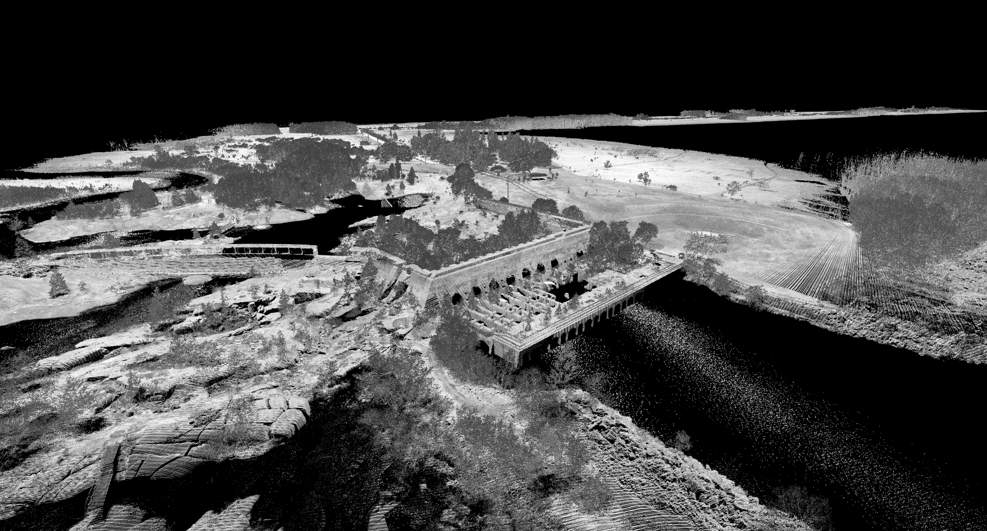
Airborne LiDAR scan of the Great Falls Dam in Manitoba, Canada.
Mapping and modelling using ALS may be expensive yet the point cloud density, speed of capture and accuracy of data is unparalleled–until you combine it with data collected from the ground. Vehicle mounted LiDAR systems have been around for a few years and have allowed highway and rail operators to map their networks and assets while on the move, meaning that there is less disruption to service users. This, coupled with the lowered risk of collecting data remotely, has led to this type of system being adopted by many local governmental organisations and contractors across the globe.
Combining airborne data with data collected from the ground allows for even more detailed survey results. Once the two datasets are combined, a denser point cloud can be generated, with relative accuracies of as little as 3mm. Obviously, this method of surveying requires the possession of both an ALS system and vehicle or backpack mounted system for the ground level survey, something which requires significant investment or collaboration with other teams.
Building a Business Case for MLS
Systems such as ROBIN represent a further step-change in the use of LiDAR for surveying tasks. Multi-use mobile mapping systems take the scope for laser scanning further by offering the ability to mount the LiDAR system in different ways. One of the reasons that many surveyors rely on traditional methods and technology, such as GPS and total stations, is the lack of budget or ability to invest in such an expensive capital purchase.
Justifying or raising investment for a large capital purchase can often be difficult, especially when it comes to investing in new technology. This is why many companies are now exploring cheaper surveying solutions. As many surveying businesses have invested in terrestrial laser scanners in recent years, it also becomes more difficult to substantiate reinvestment just because the technology has advanced.
Multi-platform mapping systems allow for enhanced services to be offered by one company. In the case of ROBIN, you can attach the same system to a backpack, vehicle or helicopter and swap between each function in a simple transition. This means that building a business case for a mobile mapping system is easier to justify. Often, surveying teams will specialise in either ground level or airborne data capture, not usually both. These flexible systems make it easier to diversify a service offering to cover both ground and air projects, even where detailed data is required or access to the site is limited.
UAV LiDAR
Standard UAVs have become a great way of dipping a toe in the water of the latest disruptive technologies and are often a good enough platform for entry level surveying tasks where accurate geopositioned measurements are not required. Roof inspections and even infrastructure surveys can be carried out by a single drone operator quickly and safely, they simply cannot provide the levels of detail contained within a point cloud.
It’s only been in recent months that UAV LiDAR systems have become an affordable possibility for many commercial operations. The limitations of payload weight on a standard UAV has meant that integrating an IMU and laser scanner was an impossible feat; other than for heavy-lift systems, which in themselves are prohibitively expensive for most surveyors. Thanks to further advancements in MLS technology, scanners can now be small and compact enough to fit on a UAV system without having to be a gamble.
ROBIN mini is one of a few systems available which combines the affordability and ease of a drone survey with the detail and accuracy of LiDAR. The lightweight laser scanner has been designed specifically for use with a UAV and makes use of the same echo signal digitization and online waveform processing technology which made ALS so popular for mapping dense vegetation.
Although flight time will still be limited without a tether, these compact and lightweight UAV LiDAR systems can collect around 100,000 measurements per second, making light work of construction and building surveys, powerline inspections and infrastructure projects.
These types of system now prove that LiDAR can be an affordable alternative for surveying businesses either looking to diversify their offering or looking to utilise the latest in disruptive technology without compromising on data quality or accuracy.
It’s always been easier to justify the introduction of entry level technology and we are now in an era where technology moves at a speed where it can be easier to ignore advancements or to choose a cheaper option until a proof of concept has been established. UAV LiDAR and mobile mapping systems are now at the stage where it is not only commercially viable, but also affordable for most commercial surveying operations. Yes, a smartphone could map the inside of your house to help you measure for a carpet, but can it really be relied upon to provide the accurate data a client needs to make critical decisions? Will a drone equipped just with a 20MP camera be able to provide a dense and accurate enough point cloud to enable clients to plan major highway expansions or smart city initiatives? Probably not.
Technological advancements are what keep us striving to find new solutions to old problems and it’ll be a while until your average smartphone or tablet can integrate a LiDAR sensor.
Joe Beeching, LiDAR Systems Engineer, 3D Laser Mapping, has worked in the GIS and surveying industries since 2004, and has been working with LiDAR technologies since 2005. His background is in Earth Sciences, graduating from Brunel University in 2003 with a First Class (Hons) Bachelor’s degree. Joe joined 3D Laser Mapping Ltd in 2005 and provides technical support for laser scanner hardware and software.